Couple Storm Systems To Deal With Before A Pleasant Weekend…
 Highlights:
- Couple rounds of rain this week
- Periods of dry weather in between
- Nice weekend ahead
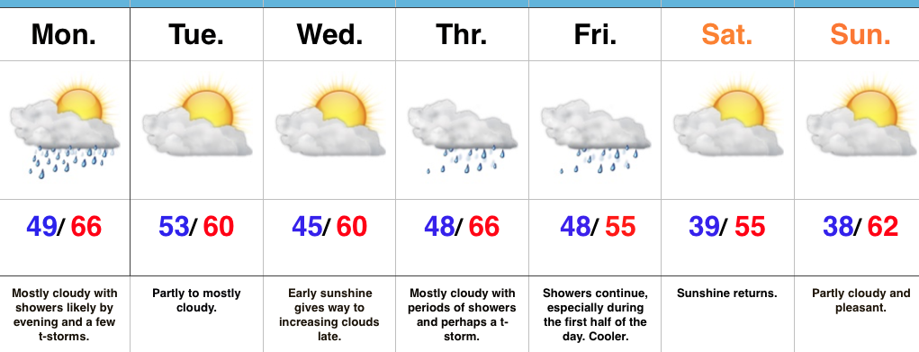
Not A Bad Week…The work week is off to a dry start, but a fast-moving storm system promises to trigger showers later this afternoon into the evening hours across central Indiana, and perhaps some stronger thunderstorms across southern Indiana. With this being a quick moving storm, dry conditions will return as early as tomorrow. Dry conditions remain Wednesday with periods of sunshine and pleasantly mild temperatures.
Another storm system will deliver showers and thunderstorms Thursday into Friday. Temperatures will remain mild through Thursday, but Friday will feature cooler conditions (near seasonal norms). This shouldn’t be a particularly heavy rain maker, but expect wet times Thursday into Friday.
The good news in this forecast is the timing between storm systems should allow for a beautiful weekend ahead. We forecast sunshine to return and while it’ll be a touch cooler, that high early April sun angle will provide for a pleasant feel.
Upcoming 7-Day Precipitation Forecast:
- Snowfall: 0.00″
- Rainfall: 0.75″ – 1.25″
 Highlights:
 Highlights:
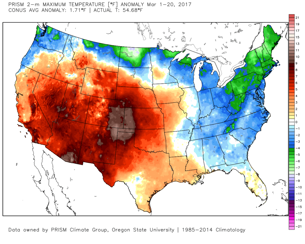
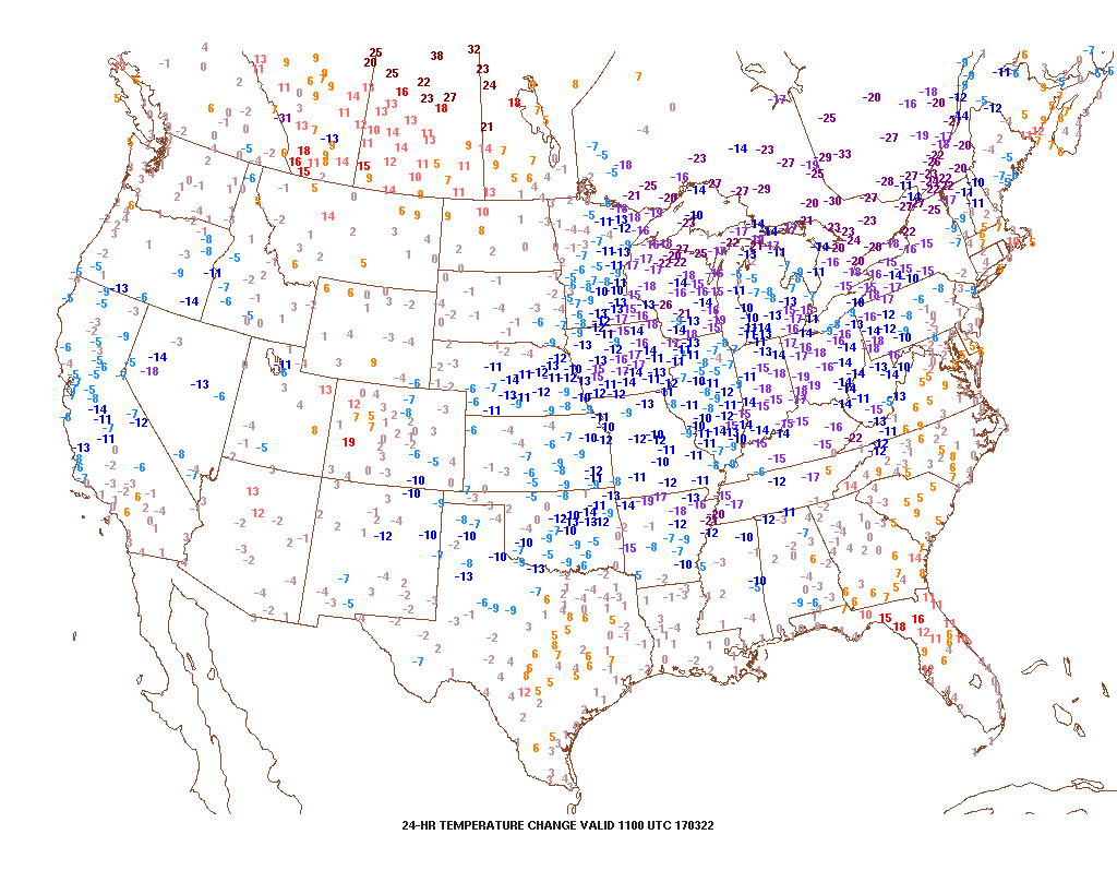 2.) Speaking of cold, to-date, March is running slightly colder than average (by 1.1°). Note the spring and summer-like warmth across the SW. “Pieces” of that warmth will eject northeast in modified fashion late March into April.
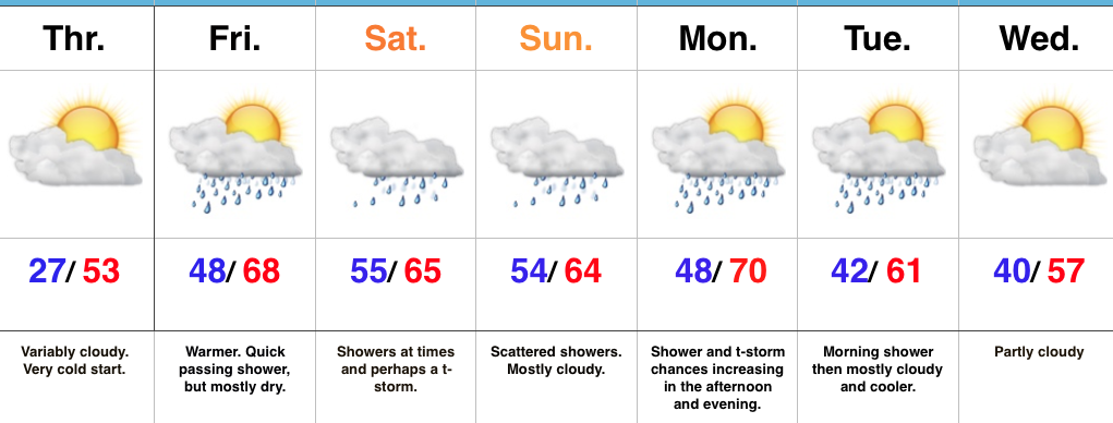
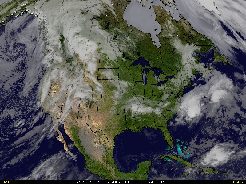
 3.) High pressure will supply a dry, but cold Wednesday. Highs will run close to 10° below average (lower 40s), but at least we’ll enjoy the sun!
 4.) Temperatures will begin to warm as we progress through the latter portions of the week. We’ll be near seasonal norms Thursday (low 50s), and above normal Friday into the weekend (mid-upper 60s). With the warmer air, rain and storm chances will also be on the increase. As of now, we target best rain chances late Saturday into Sunday. A couple thunderstorms are also possible. Rainfall totals of 0.50″-1.00″ seem like a good bet with locally heavier amounts.
 5.) This is just the beginning of an active stretch of weather to wrap up the month of March. (3) additional storms will have to be monitored next week. Accordingly, precipitation anomalies will run above normal.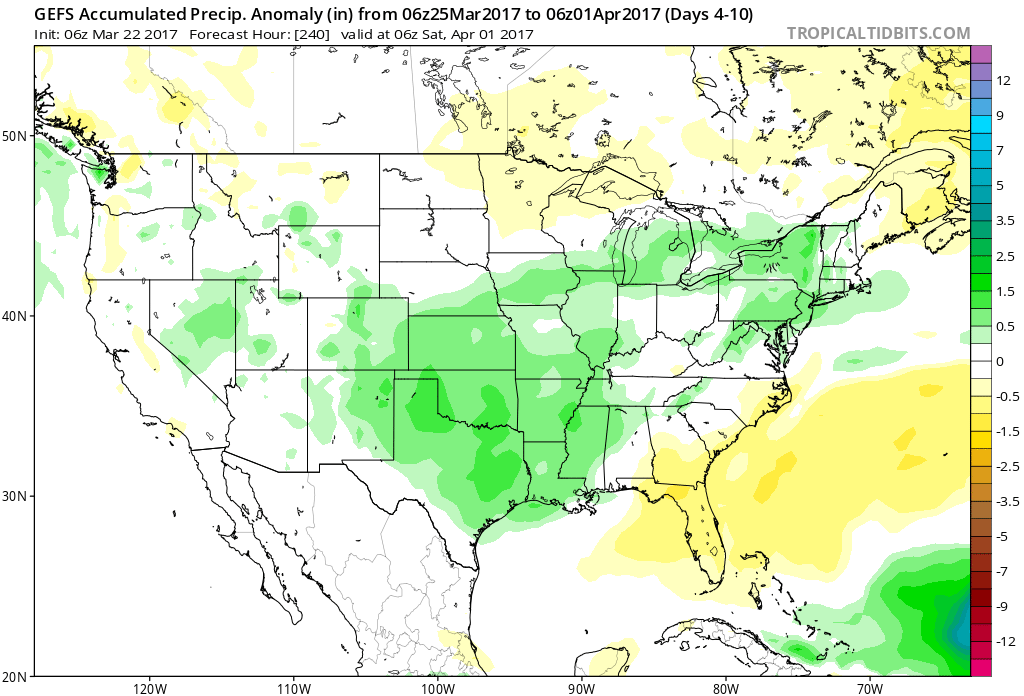
 Highlights: