January 2020 Outlook: Don’t Put Us In The “Winter’s Done” Camp…
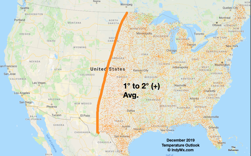
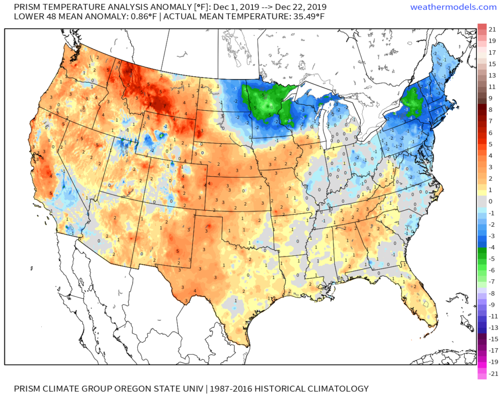
The 1st half of December got off to both a colder and snowier than average start. In what’s now going to be known for a “warm” December around these parts (last 9 consecutive days have run above, to well above, average), it’ll also go down as a snowier than average month. The recent warmth has ignited chatter within (and outside) the weather community that winter may be finished. Simply put, please don’t confuse us for being in that camp.
We thought December would turn warmer than average across the eastern half of the country, but that the ‘mean’ winter pattern would begin to show itself in January. A big reason for this has to do with the sea surface temperature configuration, including the warmer than average northeast Pacific and reflection of a Modoki El-Nino. With a couple days left in December, this still holds true.

Simply put, as the winter season matures, these should work in tandem to generate a more persistent ridge across NW North America with a more sustained trough setting up across the Great Lakes region. This negative EPO pattern should carry the day from mid-late January, through February (already know where we’re leaning with our February Outlook ;-)) and into March.
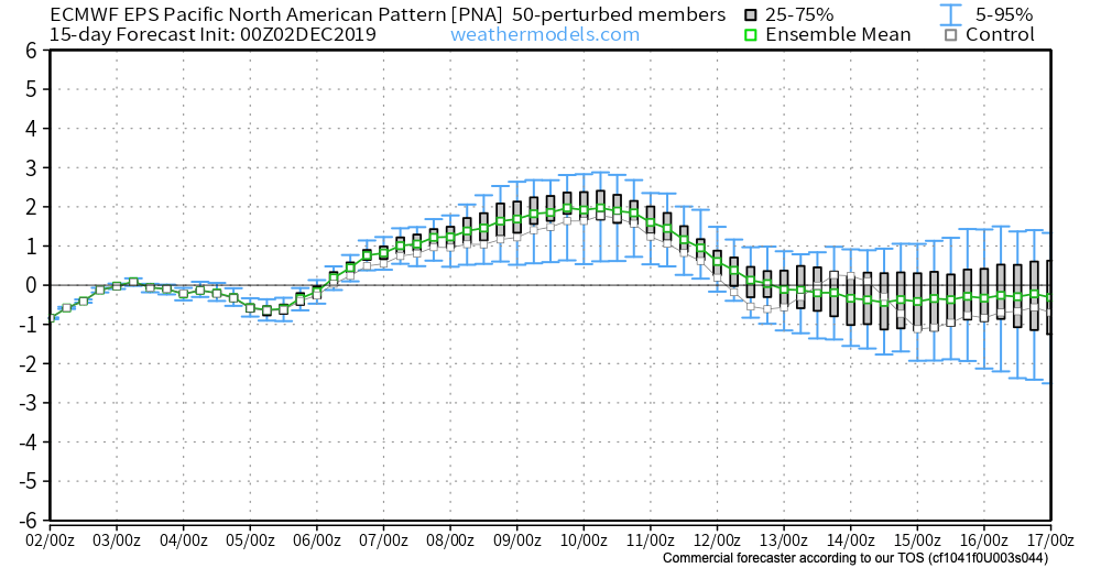
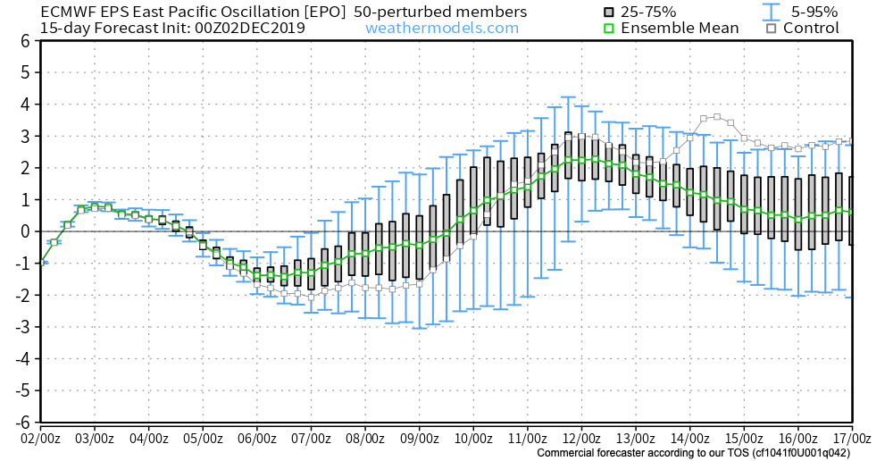
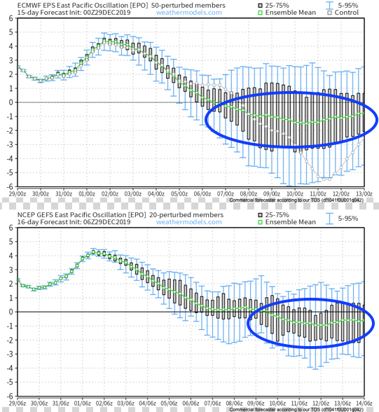
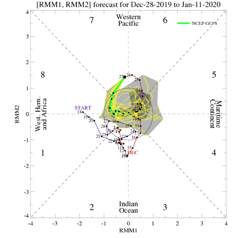
Models seem to be discovering the negative EPO pattern on the horizon:
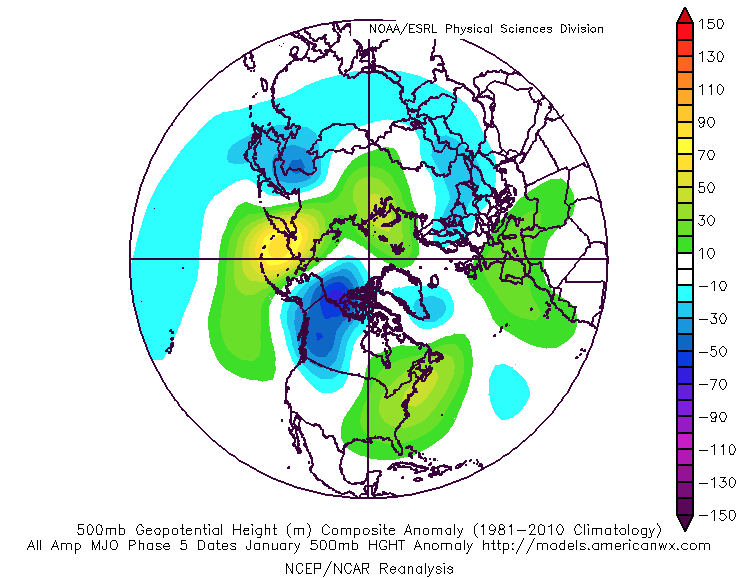
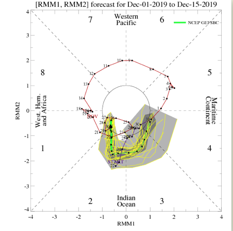
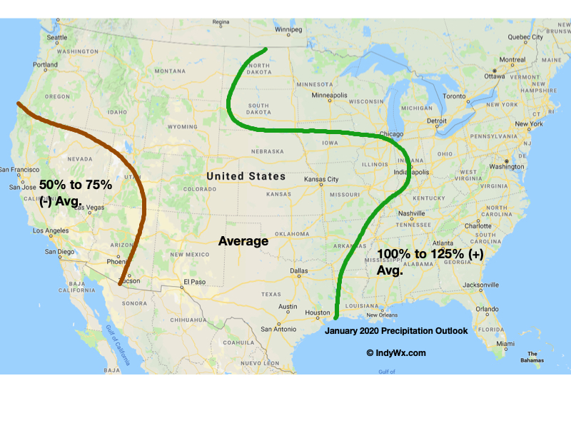
Interestingly, until then, the MJO rumbling through Phases 7-8 will likely generate wintry “fun and games” during the 1st full week of the month. This will come at the end of a relatively mild open to the month, and could set the stage for what we believe will be a situation where cold “presses” southeast and eventually overwhelms the pattern. The exception may be along the immediate Southeast and coastal areas up into the Northeast region. Here, more sustained ridging will likely be associated with the MJO getting into Phases 5-6. Elsewhere, we anticipate the negative EPO to begin to win the day. The month should be quite stormy for the Southeast into the upper Midwest and Great Lakes into the Northeast.
Our official January Outlook reflects our cold, stormy thoughts.

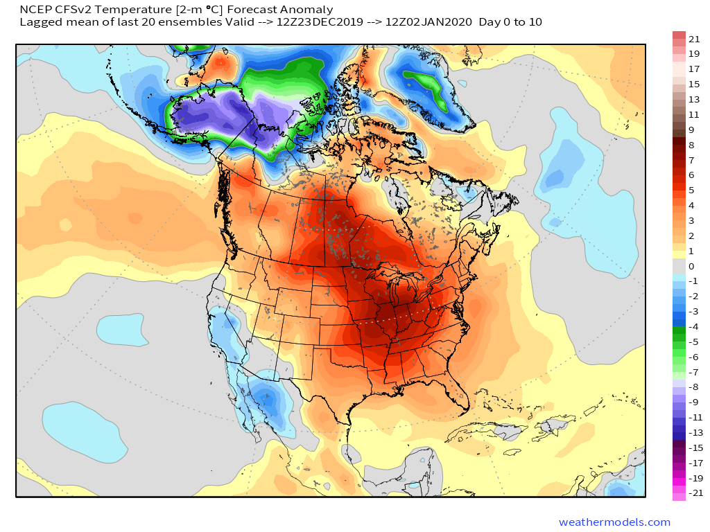
Initially, cold will dump into the West, but likely begin to spread out as the negative EPO develops. We also note the majority of models are beginning to “tap the brakes” with respect to the overall amplitude of the MJO swinging through the warmer phases (some now even hint of keeping things in the wheelhouse or curling back into the colder phases).
More specific to central Indiana, we think the month opens milder than average before cold begins to “win out” during the 2nd week of the month. The potential of a winter storm precedes the colder shift and our short-term products will handle that situation. The back half of the month should feature more sustained cold weather. With an active storm track, we believe January will produce the 2nd consecutive month of above average snowfall across central Indiana.