February 2020 Outlook: Watching The Battle Play Out…
Before we dig into the reasoning behind our February forecast, here’s what a few of the longer range models are suggesting the month will provide:
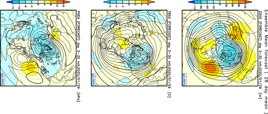
JMA
CFSv2

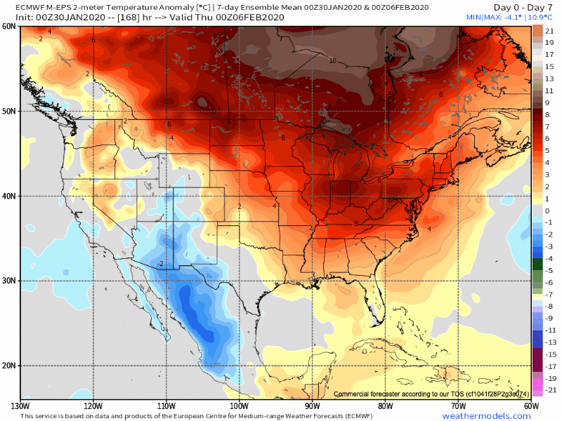
European Weeklies
February features “average” temperatures rising from a high of 37° on the 1st to 45° on the 29th. Average lows rise from 21° to 28° by the end of the month. IND averages 2.32″ of rainfall and 6.5″ of snow during the month.
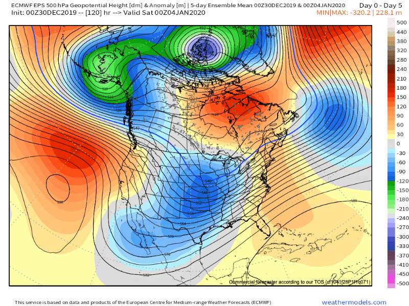
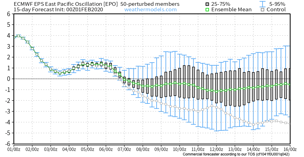
As we look at February 2020, we have an interesting battle on our hands. Latest EPO trends are negative and that is a cold signal, potentially significantly so if the current trends continue. That said, it’s also important to note that many times throughout January, medium to long range negative EPO trends didn’t materialize, and, accordingly, warmth dominated.

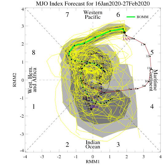
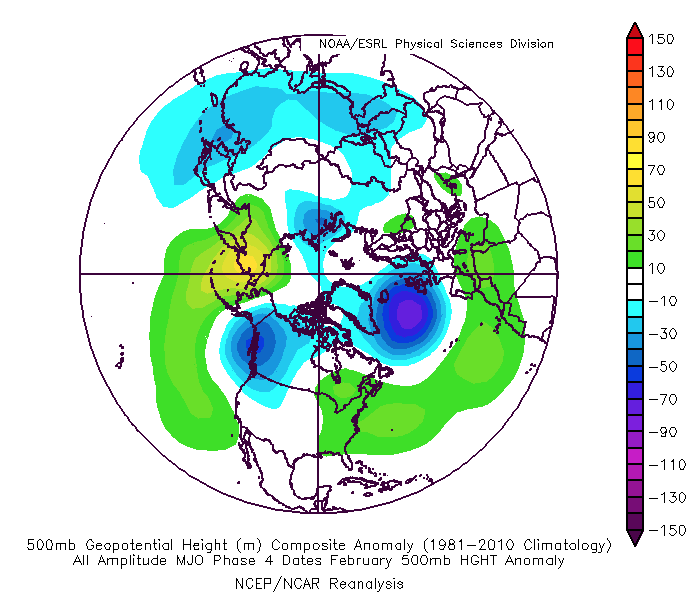
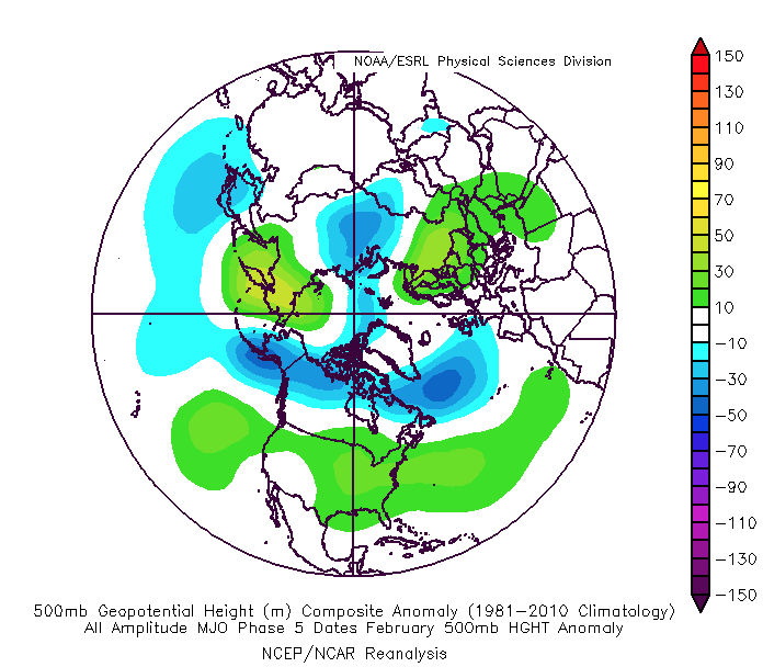
To make things more complicated, the latest MJO plots are bullish on warmth persisting, overall, for the the better part of the month. Note the trends to take things back into Phases 4-5. This would promote the tendency towards more of a persistent eastern ridge (similar to what the European and CFSv2 show above).

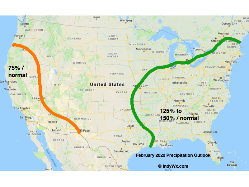
While our forecast will show a significantly warmer than average month, we also believe snowfall will run near average. The reason has to do with a battle ground that we anticipate sets up across the Ohio Valley throughout the majority of the month. At times, even marginally cold air will create challenges. Case in point will be the middle and latter part of this upcoming week. This will likely set the tone for the month ahead: warmer than average with well above average precipitation/ near normal snowfall. The other concern has to do with the threat of sleet/ freezing rain events. Late winter and early spring can prove to be troublesome with the kind of ‘mean’ pattern that lies ahead as shallow cold air at the surface undercuts. This will be something to keep close tabs on moving forward.
IndyWx.com February Outlook…