All-Access Video: August Outlook…
You must be logged in to view this content. Click Here to become a member of IndyWX.com for full access. Already a member of IndyWx.com All-Access? Log-in here.
You must be logged in to view this content. Click Here to become a member of IndyWX.com for full access. Already a member of IndyWx.com All-Access? Log-in here.
The year continues to fly by! We’re now finalizing our forecast for the last month of meteorological summer and will include a look-ahead to our early fall ideas with the official August Outlook that hits the site later next week. With that said, here are some of our early August ideas:
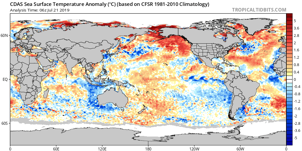
I. Sea surface temperatures remain well above average through the western Atlantic basin as well as the northeastern Pacific. This should promote warmer than normal conditions, overall, along the coastal areas. Additionally, we’ll need to continue to keep a close eye on the potential of additional “home grown” (Gulf of Mexico and off the southeast US coast) tropical development as we move closer to the peak of the hurricane season.
II. The MJO isn’t nearly as hyper as months past. While we’ll continue to keep a close eye on things, we currently don’t anticipate being able to lean on this tool as a good indicator for what may transpire through the month of August (at least early on).

III. We need to keep a very close eye on the EPO over the upcoming week to see if modeling continues to project a significantly negative phase into August. This can “up the ante” for a cooler than normal central US during August if so.

IV. Lack of widespread drought/ dryness. The wet spring and early summer really can help make an impact longer term and that has been seen as early as this week (added humidity with the heat wave), but also helps overall when it comes to late summer and the respect to the staying power, or longevity, of heat waves.
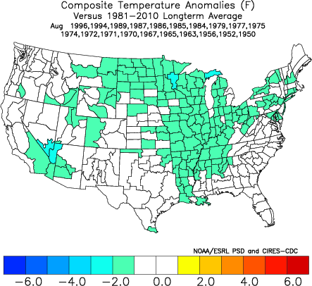
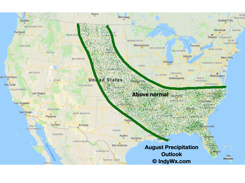
Here’s our early thinking with respect to August temperatures and precipitation. Again, our final, more detailed, outlook will be issued next week!

You must be logged in to view this content. Click Here to become a member of IndyWX.com for full access. Already a member of IndyWx.com All-Access? Log-in here.
Averages for June are as follows:
As we head to the 50-yard line of 2019 (already?!), we’re of the belief we’re looking at a cooler than normal month of June with close to average rainfall. Before we get into our reasoning of such, let’s look at a few snap shots of the latest data:
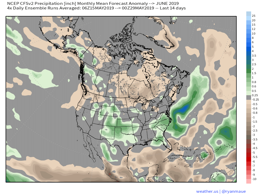
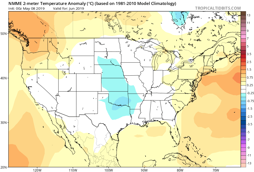
CFSv2
JMA

NMME

Though we can’t show it, the longer range European model paints a cool, wet picture from the south-central into the Plains and portions of the Northeast.
Given the analogs we’ve looked over with weak El Ninos along with similar MJO pulses, we’ve built a generally wet and cool June forecast nationally:
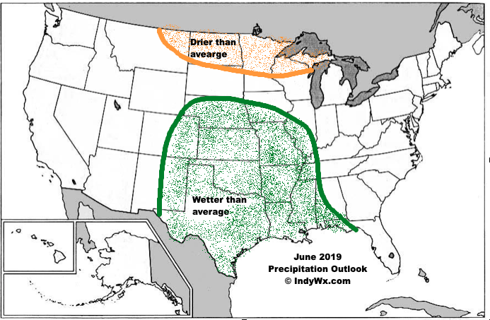

Ridging should support warmer than average conditions across the Southeast and Pacific Northwest, along with a rather widespread cooler than normal regime through the south-central Plains into the Great Lakes and New England. Unfortunately, we think wetter than normal conditions remain from the Delta into the central Plains. With that said, conditions seem more favorable for planting through a large portion of the OHV region.
We know the upcoming (10) day period is going to feature a continuation of above average rainfall, but what lies beyond that? Ensemble data is entirely in two different camps once we get to the Day 10-15 period.
GEFS:

EPS:
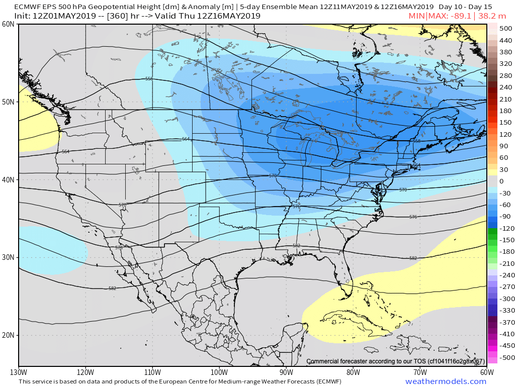
Talk about a night and day difference. This would result in widespread 70s and 80s should the GEFS prove accurate (and put our May outlook in jeopardy) versus 50s and 60s should the European turn out to be correct (more in line with our monthly outlook). Unfortunately, from a precipitation perspective, wetter than normal times are expected to continue for the balance of the month of May and the data is in more agreement from that perspective- despite the vast differences at 500mb.
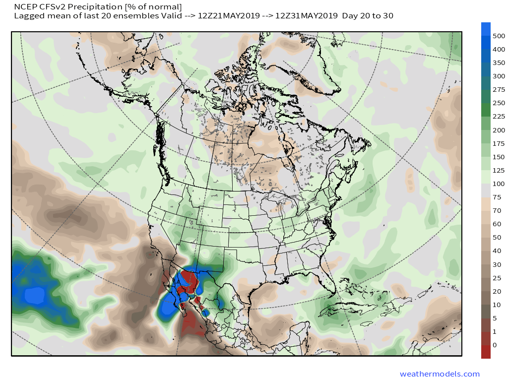
When we look at the latest CFSv2, it’s more in line with the European camp, including rather widespread chilly, damp weather for the mid-to-late May time period.

The combination of a negative NAO and AO, though not nearly to the extent of chill found in late winter/ early spring, do continue to hint at cooler than normal times in May. Eventually I would expect the GEFS to trend cooler, as well.
Furthermore, the PNA (currently negative) is forecast to trend positive by mid-May and that supports the cooler anomalies returning to our immediate region.
We’ll also have to keep close tabs on the MJO and see if it wants to propagate through Phases 5-8, or go back in the “wheelhouse” and really not be a factor. (More to come there).
To sum things up, we don’t see an end in sight to the overall wetter than average pattern as we progress into the middle of May. We’re less confident on the overall temperature pattern, but lean towards the EPS and CFSv2 “winning” over the warm GEFS solution in the end.