Damp At Times Into The Weekend; Christmas Pattern Change?
You must be logged in to view this content. Click Here to become a member of IndyWX.com for full access. Already a member of IndyWx.com All-Access? Log-in here.
You must be logged in to view this content. Click Here to become a member of IndyWX.com for full access. Already a member of IndyWx.com All-Access? Log-in here.
You must be logged in to view this content. Click Here to become a member of IndyWX.com for full access. Already a member of IndyWx.com All-Access? Log-in here.
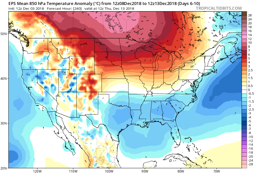
Since this cold pattern took over in mid-October, I thought we’d see a “pull back” of sorts develop at some point. Initially, the thinking was this would come in the middle parts of November, but that never developed. Fast forward to where we are now, and it still appears a relaxation of the cold will develop- albeit much later than originally anticipated. Please understand this doesn’t mean there can’t be cold days or, for that matter, even wintry “mischief.” What it does mean is that the sustained significantly colder than normal air should reverse to seasonable levels and above normal conditions for a time around mid-month.
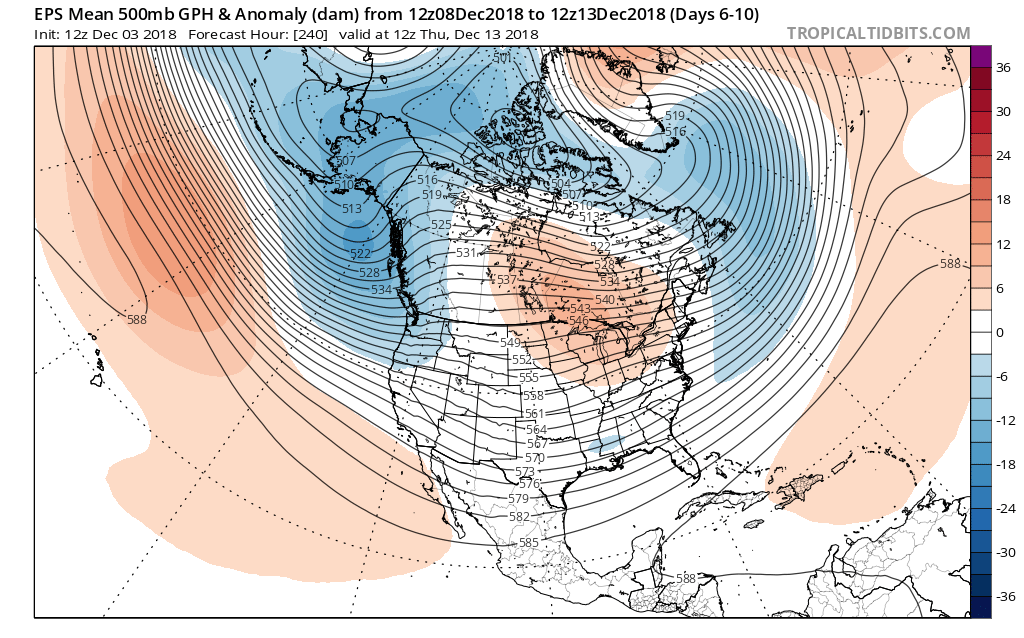
With that said, we’re as fired up as we’ve been for what we continue to think will be a very cold winter and, at times, snowy- as outlined in our winter outlook published last month. In fact, the latest European Weeklies in this evening suggest winter roars back with authority around Christmastime, continuing deep into the New Year period. Analog data and other key components (some of which were outlined in our winter outlook) would back up this idea. Taken verbatim, the new European Weeklies like the idea of “coast-to-coast” cold developing for the holidays this year. While I’m not ready to go that far just yet (still think the mean ridge will set-up shop in a manner to keep the northwest balmy, compared to normal), I do like the idea of a cold and active period returning late December for our part of the country…
Anyone else dreaming of a white Christmas (for the 2nd year in a row)?!
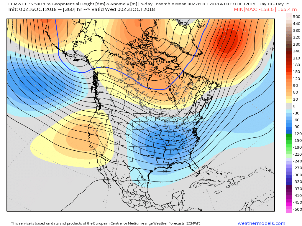
The short and medium range weather pattern will be highlighted by a colder than average regime, but one that’s also drier than normal.
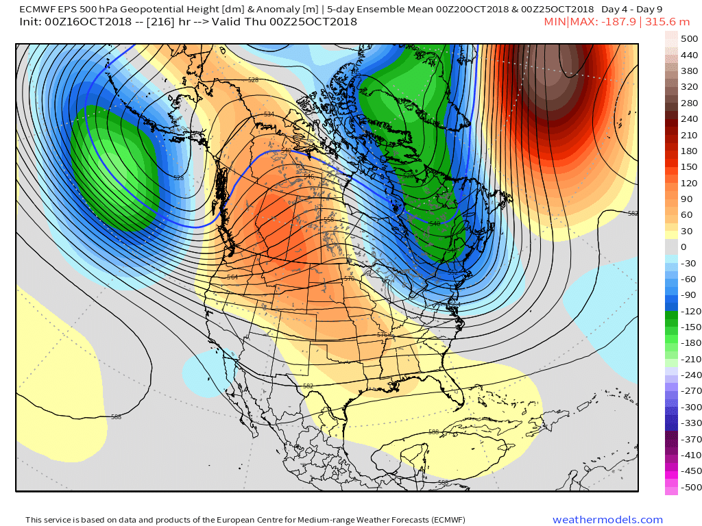


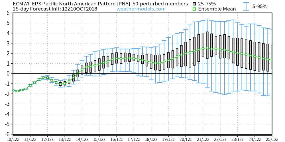
The positive PNA will continue to support the mean trough position in the central and eastern portion of the country as we rumble into late October.

As we look ahead, there are growing indications a more significant storm may impact the general region as we get closer to Halloween. This is the next time frame we’re closely monitoring for the potential of an impactful storm system. Given the overall setup, we would be surprised if this particular storm didn’t present a wintry side, as well, but it’s simply too early to know the details from a couple of weeks out. Stay tuned.
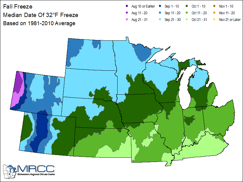
The average date for the first frost and freeze in Indianapolis takes place on October 11th and 14th, respectively. Right on cue, the first frost of the season will take place for most central Indiana neighborhoods over the weekend. If you happen to miss out on the frosty conditions this week, reinforcing chilly air will descend on the region early next week.
We forecast (3) of the upcoming (7) nights to fall into the 30s. This is, obviously, a significant change from the extended summer like conditions we’ve been dealing with as of late. One primary driver behind the significantly cooler pattern has to do with the change in the PNA. The shift towards a positive PNA will result in the cooler air remaining in place with more staying power than the fleeting cool shots of a few weeks ago.
 A series of cold fronts will sweep through the Ohio Valley over the upcoming couple of weeks and each will likely feature progressively cooler conditions.
With the positive PNA in place, it’s no surprise to see the mean trough setting up shop over the eastern portion of the country.
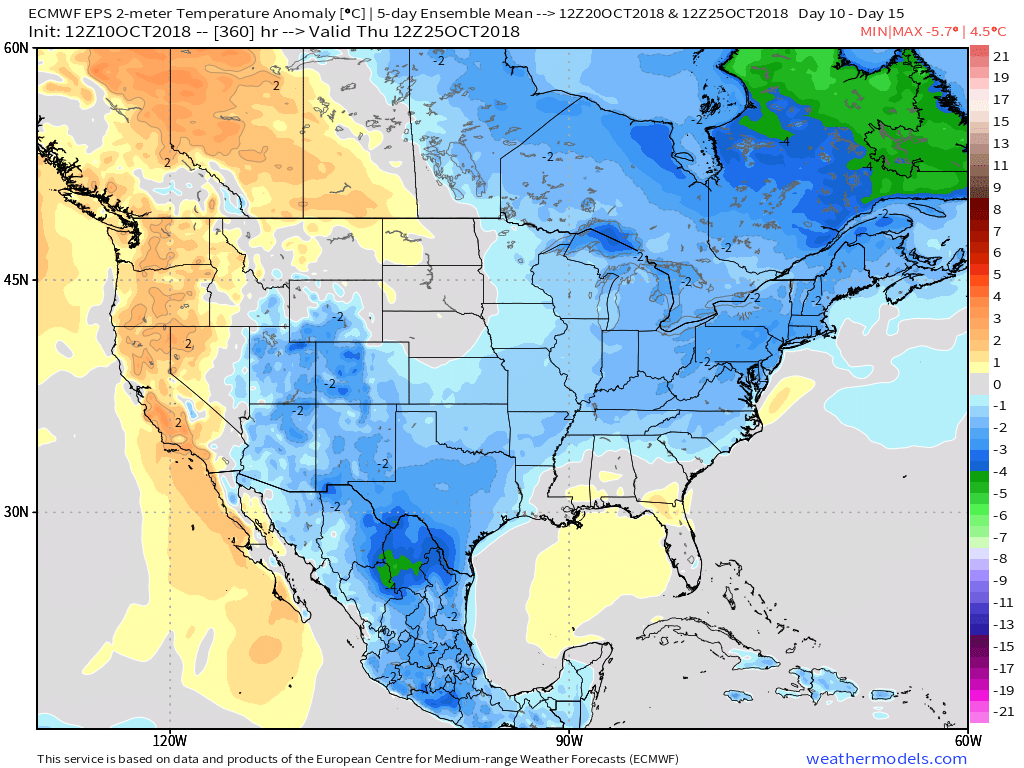
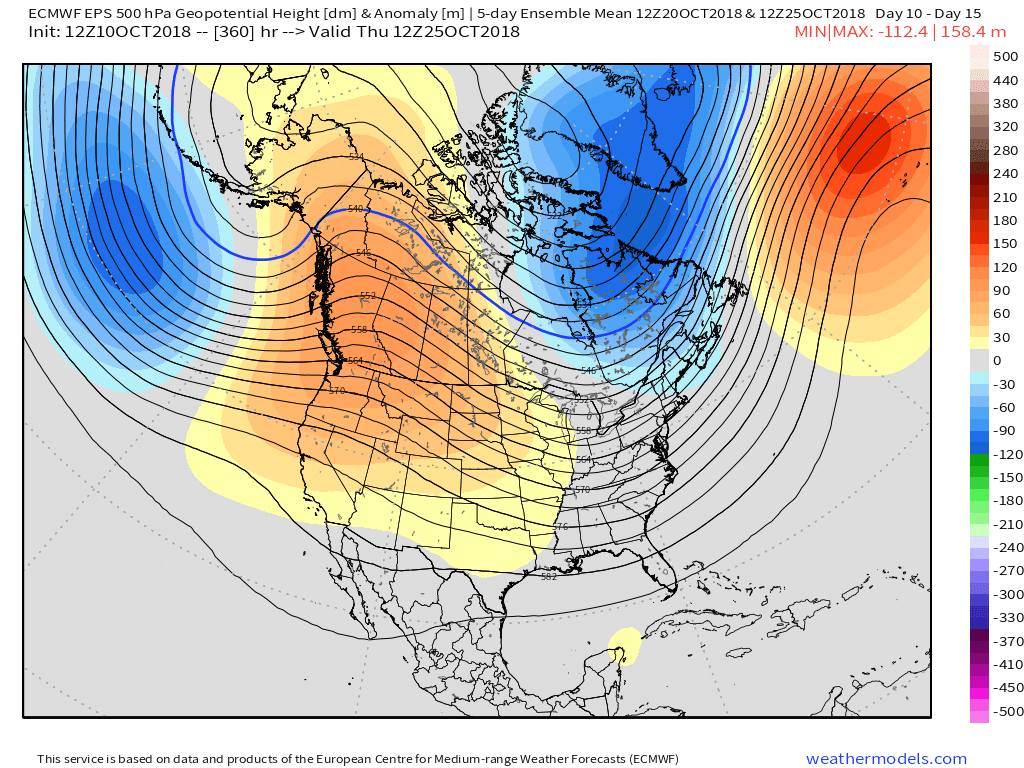 At the surface, we see the cool pattern taking hold into not only the short-term, but the 10-15 day range, as well.