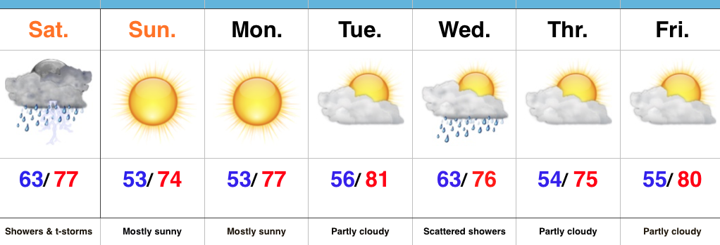
Turning Unsettled This Afternoon…
The initial push of moisture will ride into central IN this afternoon (likely between 2p-3p time frame). Embedded thunder will be a good bet, but the storms pushing in should be in a weakened state compared to what our neighbors to our west will experience a few hours earlier.
 Periods of scattered showers and thunderstorms will continue Saturday. The good news? After the initial round of showers this afternoon, most high school football games could very well be dry tonight.
 It won’t rain the entire time Saturday, but scattered storms are a good bet through the day. Some locally heavy rainfall is likely, but rain amounts won’t be uniform. On average 0.75″-1″ is a good bet.
 Sunday will be the pick of the weekend as high pressure builds in and supplies a drier air mass. Flipping the page to next week, the big story will be a late season push of summer heat followed by a significant cold front next weekend. Behind this front, a true push of bonafide autumn air will push in. Sweaters and jackets will likely be needed as we put a wrap on September…


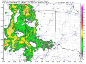
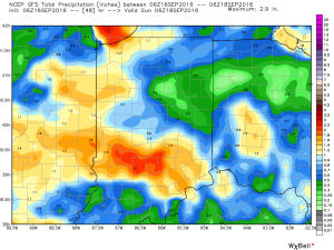
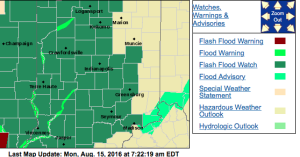 No doubt about it, today will be very wet across the entire region, including periods of heavy rain- especially across the western half of the state.
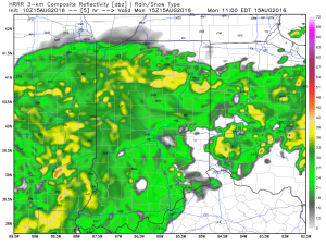
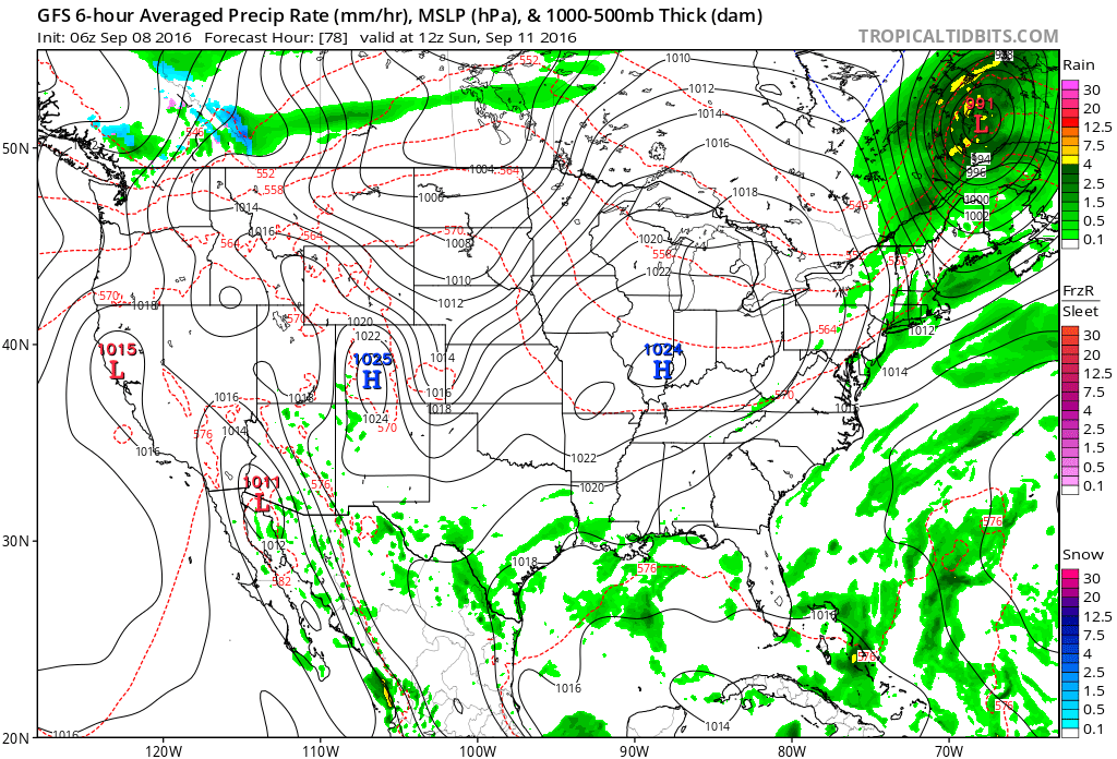
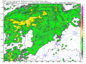 Tropical moisture will continue to stream into the state tonight into Tuesday. In fact, most intense rains will likely set up tonight and may feature “banding” signatures that would train over the same areas. Within these intense rain bands, prolific rainfall rates can be expected, enhancing the flash flood risk. Latest short-term model data shows this threat, and would place a premium focus on areas generally west of US-31. We’ll have to keep a close eye on things.
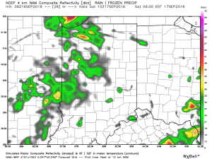
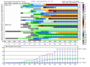
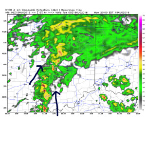 Plenty of “juice” is available to tap into across western sections tonight. Precipitable water values (PWATs) of 2″-2.5″ will be more than enough to fuel torrential rainfall.
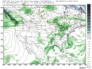
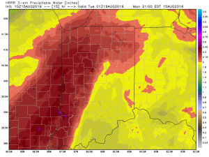 Eventually (mid and late week), we’ll dry things out and a significant cool down is still in store developing this weekend into early next week. Lows will fall deep into the 50s with highs only in the 70s. Talk about an early taste of fall…