Tropical Feel; Stormy Later Tonight…
 Highlights:
- Strong storms late tonight
- Turning cooler and less humid
- Unsettled pattern back half of next week
Storms Rumble In Late Tonight…Most of the daytime today will be dry and hot. High humidity will also be with us and will help boost heat indices into the middle 90s. Take it easy outdoors today.
We’ll have to keep a close eye on radar trends upstream tonight as a complex of thunderstorms is expected to erupt to our northwest this evening. This storm complex will track southeast and begin impacting Indiana by late-evening (thinking around 11p, or so, across northwest portions of the state as of now). As we push into the overnight, these storms will continue to settle southeast, including central Indiana. A couple of these storms may be strong and with such high moisture content, locally heavy rainfall is, once again, a good bet.
A couple of showers or thunderstorms will be with us Father’s Day, but outdoor plans shouldn’t be cancelled, as most of the day appears to be dry. It’ll be a cooler day and less humid air will filter into the state Sunday night. This will produce a glorious open to the work week!
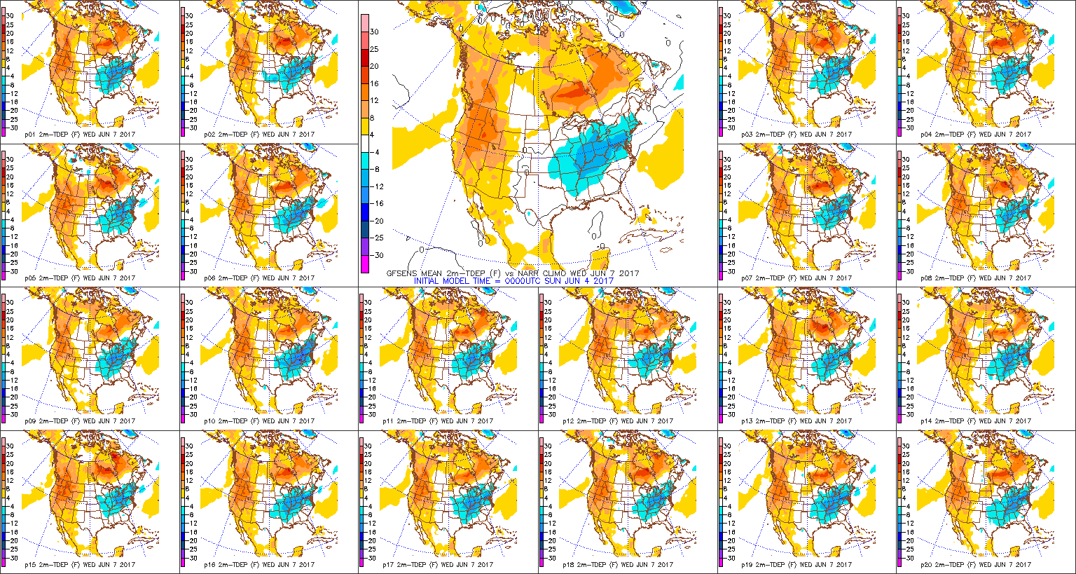
Unsettled weather will return by the middle and latter portions of next week, along with a briefly warmer and more humid feel.
Upcoming 7-Day Precipitation Forecast:
- Snowfall: 0.00″
- Rainfall: 1.50″ – 2.00″
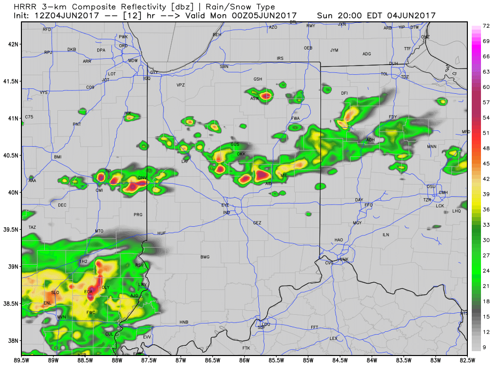
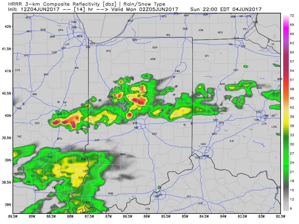
 Similar to Tuesday, any storms that develop will be capable of locally heavy rain and flash flooding. While storms should move in a quicker fashion today, precipitable water values (PWATs) remain downright tropical and will exceed 2″ later this afternoon.
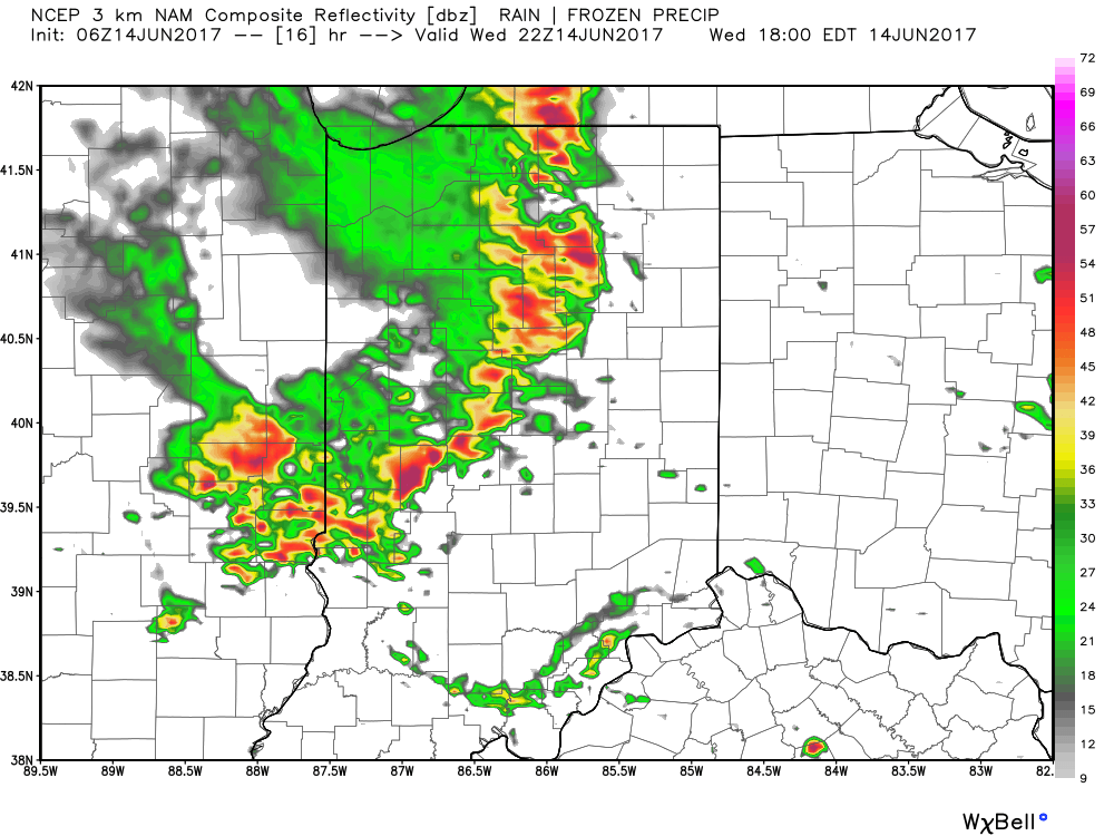
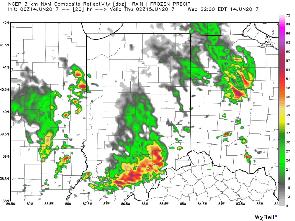
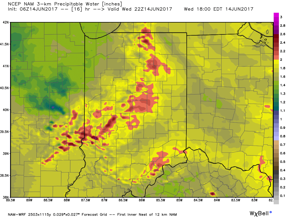 Overall storm coverage should become more widespread as we push into the afternoon and evening hours. Here’s what the radar may look like during the 4p, 6p, and 10p time frames:
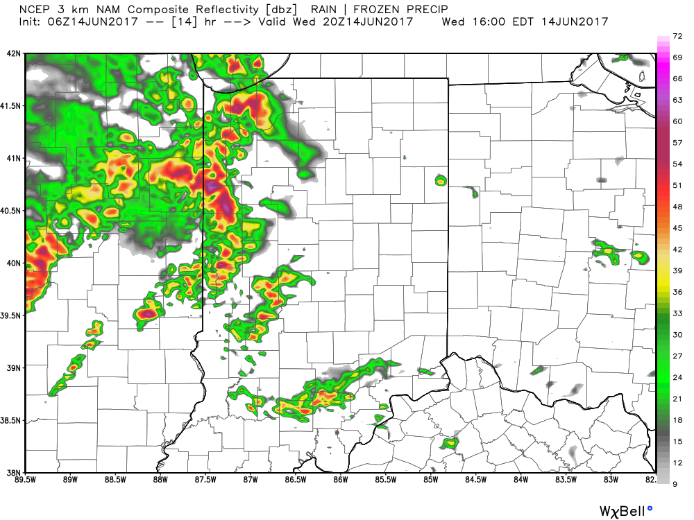
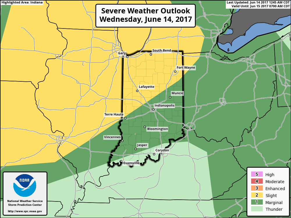
 From a severe perspective, the biggest concern is damaging straight line winds with stronger storms. Remain weather-aware later today, friends!
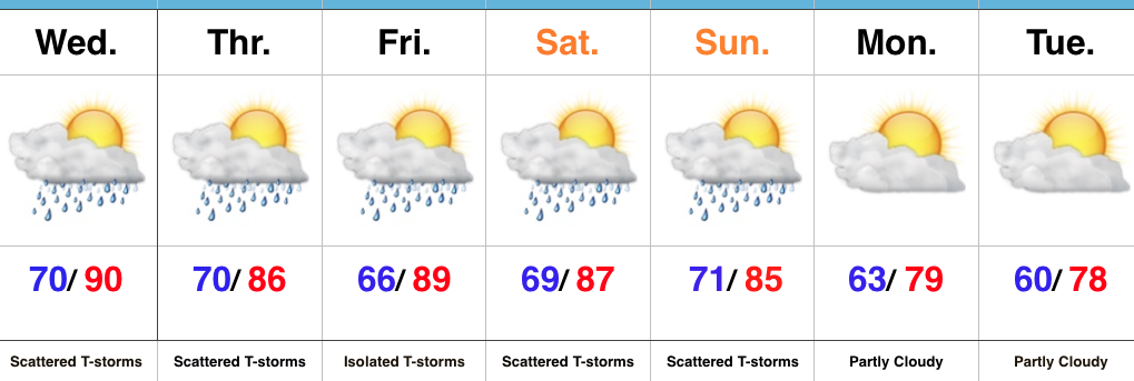 Highlights:
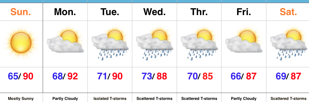 Highlights:
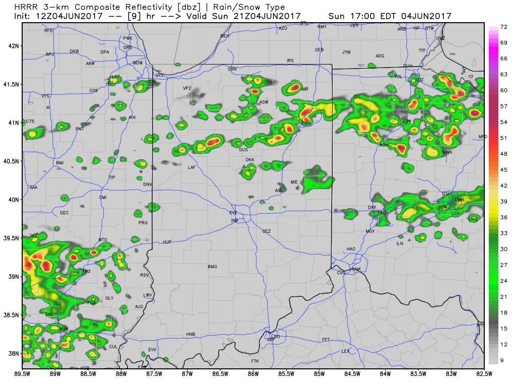
 Most significant rainfall will occur across the northern half of the state, including a couple of 1″+ totals in the heavier storms.