Cool And Increasingly Wet Today…
The morning is starting off dry across most of central Indiana, but that will begin to change as we progress into the afternoon and evening hours as rainfall grows in coverage and intensity.
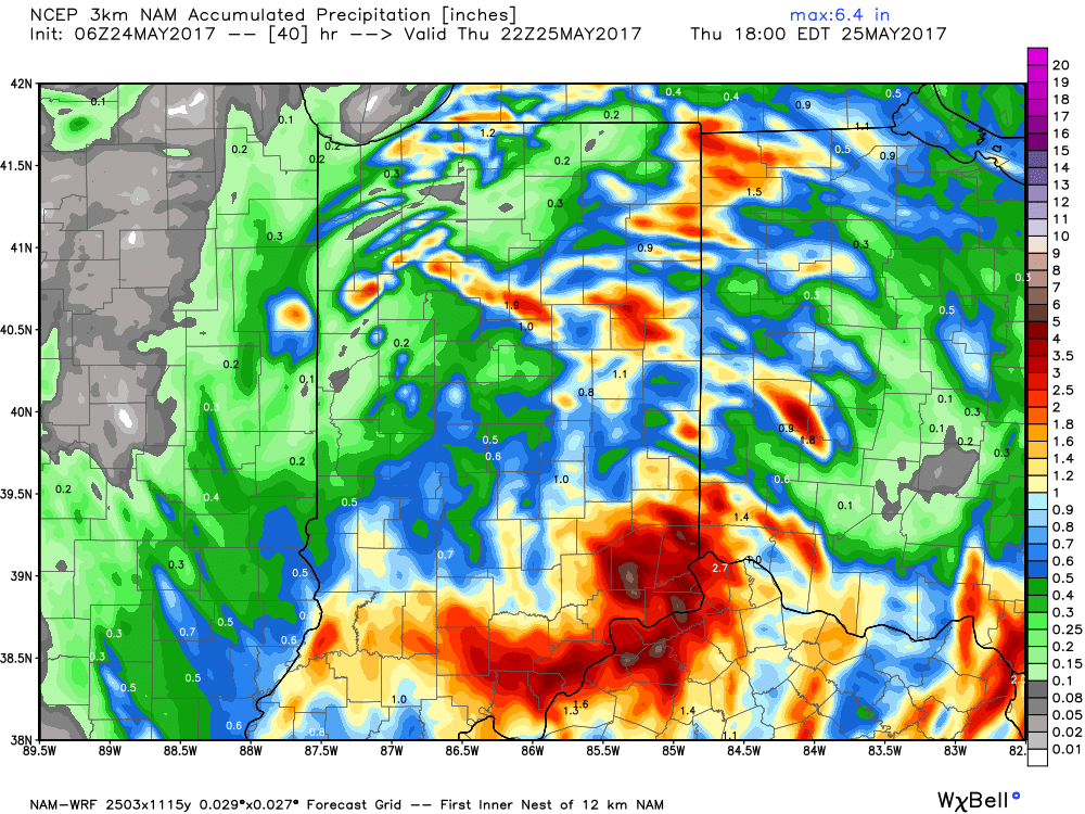
Widespread rain will continue tonight as low pressure tracks north out of the TN Valley and slowly meanders across eastern IN and OH tonight before pulling off to the northeast Thursday.
 Thankfully, rain will begin to diminish Thursday morning and we’re back to mostly dry conditions by Thursday afternoon. Before dry weather returns, some neighborhoods can expect to accumulate between 1″-2″ of rain.
 With the clouds and showers around, expect unseasonably cool conditions both today and Thursday. Highs will only reach the mid to upper 60s both days.
As we look ahead, we think our dry Thursday afternoon should continue into most of Friday before scattered showers and thunderstorms return to the forecast Saturday and Sunday. More on those details later today! Make it a great Wednesday!
 Highlights:
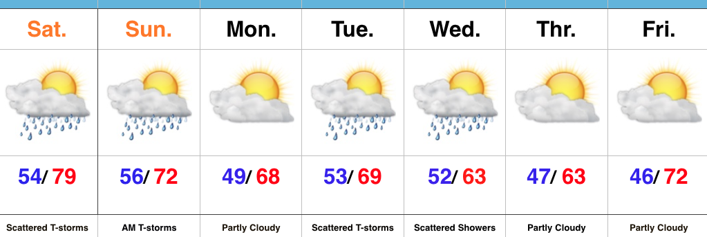 Highlights:
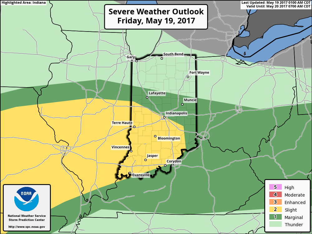
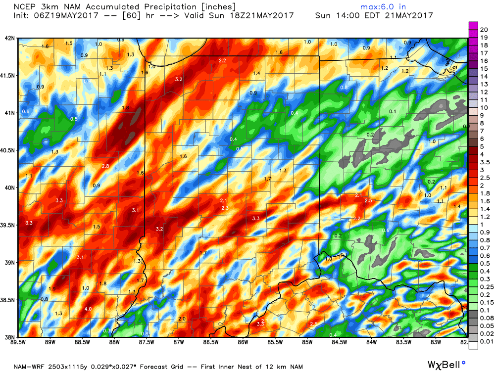
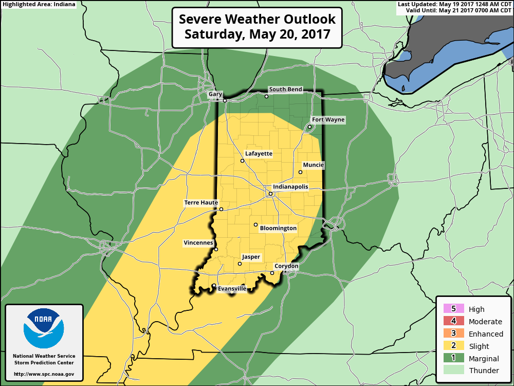 The culprit is a stalled frontal boundary that lies across the center of the state. This front will “bobble” around from time to time over the next 24 hours before lifting back north as a warm front Saturday evening. Accordingly, expect a significant temperature spread from north to south today and periods of showers and thunderstorms scattered about central Indiana. With high precipitable water values, localized heavy rains are expected, but, as mentioned, this won’t be a “uniform” event and there will be “haves and have nots.” Some neighborhoods can expect to pick up a 2-3 inches of rain between now and Sunday afternoon. Greatest severe threats include large hail and damaging straight line winds with storms, but we’ll also have to monitor things for the potential of a couple rotating storms as well.