Unsettled Stretch Of Weather Ahead…
 Highlights:
- Scattered storms
- Turning cooler next week
- Continued unsettled
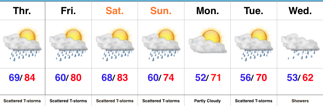
Periods Of Storms In The Days Ahead…While we’ll have more dry time than not into the weekend, multiple rounds of showers and thunderstorms can be expected as we close the work week and move into the weekend. With a moisture-rich air mass in place, locally heavy rain is possible. Storms will reach most widespread coverage during the afternoon and evening hours through Saturday.
A cold front will sweep through the state Sunday with scattered to numerous showers and thunderstorms followed by drier, cooler air for Monday.
As we progress through next week, the region will remain in a much cooler, challenging northwest flow. Individual disturbances will race southeast and result in continued unsettled weather as race weekend and the Memorial Day holiday draws closer. We’ll keep a very close eye on things. The balance of next week will be significantly cooler than average.
Upcoming 7-Day Precipitation Forecast:
- Snowfall: 0.00″
- Rainfall: 1.50″ – 2.00″
 Highlights:
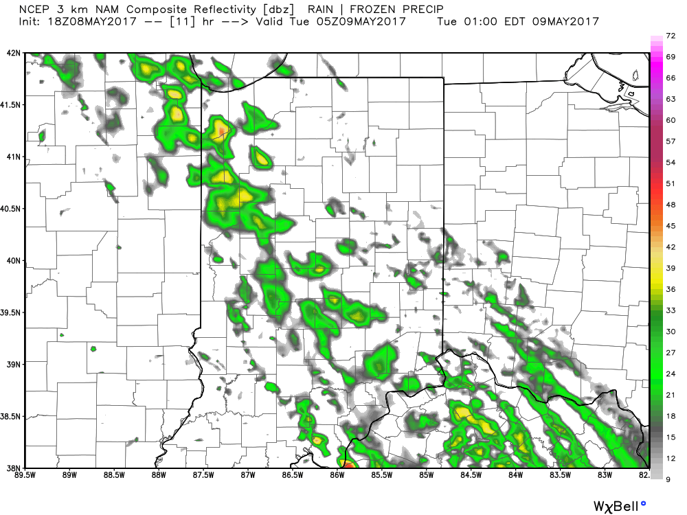
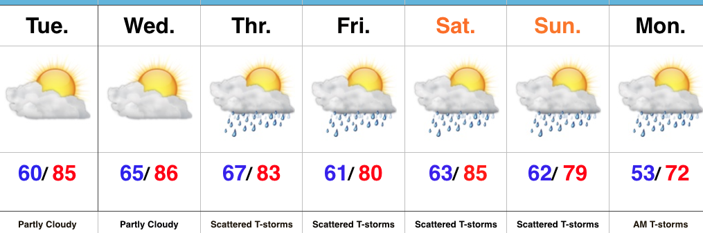
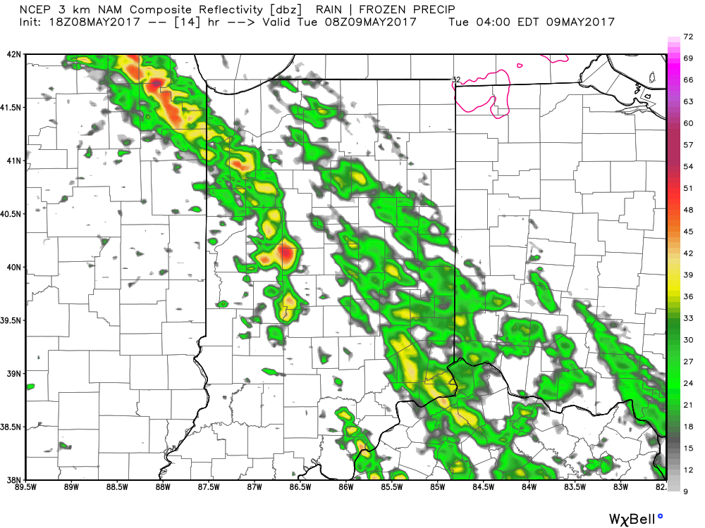 Showers and thunderstorms will continue to impact the central portion of the state through the rush hour before storms diminish and give way to dry time early Tuesday afternoon.
 Unsettled weather will continue as we push through midweek, including another round of showers and thunderstorms late Wednesday into Thursday (likely following a similar path to what tonight’s storms take).