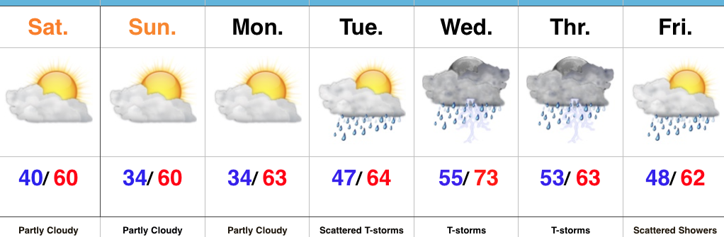
Frosty Mornings; Heavy Rain Returns Next Week…
 Highlights:
- Needed dry time
- Frosty mornings
- Heavy rain and storms return
Drier, But Unseasonably Cool…Much-needed dry time has arrived. High pressure will dominate our weather pattern this afternoon through Monday, supplying dry skies. Despite the return of the sunshine, temperatures will continue to run much cooler than average. In fact, with drier conditions in place, overnight lows will tumble into the frosty range Sunday and Monday mornings. Cover up that tender vegetation.
Our next weather maker will arrive on the scene by the middle of next week as a frontal boundary stalls out over the region. Unfortunately, this is a rather ominous signal for heavy rains to return. We forecast periods of showers and thunderstorms Tuesday through Thursday before wrapping up the work week with scattered showers. We’ll keep a close eye on the data over the next few days as additional heavy rains are the last thing we need.
Upcoming 7-Day Precipitation Forecast:
- Snowfall: 0.00″
- Rainfall: 1.50″ – 2.00″
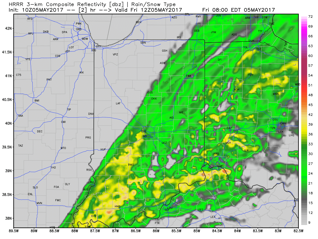
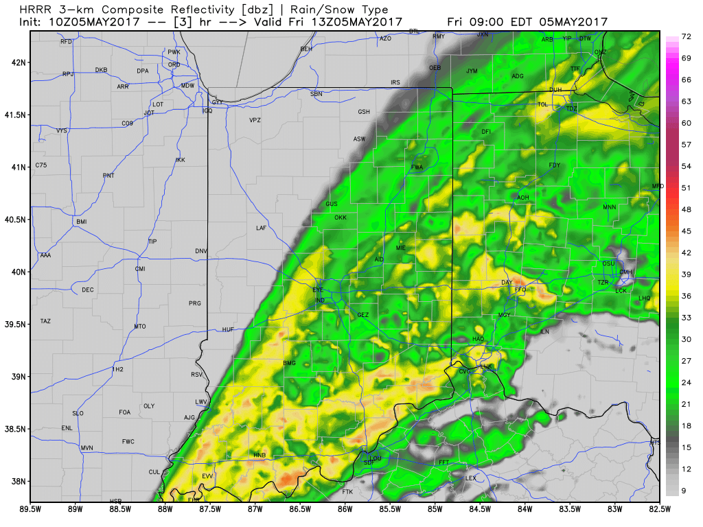
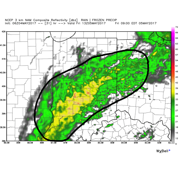
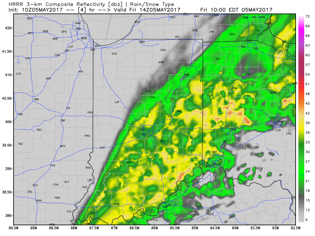 Additional rainfall of 1″-1.5″ is likely from Indianapolis and points south and east with this band of rain before drier weather finally works in here this afternoon and evening. Otherwise, expect continued windy, cold, and raw conditions today as temperatures remain in the 40s this afternoon, including wind chills in the 30s.
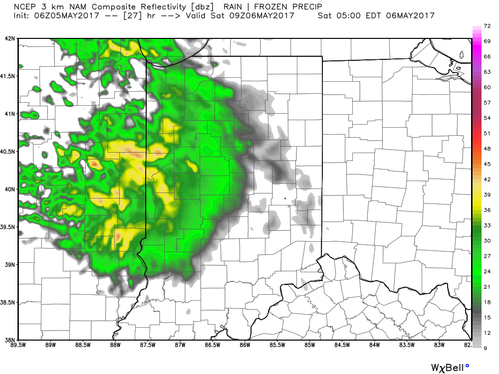
 We’ll finally get rid of the rain and introduce a drier regime Saturday afternoon into Sunday, including a sunny close to the weekend. With the drier air, overnight lows will fall to frosty levels Sunday and Monday mornings (lower to middle 30s).
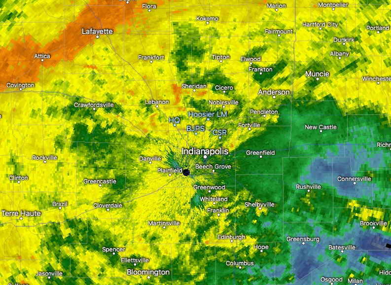
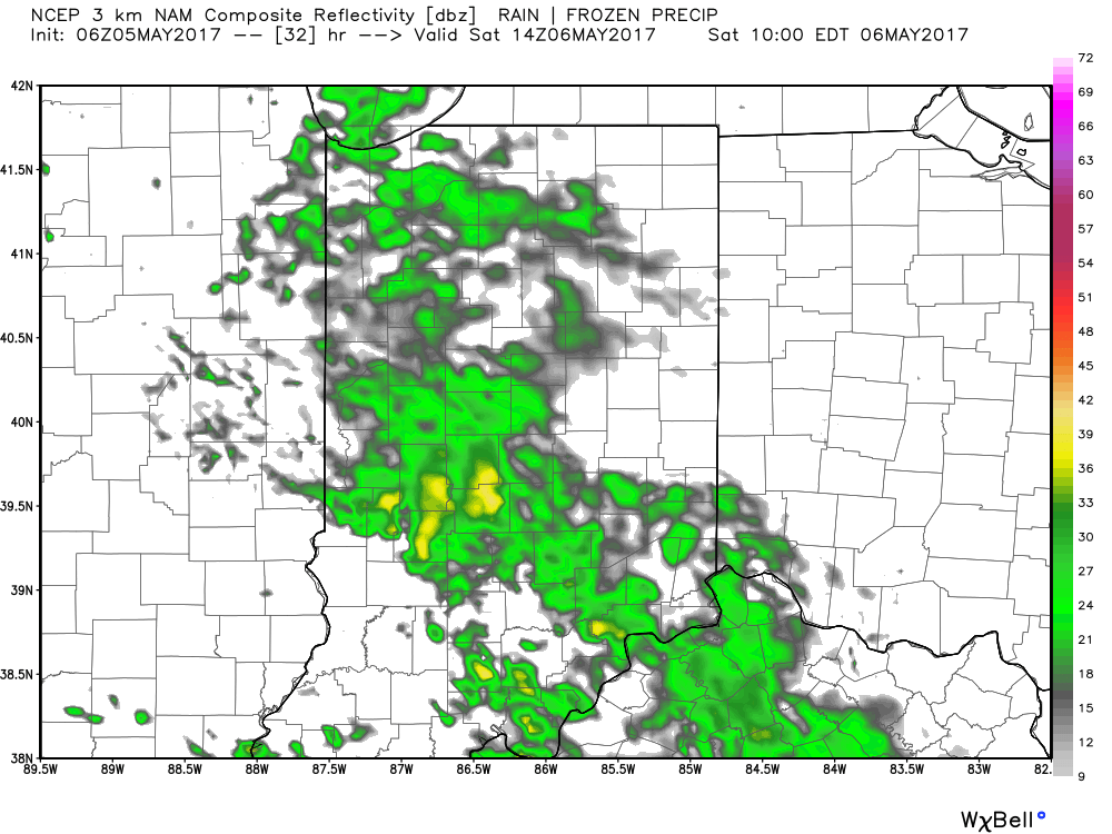
 We should finally get into drier air Friday night before one last round of showers pushes southeast across the state Saturday morning. As of this update, we bracket the 4a-10a timeframe for renewed wet weather. By Saturday afternoon, drier air should win out and result in a much more favorable forecast Saturday night into Sunday.
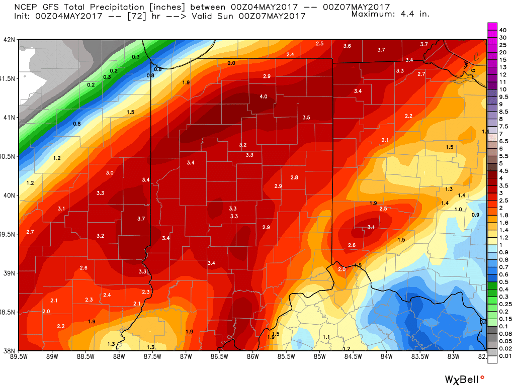 In closing, as drier air begins to arrive on the scene Saturday evening, much cooler conditions will result in areas of frost into early next week. Lows in the lower to middle 30s will be common Sunday and Monday mornings across central Indiana.
 Highlights: