Monday Morning Video: Heavy Rain And Freezing Rain Potential Grabs The Headlines…
You must be logged in to view this content. Click Here to become a member of IndyWX.com for full access. Already a member of IndyWx.com All-Access? Log-in here.
You must be logged in to view this content. Click Here to become a member of IndyWX.com for full access. Already a member of IndyWx.com All-Access? Log-in here.
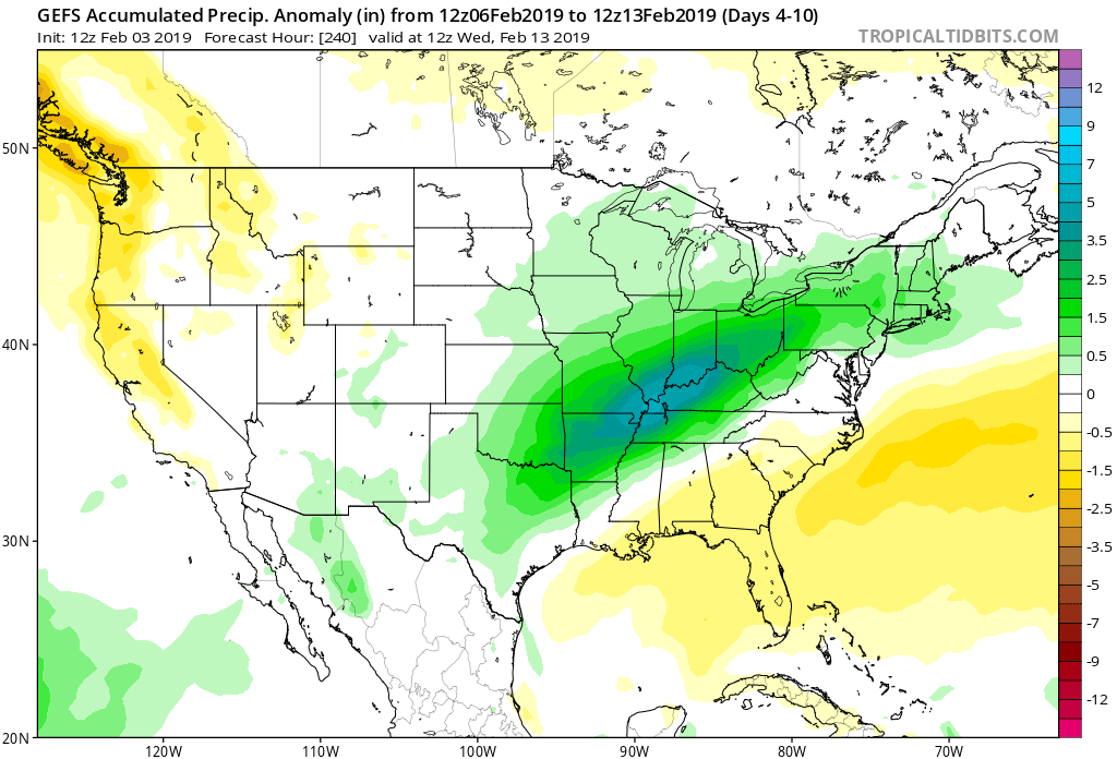
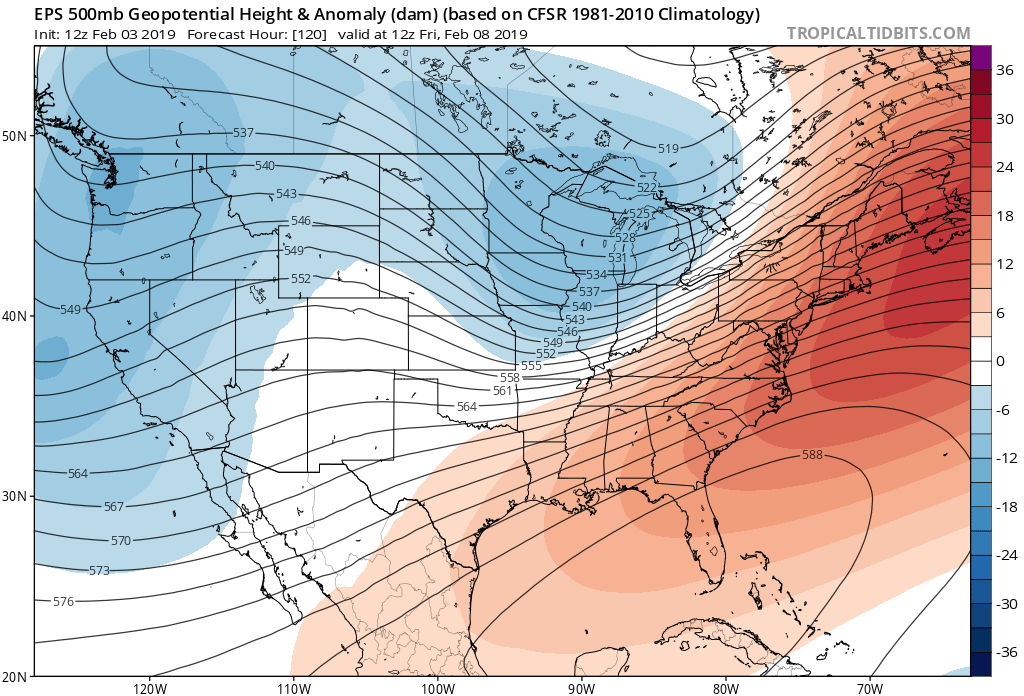
In the short-term, there’s no getting around the very active pattern in place. As we’ve been discussing, we’ll find ourselves “smack dab” in the middle of a battle ground between a stubborn southeast ridge and building cold to our northwest. The fight in between will yield well above normal precipitation over the next couple of weeks.
Over the upcoming (10) days, expect a roller coaster ride in the temperature department as the battle takes place. While the most anomalous warmth is taking place now (IND is on pace to set a new record high temperature before the end of the day), relative warmth will continue to dominate into midweek before colder air presses and wins out.
After Monday’s light rain, we’re targeting (3) opportunities for significant precipitation across the region:
I. Tuesday night-Wednesday (still may include a risk of freezing rain across north-central communities).
II. Wednesday night-Thursday morning
III. Thursday night-Friday morning (ending as light snow)
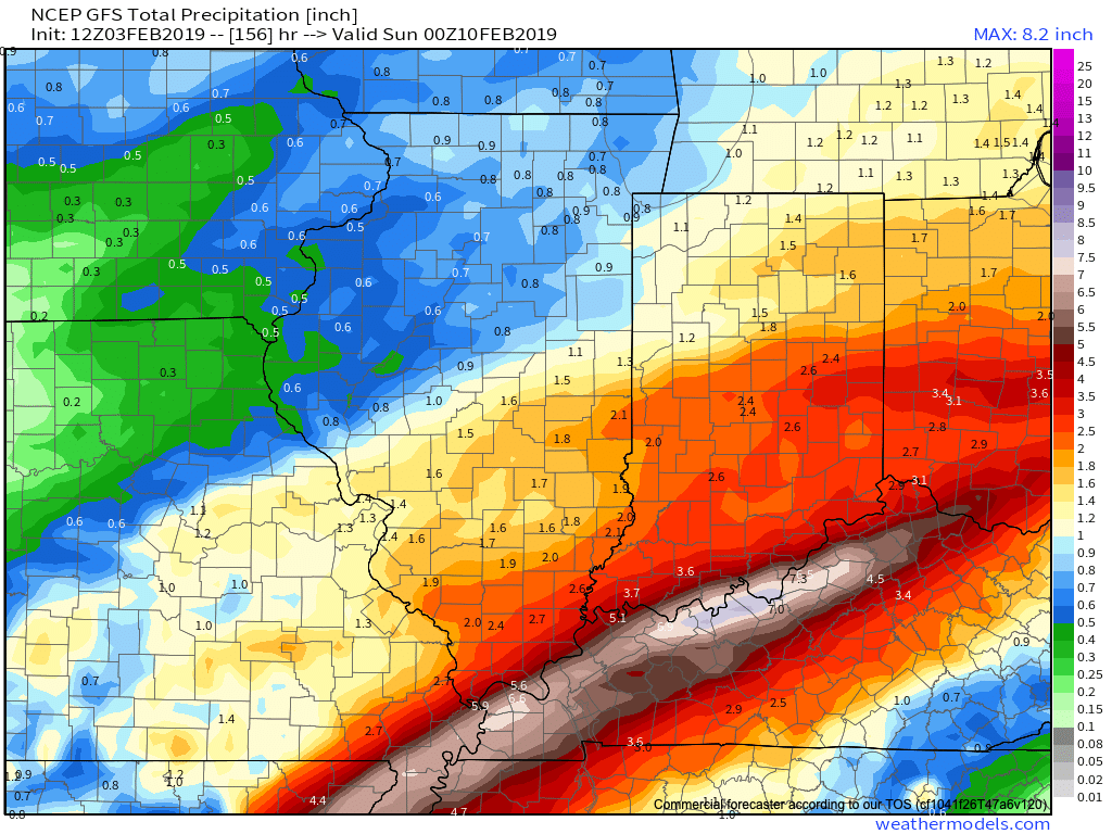
When all is said and done, model data is in agreement on significant rainfall totals across central Indiana (2″ to 3″ amounts will be common by Friday).
Thereafter, confidence is high on colder air returning as we close the week and head into next weekend.

Guidance suggests that we still need to remain abreast of the potential of a more widespread wintry event late next weekend and this is something we’ll continue to keep close tabs on as we progress through the upcoming week. As of now, this doesn’t appear to be a major event, but stay tuned.
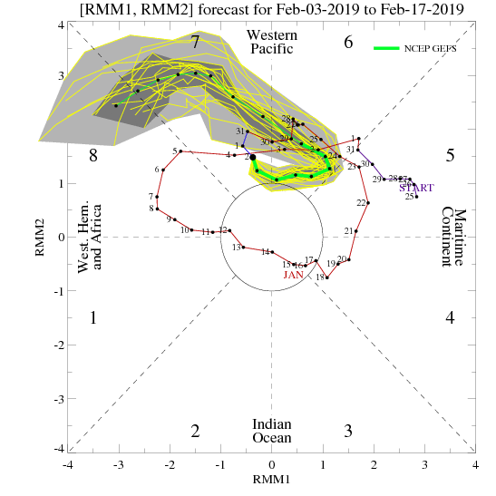
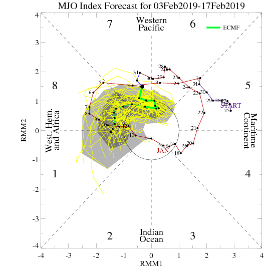
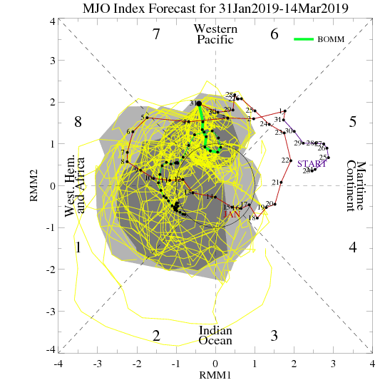
As we look ahead, we’ll have to continue keeping a close eye on the MJO. Today’s update shows the majority of data swinging things into Phase 8 by mid to late month. Should that come to fruition, prospects of another significant cold spell loom large…

Fun times ahead- no matter how you look at it! 🙂
Enjoy the game!
A new week has dawned and with it will come a very busy weather pattern. Thankfully, today we’ll enjoy a “hint of spring,” including temperatures approaching the 60 deg. mark…
You must be logged in to view this content. Click Here to become a member of IndyWX.com for full access. Already a member of IndyWx.com All-Access? Log-in here.
You must be logged in to view this content. Click Here to become a member of IndyWX.com for full access. Already a member of IndyWx.com All-Access? Log-in here.
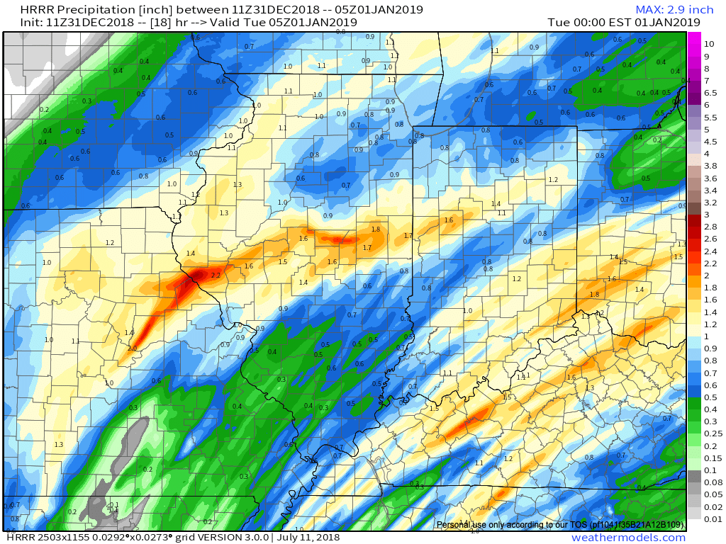
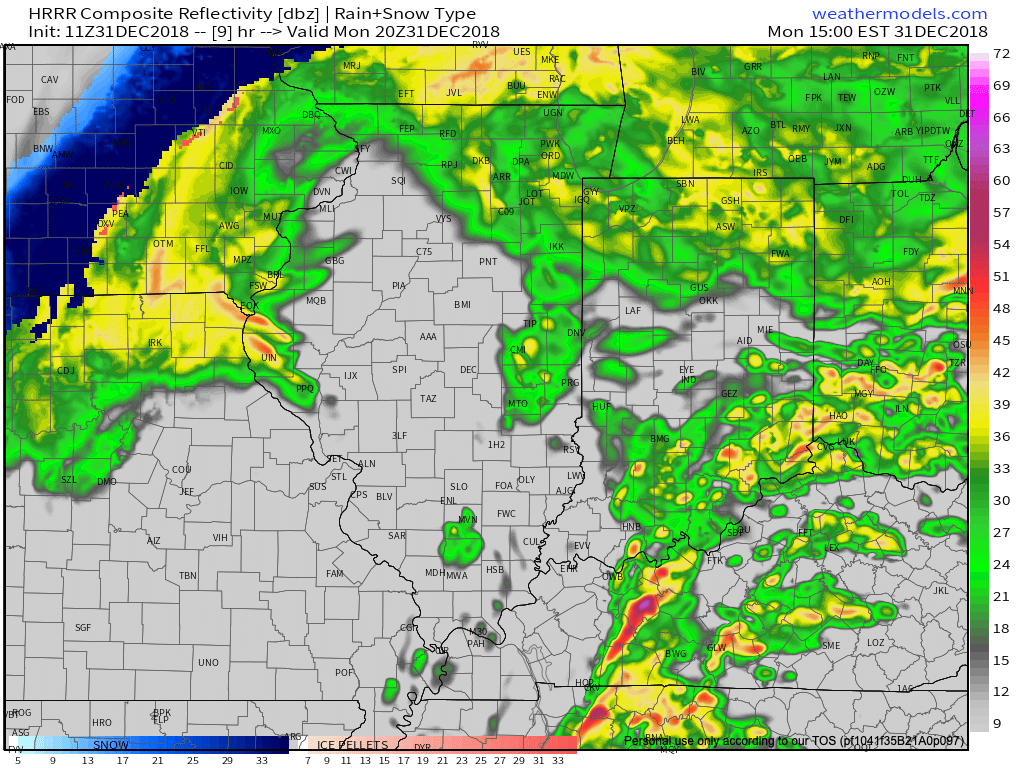
IND has already recorded over half an inch in the rain gauge this morning and there’s more where that came from between now and tonight. Steady rain will be replaced with scattered downpours late morning to around the lunchtime hour before widespread rain and embedded thunder returns early to mid afternoon. Most can expect to tack on an additional half inch to inch of rain today and the latest HRRR sees this as well.
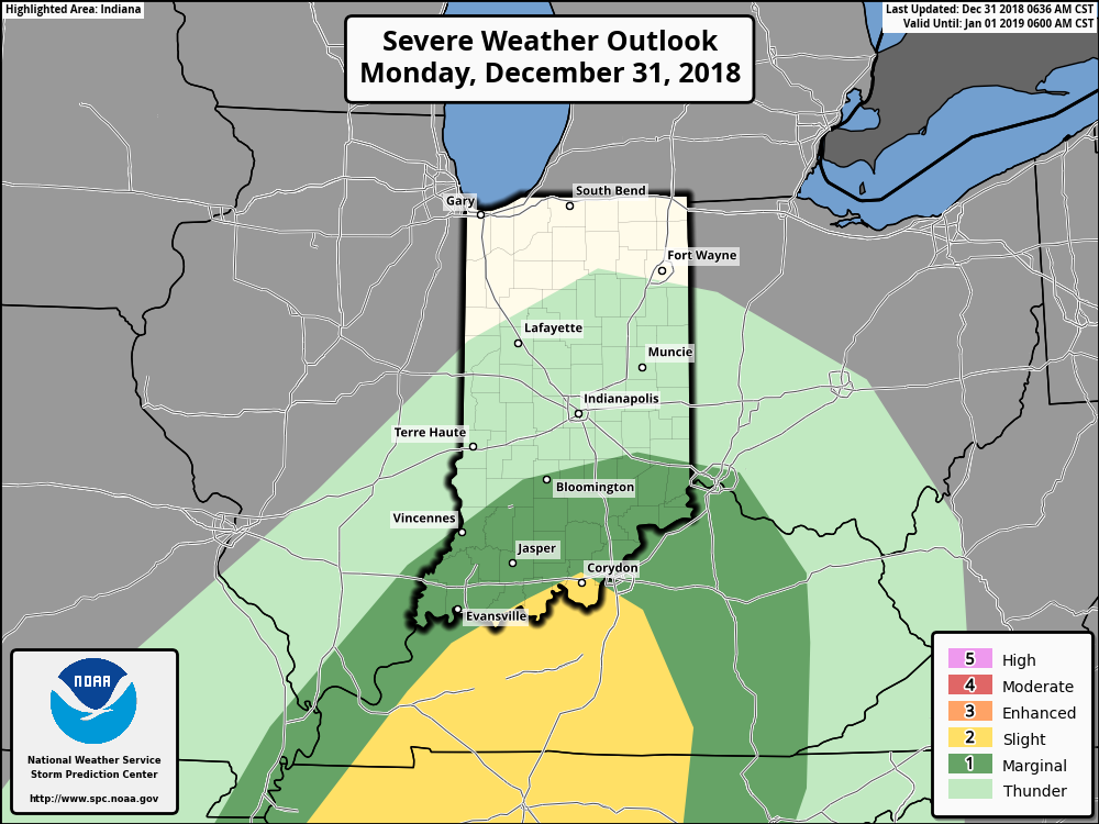
 We’re also still monitoring the potential of strong to severe thunderstorms across southern portions of the state. The Storm Prediction Center now includes far southern Indiana in a Slight Risk for severe weather today. The primary concerns remain strong, damaging winds with a line of thunderstorms that may develop between 2p and 4p. If your travels take you south towards Louisville today remain weather-aware.
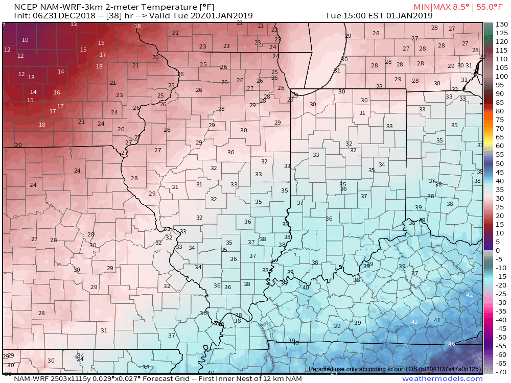
 Temperatures will run 25° to 30° colder New Year’s Day and a couple of scattered snow showers may fly- especially across the favored snowbelt areas to our north.
 Have a happy and safe New Year’s Eve, friends!