Heavy Rain (And Thunder Downstate) Arrives For New Year’s Eve…
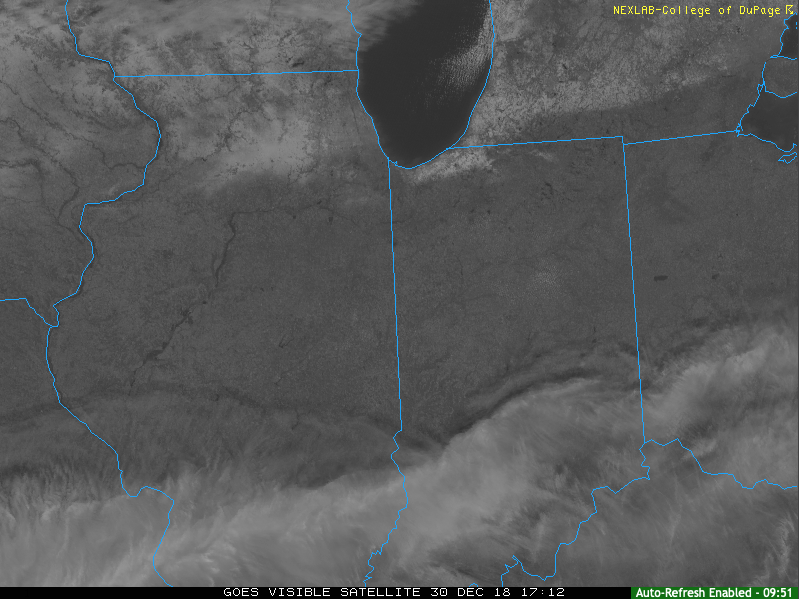
We’re enjoying pleasant conditions this afternoon with filtered sunshine and temperatures that should top out in the upper 30s to lower 40s later on. Enjoy it, as a big rain event gets underway for New Year’s Eve.
Clouds will increase tonight and rain won’t be too far behind. We think wet weather builds into central Indiana before sunrise Monday (likely between 4a to 6a) and periods of heavy rain are still expected late morning into the afternoon and evening hours.
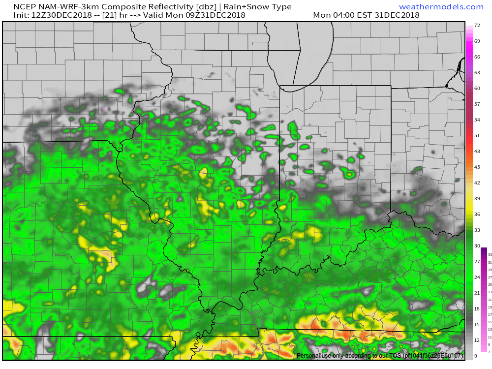
We continue to monitor the prospects of a skinny line of strong thunderstorms that may impact southern Indiana Monday afternoon and evening. If your travels take you south to Louisville for NYE plans, this is something to monitor. Widespread severe weather isn’t expected, but strong winds are possible if this line materializes.

This storm system will have a true tropical connection. Precipitable water values will be quite “juicy” for late December and plenty capable of producing locally heavy totals. Widespread 1″ to 1.5″ can be expected, but a few area rain gauges will likely see higher amounts.
 Colder air will whip in here late tomorrow night and help lingering moisture fall as scattered snow showers New Year’s Day. More later on the potential of wintry “mischief” later in the week…
 Highlights:
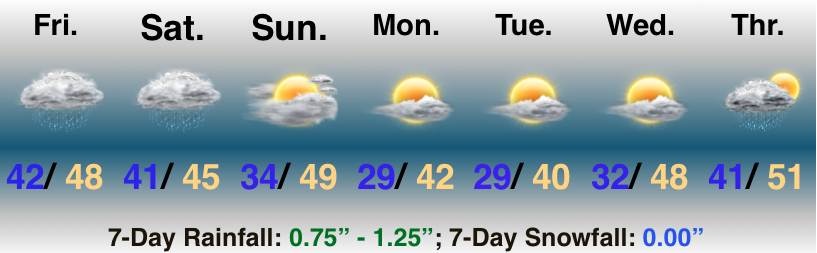 Highlights:
 II. Highs today will come tonight (mid-to-upper 50s) ahead of the cold front. Once the front moves through, colder air will return for the second half of the weekend. As wrap-around moisture combines with the colder air, light snow showers will develop late Sunday night into Monday morning (shown below). This won’t be a huge deal.
 III. The next item of interest will come from a clipper system Thursday. This won’t only serve up another round of light snow, but also help to reinforce the unseasonably cold air. Highs will return to around freezing to close the week with lows in the 20s.
 IV. That leads us to what comes next weekend. While it’s still far too early for any sort of specifics, we’ll simply say to keep a mental note in the back of your mind for the potential of a more disruptive winter event coming out from the southern Plains into the Ohio Valley. We’ll certainly have to fine tune things and “hone in” as we progress through the upcoming week. From this distance, prospects range from nothing more than a light snow to a “plowable” storm. Unlike this weekend’s storm, there will be a limit to how far north next weekend’s storm will be able to track…