You must be logged in to view this content. Click Here to become a member of IndyWX.com for full access. Already a member of IndyWx.com All-Access? Log-in here.
Category: Hail
Permanent link to this article: https://indywx.com/video-severe-weather-event-tonight-a-lot-of-noise-with-regard-to-the-late-august-pattern/
Aug 07
Severe Potential East Thursday; Great Weekend On Deck, And Looking Ahead To Next Week…
Needed moisture missed much of immediate central Indiana Tuesday. Areas south of the city picked up some locally heavy downpours, but the early morning diminishing convection to our northwest helped stabilize things just enough to prevent storms from redeveloping locally.
There will be another opportunity for getting some needed rain Thursday, but we caution coverage, yet again, will likely be of the “hit and miss” variety. Given some of the ingredients, a couple of severe cells will be possible ahead of the frontal boundary Thursday afternoon. Best chances of being impacted by a storm Thursday will be across east-central Indiana as a line of storms across Ohio “tails back” into Indiana. Accordingly, the Storm Prediction Center (SPC) does include this part of the state in a Slight Risk of severe weather Thursday.
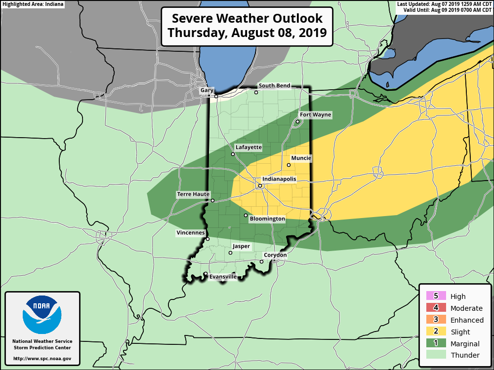
Primary concerns for any stronger thunderstorm that develops will be large hail and straight line winds.
As we look ahead to the weekend, sprawling high pressure is still expected to move overhead and produce plentiful sunshine, low humidity (you’ll notice a big drop in moisture levels Thursday afternoon to Friday morning), and very pleasant temperatures.
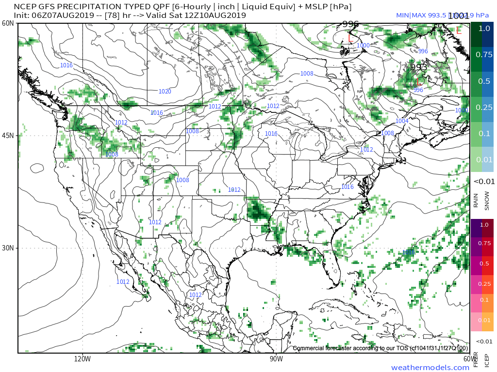
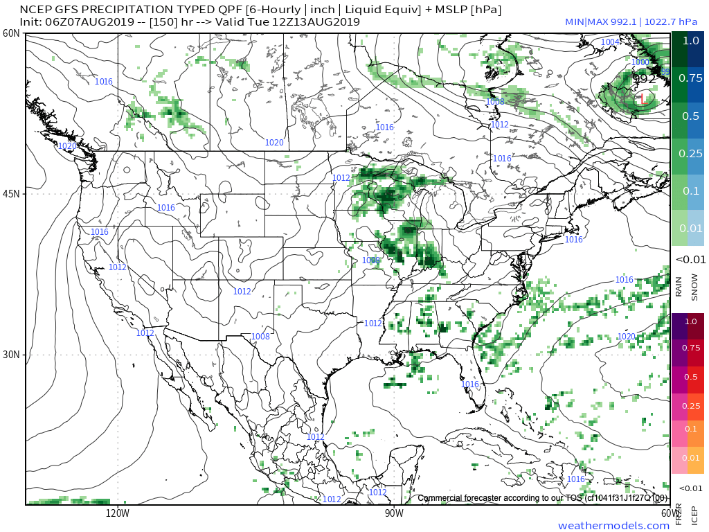
Our next chance of rain and storms will arrive Monday into Tuesday.
More a bit later with the issuance of our Wednesday evening video update! Enjoy your Wednesday!
Permanent link to this article: https://indywx.com/severe-potential-east-thursday-great-weekend-on-deck-and-looking-ahead-to-next-week/
Jun 14
Friday Evening All-Access Video Update: A Wet, Stormy Weekend Awaits…
You must be logged in to view this content. Click Here to become a member of IndyWX.com for full access. Already a member of IndyWx.com All-Access? Log-in here.
Permanent link to this article: https://indywx.com/friday-evening-all-access-video-update-a-wet-stormy-weekend-awaits/
May 30
Short-Term Video Update: How Long Do Storms Last Tonight? Strong Storms Saturday PM?
You must be logged in to view this content. Click Here to become a member of IndyWX.com for full access. Already a member of IndyWx.com All-Access? Log-in here.
Permanent link to this article: https://indywx.com/short-term-video-update-how-long-do-storms-last-tonight-strong-storms-saturday-pm/
May 16
Short-Term Update: Keeping An Eye On Severe Potential This Evening-Tonight…
The Storm Prediction Center has issued a Severe Thunderstorm Watch in effect until 7p.
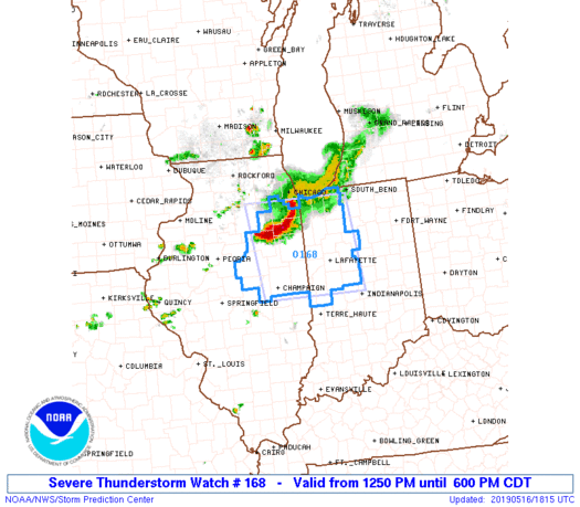
Greatest concern has to do with the Southwest flank of the thunderstorm complex that will continue to push southeast into the evening hours. (This is the same complex of storms that moved through MN and WI earlier this morning).
As we look at the ingredients needed for severe weather, there’s reason to believe this complex will hold together, including occasionally producing severe weather (large hail and damaging winds remain the biggest concerns) into portions of central Indiana by early to mid evening (5p-8p time frame).
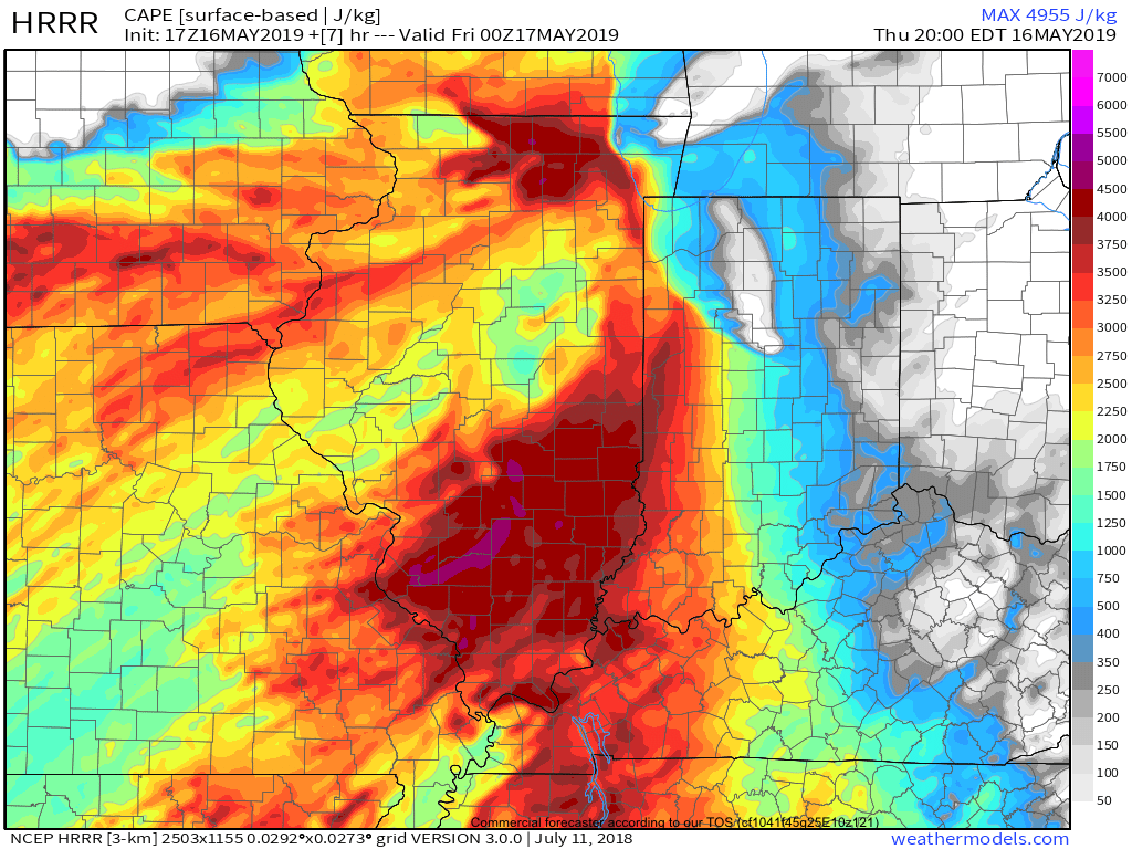
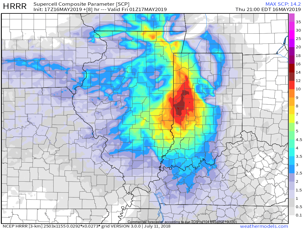
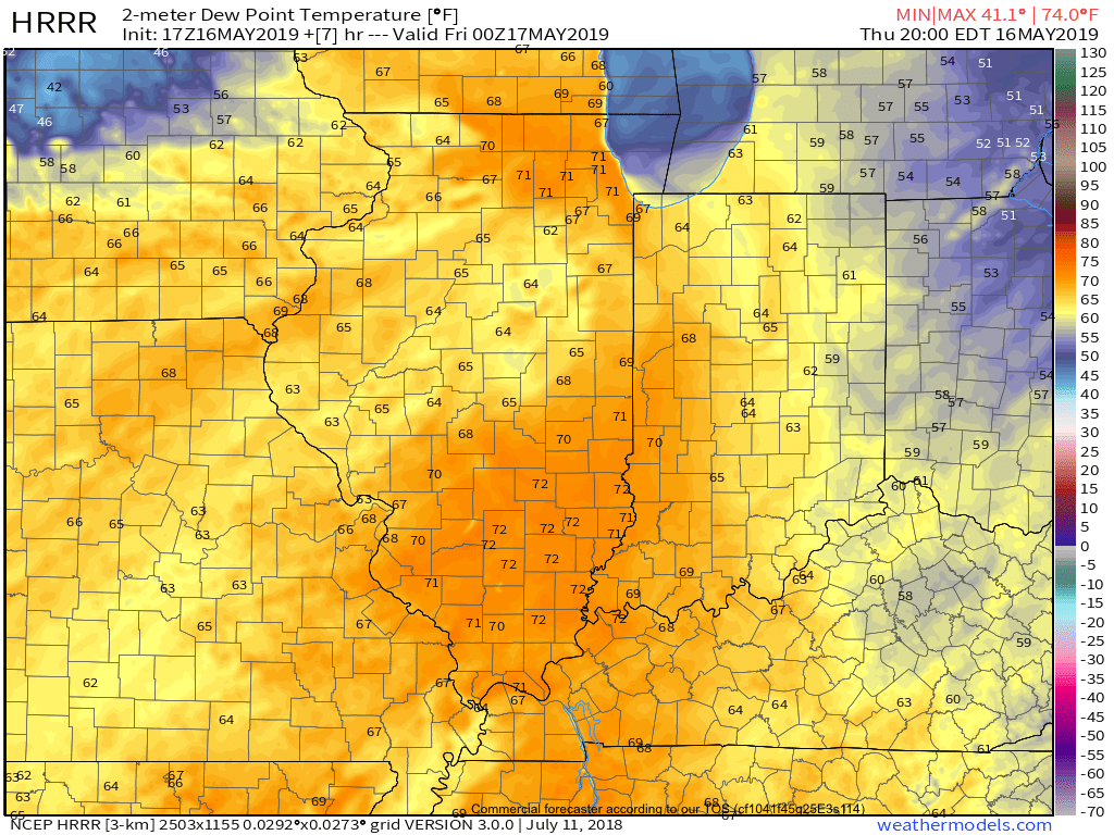
This shouldn’t have any impact on another, more widespread, complex of storms that will initiate well to our north late tonight before rumbling south into central Indiana around, or just after, midnight in a weakening state…
More later!
Permanent link to this article: https://indywx.com/short-term-update-keeping-an-eye-on-severe-potential-this-evening-tonight/
