You must be logged in to view this content. Click Here to become a member of IndyWX.com for full access. Already a member of IndyWx.com All-Access? Log-in here.
Category: GFS
Permanent link to this article: https://indywx.com/video-strong-storm-threat-nw-tomorrow-where-will-soon-to-be-barrys-remnants-track-next-week/
Jul 07
Getting To Be That Time Of Year: Major Model Differences Around Tropical Mischief…
A trough of low pressure will continue moving south through the Southeast region (now) and into the northern Gulf (by the early to middle portion of the work week).
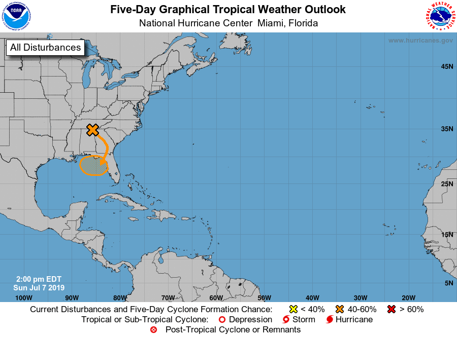
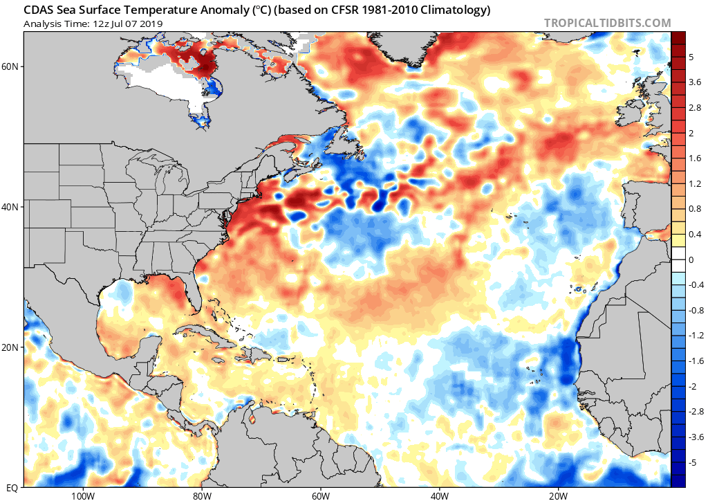
With warmer than average sea surface temperatures across the north-central and northeastern Gulf, along with a favorable upper level wind environment, the potential is present for this disturbed area of weather to strengthen into a tropical depression over the next few days before meandering just off the coastline.
While Gulf Coast beach-goers will need to remain on guard for the threat of more organized unsettled weather during the upcoming period centered on early to mid week, the potential inland impacts are much less certain at this point.
Reviewing the latest midday model guidance shows two different camps:
I. The GFS likes the idea of a heavy inland rain threat impacting the Carolinas (primarily east of the Appalachians) late week and into the weekend.
II. The European forecast model “curls” the area of disturbed weather west. A polar opposite of the GFS solution, the European strengthens the system across the north-central Gulf before bringing potential Barry into LA over the weekend. Thereafter, if this solution proves correct, portions of the OHV (including central Indiana) would deal with rain early next week.
We, obviously, have a long way to go with this set-up, but given the overall upper air pattern we tend to favor more of a GFS solution at this point in time. Needless to say, we’ll keep a very close eye on things over the upcoming few days…
Permanent link to this article: https://indywx.com/getting-to-be-that-time-of-year-major-model-differences-around-tropical-mischief/
May 22
Prolonged Unsettled Stretch Of Weather…
Yesterday was only the beginning of a renewed prolonged stretch of unsettled and stormy weather. A series of fronts will make a move towards the OHV only to stall out and lift north back as a warm front over the upcoming 7-day period. The end result? An extended stretch of wet, stormy conditions.
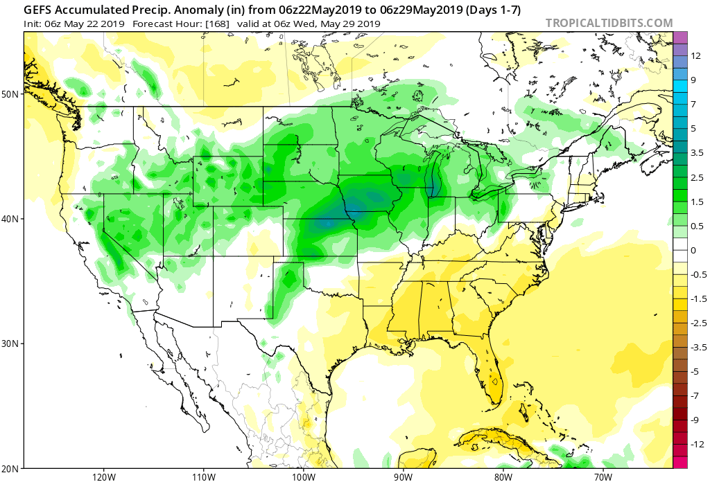
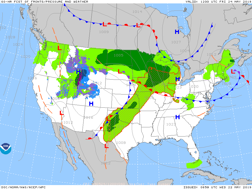
Get used to the setup above with a stalled front nearby and waves of low pressure moving along the associated boundaries from time to time. As these ripples of energy scoot along the front, more enhanced showers and thunderstorms can be expected.
It’s still tough from this distance to say with certainty which day(s) will offer up the most widespread shower and thunderstorm coverage in this pattern, but we continue to lean towards Saturday into Sunday. Stay tuned.
Models agree on widespread 1.5″ to 2.5″ rainfall totals over the upcoming week with locally heavier amounts.
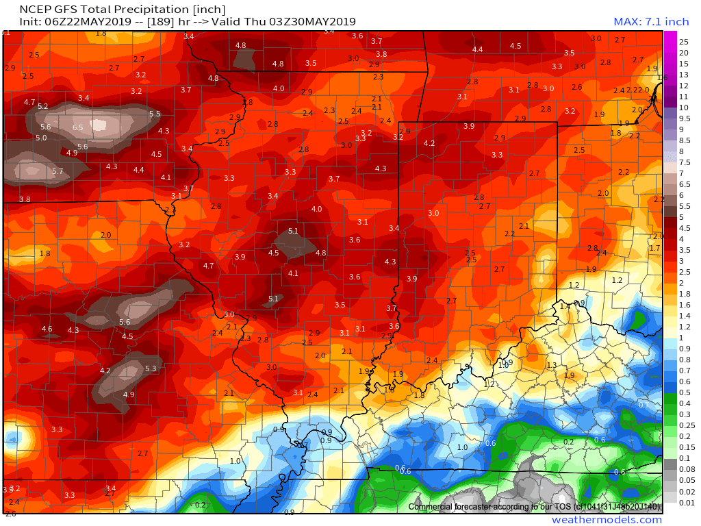
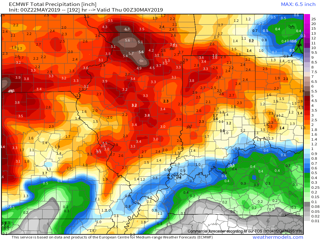
Conditions will also return to a warmer than normal theme into the middle of next week. At times, conditions will become oppressive (depending on which side of the front you find yourself on). If heading to the track, ensure you have means to remain cool and pack the rain gear just to be safe!
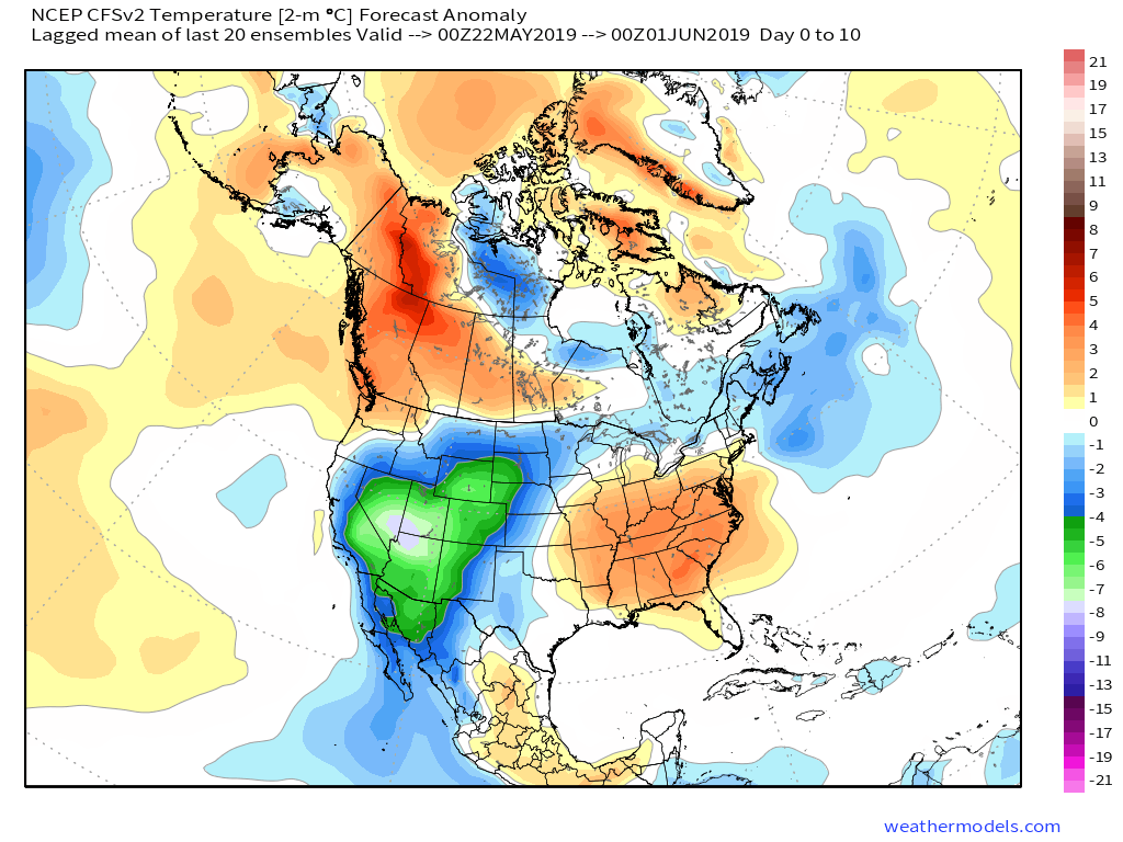
More later tonight on the long range, including a video recap of our Summer Outlook.
Permanent link to this article: https://indywx.com/prolonged-unsettled-stretch-of-weather/
May 06
All-Access Video: Timing Out Storm Chances This Week; May Takes On A Cooler Feel…
You must be logged in to view this content. Click Here to become a member of IndyWX.com for full access. Already a member of IndyWx.com All-Access? Log-in here.
Permanent link to this article: https://indywx.com/all-access-video-timing-out-storm-chances-this-week-may-takes-on-a-cooler-feel/
May 05
All-Access Video: Week-Ahead Outlook; Cooler Than Average Pattern On Deck As May Progresses…
You must be logged in to view this content. Click Here to become a member of IndyWX.com for full access. Already a member of IndyWx.com All-Access? Log-in here.
Permanent link to this article: https://indywx.com/all-access-video-week-ahead-outlook-cooler-than-average-pattern-on-deck-as-may-progresses/
