In The Deep Freeze…
 Highlights:
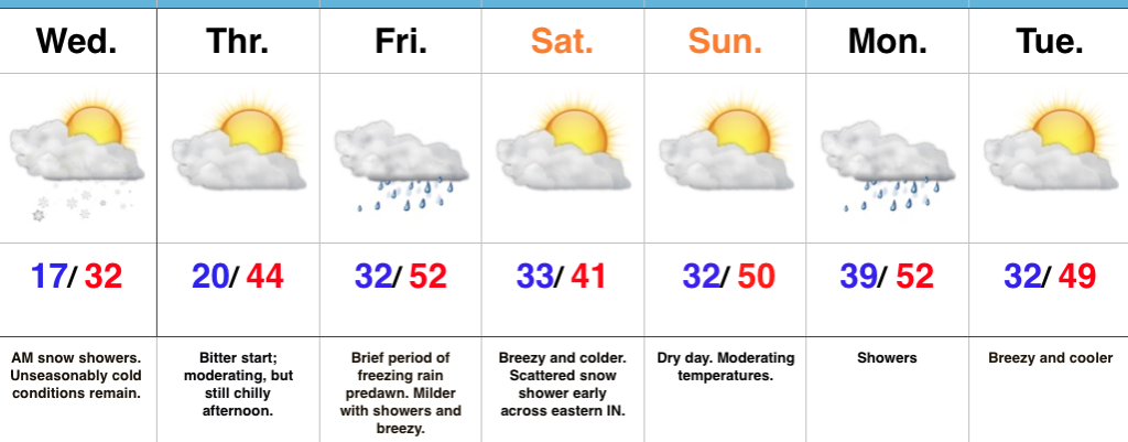
- Morning snow showers end
- Slowly moderating temperatures
- Wet St. Patrick’s Day
- Sunshine returns this weekend
Heavy Winter Gear Required…The calendar may say mid-March, but Old Man Winter refuses to go away without having the last word. To put things into perspective, our forecast high of 32° today is colder than our average low for the 15th (33°)! To make matters worse, gusty north winds are pushing the wind chill factor into the single digits this morning. Bundle up! Moving forward, lake-enhanced snow showers will continue through the morning hours before ending as we progress through the afternoon.
After a cold start Thursday, a moderating trend will develop by afternoon. Plentiful sunshine should be with us Thursday before clouds increase late in the day in advance of a warm front lifting northeast. Showers will develop Friday (could begin as a touch of freezing rain, but not expecting problems Thursday night/ early Friday morning), but temperatures will actually reach seasonal levels despite the wet, breezy conditions.
Sunshine returns this weekend and though it’ll be cooler Saturday when compared to St. Patrick’s Day, considering how cold we’ve been of late, it won’t feel that bad. Early morning snow showers will target eastern and northeastern portions of the state before sunshine returns.
The next weather maker will provide showers Monday before we focus in on the middle of next week with potential of a more significant storm to deal with…
Upcoming 7-Day Precipitation Forecast:
- Snowfall: Dusting
- Rainfall: 0.50″ – 0.75″
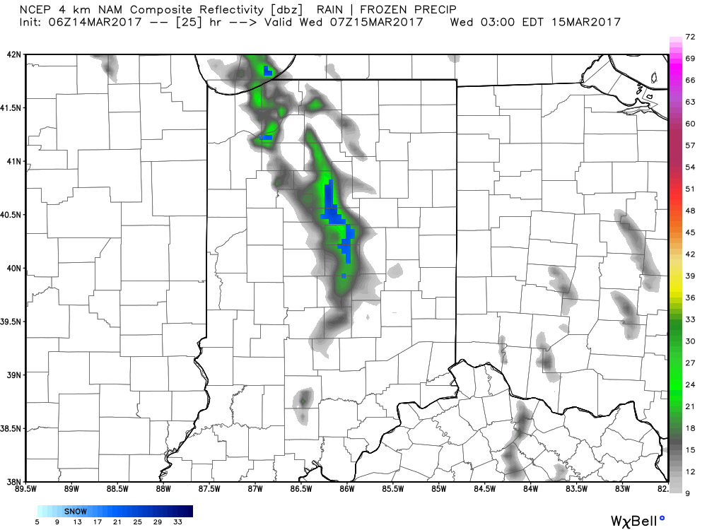
 As we progress through the afternoon hours, clouds will increase and scattered snow showers will develop. Highs will remain below freezing today- generally in the upper 20s to around 30.
 With very cold air aloft, a lobe of upper level energy, and some lake enhancement, scattered snow showers will develop this afternoon and continue into the evening hours. Additionally, snow squall parameters are high and locally intense bursts of snow can also be expected as we move through the afternoon and evening hours. These won’t impact everyone, but where they do occur, expect rapidly reduced visibility and a quick accumulation. Forecast radar shows this potential as we move into the afternoon hours, with a couple of lake effect streamers continuing Wednesday morning.
 Highlights:
 Highlights:
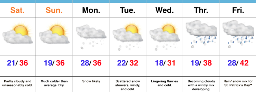 Highlights: