Enjoy Today; Winter Returns…
 Highlights:
- Spring-like feel today
- Much colder pattern developing
- Accumulating snow early next week?
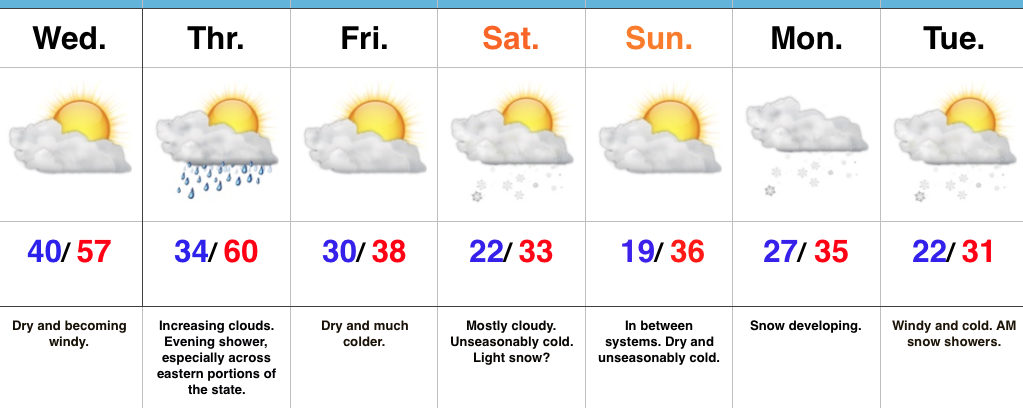
Colder Pattern Taking Hold…The day is dawning bright and sunshine will be with us through the majority of the day, along with pleasant, spring-like temperatures. Find a way to get out and enjoy it! Unfortunately, the pleasant weather will end tonight.
Clouds will increase late in the day and give way to showers during the nighttime period. A cold front will press south and pull much colder air into the region as we wrap up the work week and head into the weekend. The suppressed route is still the one most likely for the weekend system and instead we’re left with an unseasonably cold, mostly dry forecast, locally. We’ll still be on the watch for the potential of some light snow early Saturday, but the more significant, accumulating snow will be shoved south to the TN Valley. Those beautiful northeast TN and western NC mountains look to be in the “sweet spot” for this storm (plowable accumulations).
Another storm system will track through the Mid West as we close the weekend and open next week. Consequently, clouds increase late in the day Sunday and snow should overspread the region Monday. Reinforcing cold air will arrive Tuesday with snow showers and gusty winds.
Upcoming 7-Day Precipitation Forecast:
- Snowfall: 1″ – 3″
- Rainfall: 0.10″ – 0.20″
 Highlights:
 Highlights:
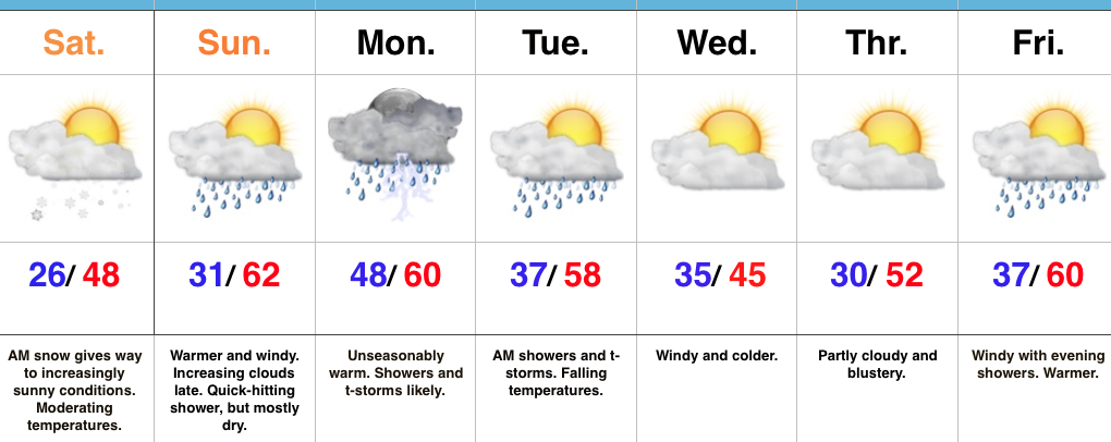 Highlights:
 Highlights: