It’s a nice start to the day, though patchy dense fog is impacting some communities this morning. Sunshine will burn through the fog over the next hour, or two.
 That said, things will change as we progress into the prime heating hours of the afternoon and evening. Upper level energy will rotate east out of the Plains (this morning) and across Indiana this afternoon and evening.
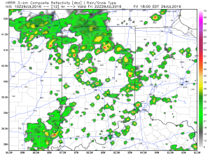
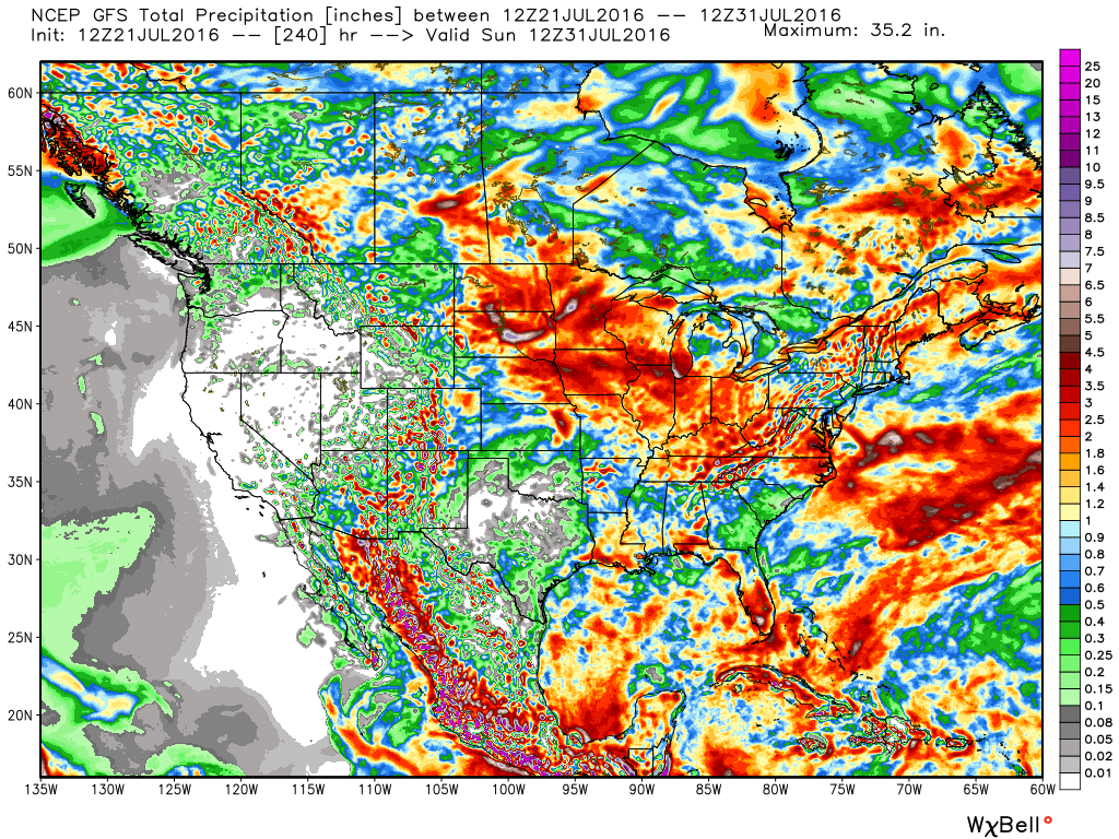
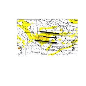 This will help ignite thunderstorm development during the afternoon and evening. While a storm could impact any given neighborhood this evening, best concentration of storms should lie north of the I-70 corridor. Locally heavy rain will be a good bet with the stronger storms. Localized rainfall amounts in excess of 2″ will be possible.
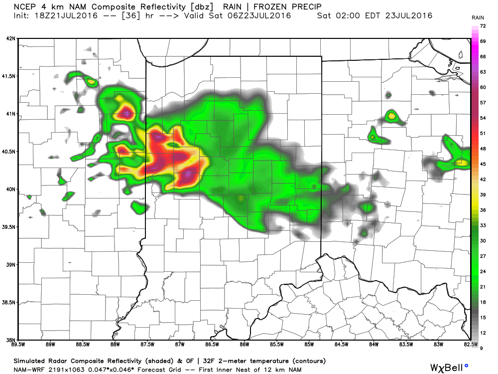
 Additional scattered thunderstorm activity will continue Saturday, but there will be many more dry hours than wet/ stormy.
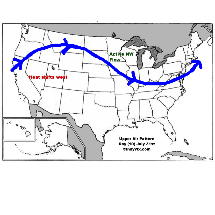
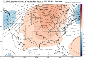
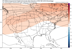
Looking ahead, a shot of heat will come out next week (lower 90 potential), but this will be transient. By the 8-10 day period, we’re back into an active NW flow type look. You know the drill by now. That means potential storm complexes and the worst of the heat to our west, relative to averages.
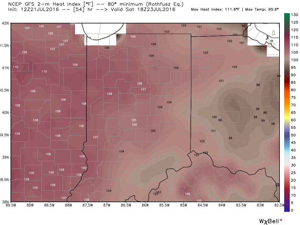
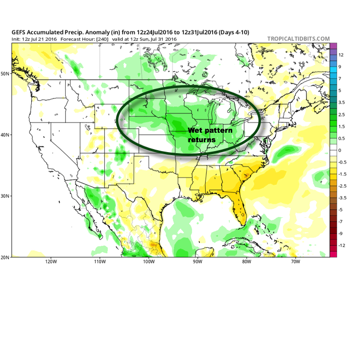
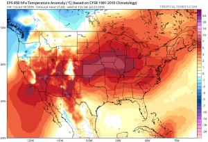
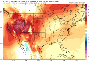 While some oppressive heat and humidity will impact our local area to wrap up the work week and head into the weekend, this is a pattern where it’s incredibly difficult to deal with any sort of one particular weather pattern for any time of substance. Looking forward to August, we don’t see this changing. Remember that word we leaned on to begin summer? “Transient” remains the best way to describe the pattern moving forward, as well.
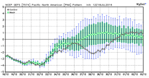
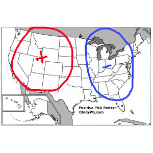
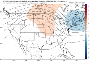
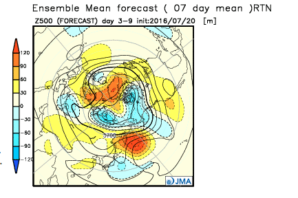
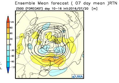
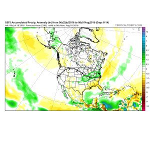 To close, we’ll leave you with a look at the latest PNA pattern. This has been the primary driver of our weather this summer, and it also argues any sort of dry, hot weather doesn’t last. Note the positive PNA returning to close July. This also lines up well with our idea of unsettled times returning…