We’re enjoying quiet times across Indiana this evening, but times are quickly changing to put us into a stormy position between Wednesday morning and wrapping up the work week.
While the overall pattern is an easy one to label from a broad scale perspective as “stormy,” the precise details are incredibly difficult to pin point much more than 12-24 hours in advance. With that said, most of the state is very much in fair game for periods of storms (generally tracking in a NW to SE fashion) between now and the end of the work week. Eventually, drier air will set us up for a very pleasant weekend, including lots of sunshine and cooler temperatures. In fact, latest data still suggests we can expect to wake up to the 50s Sunday and/ or Monday morning(s).
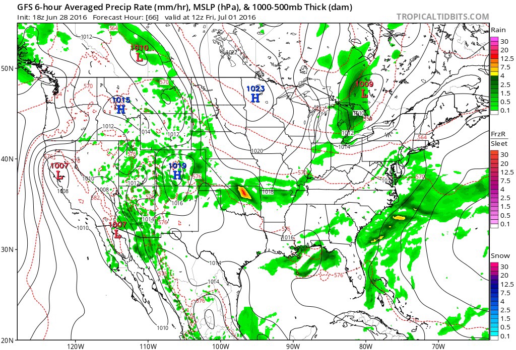
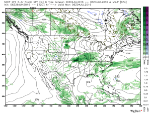
Before we enjoy the pleasant weekend weather, the first of a series of storm complexes will approach Wednesday morning. Mesoscale Convective Complexes (MCCs) can be a true pain for short-term modeling to handle, but the overall idea this evening is for the first of (2) complexes to impact parts of the region Wednesday morning.
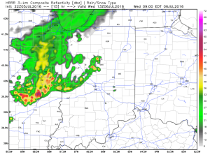
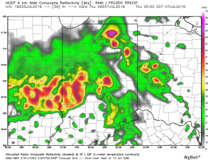
This is an idea what the radar may look like around 9a. This would be the same complex that will deal quite the blow to portions of the eastern Plains and upper Mid West tonight (localized damaging straight line winds will be an issue to our NW). Thankfully, we expect weakening of this complex as it dives off to the SE, in our general direction.
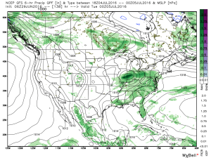
 We’ll go through a quiet period during the afternoon hours before a second surge of storms takes aim on the region tomorrow night into Thursday morning (again, understanding we’ll have to “sure up” timing as we go).
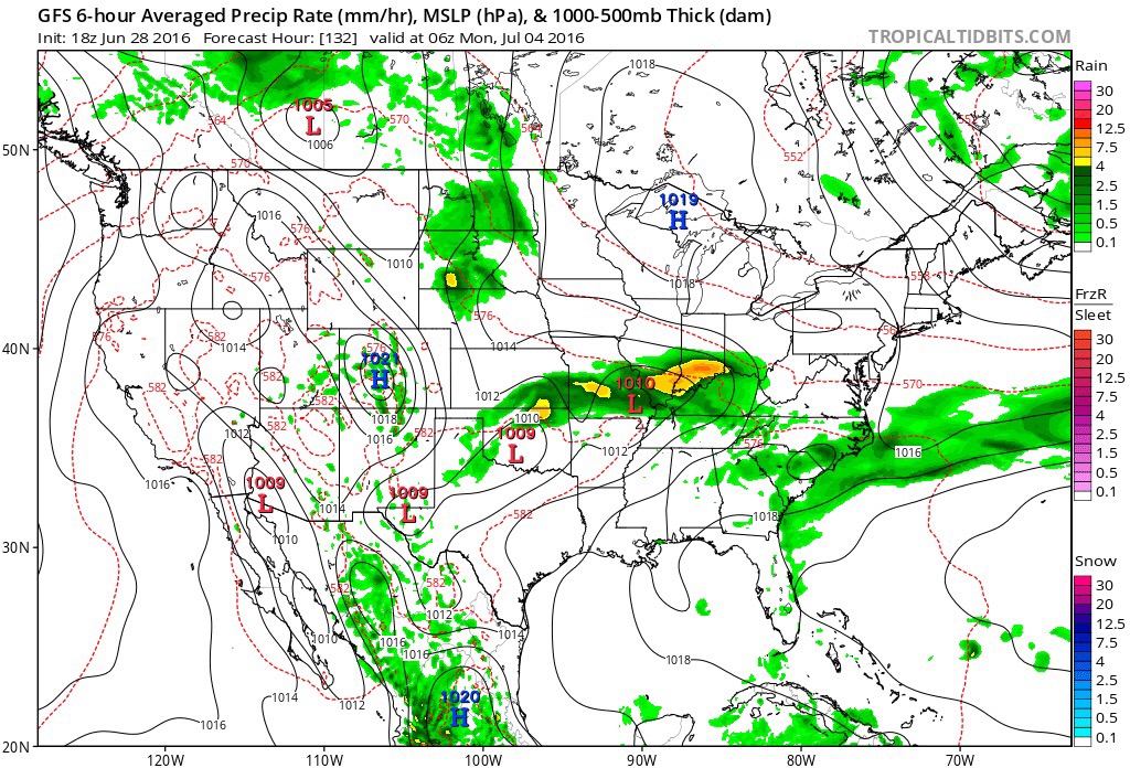
 Additional storm complexes will follow Thursday into Friday before that drier air gets here. Some of these could be strong to severe.
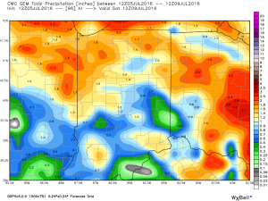
While rainfall amounts won’t be uniform, there’s the potential for some neighborhoods to get 2″-3″ of rain between now and week’s end (where storms train).
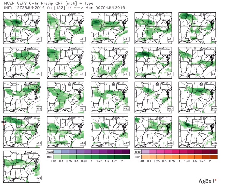
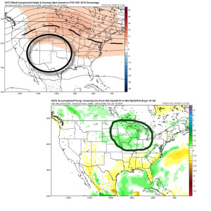
 Looking ahead, after a dry weekend and open to next week, indications point towards a return of wet and active times as we approach Day 10. Long range ensemble data backs up the wet, stormy look nicely, and there’s really no end in sight…
 Mid and high level clouds will spread over the region today, but we’ll stay dry. We’ll notice a lowering and thickening cloud deck by evening and this is a hint at things to come Sunday.
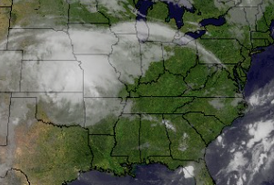 Rain will overspread the region Sunday morning, increasing in coverage and intensity as we progress into Sunday evening.
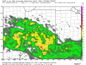 Rain will turn locally heavy at times and we expect a widespread swath of 2″-3″ totals through the heart of the state, with localized heavier amounts. Precipitable water values exceed 2″ across central and southern IN Sunday evening and will likely promote a flash flood threat.
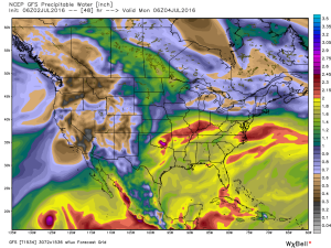 Most of the rain falls Sunday morning-Monday morning before drier air begins to try and work in here as Monday afternoon arrives. As of now, we think Monday evening firework shows should be a go!
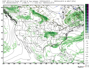
 We note ensemble support, as well.
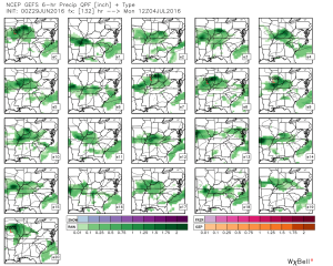 Rain totals will likely be hefty for some, including widespread 2″+ totals where the axis of heaviest rain falls.
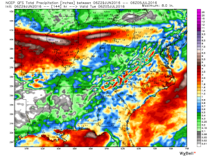
 Stay tuned as we continue to look over data and update the important Independence Day weekend forecast.