Category: Forecast Discussion

Wednesday Evening Video Update: Rain Moving In; Arctic Blast This Weekend

http:/ Tonight’s Video Highlights: We talk rain and amounts for Thursday and Friday. The coldest air of the season and coldest November day in some 13 years is ahead! A…

You must be logged in to view this content. Click Here to become a member of IndyWX.com for full access.  Already a member of IndyWx.com All-Access?  Log-in here.

Permanent link to this article: https://indywx.com/wednesday-evening-video-update-rain-moving-in-arctic-blast-this-weekend/

Video Update On The Remainder Of This Week And At Some Thanksgiving Week “Wintry Mischief”

http:/

You must be logged in to view this content. Click Here to become a member of IndyWX.com for full access.  Already a member of IndyWx.com All-Access?  Log-in here.

Permanent link to this article: https://indywx.com/video-update-on-the-remainder-of-this-week-and-at-some-thanksgiving-week-wintry-mischief/

Monday Forecast: A Calmer, Colder Week Ahead…

Updated 11.17.13 @ 8:46pm

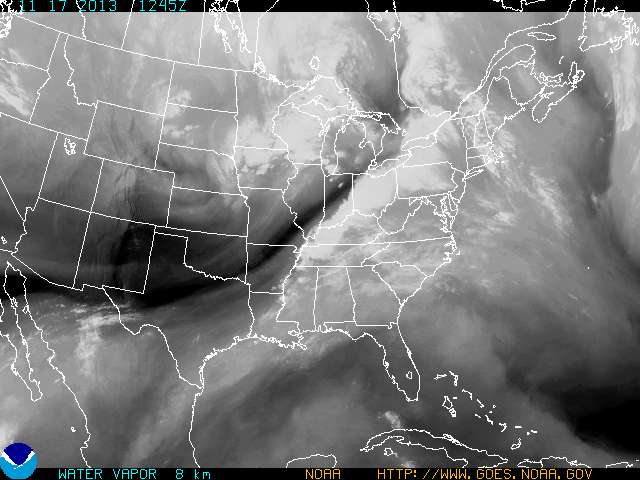
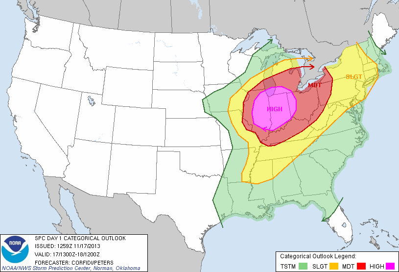
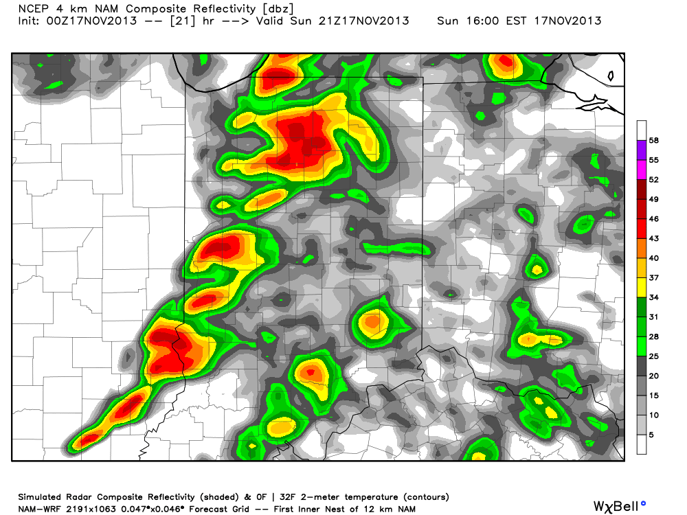
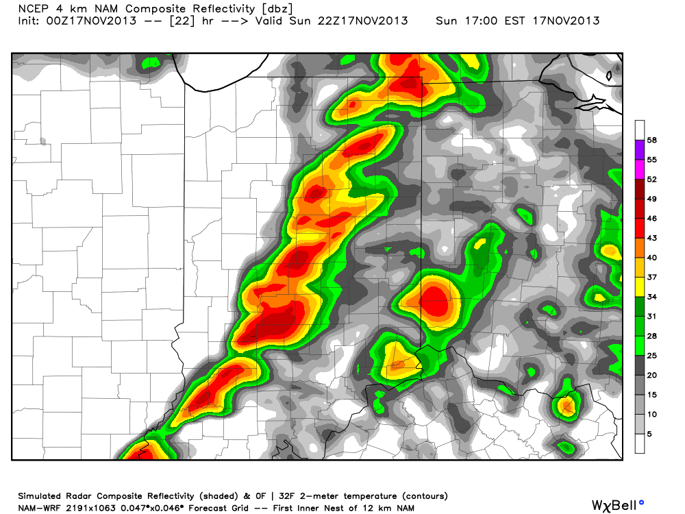
Zionsville, IN Sunday was a violent day across central Indiana, including multiple tornado touchdowns (Lebanon and Kokomo, for example), heavy rain (widespread 1″+ totals), and damaging straight line winds (numerous trees and power lines down across the region, fueled by 70-80 MPH wind gusts).

Thankfully the new work week will dawn with a much calmer weather pattern in place, albeit much cooler.  High pressure will dominate our region, featuring dry and mostly sunny conditions both Monday and Tuesday.  Monday will still be a bit breezy and we’ll note a stronger push of cold air arriving Monday night, setting the stage for a seasonably chilly Tuesday and Wednesday.

Our next weather maker will arrive as we wrap up the work week. The culprit will be a cold front blowing through the Hoosier state and while model data differs significantly on precipitation totals in the Thursday-Friday time period, we’re confident in rain falling followed by a big blast of cold air for the weekend.

Looking ahead to Thanksgiving week, the threat is there for some wintry “mischief” as southern branch low pressure attempts to attack the cold high to our north… We have plenty of time to watch this, but just make a mental note in the back of your mind for now as you prep for Thanksgiving holiday travel.

Monday: Mostly sunny; 40/ 51

Status-weather-clear-icon


Tuesday: Mostly sunny; 29/ 48

Status-weather-clear-icon


Wednesday: Increasing afternoon cloudiness; 30/ 51

Status-weather-clouds-icon


Thursday: Cloudy and raw with rain likely; 43/ 49

Status-weather-showers-scattered-icon


Friday: Cloudy with rain likely; 44/ 49

Status-weather-showers-scattered-icon


Saturday: Mostly cloudy and colder; 30/ 39

images


Sunday:  Mostly sunny and cold; 19/ 30

Status-weather-clear-icon

Permanent link to this article: https://indywx.com/monday-forecast-a-calmer-colder-week-ahead/

Extremely Dangerous Severe Weather Outbreak Ahead…

Good morning!  We’re waking up to sunshine this morning after a round of rain and thunderstorms overnight.  Over 1″ of rain fell for many during the overnight period (1.53″ to be exact here at IndyWx.com HQ).

Unfortunately, skies now are clearing and this is only going to aid in the severe weather potential today, including some dangerous long-lived and strong tornadoes.

ECWVThis is a very rare November high severe weather risk day and must be taken seriously by all.

day1otlk_1300

The thinking here hasn’t changed in that we feel discrete super cells develop during the late morning and early afternoon before morphing into a squall line capable of producing damaging straight line wind. With the dynamics and energy in play here, any of these super cells could spawn a tornado. Additionally, it’s possible that a few of these tornadoes could be long tracked and very strong tornadoes.  The latest high-resolution simulated radar data shows this well.

hires_ref_indy_16

We still target a cold front passing through the region around, or just after, sunset and with this frontal passage the severe weather will come to an abrupt end.  The latest HRRR data shows this well as dew points begin to crash behind the cold front, indicative a much drier, cooler, and more stable air mass arriving tonight.

hrrr_dew2m_ky_12

Permanent link to this article: https://indywx.com/extremely-dangerous-severe-weather-outbreak-ahead/

Late Saturday Night: Thunderstorms Develop Overnight; Update On Sunday

Good evening, Hoosiers!  Showers are developing now, and these will increase in coverage and intensity as we progress through the overnight. As we move into the wee morning hours, don’t be surprised if you’re awoken with loud claps of thunder, gusty winds, brief heavy rain, and small hail.  That said, we think overnight thunderstorms remain below what would officially be considered “severe.”

Here’s a look at the simulated radar later tonight, valid at 2am local time, courtesy of the HRRR model.

hrrr_ref_indy_6

As for Sunday, we continue to look over the latest data and our thoughts haven’t changed. It still appears the two biggest threats will be from damaging straight line winds and the possibility of quick spin-up tornadoes associated both within the squall line, itself, but also with any individual severe cells that develop before “morphing” into the squall line.  It should also be pointed out that even outside thunderstorms, southwest winds will howl across central Indiana, periodically gusting upwards of 40-45 MPH even outside of thunderstorms. Hunker down…

The latest high-resolution NAM suggests the possibility of super cells entering western Indiana early Sunday afternoon before organizing into a squall line as it moves through central and western Indiana. This line will mean business as it moves east across the state, and latest data suggests the most significant severe threat for central Indiana will be from 12 noon through 6p, moving west to east.  By sunset Sunday, most of central Indiana will see a much needed (and much colder) wind shift to the northwest, ending any threat of severe weather.

hires_ref_indy_22hires_ref_indy_23

Permanent link to this article: https://indywx.com/late-saturday-night-thunderstorms-develop-overnight-update-on-sunday/