
We’re enjoying pleasant conditions this afternoon with filtered sunshine and temperatures that should top out in the upper 30s to lower 40s later on. Enjoy it, as a big rain event gets underway for New Year’s Eve.
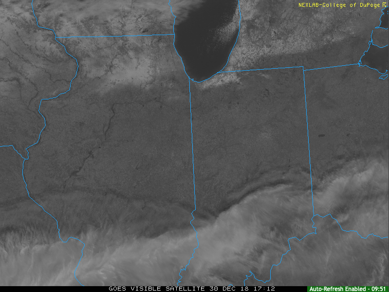
This afternoon’s visible satellite shows sunshine dominating across the northern half of #INwx.
Clouds will increase tonight and rain won’t be too far behind. We think wet weather builds into central Indiana before sunrise Monday (likely between 4a to 6a) and periods of heavy rain are still expected late morning into the afternoon and evening hours.
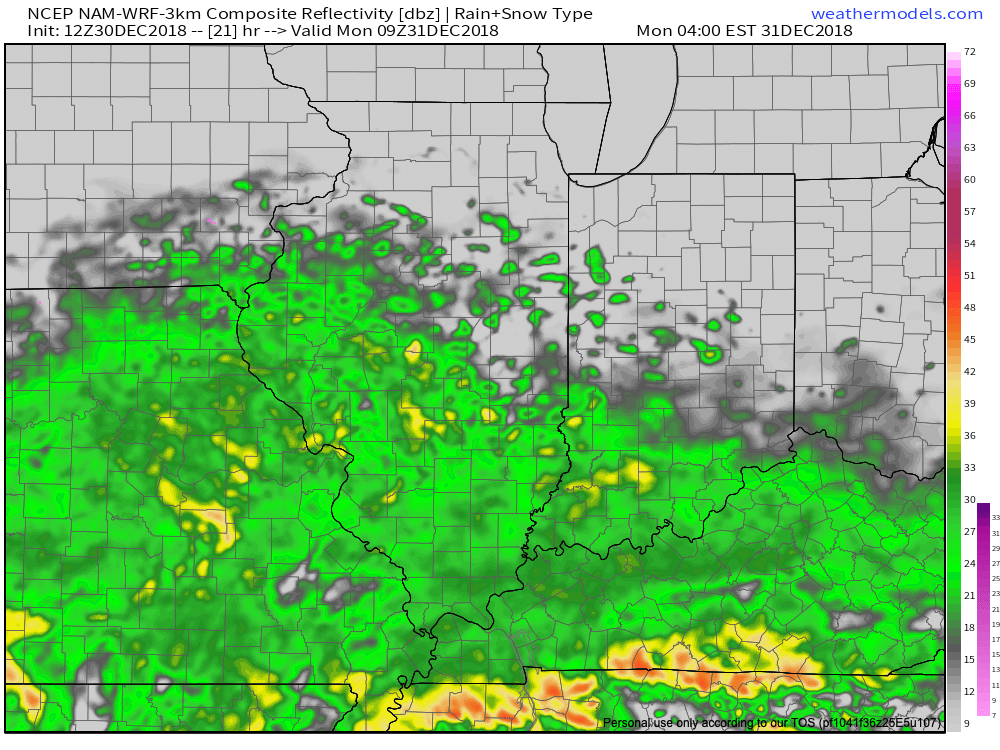
Rain will arrive into the city itself between 4a and 5a Monday.
We continue to monitor the prospects of a skinny line of strong thunderstorms that may impact southern Indiana Monday afternoon and evening. If your travels take you south to Louisville for NYE plans, this is something to monitor. Widespread severe weather isn’t expected, but strong winds are possible if this line materializes.

Timing out prospects for a skinny line of storms to impact southern #INwx Monday afternoon. Best idea as of now will come between 2p and 4p.
This storm system will have a true tropical connection. Precipitable water values will be quite “juicy” for late December and plenty capable of producing locally heavy totals. Widespread 1″ to 1.5″ can be expected, but a few area rain gauges will likely see higher amounts.
 Colder air will whip in here late tomorrow night and help lingering moisture fall as scattered snow showers New Year’s Day. More later on the potential of wintry “mischief” later in the week…
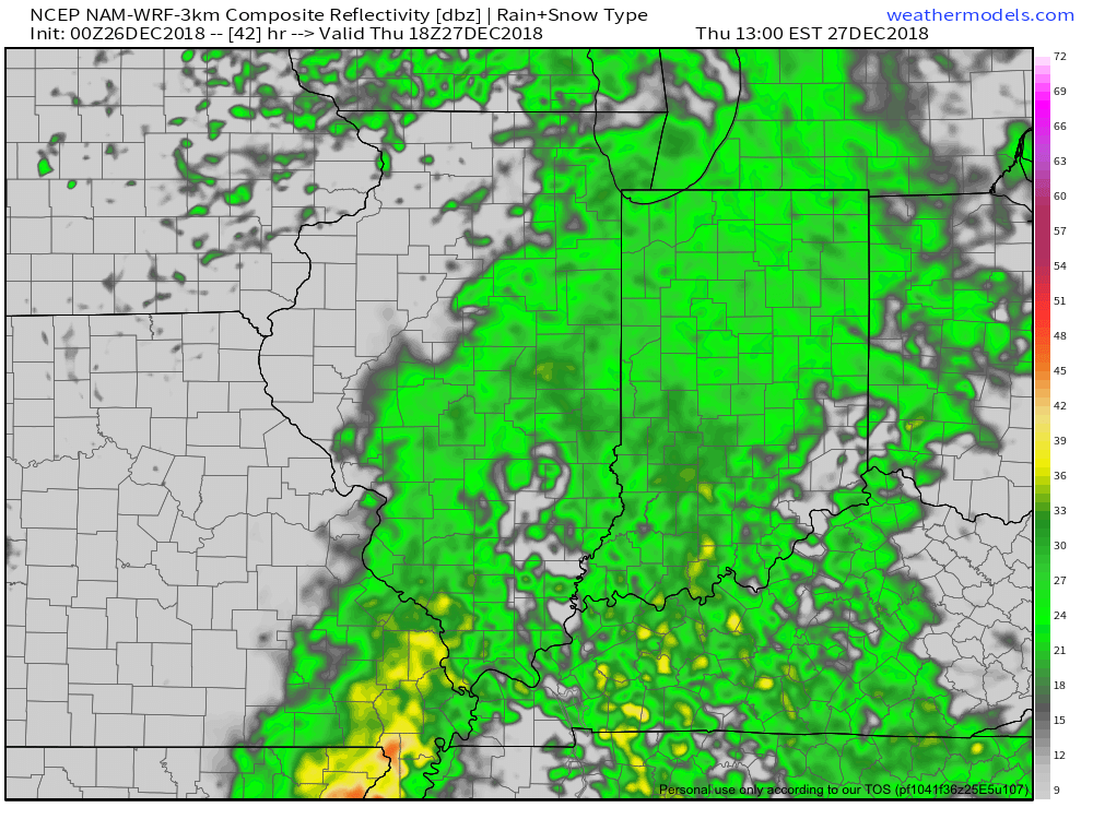

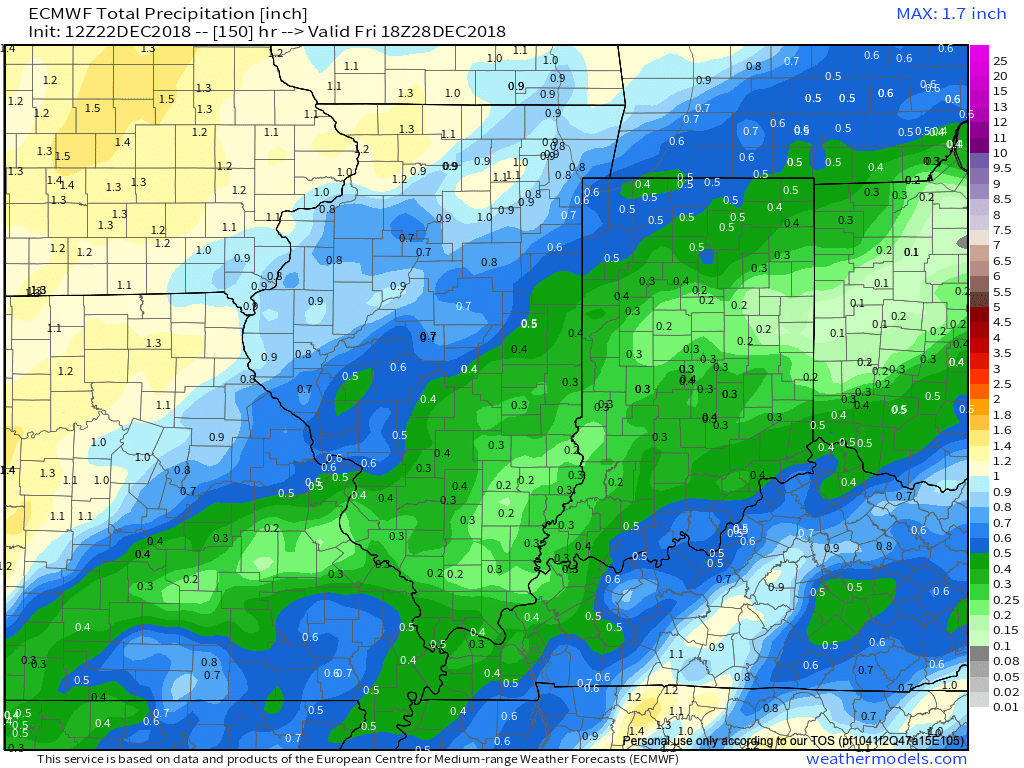
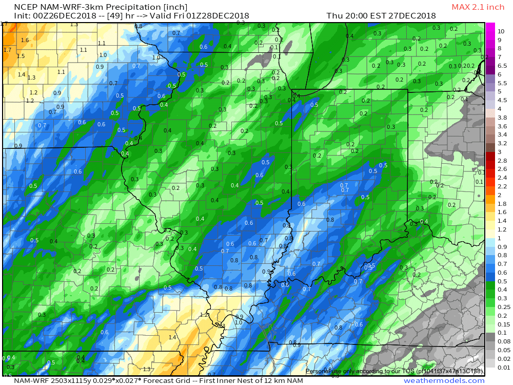 Most of the concentrated rain should come to an end around dark Thursday. By that time we forecast a general 1/2″ to 1″ to fall in area rain gauges.
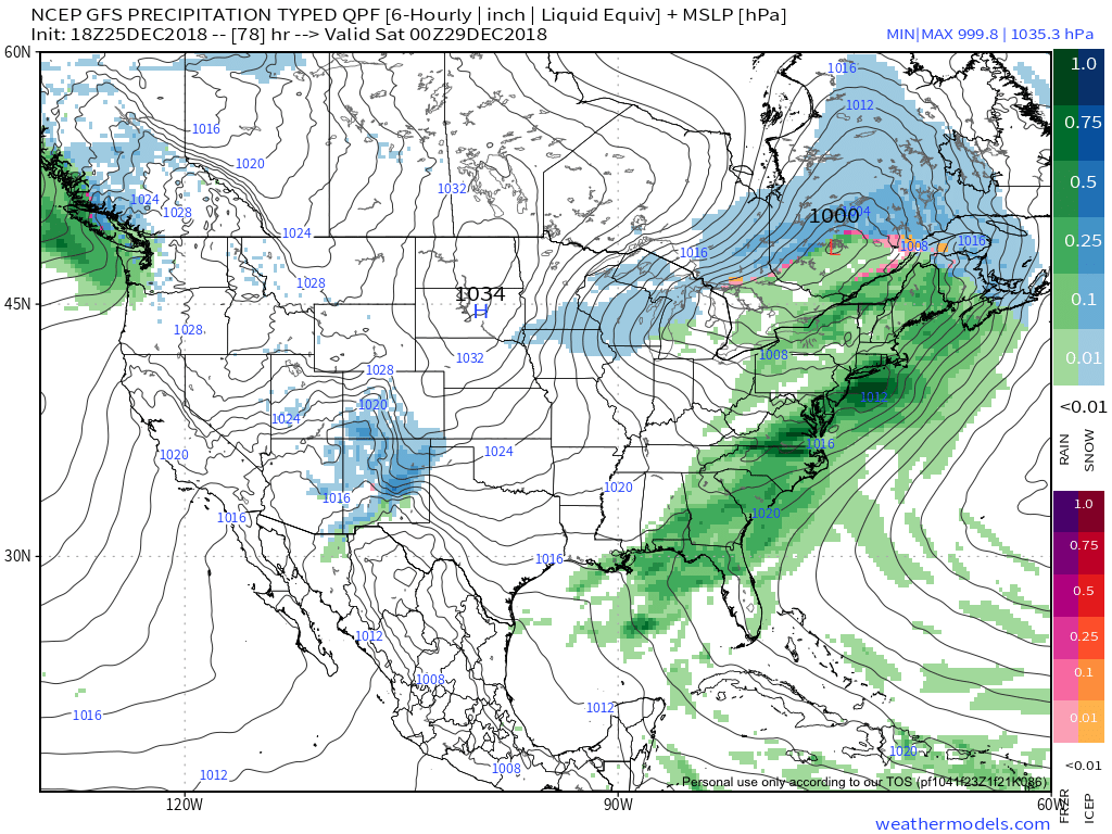

 II. A much stronger storm system will wrap up to our northwest Wednesday night and Thursday. We’ll notice an increasingly strong southerly breeze during this time period and rain will be on the increase as we progress through the day Thursday. The trade-off? Highs between 55° and 60° to close the week- though those temperatures may actually come Thursday evening before cooler air begins to slip in here during the day Friday.
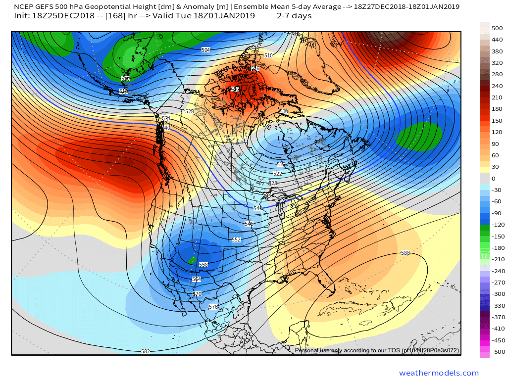
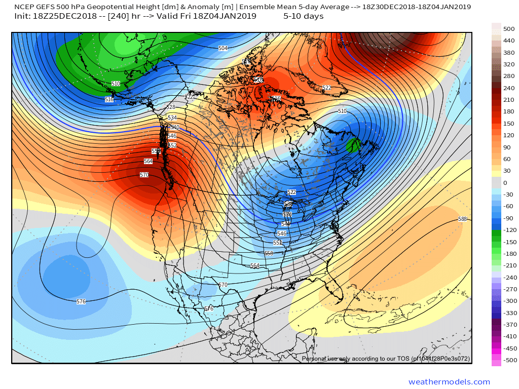
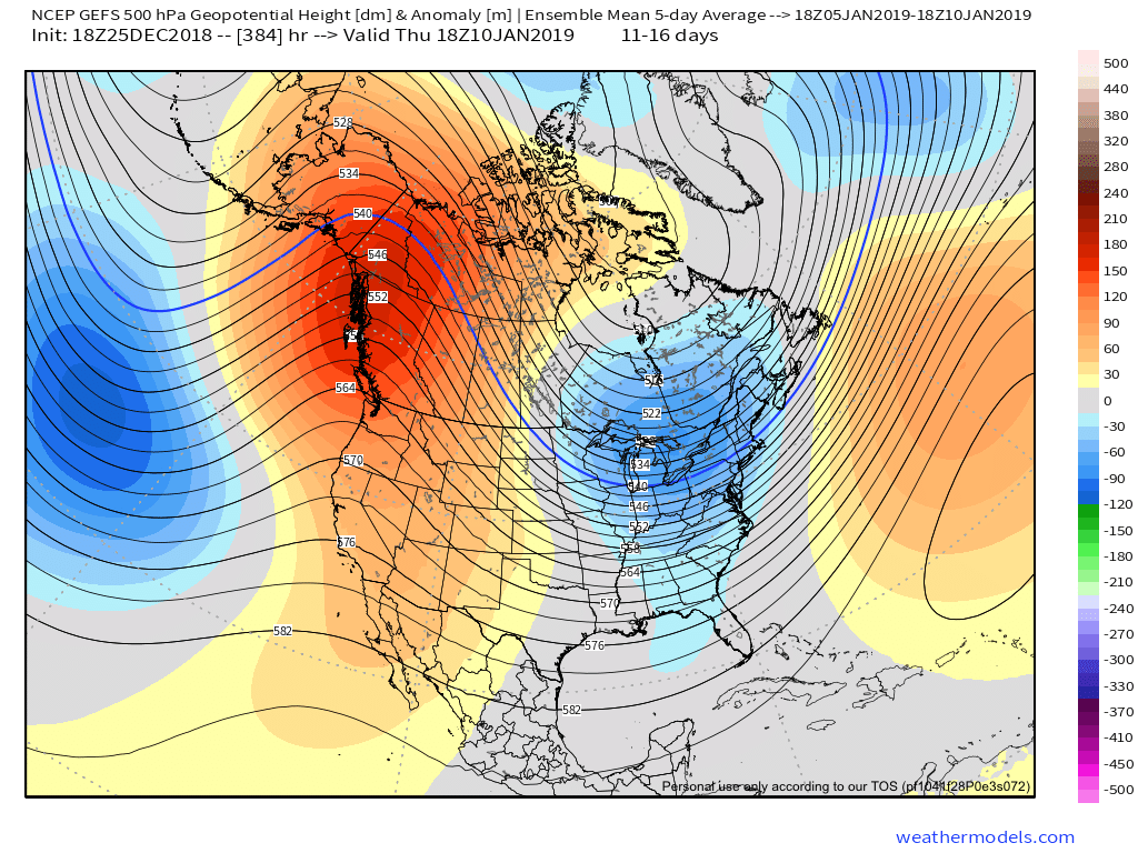
 III. All attention is squarely focused on a significant pattern change that takes shape as we head into the new year. As mentioned in previous posts and discussions, the transition is likely to be a stormy one, but it’s far too early to talk precipitation types. A combination of ingredients appears to be aligning to create a colder than normal (and potentially significantly so) pattern at the traditionally coldest time of year (mid-Jan).