The combination of an approaching cold front to our north and remnant tropical moisture from Cindy will serve to enhance rainfall amounts across central Indiana late tonight into early Friday evening.…
You must be logged in to view this content. Click Here to become a member of IndyWX.com for full access. Already a member of IndyWx.com All-Access? Log-in here.
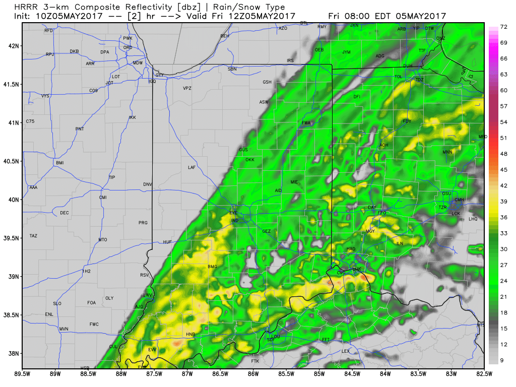
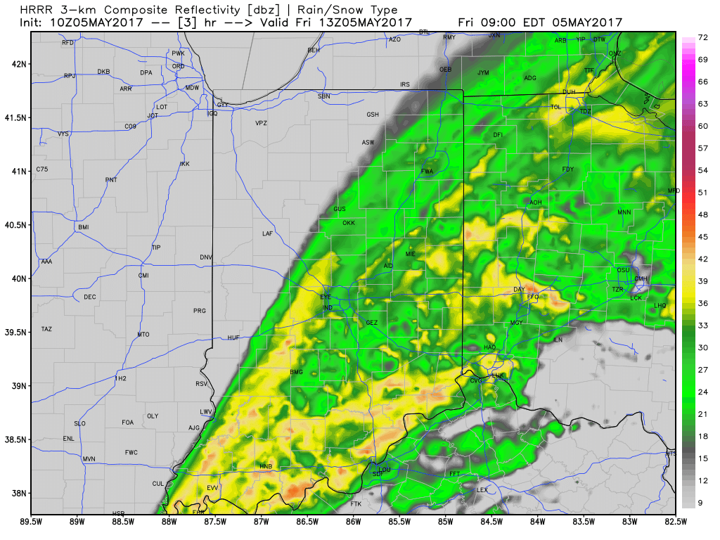
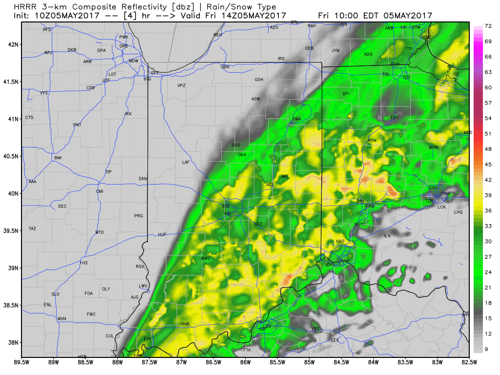
After a relative “lull” in the rainfall coverage and intensity overnight, rain is expanding in coverage and intensity yet again this morning. While there will be a rather sharp cut-off to the west, additional heavy rains are ahead from northwestern Indianapolis ‘burbs (including places such as Brownsburg, Whitestown, and Sheridan), Indianapolis, and points south and east.
HRRR simulated radar shows this rain shield nicely as we progress through mid and late morning.
Additional rainfall of 1″-1.5″ is likely from Indianapolis and points south and east with this band of rain before drier weather finally works in here this afternoon and evening. Otherwise, expect continued windy, cold, and raw conditions today as temperatures remain in the 40s this afternoon, including wind chills in the 30s.
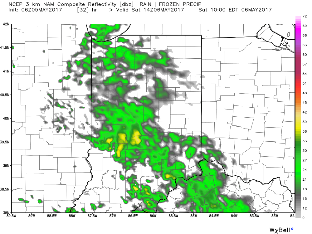
Looking ahead, one last batch of rain will arrive on the scene Saturday morning.
We’ll finally get rid of the rain and introduce a drier regime Saturday afternoon into Sunday, including a sunny close to the weekend. With the drier air, overnight lows will fall to frosty levels Sunday and Monday mornings (lower to middle 30s).
You must be logged in to view this content. Click Here to become a member of IndyWX.com for full access. Already a member of IndyWx.com All-Access? Log-in here.
Unfortunately, we don’t have any changes to our ongoing forecast. Widespread rain will continue through Friday, occasionally heavy. By the time all is said and done, many local rain gauges will check in between 3″-4″. Lets break it down:
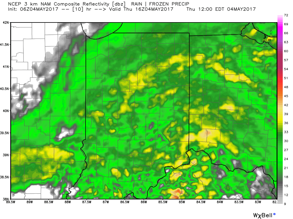
This morning’s radar shows rain intensifying across central and western portions of the state this morning, especially west of I-65.
7:30a radar snap shot.
Plan on steady rains to continue today, periodically heavy. If you live near a body of water, remain aware of current water levels. Significant rises will begin to take place this afternoon as the periodically heavy rains add up.
12p forecast radar.
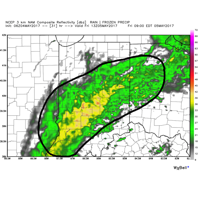
Widespread rain will continue overnight into Friday morning. As low pressure slowly tracks northeast, we think a “deformation zone” will set-up shop across central Indiana Friday. Within this large band of rain, multiple intense rain bands will pivot through central Indiana. Flood concerns will remain high through Friday.
We should finally get into drier air Friday night before one last round of showers pushes southeast across the state Saturday morning. As of this update, we bracket the 4a-10a timeframe for renewed wet weather. By Saturday afternoon, drier air should win out and result in a much more favorable forecast Saturday night into Sunday.
By the time all is said and done, widespread 3″-4″ storm totals are expected, and will most certainly lead to flooding. Even localized 4″+ amounts can be expected within areas where the heaviest rain bands persist.
In closing, as drier air begins to arrive on the scene Saturday evening, much cooler conditions will result in areas of frost into early next week. Lows in the lower to middle 30s will be common Sunday and Monday mornings across central Indiana.
Live Near A Body Of Water? Keep An Eye On The Level…Central Indiana will deal with an extended period of rain, occasionally heavy, tonight through Friday afternoon. With saturated soils in place, an additional widespread 2.5″-3.5″ (with locally heavier amounts) between now and Saturday morning, flooding concerns are very high. As the lead off states, please remain aware of water levels if you live near a creek, stream, or river. The other aspect of this storm will be unseasonably chilly air and gusty easterly winds that will shift to the north Friday night into Saturday.
The weekend will provide a drier trend, but the improvements will be slow to occur. Showers remain in our Saturday forecast before drier air finally wins out Sunday with sunshine. The worry once to Sunday and Monday mornings will be the potential of frost and freeze conditions- especially in communities away from downtown. Remember, no planting around these parts until after Mother’s Day! 😉
 Additional rainfall of 1″-1.5″ is likely from Indianapolis and points south and east with this band of rain before drier weather finally works in here this afternoon and evening. Otherwise, expect continued windy, cold, and raw conditions today as temperatures remain in the 40s this afternoon, including wind chills in the 30s.
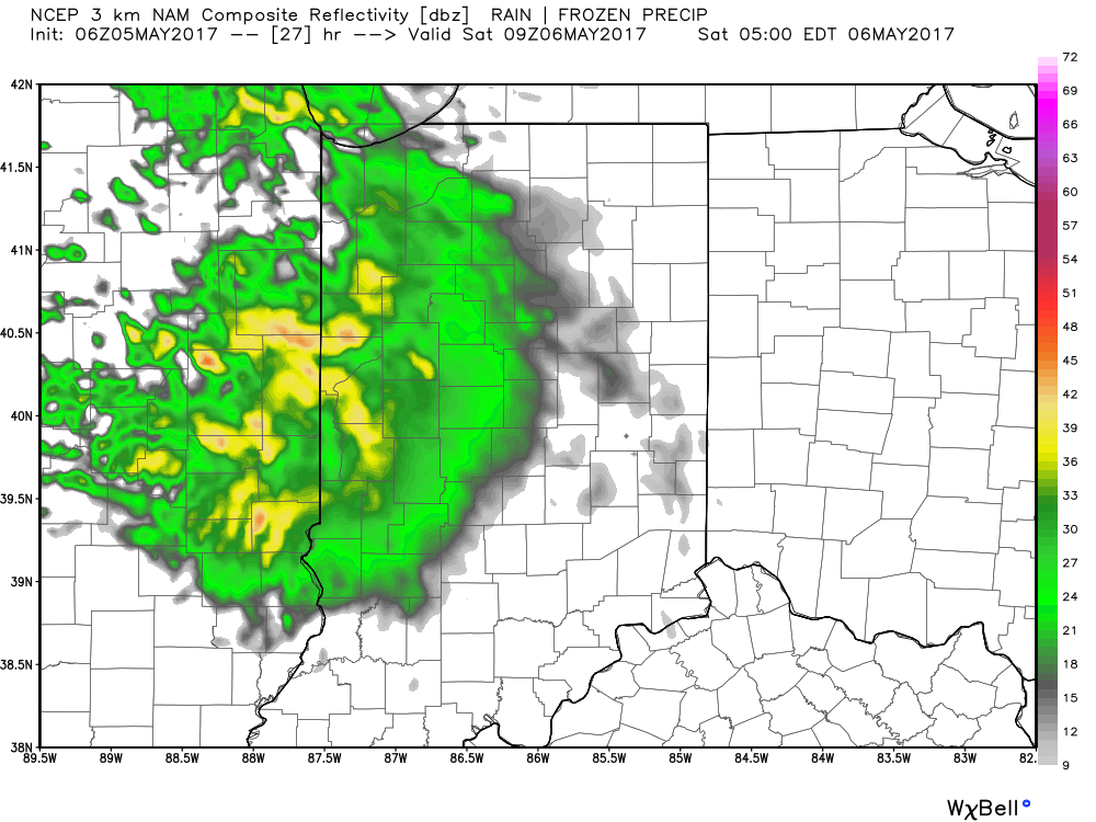
 We’ll finally get rid of the rain and introduce a drier regime Saturday afternoon into Sunday, including a sunny close to the weekend. With the drier air, overnight lows will fall to frosty levels Sunday and Monday mornings (lower to middle 30s).
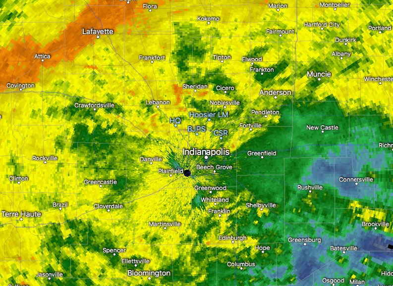
 We should finally get into drier air Friday night before one last round of showers pushes southeast across the state Saturday morning. As of this update, we bracket the 4a-10a timeframe for renewed wet weather. By Saturday afternoon, drier air should win out and result in a much more favorable forecast Saturday night into Sunday.
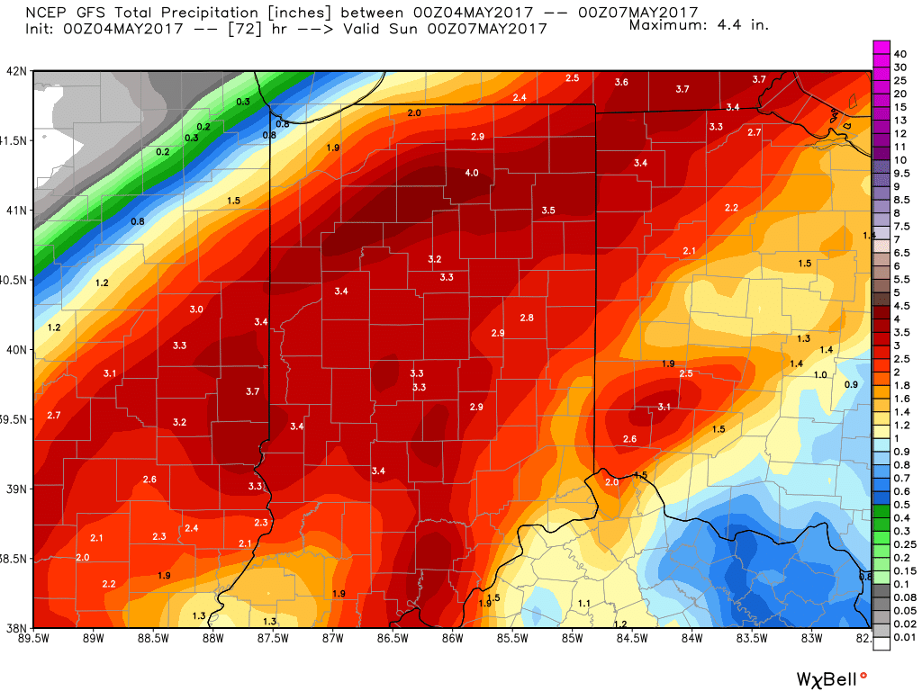 In closing, as drier air begins to arrive on the scene Saturday evening, much cooler conditions will result in areas of frost into early next week. Lows in the lower to middle 30s will be common Sunday and Monday mornings across central Indiana.
 Highlights: