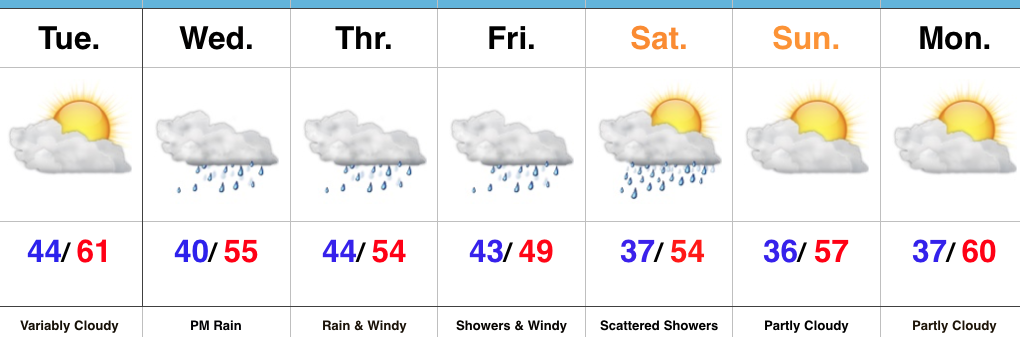
Unseasonably Chilly; Another Heavy Rain Maker Blows Into Town…
Clouds will lower and thicken Wednesday morning and give way to an expanding rain shield late morning into the early afternoon hours. Initially this rain won’t be heavy, but will begin to increase in overall coverage and intensity as we progress into the nighttime hours.

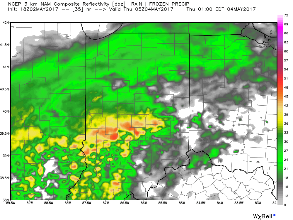
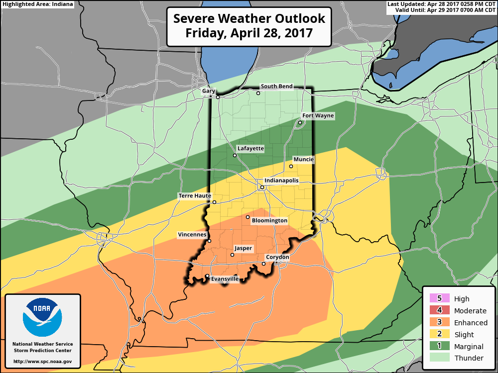
The culprit behind this new heavy rain maker is a deepening surface low pressure system that will slowly track from Arkansas (Wednesday night) northeast along the Ohio River (Thursday) and into Ohio (Friday). Not only will this spread heavy rain across central Indiana, but will also result in strong and gusty easterly winds Thursday into Friday, and unseasonably cold air. In fact, temperatures Friday will likely remain in the 40s across central IN with wind chills in the 30s. Add in that wind-driven rain and we have the makings for an UGLY day.
Periods of heavy rain will fall on the region Wednesday night into Friday and by the time all is said and done (Saturday night) widespread rainfall of 3″ is likely across most of central Indiana. Locally heavier totals will be possible where the most persistent heavy rain bands set-up shop.
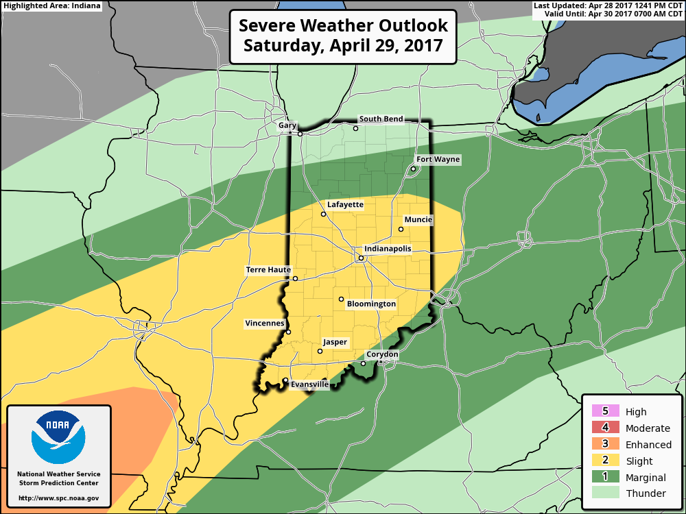
 We’ll begin to dry things out Saturday night into Sunday, but unseasonably chilly air will remain. Lows over the weekend into early next week will grow cold enough to allow patchy frost to develop in outlying communities. We think low to mid 30s will be common across the region Sunday and Monday mornings.

 Highlights:
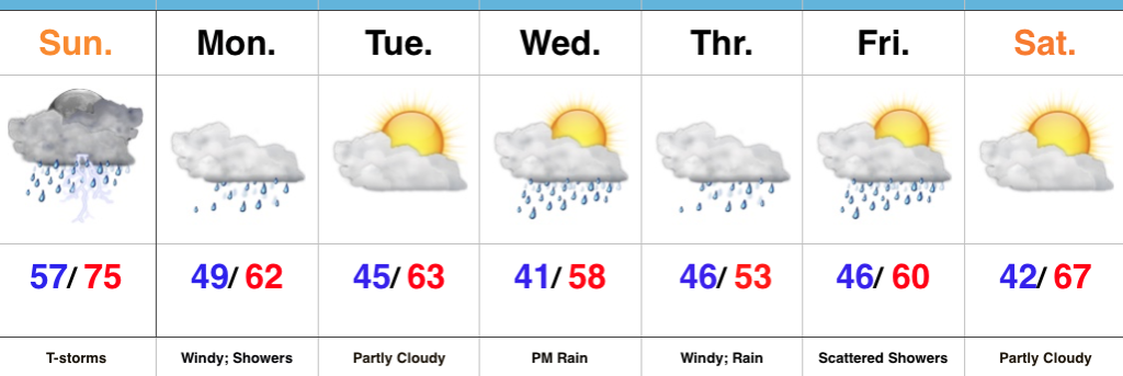 Highlights:
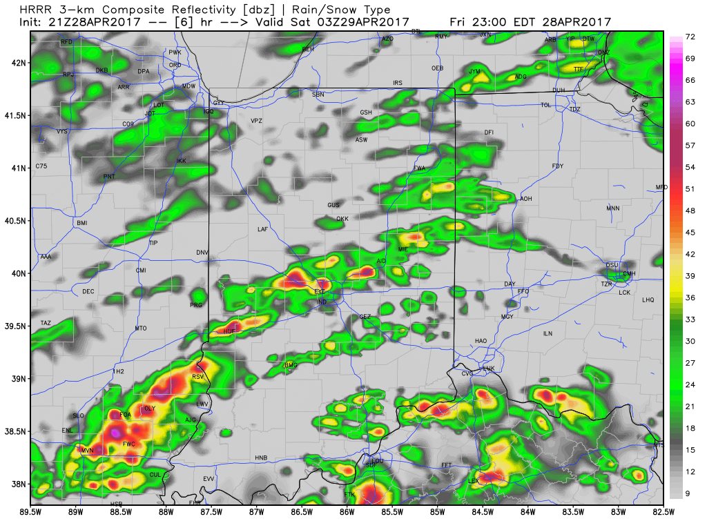
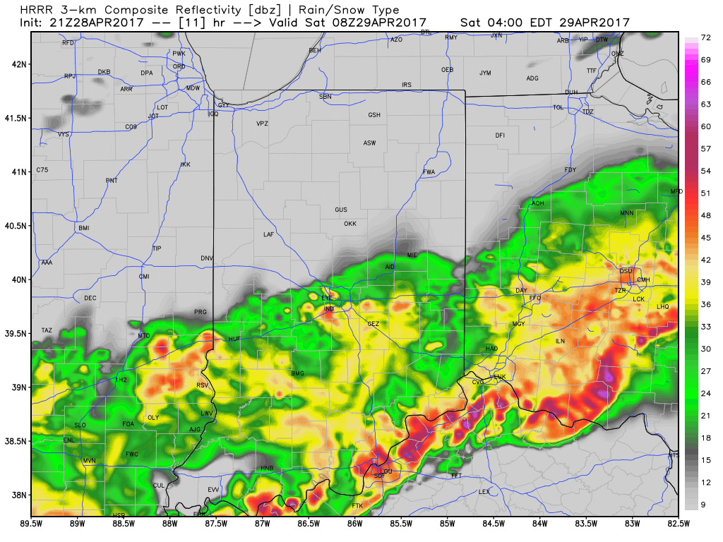
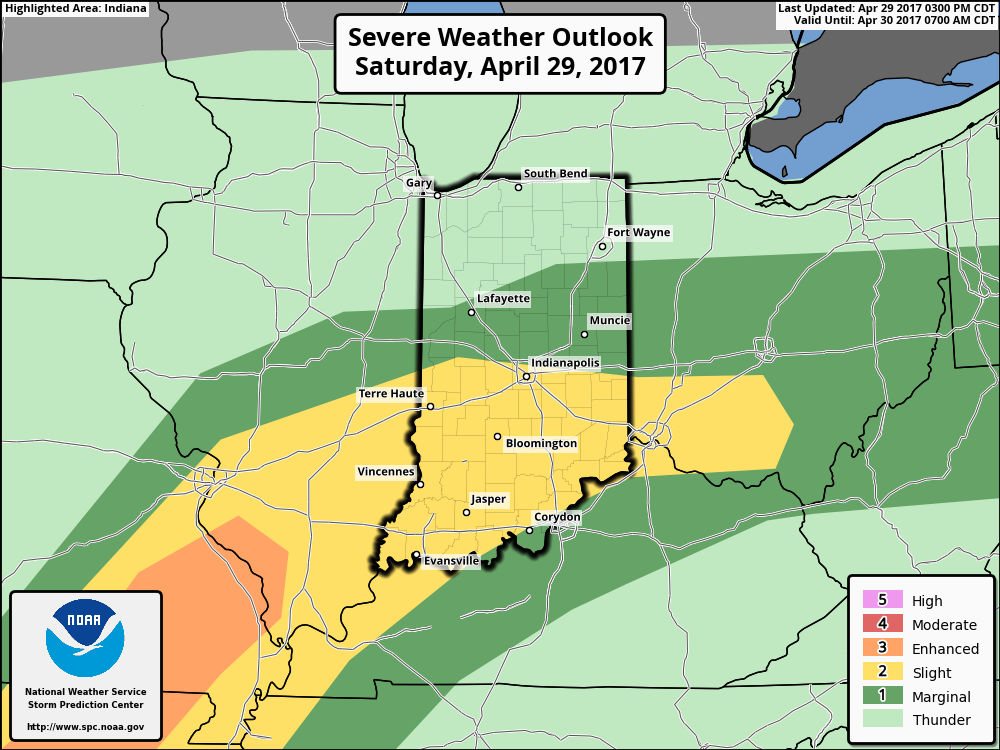 We think an eastward-advancing line of thunderstorms will blow into central Indiana later this evening (between 9p and midnight). Some of these may reach strong to severe levels with damaging straight line winds of greatest concern. Additionally, torrential downpours will occur within this line of storms.
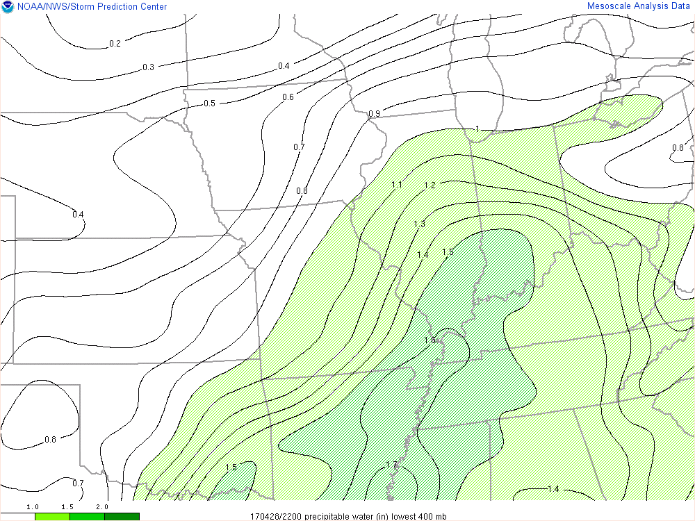
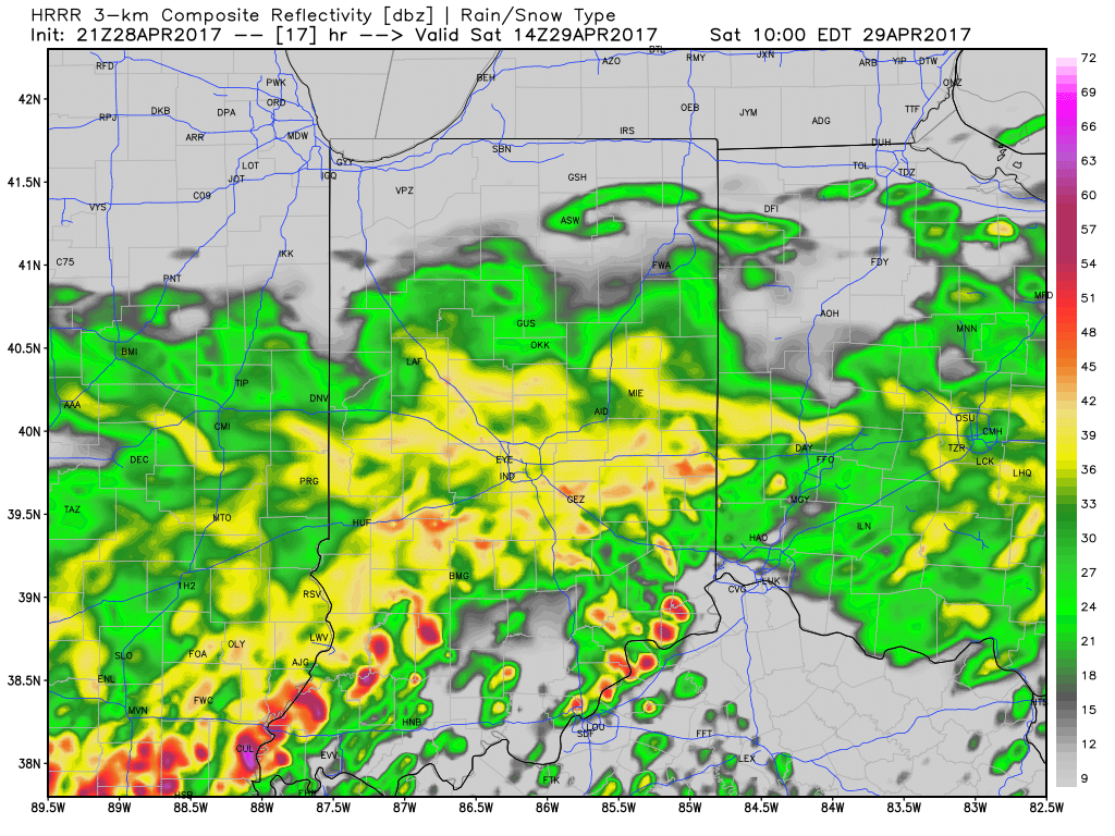
 Once all is said and done, we anticipate widespread 2″-3″ rainfall totals through central Indiana, but also note there will be localized heavier amounts. Once to Monday we’ll look at a much cooler, windy, and “showery” regime. Look for falling temperatures through the day Monday and this will set the stage for the week ahead: MUCH cooler, overall…. More on that later this weekend!