Rain Returns; Late Week “Backdoor” Cold Front…
 Highlights:
- Rain and storm chances increase
- Late week cold front
- Gearing up for a bigger blast of fall air
Dry Close To The Weekend…First and foremost, our thoughts and prayers are with Texas as one of the worst flood events in our country’s history is unfolding this morning. With days of heavy rain ahead, an additonal 20″-30″ will fall on eastern Texas. Just horrific.
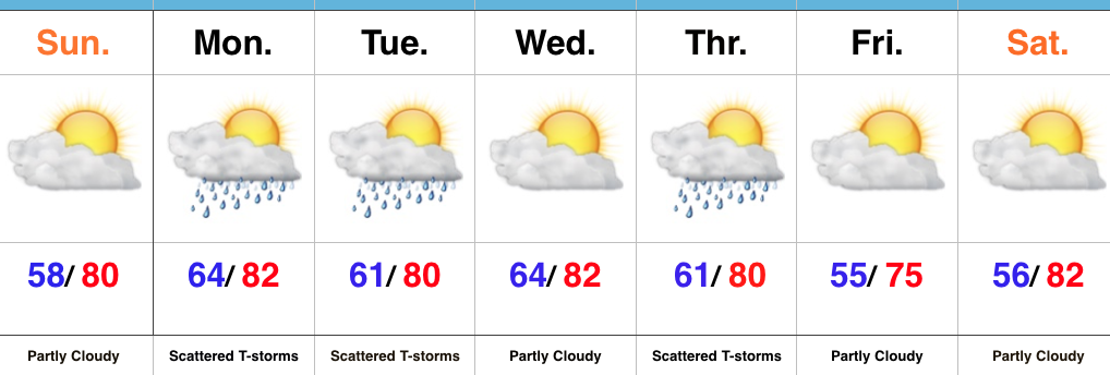
Here on the home front, we’ll wrap up the weekend on a dry note, but upper level energy will drift overhead late tonight and help generate scattered showers and thunderstorms as early as the predawn hours Monday. We’ll maintain a bit of an unsettled regime into Tuesday before dry conditions return Wednesday.
A backdoor cold front will push through central Indiana Thursday and a broken line of showers and thunderstorms may accompany this frontal passage. A northeasterly flow will usher in an unseasonably cool, early fall-like, close to the work week.
Looking ahead, an even stronger cold front has it’s eyes set on the region late next weekend or early the following week. Strong thunderstorm potential is present with this storm system followed by the coolest air since last spring…
Upcoming 7-Day Precipitation Forecast:
- Snowfall: 0.00″
- Rainfall: 0.50″ – 1.00″
 Highlights:
 Highlights:
 Highlights:
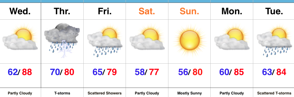
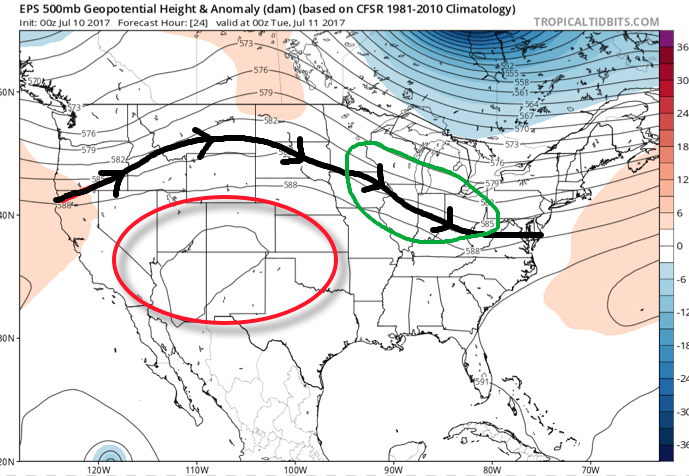 A quick step outside this morning will tell the story on just how different it feels. Gone is the refreshing air mass we enjoyed over the weekend and in return we’ve transitioned to an oppressive, tropical feel. Dew points will remain in the 70s through the majority of the work week and precipitable water values will reach 2″+ at times. With such a moisture laden air mass in place, flash flooding will likely result for some communities as the storms continue to track over the same areas this week.
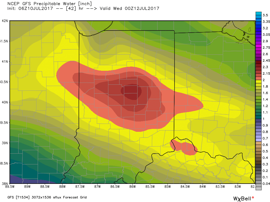 Additional waves of thunderstorms will impact the region through mid-and-late week before we advect some drier air into the state Friday evening into the weekend. Despite the lower dew points and cooler air, we still can’t rule out a shower or thunderstorm this weekend as a secondary front settles south.