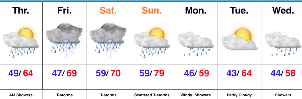
While it won’t rain the entire weekend, central Indiana should be prepared for multiple rounds of heavy rain and thunderstorms over the next few days. For those with outdoor plans this weekend, unfortunately what we’re seeing this evening is only the beginning of stormy times ahead. There will be periods of dry weather in between the waves of storms, but the big story will be the hefty rain totals come Monday morning and embedded severe storms to boot.
Moisture content continues to increase across central Indiana this evening.
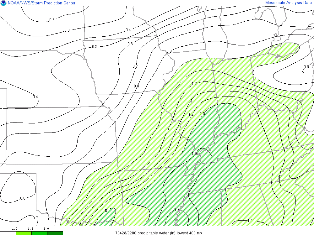
Precipitable water values continue to increase this evening and will aid in locally heavy rainfall tonight and through the weekend.
Forecast radar shows the waves of moisture that will impact the region throughout the night. We project most widespread heavy rain arrives on the scene Saturday morning.
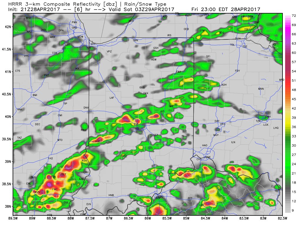
Forecast radar 11p
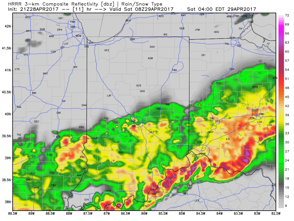
Forecast radar 4a
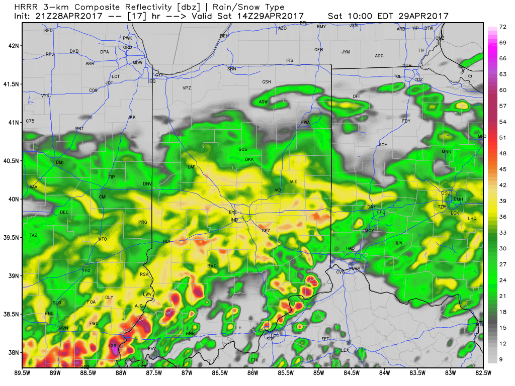
Forecast radar 10a
While scattered strong to severe storms will remain in our forecast Saturday afternoon through Sunday, we think the most widespread rains will diminish as we progress through the afternoon hours Saturday. That said, with such high moisture content, any storms that develop will be plenty capable of producing locally heavy rainfall in a short timeframe. It should also be mentioned that as the warm front lifts north, central Indiana will get into an increasingly warm and moist air mass Saturday afternoon and Sunday. In fact, highs Sunday may approach the lower to middle 80s. Add in a dew point that will approach 70°, a true muggy, summer-like feel will result.
Overall coverage of thunderstorms is expected to, once again, increase Sunday evening into the overnight period. Additional heavy rain is expected and with saturated soils in place, flash flooding may result. If you live near a creek or stream, please pay attention to the water levels into early next week.
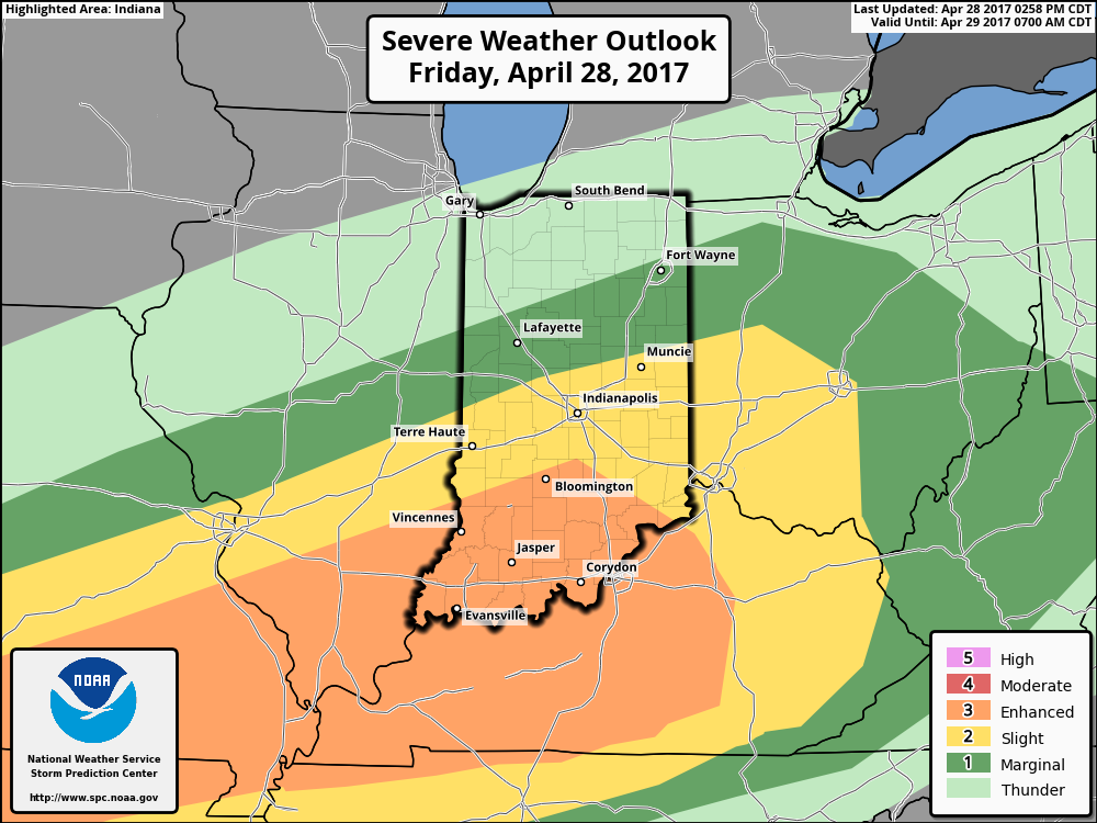
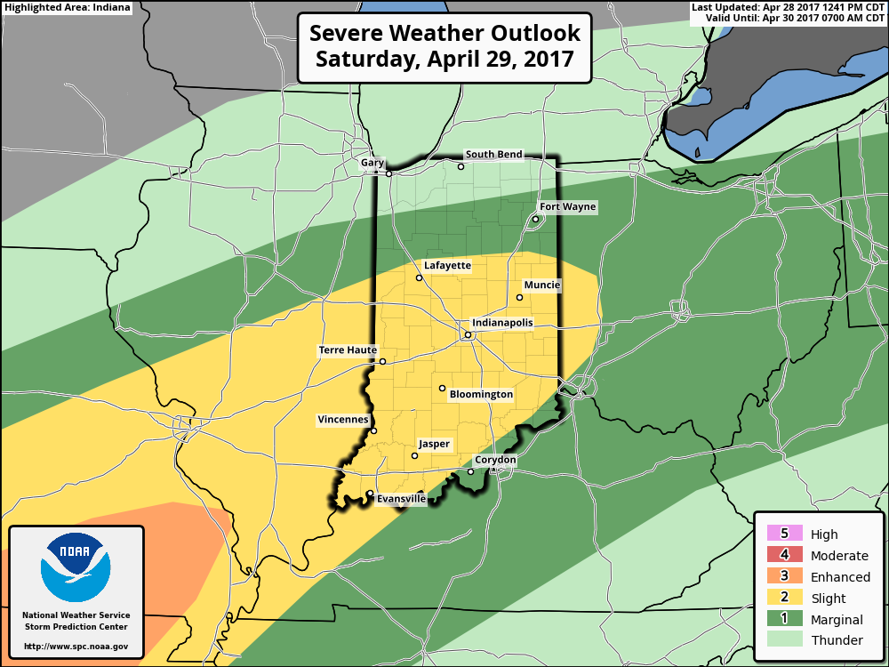
The Storm Prediction Center outlines the region for the potential of severe weather tonight through Sunday (don’t be surprised if the “Slight Risk” is pulled further north on Sunday in future updates from the SPC).
 Once all is said and done, we anticipate widespread 2″-3″ rainfall totals through central Indiana, but also note there will be localized heavier amounts. Once to Monday we’ll look at a much cooler, windy, and “showery” regime. Look for falling temperatures through the day Monday and this will set the stage for the week ahead: MUCH cooler, overall…. More on that later this weekend!
 Highlights:
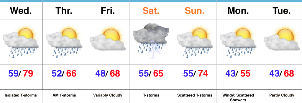 Highlights:
 No doubt about it, today will be very wet across the entire region, including periods of heavy rain- especially across the western half of the state.
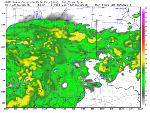
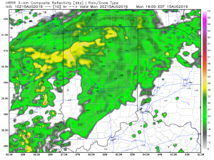 Tropical moisture will continue to stream into the state tonight into Tuesday. In fact, most intense rains will likely set up tonight and may feature “banding” signatures that would train over the same areas. Within these intense rain bands, prolific rainfall rates can be expected, enhancing the flash flood risk. Latest short-term model data shows this threat, and would place a premium focus on areas generally west of US-31. We’ll have to keep a close eye on things.
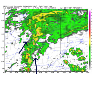 Plenty of “juice” is available to tap into across western sections tonight. Precipitable water values (PWATs) of 2″-2.5″ will be more than enough to fuel torrential rainfall.
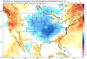
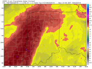 Eventually (mid and late week), we’ll dry things out and a significant cool down is still in store developing this weekend into early next week. Lows will fall deep into the 50s with highs only in the 70s. Talk about an early taste of fall…