VIDEO: Gordon’s Remnant Moisture Arrives To Close The Week…
You must be logged in to view this content. Click Here to become a member of IndyWX.com for full access. Already a member of IndyWx.com All-Access? Log-in here.
You must be logged in to view this content. Click Here to become a member of IndyWX.com for full access. Already a member of IndyWx.com All-Access? Log-in here.
You must be logged in to view this content. Click Here to become a member of IndyWX.com for full access. Already a member of IndyWx.com All-Access? Log-in here.
A cold front will sink south into the Ohio Valley Tuesday afternoon before stalling out through the remainder of the work week and into the weekend.
Rain and storm chances will increase in overall coverage and intensity as we move into Tuesday- particularly during the afternoon hours. With precipitable water values exceeding 2″ at times, locally heavy downpours can be expected.
 Despite cooler (still mighty humid) temperatures arriving, the overall pattern won’t change significantly into late week and this weekend. With the frontal boundary draped across the Ohio Valley, periods of showers and thunderstorms will remain in the forecast. At times, disturbances will track along the boundary and lead to increased coverage of storms. Perhaps Thursday and Friday will serve up the greatest coverage of thunderstorms as a surface wave moves out of the central Plains into the Great Lakes.
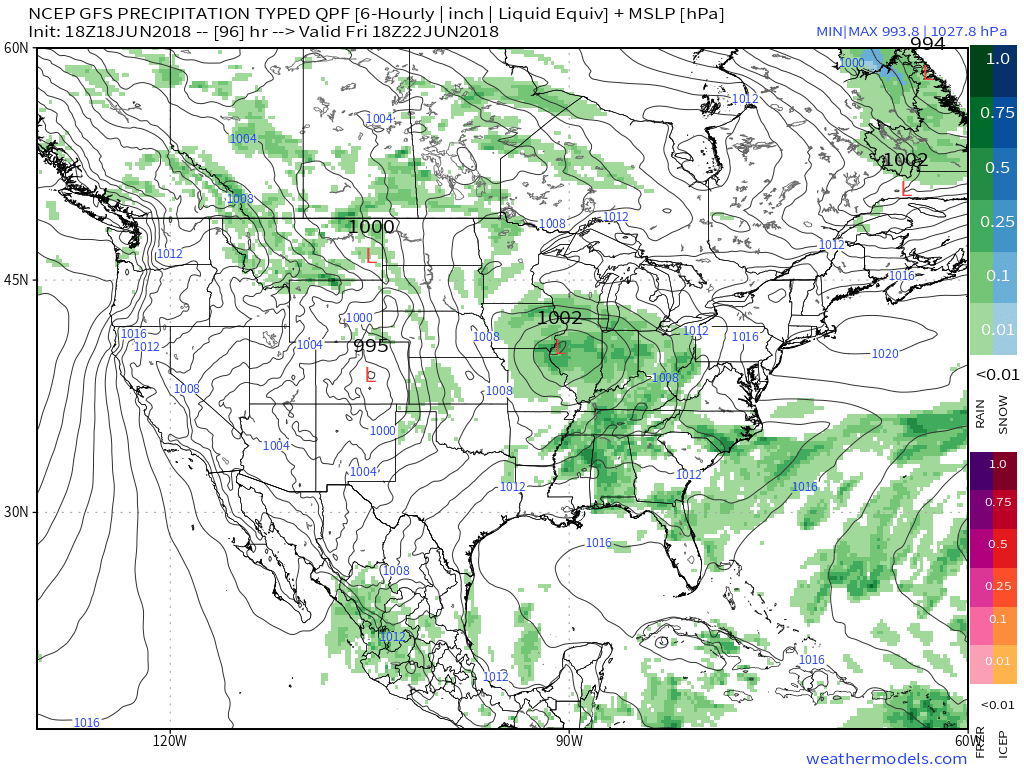 The combination of a juicy air mass and a stationary boundary draped overhead spells a flash flood risk. The lack of any sort of overall steering current suggests the potential of thunderstorms that may train over the same communities at times. As mentioned earlier, precipitable water values (PWATS) will approach and exceed 2″ and this will support torrential downpours at times.
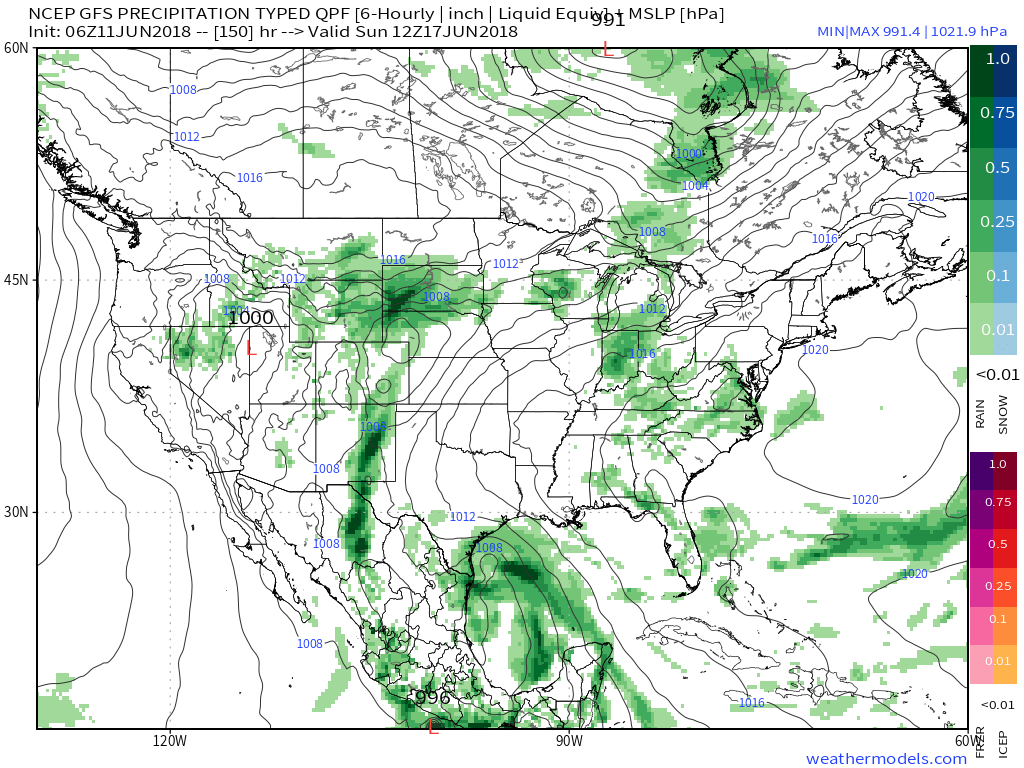
 Officially, we think the upcoming 7-day period will deal out widespread 2″ to 3″ rainfall totals across central Indiana, but there will be locally heavier amounts where thunderstorms train.
After a dry few days with exceptional heat, the unsettled and cooler pattern, overall, will be welcomed with open arms!
You must be logged in to view this content. Click Here to become a member of IndyWX.com for full access. Already a member of IndyWx.com All-Access? Log-in here.
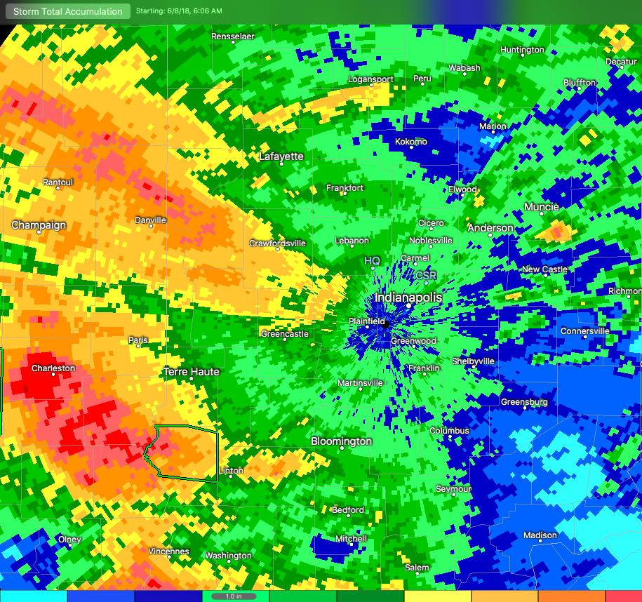
Central Indiana has dealt with heavy rain over the past (24) hours, and it’s continuing this morning. In some areas, rainfall has been excessive. Note the latest Storm Total Rainfall map below. Areas of light green indicate where 1″ of rain has fallen (since June 8th), yellow indicates where 2″ of rain has accumulated, and the orange hues represent areas of 4″ to as much as 5″ in spots. – Again this is just rainfall from Friday morning through 7a Monday.
 Moisture continues to stream across central and southern Indiana this morning, and some of this rain is falling at a moderate to heavy rate.
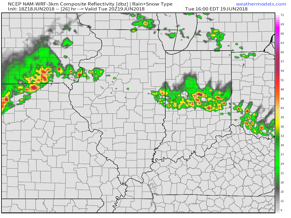
 Widespread rain will eventually come to an end later this afternoon before scattered showers and thunderstorms redevelop this evening into tonight. Potential is also present for the possibility of another thunderstorm complex impacting parts of the region late tonight into early Tuesday- especially across the southwest part of the state. Scattered thunderstorm chances will remain Tuesday (more of the splash and dash variety as opposed to a widespread soaker).
 Eventually, drier air will work into the state for midweek and rainfall coverage will diminish Wednesday and most of Thursday.
An increasingly moist air mass will return to close the week and with the increasing humidity, rain and storm chances will make a return Friday into the upcoming weekend.