Model Data Remains Consistent On A More Active Pattern Returning…
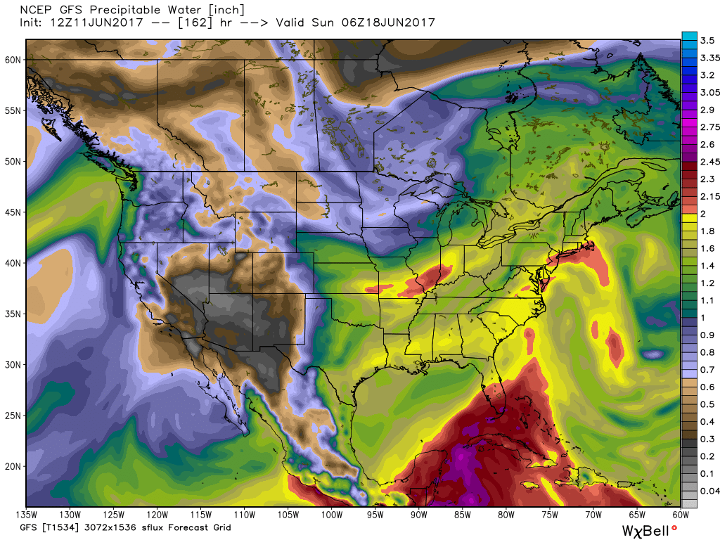
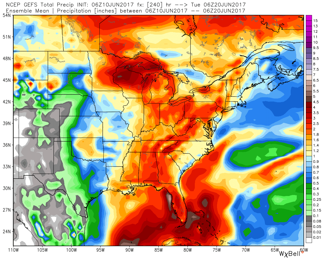
Today’s 12z model suite is in and it remains consistent on a more active weather pattern returning to the delight of many Hoosiers! A blend of the GFS and European 10-day rainfall numbers print out 2″ for Indianapolis. The GFS ensemble ‘mean’ (a blend of 21 individual members) agrees.
 Best overall coverage of showers and thunderstorms should come in (3) waves over the upcoming 10-day period:
- Wednesday into Thursday
- Saturday into Sunday
- Middle parts of the following week
While we don’t see any sort of uniform type rains in the upcoming period, the “smattering” of storms should help most neighborhoods get in on the rainy “goods” at one time or another over the upcoming week and a half. Keep in mind, we’re in mid-June now and it’s mighty difficult to ask for anything much more than scattered storms this time of year on through late-summer…unless a tropical entity gets involved. That’s just the way this time of year is. With that said, localized torrential downpours are a very good bet from time to time, beginning as early as mid-week, as precipitable water values approach, or exceed, 2″ (about as moisture-rich as you can ask the air mass to get around these parts) into the upcoming weekend.
 As I type this outside on the back porch this evening, I hear the sounds of sprinklers in full-force through the ‘hood. Thankfully, Mother Nature will help save on the water bill later this week. Longer-term, you’ll hear us use the word “transient” many times this summer when discussing the overall weather pattern. Thankfully that tends to result in a fairly busy time of things. Before you know it, college football season will be back (83 days until my beloved Auburn Tigers kick-off), those wetter autumn storms will return, and thoughts will begin to shift to winter (they may have already started here :-))- not that we’re trying to rush summer away or anything…

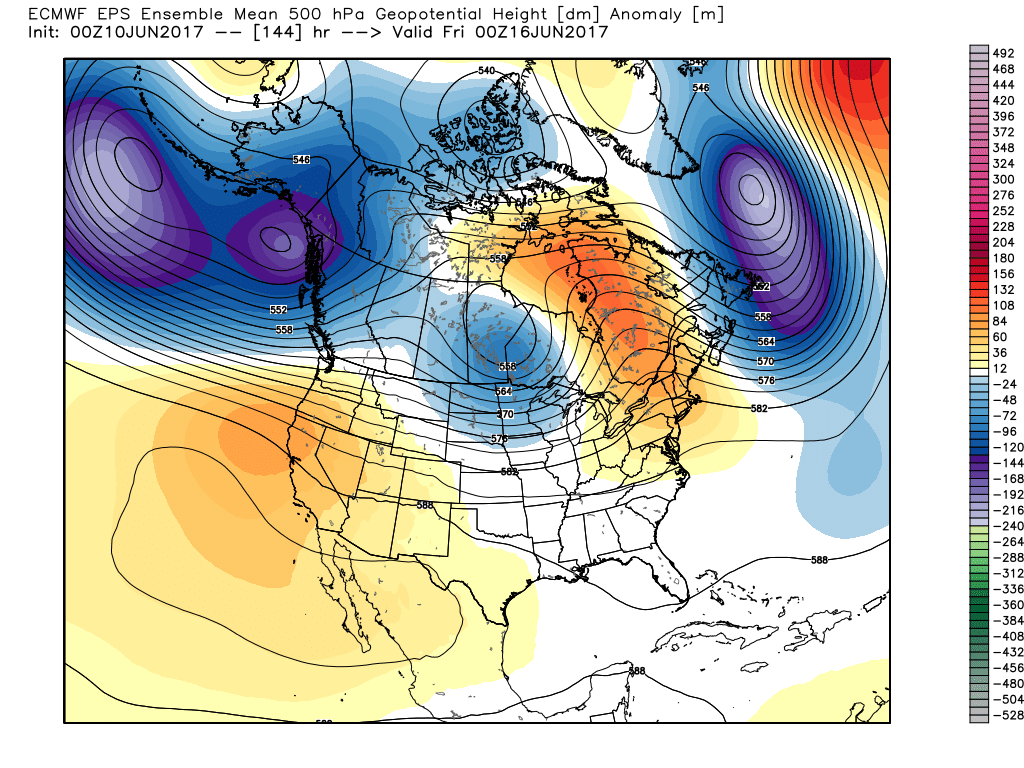


 However the cold air won’t last and milder times will return by the second half of the weekend. This back and forth “tug of war” type regime will remain as cold and warmth (relative to average) continue to battle over the upcoming couple weeks. The latest European ensemble shows this nicely.
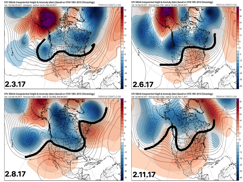 This also favors a rather active pattern and confidence is high on a wetter than average period upcoming over the next couple weeks. See the GFS ensembles support this idea. A couple strong storms are also possible Tuesday.
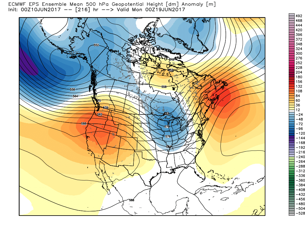
 Unfortunately for snow lovers, the majority of significant moisture should fall as rain. Best snow chances appear to come with “backlash” wrap around snow showers and squalls Tuesday night into Wednesday morning. Accumulating snow is possible, but most amounts should be light. We’ll keep an eye on it.
 Longer-term, the fight continues deeper into the month. As
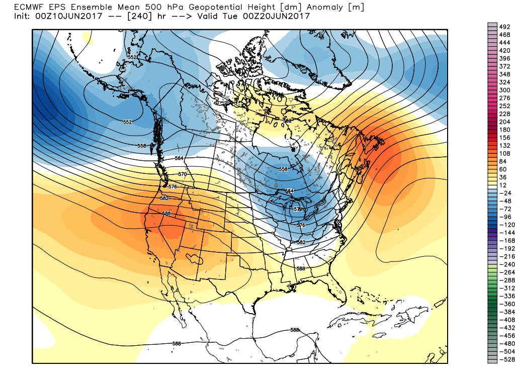
 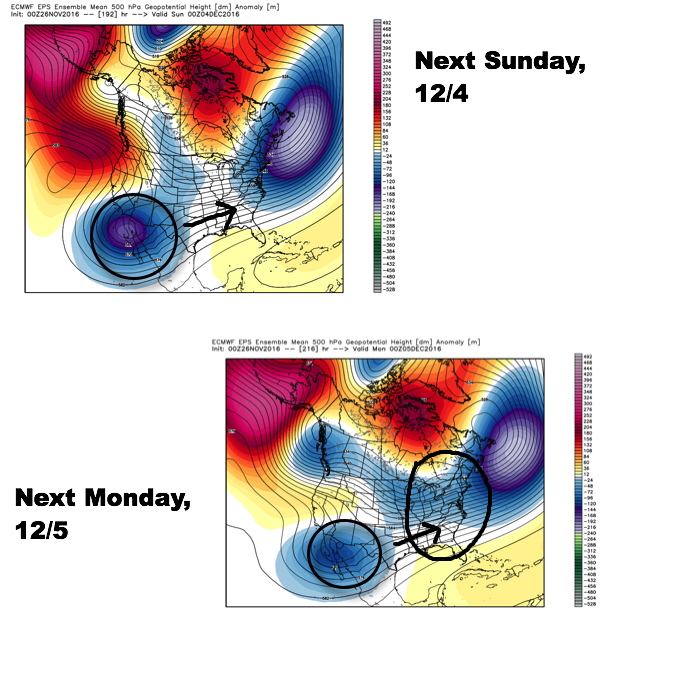 Since then, the European has begun to lock-in to a trend of bringing that SW energy out quicker and, in return, igniting a surface low to develop in the western Gulf of Mexico (GOM) Saturday before tracking northeast into the TN Valley (Sunday) and Great Lakes region (Monday).
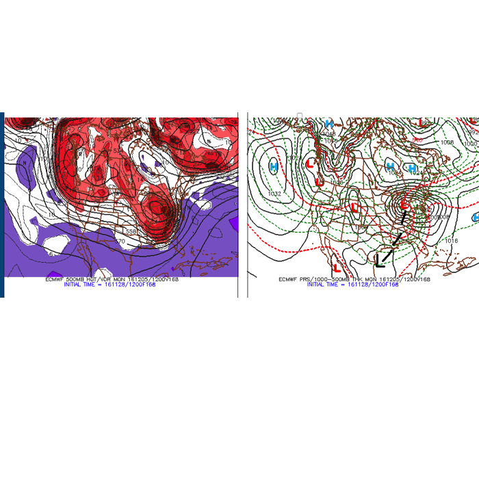 Taken verbatim, this would spread a cold rain into central IN Sunday before colder air begins to change the rain over to a wet, heavy snow Sunday night into Monday morning across central IN. Heavy, wind-blown, snow amounts would result with such a solution for portions of central IN. Such a scenario would be a high-impact event. While the majority of model data (factoring in the GFS and Canadian, for example) is far from agreeing on such a solution, it’s important to note that a trend of such a scenario is beginning to develop within the powerful European forecast model. Furthermore, roughly half of the European’s (51) ensemble members agree on an impactful winter event in the Sunday-Monday time period for central Indiana.