VIDEO: Upcoming 10 Days Looks Warm And Dry, Overall…
You must be logged in to view this content. Click Here to become a member of IndyWX.com for full access. Already a member of IndyWx.com All-Access? Log-in here.
You must be logged in to view this content. Click Here to become a member of IndyWX.com for full access. Already a member of IndyWx.com All-Access? Log-in here.
You must be logged in to view this content. Click Here to become a member of IndyWX.com for full access. Already a member of IndyWx.com All-Access? Log-in here.
The general consensus between the JMA and CFSv2 is that warmth is the story through Week 2, especially this weekend into next week. JMA first:
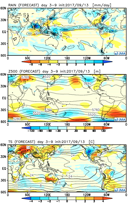

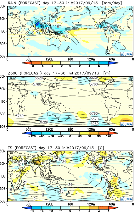
Before we show the CFSv2, a couple take-aways from the JMA:
Now…the CFSv2:
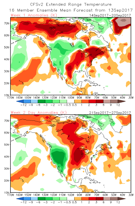
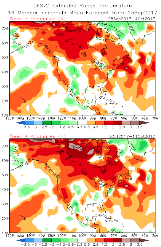
Key take-aways:
While we can’t show the European Weeklies due to licensing issues, they paint a similar theme, overall. They sing a similar song in the short-term for warmth to close the month, but are much more bullish on the transition to a colder than average first half of October compared to the CFSv2 and JMA.
To sum things up, confidence is high on a summer-like regime to engulf the region through the balance of the second half of September as a ‘Nina-ish pattern takes hold. Late-season summer warmth will rule through next week, including highs in the 85°-90° range at times- developing as early as this weekend. This, of course, comes on the heels of an unusually early cool start to meteorological fall (IND is running a whopping 6° below average, MTD). After the warmth dominates, a transitional pattern should ensue, including more active times (wetter than average as we close September and open October), along with “pops” of colder air. That said, a consistently positive southern oscillation index has us “raising an eye brow” to the aggressively cold start to October such as the Euro implies… Stay tuned.
Irma: Irma’s remnants will begin to impact the state Tuesday. We noticed an increasing mid and high level cloud deck today and moisture will spread north to encompass southern Indiana…
You must be logged in to view this content. Click Here to become a member of IndyWX.com for full access. Already a member of IndyWx.com All-Access? Log-in here.
Today’s 12z model suite is in and it remains consistent on a more active weather pattern returning to the delight of many Hoosiers! A blend of the GFS and European 10-day rainfall numbers print out 2″ for Indianapolis. The GFS ensemble ‘mean’ (a blend of 21 individual members) agrees.
 Best overall coverage of showers and thunderstorms should come in (3) waves over the upcoming 10-day period:
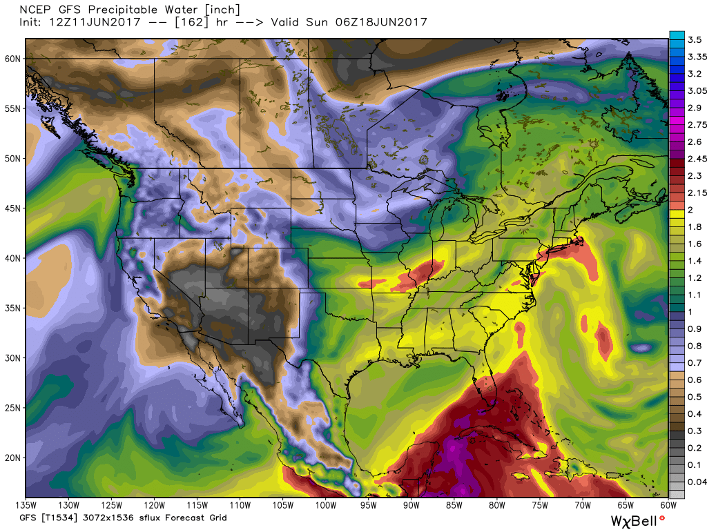
While we don’t see any sort of uniform type rains in the upcoming period, the “smattering” of storms should help most neighborhoods get in on the rainy “goods” at one time or another over the upcoming week and a half. Keep in mind, we’re in mid-June now and it’s mighty difficult to ask for anything much more than scattered storms this time of year on through late-summer…unless a tropical entity gets involved. That’s just the way this time of year is. With that said, localized torrential downpours are a very good bet from time to time, beginning as early as mid-week, as precipitable water values approach, or exceed, 2″ (about as moisture-rich as you can ask the air mass to get around these parts) into the upcoming weekend.
 As I type this outside on the back porch this evening, I hear the sounds of sprinklers in full-force through the ‘hood. Thankfully, Mother Nature will help save on the water bill later this week. Longer-term, you’ll hear us use the word “transient” many times this summer when discussing the overall weather pattern. Thankfully that tends to result in a fairly busy time of things. Before you know it, college football season will be back (83 days until my beloved Auburn Tigers kick-off), those wetter autumn storms will return, and thoughts will begin to shift to winter (they may have already started here :-))- not that we’re trying to rush summer away or anything…