VIDEO: Summer-Like Feel Develops; Talking Storm Chances In The Days Ahead…
You must be logged in to view this content. Click Here to become a member of IndyWX.com for full access. Already a member of IndyWx.com All-Access? Log-in here.
You must be logged in to view this content. Click Here to become a member of IndyWX.com for full access. Already a member of IndyWx.com All-Access? Log-in here.
As we look ahead to late-May and early June, “transition” is the word that comes to mind when describing the overall weather pattern.
We’re going to begin pulling out of this unseasonably chilly pattern late-week and we’ll replace it with a true summer-like regime. Note the differences at 500mb between now and this weekend:
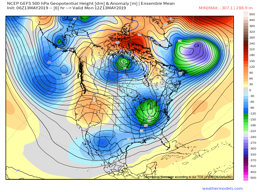
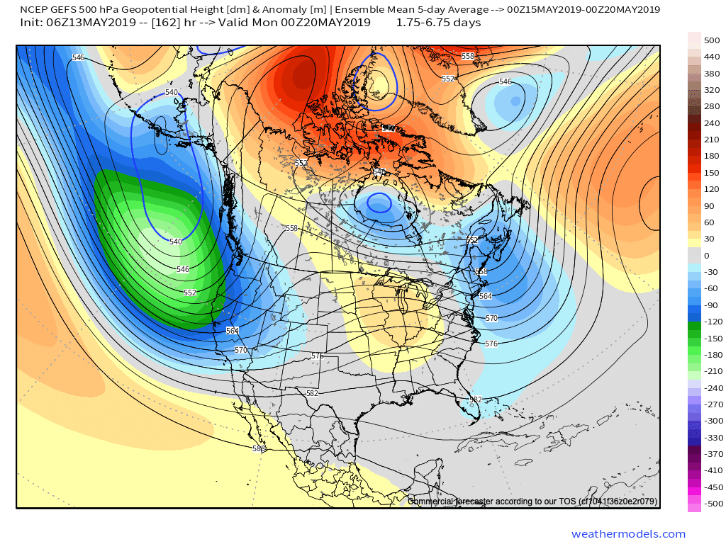
Not only will the 80s return, but oppressive dew points can be expected as well by Friday (65-70 degrees). The sweat factor will be back in full effect!
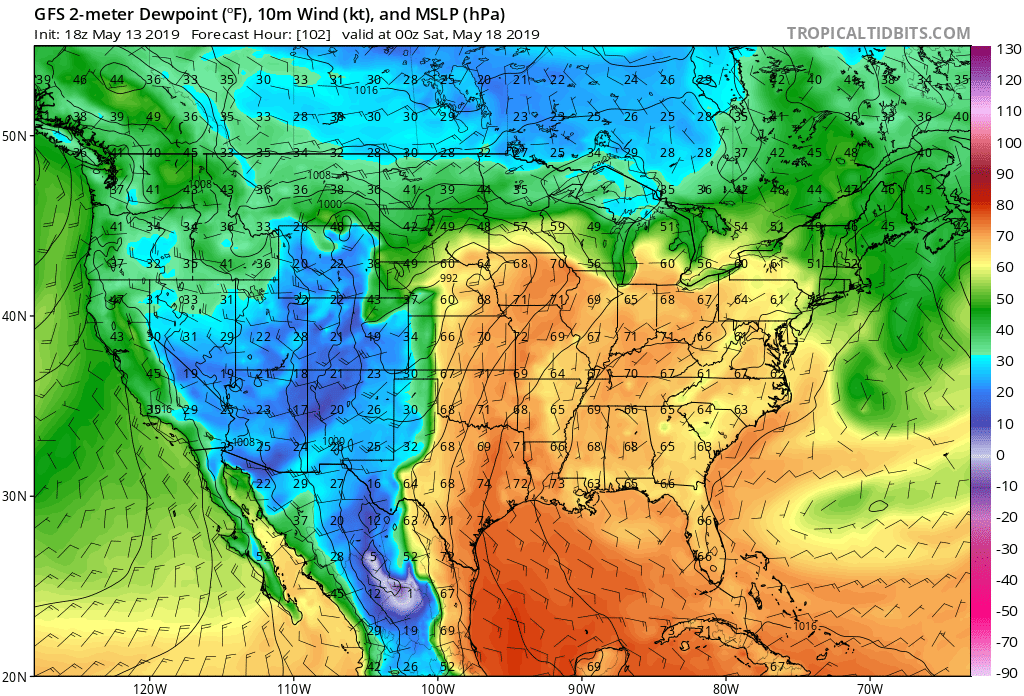
With that said, there’s reason for concern that the flip to summer may not last.
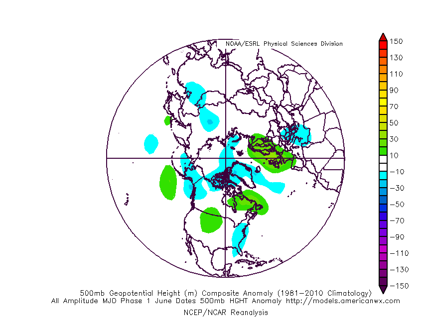
Not only do we continue to see high-latitude blocking in place, but the MJO is showing signs of rotating into Phase 1 as we inch closer to early-June. That Phase 1 this time of year is a cool one for the eastern portion of the country. Note the tendency for eastern troughiness illustrated in Image 2 below.

Perhaps ensemble data is seeing this cooler transition in the pattern on today’s 12z run:

Bottom line, confidence is high on a summer-like flip as we welcome in the weekend, continuing into early parts of Week 2, but we don’t think it’s a “stick and hold” variety of warmth. There’s growing reason to believe a flip back to cooler conditions looms before we close out the month.
Though May has opened warmer than average (to the tune of 1 degree F above normal, month-to-date), there’s growing evidence behind a shift towards not only a cooler pattern for mid-month, but drier, as well.
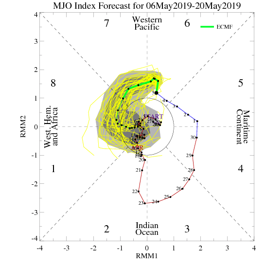
MJO:
The Madden Julian Oscillation is forecast to move through Phase 7 (a cooler phase in May across the eastern half of the country).
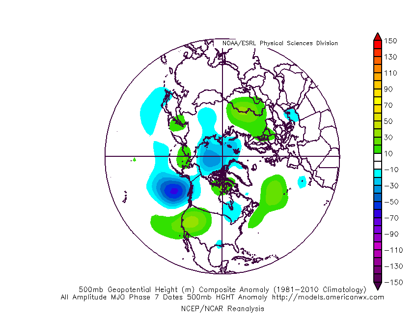
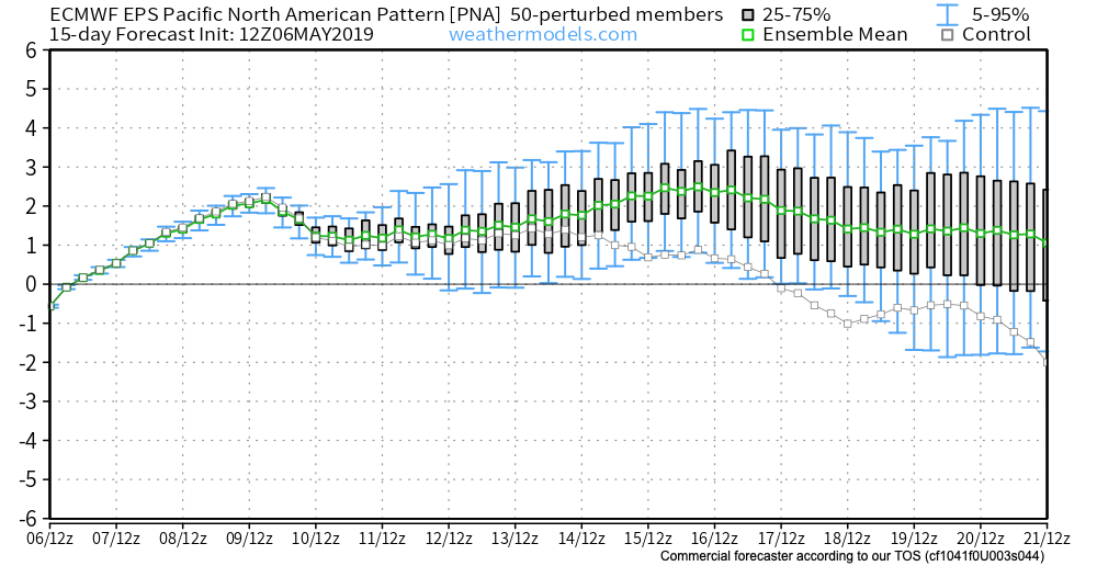
PNA:
The Pacific North America pattern is forecast to remain positive into mid-May. This favors a cooler than normal south-central into the eastern portion of the country, as well.
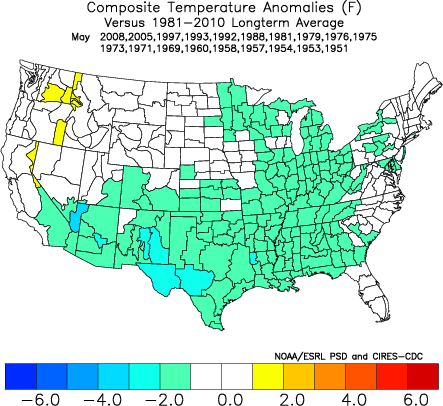
To no surprise, we see modeling now in excellent agreement of the cooler mid-month shift that awaits on deck. Recall that this wasn’t the case last week when the GFS and EPS were in vast disagreement.
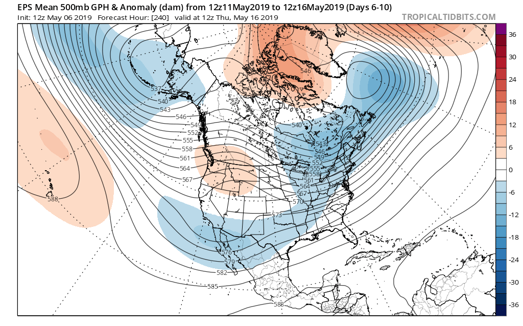
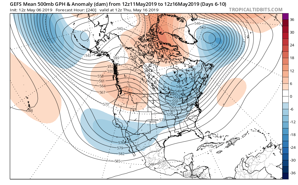

The cooler shift also will provide relief from the seemingly unending wet regime we’ve been in as of late.

Hang in there; after a warm, wet open to the month, the pattern will begin to shift around in significant fashion as we move into the weekend and beyond…
You must be logged in to view this content. Click Here to become a member of IndyWX.com for full access. Already a member of IndyWx.com All-Access? Log-in here.
We know the upcoming (10) day period is going to feature a continuation of above average rainfall, but what lies beyond that? Ensemble data is entirely in two different camps once we get to the Day 10-15 period.
GEFS:

EPS:
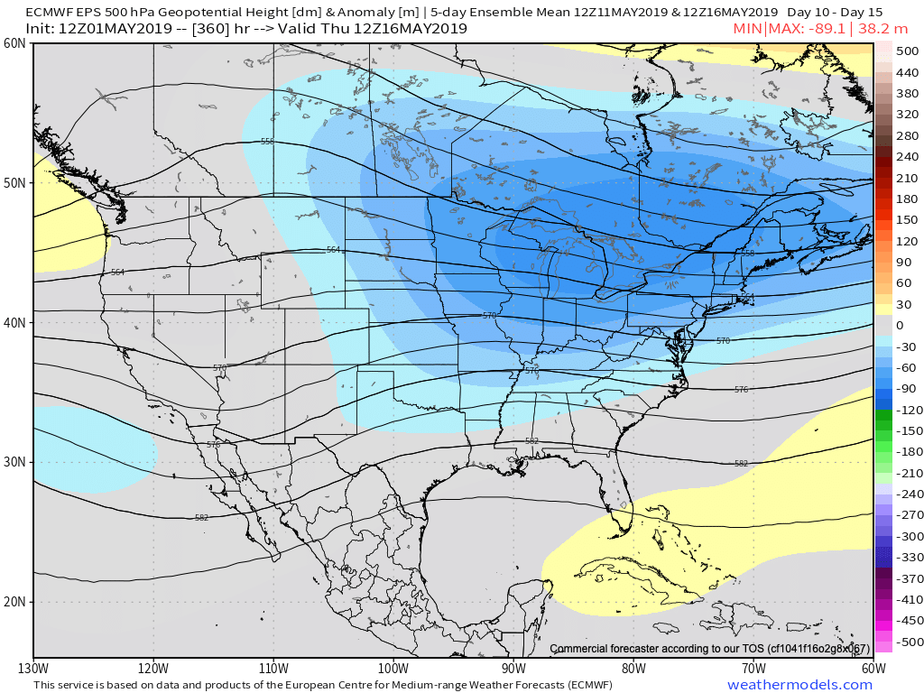
Talk about a night and day difference. This would result in widespread 70s and 80s should the GEFS prove accurate (and put our May outlook in jeopardy) versus 50s and 60s should the European turn out to be correct (more in line with our monthly outlook). Unfortunately, from a precipitation perspective, wetter than normal times are expected to continue for the balance of the month of May and the data is in more agreement from that perspective- despite the vast differences at 500mb.
When we look at the latest CFSv2, it’s more in line with the European camp, including rather widespread chilly, damp weather for the mid-to-late May time period.

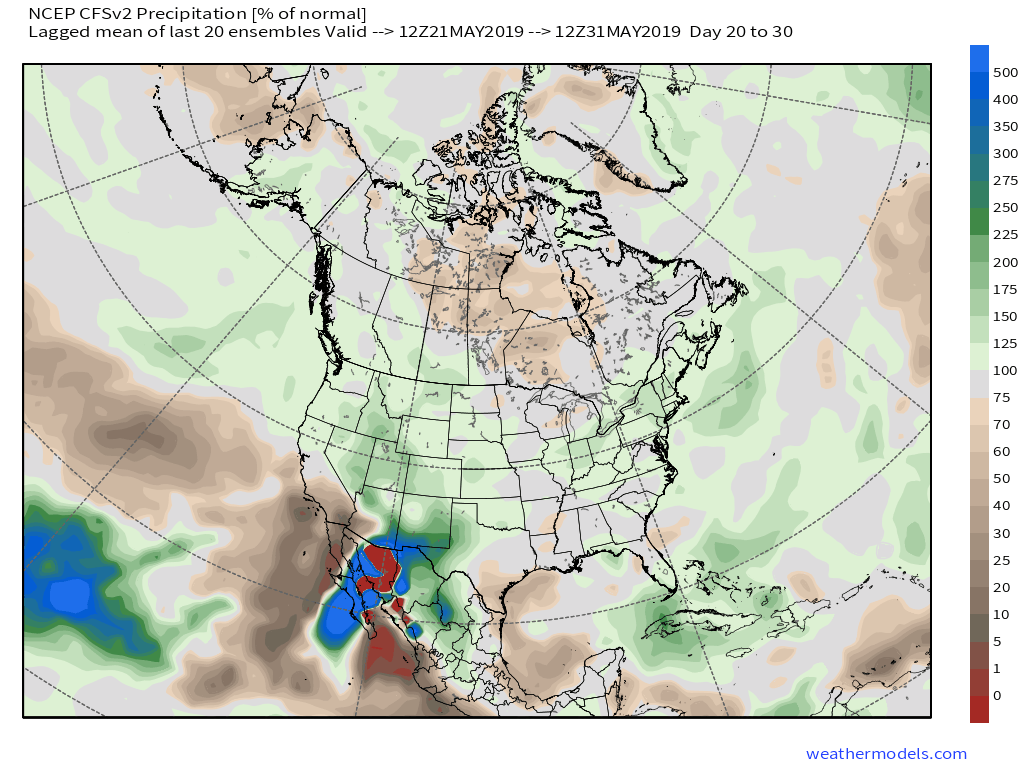
The combination of a negative NAO and AO, though not nearly to the extent of chill found in late winter/ early spring, do continue to hint at cooler than normal times in May. Eventually I would expect the GEFS to trend cooler, as well.
Furthermore, the PNA (currently negative) is forecast to trend positive by mid-May and that supports the cooler anomalies returning to our immediate region.
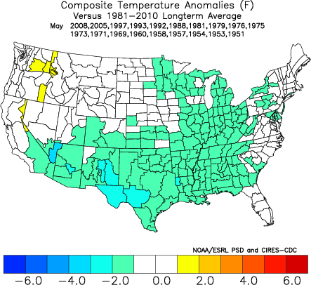
We’ll also have to keep close tabs on the MJO and see if it wants to propagate through Phases 5-8, or go back in the “wheelhouse” and really not be a factor. (More to come there).
To sum things up, we don’t see an end in sight to the overall wetter than average pattern as we progress into the middle of May. We’re less confident on the overall temperature pattern, but lean towards the EPS and CFSv2 “winning” over the warm GEFS solution in the end.