Some are beginning to grow tired of the seemingly unending warmth and lack of snow, particularly with an above normal stretch of weather coming that includes the Christmas holiday (though not nearly as warm as the European suggested as soon as only a few days ago).
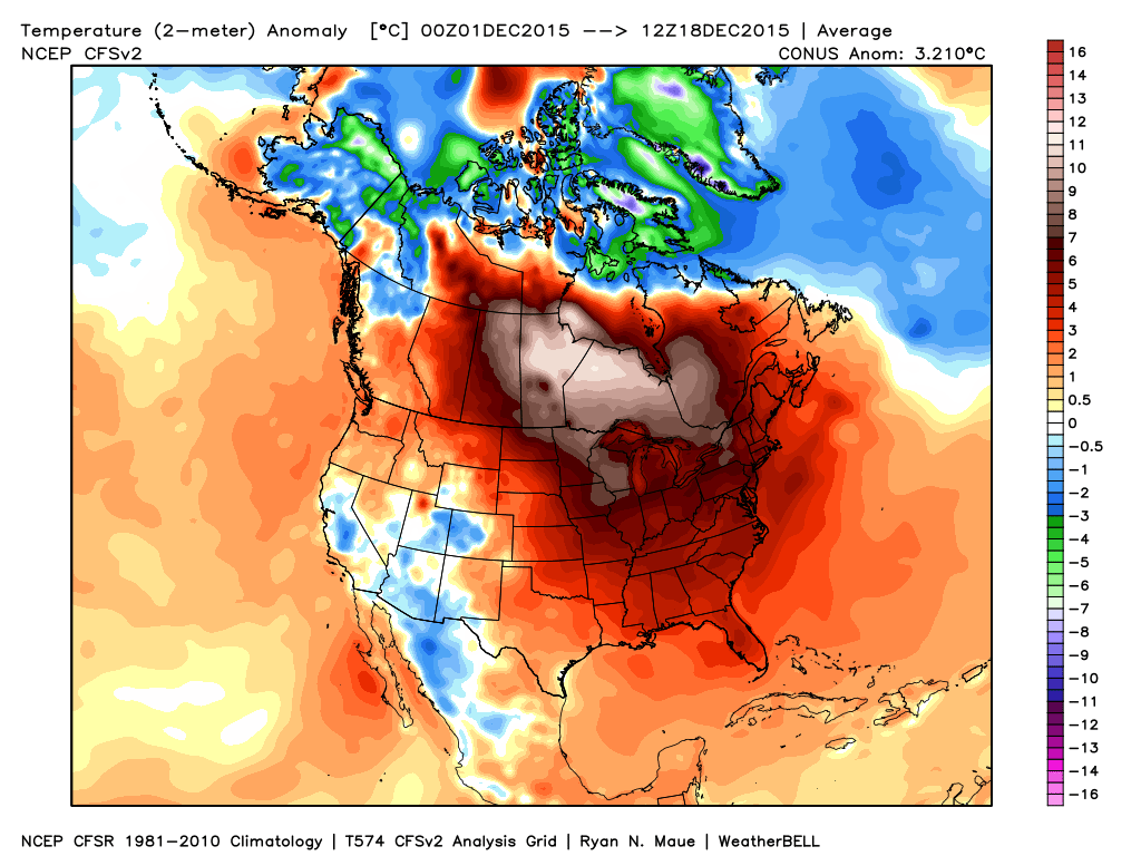
Month-to-date, December has been a warmer than normal month for most of the country. Source: Weatherbell.com
Our winter outlook stated we thought we’d get off to a warmer than normal start, but we were also very clear in stating we thought a rather marked shift to more sustained wintry conditions loomed for mid and late winter. That period is drawing closer by the day and it’s time to “put up or shut up.” By “mid winter” we mean mid January. Yes, that means three weeks out. Without holding back any punches, we’re fully expecting a colder than average period developing by then (and with staying power), along with plenty of opportunities for wintry precipitation.
You can read our full winter outlook (published in October) here.
The reasoning for our thinking has been outlined in previous posts and in our winter outlook, but, in short, it’s built on the idea of a weakening El Nino and a mean winter upper air pattern that includes W NA ridging (positive PNA regime). Later in the season, a more sustained negative AO and NAO should establish itself that could carry the wintry regime into meteorological spring.

Current Sea Surface Temperature Anomalies
We think we begin to progress into a “step down” process to the pattern explained above through the early stages of January, and the ensemble data is beginning to support this.

GFS ensembles for early January. Source: Tropicaltidbits.com
The modeled W NA ridging is a far cry from what we’ve been dealing with over the past month.
Now we caution that the initial step down to a more sustained wintry pattern won’t occur overnight. We label it “step down” for a reason. All the while, it’s a start in shifting away from the anomalous warmth we’ve been dealing with through the month of December. Initially, cold air will only be marginal, but as things align into the mid/ late winter pattern and we expand snow cover, arctic air will grow in a more widespread fashion. Something else we’ll begin to have to keep a close eye on? A potentially active NW flow that features several clippers plenty capable of producing accumulating snow. We note central-based Ninos are notorious for the clipper parade during the mid and late winter stretch.
In the shorter term, a rather unsettled Christmas week looms. Modeling will continue to “sure up” the handling of a rather complex storm system after Christmas, as well. We note runs that have pumped out copious rain numbers and others that suggest wintry precipitation may fall as the cold upper low ejects northeast. We’ll continue to monitor.
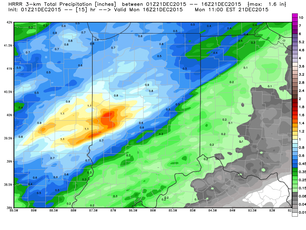
In the meantime, gear up for a rather wet Monday. We think one half inch is a good bet across the area, with locally heavier totals. Our updated 7-day in the morning will be a rather busy one. Talk with you in the AM!