
The stage is set for winter’s return. With that said, the upcoming week will likely feature a “transitional” time of things before winter returns with more authority during the 2/18 through 3/10 time period.
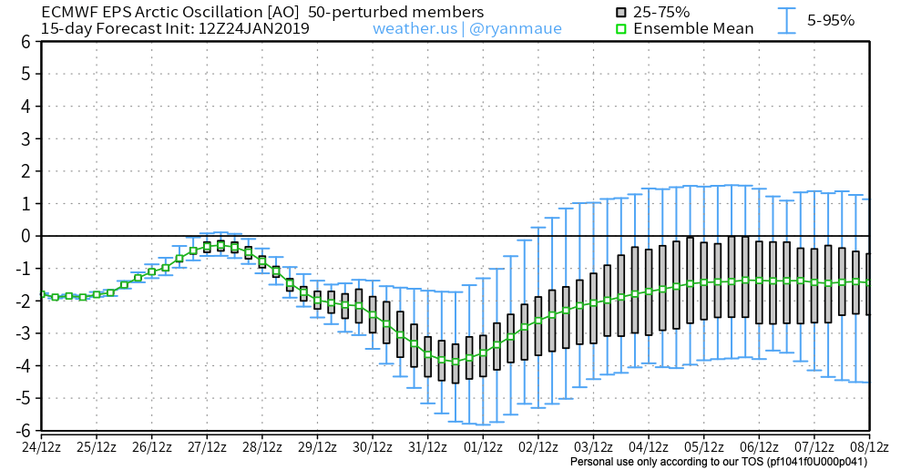
While the positive AO will continue to be heard from in the more immediate term (forcing the active storm track into the Ohio Valley and Great Lakes), this should eventually give way to a negative AO by mid and late month. Factor in a Phase 8 of the MJO and developing negative NAO and winter weather lovers will likely have a 2-3 week period of “fun and games,” including the potential of a couple significant events, along with well below normal cold late February and early March.
That said, this isn’t last year. Recall it was around this time that we were initially “faked out” by a wintry February when in all actuality it was a case of delayed, but not denied, with the worst of winter (relative to average, and in the means from a snow perspective) occurring in March and April. There are growing indications that we should actually have a spring this year, but more on that at a later time. 🙂
Let’s take a look at some of the latest long range modeling, starting with teleconnections first (always the basis of a long range forecast).
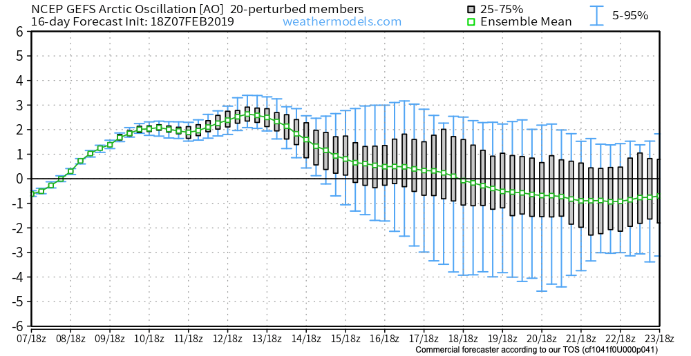

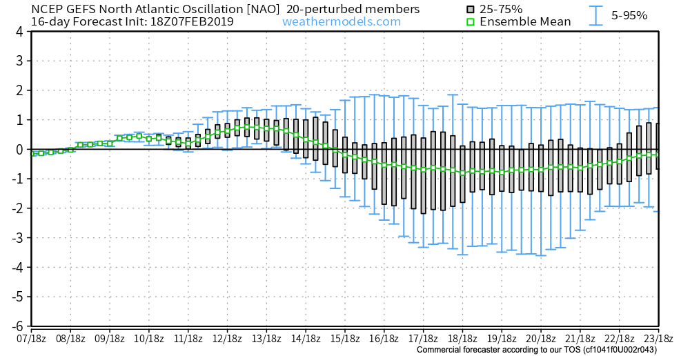
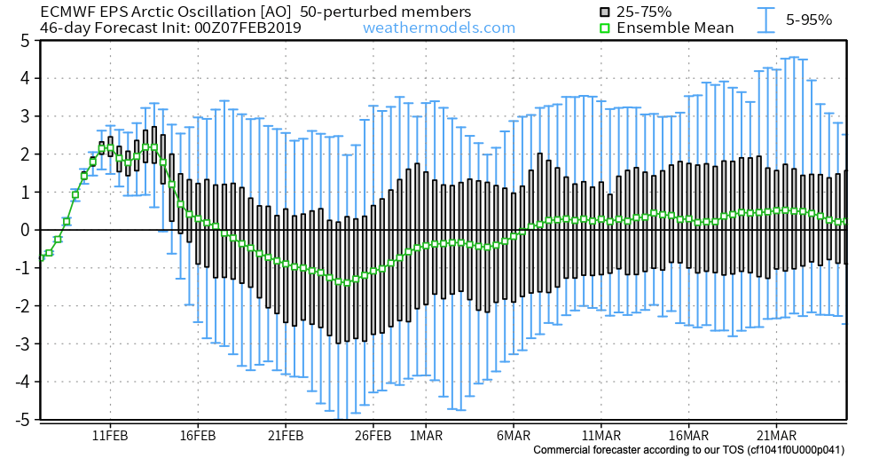
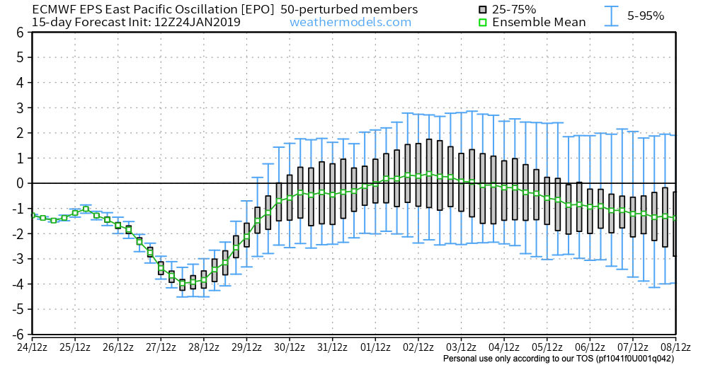
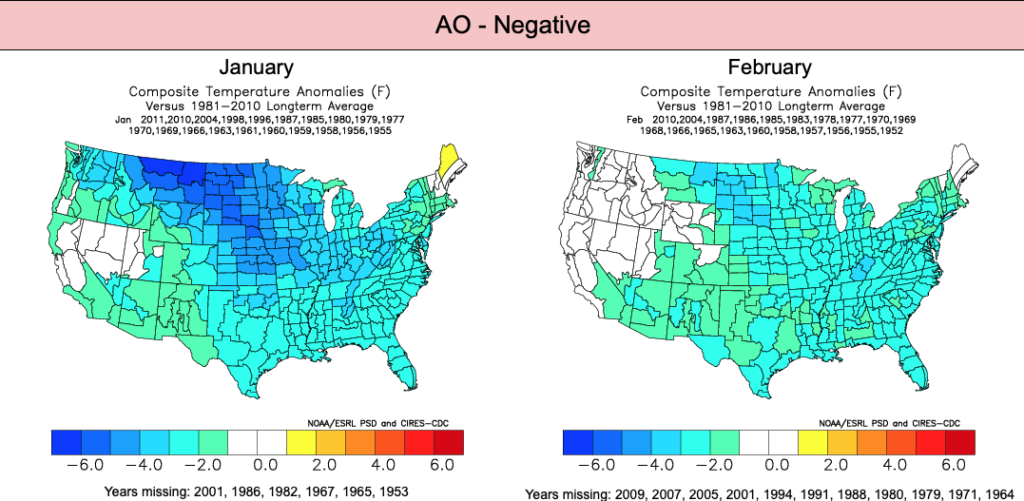
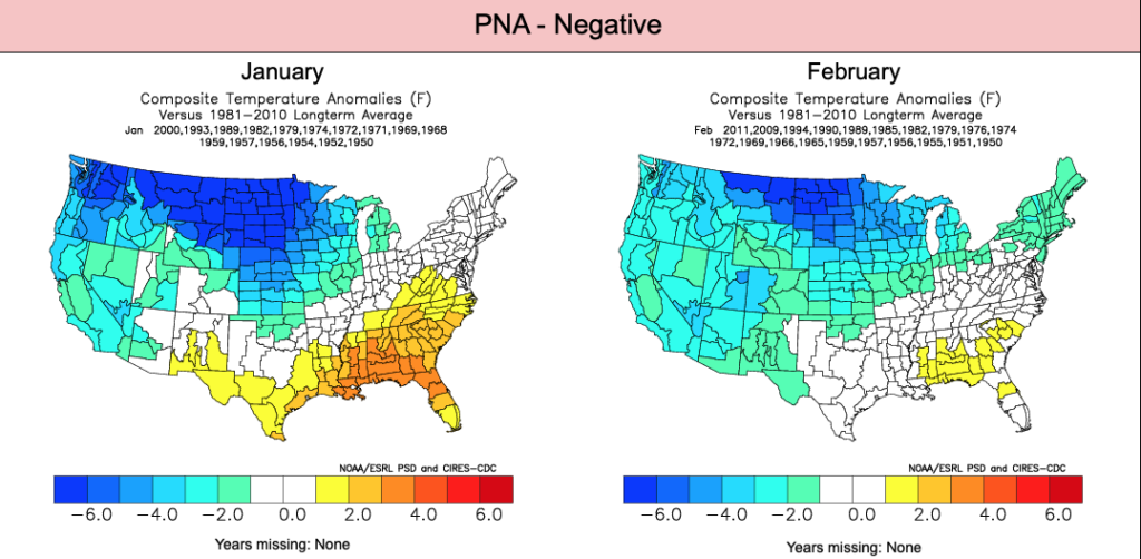
Simply put, the GEFS teleconnections line up for a return of colder than normal conditions during the middle to latter part of February. We love to see the agreement in the teleconnection states (trending negative AO (image 1) and NAO (image 3) and trending positive PNA (image 2)).
The latest European Weeklies would also agree. Note the strongly positive AO (image 1 below) at present dips negative during the 2nd half of February.

The European Weeklies like the idea of the PNA at least getting to neutral late month into early March.
- Also of importance is what the Weeklies do with both teleconnections by mid-March (this would support a warmer pattern, overall).
- Since we’re talking about the European Weeklies, while we can’t show the model output itself, it should be noted the model does deliver cold back into the region in rather widespread fashion during the last couple of weeks of February and into the first week of March.
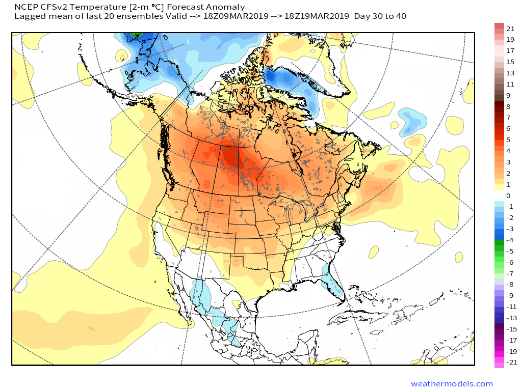
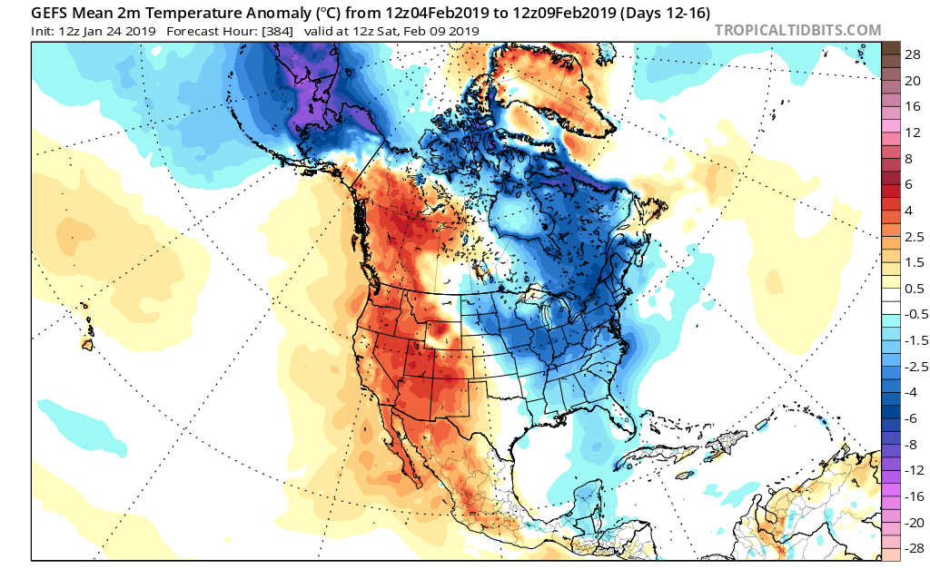
Other model data paints a similar picture as noted below between the GEFS and CFSv2 Weeklies:

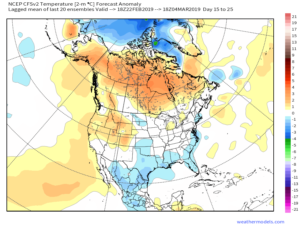
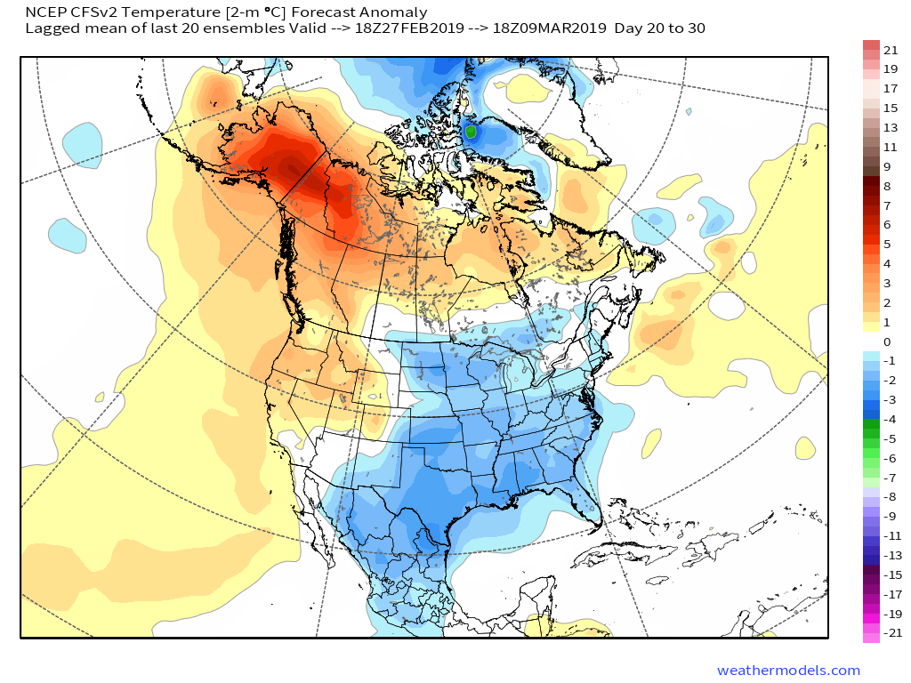
But, like other data would suggest, the CFSv2 is also in agreement that as early March gives way to the middle of the month, warmer times loom…
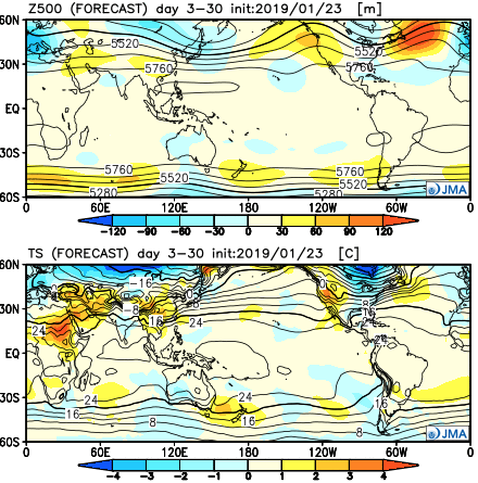
(In the event you missed it this morning, we reviewed the updated JMA Weeklies earlier here).
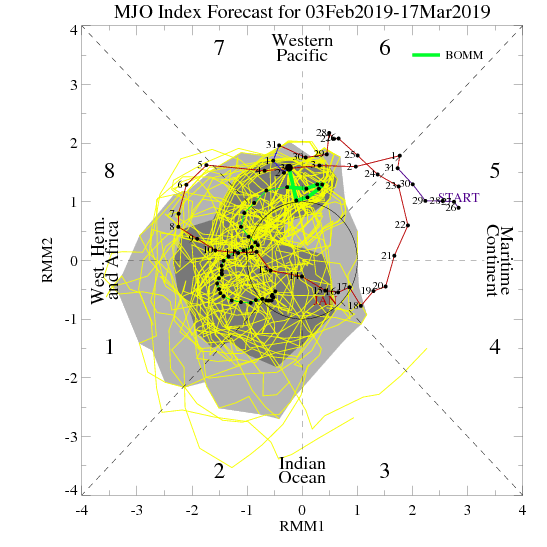
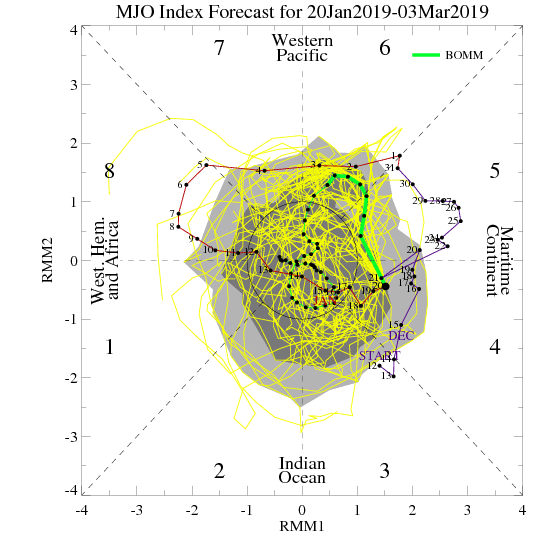
The latest MJO update continues to back up the idea of colder times returning mid and late February, continuing into early March, as noted below. Remember, this time of year, Phases 8 and 1 are colder phases for our neck of the woods.
To summarize, we expect this upcoming week to begin the transition back towards an overall colder and increasingly busy time of things from a wintry perspective. Those will snow removal interests should anticipate above average snowfall during the 2/18 through 3/10 time frame. The aforementioned period also should run colder than average, as well. However, those tired of winter, hang in there- hope is on the horizon once to mid-March and we should actually enjoy a pleasant spring this year after missing out in ’18!

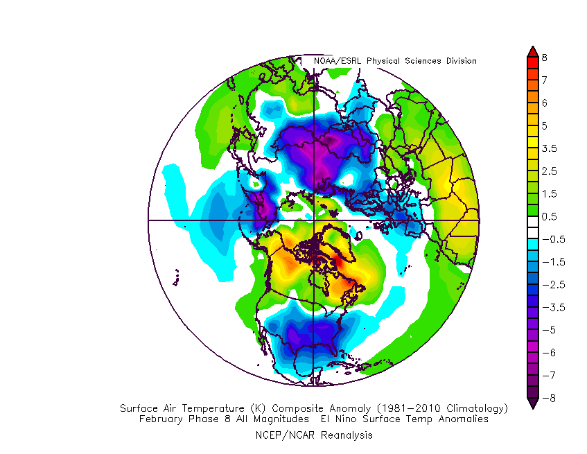
 The early “baseline” of our ideas focuses on the likelihood of El Nino returning for the upcoming winter season. As we’ve stated many times in the past, each Nino event is different from one another and other ingredients (highlighted above) can play a significant role in ultimately determining the eventual outcome.
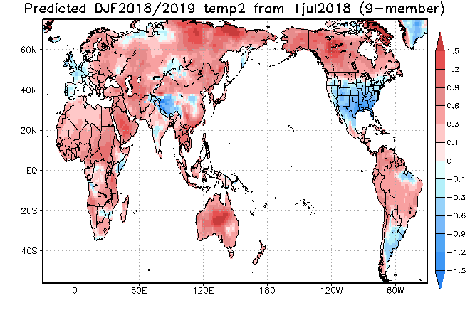
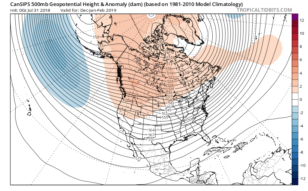

 That sea surface temperature configuration in the northern Pacific argues for western Canada ridging and downstream troughiness such as the JAMSTEC, European, and CanSIPS would imply.
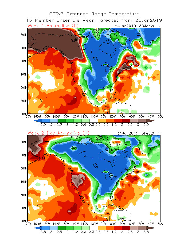
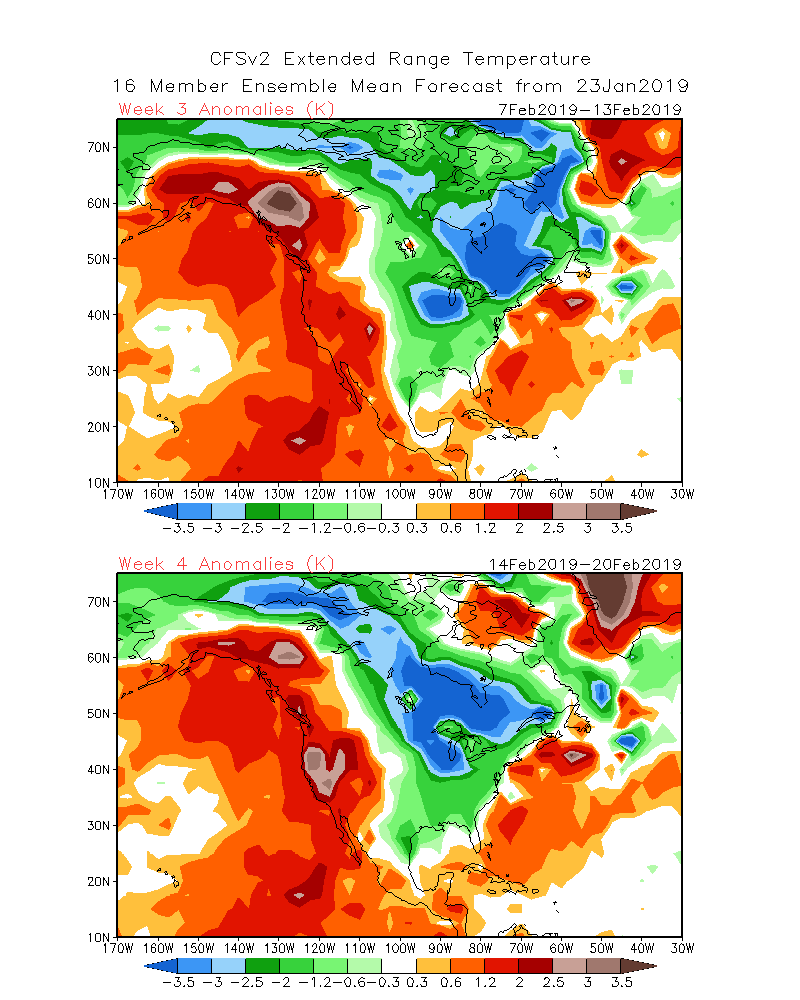
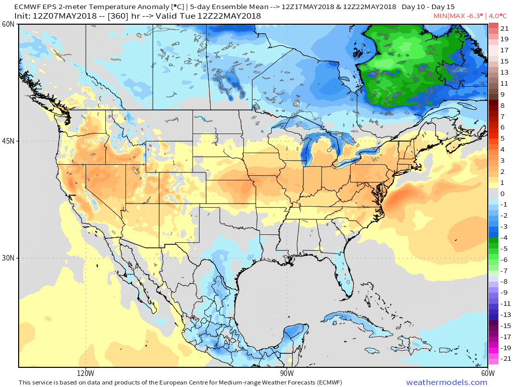
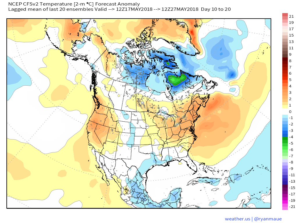
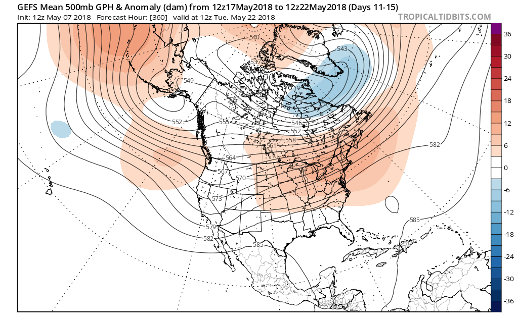 At the surface, all three major global models agree on warmth in the long range period, including the GEFS, EPS, and CFSv2:
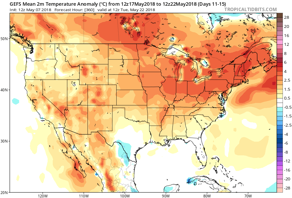
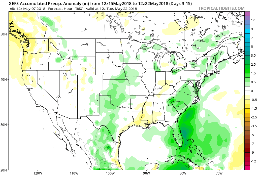
 Guidance suggests below average precipitation during the period. With broad scale ridging in place, we agree on a drier theme compared to normal. While trying to put our finger on the flip from the prolonged cold to warmer was difficult to nail down from March and April, May always looked like a drier than average month from several weeks out. (One note is the potential of active times across the Great Lakes region as “sudden summer” gains steam to the south and stubborn chill refuses to let go to our north. The gradient would promote heavier than normal precipitation relative to average).
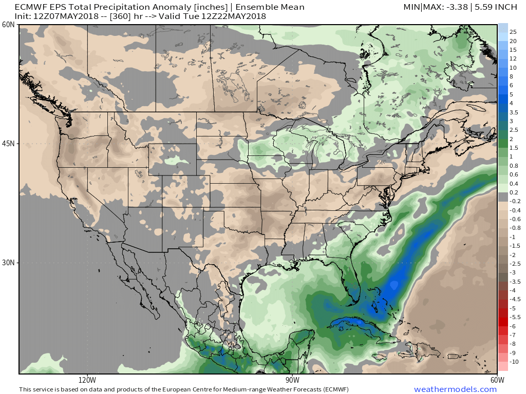
 Given the agreement in the data, along with some additional pattern drivers, we continue to believe the medium to longer term period (including mid and late May) will feature an overall warmer than average pattern along with drier than normal conditions.