Folks are growing tired of the cold and snow, and for good reason; it’s mid-April for goodness sakes. As of today, we’re currently ranked as the 5th snowiest spring (March-May) in recorded history, with Indianapolis recording 14.2″ thus far. By the way, we’re only .3″ from moving into the 4th place spot.
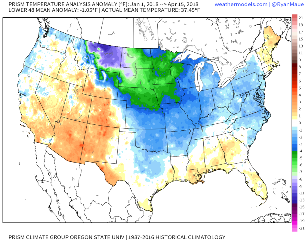
With that said, it’s not just April that’s been unusually cold and snowy, but the entire year thus far. As of April 15th, year-to-date CONUS temperatures are running more than 1° below average:
 More specific to Indianapolis, here’s the monthly temperature breakdown so far for 2018:
- April: 5.7° below normal (MTD)
- March: 3.3° below normal
- February: 5.6° above normal
- January: 3.0° below normal
As we look ahead, there are a couple of key items that we’re monitoring closely to get a better idea as to where this pattern is heading as we rumble into the merry month of May:
NAO- does it show signs of finally flipping to a positive state with any sort of duration?
MJO- does it go into the “wheelhouse” or continue to rumble into the milder phases (5 and 6 this time of year)?
The North Atlantic Oscillation (NAO) is a bit troubling as it shows signs of heading towards a negative phase once again as we open the month of May. This would promote the threat of colder than normal temperatures continuing in early May. With that said, May is the first month of the next several (until winter returns) where the overall influence of the NAO state begins to lessen it’s grip. Unlike from the mid and late winter months into the early spring (Jan through April), mid and late spring, through the fall, isn’t controlled by the NAO. With May being a “transition” month, we’ll favor a colder than average pattern continuing during the early portion of May as the NAO looks to trend negative. As we move towards mid and late month, we won’t rely on the NAO like we have been lately as the said influence “wanes.”
The Madden Julian Oscillation (MJO) is forecast by most data to head towards the “null” phase. The consensus of modeling takes it into the wheelhouse after traversing Phase 3 (present) which is a cold phase. The end result? Unfortunately, we can’t rely on the MJO with any sort of confidence from this distance for the month of May.
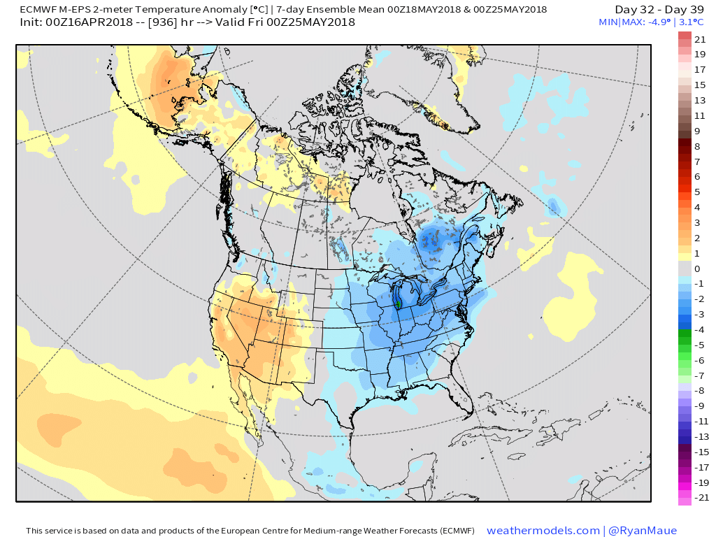
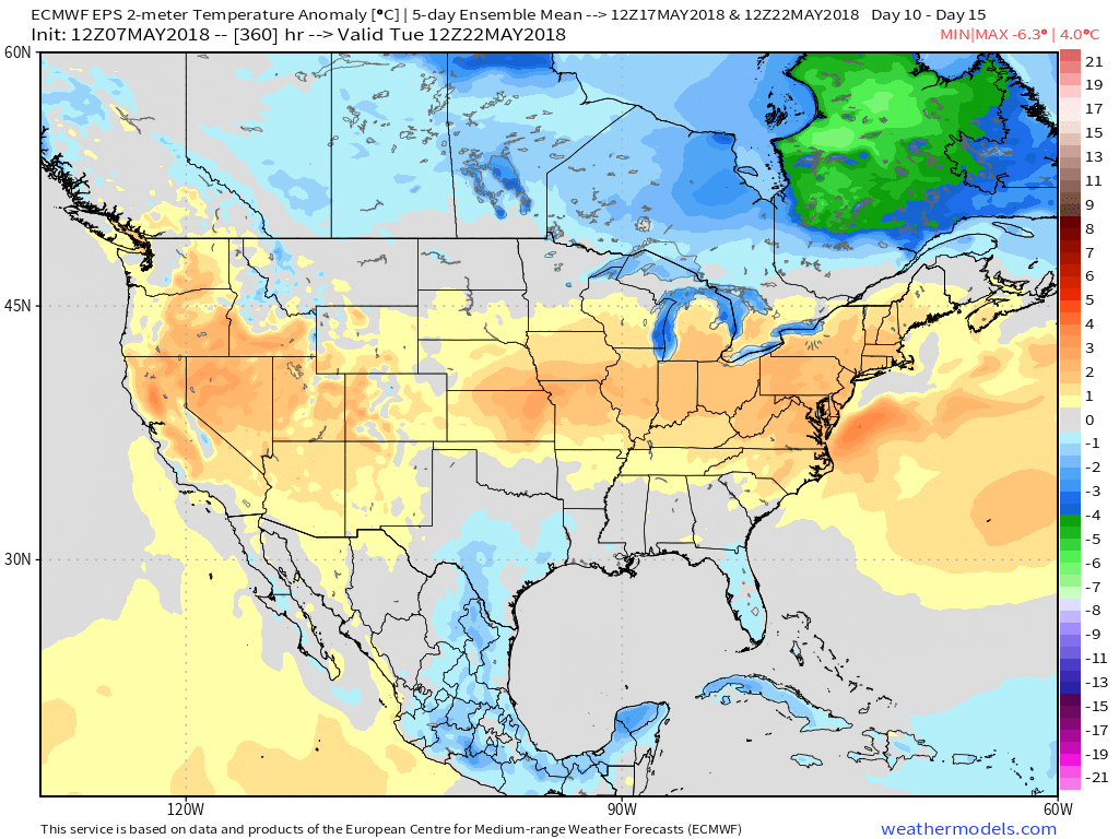
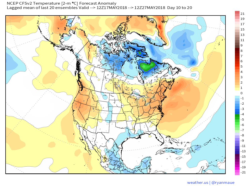
Looking at the data itself, the CFSv2 and European Weeklies (just to name a couple) show conflicting ideas. The CFSv2 (courtesy of weatherbell.com) is in the warmer than normal camp for May while the NEW European Weeklies (courtesy of weathermodels.com) suggest the chill lingers throughout the month.


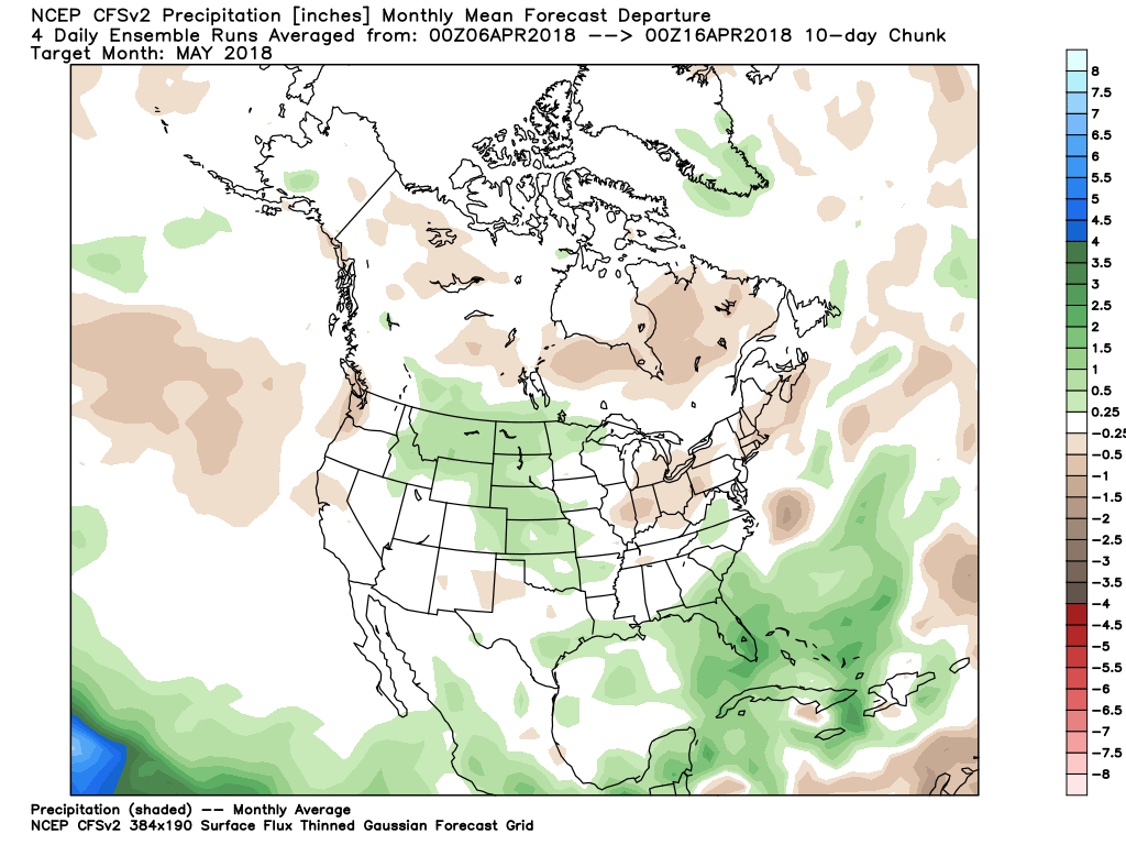
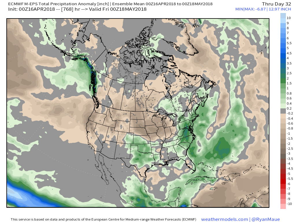
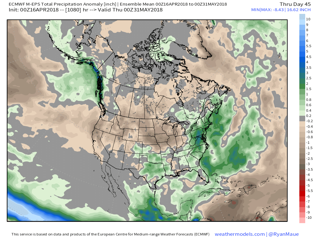
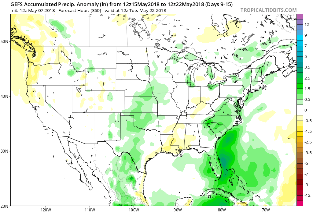
 While we have conflicting temperature ideas, both suggest a drier than average month emerging:
 At the end of the day, our call on May’s forecast from mid-April would be for an early cooler than average start before flipping towards more of a seasonable to slightly warmer than normal regime. Our idea all along this spring has been that when this pattern flips, the potential is present to jump right to a summery feel. In the face of the new European Weeklies, we still feel this warmer idea mid and late May is on the table. We’re in agreement with the data of a drier than average month.
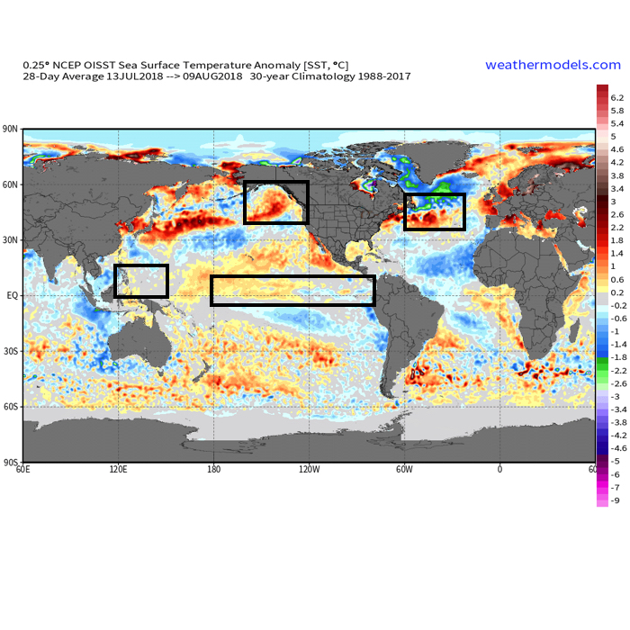 The early “baseline” of our ideas focuses on the likelihood of El Nino returning for the upcoming winter season. As we’ve stated many times in the past, each Nino event is different from one another and other ingredients (highlighted above) can play a significant role in ultimately determining the eventual outcome.

 That sea surface temperature configuration in the northern Pacific argues for western Canada ridging and downstream troughiness such as the JAMSTEC, European, and CanSIPS would imply.
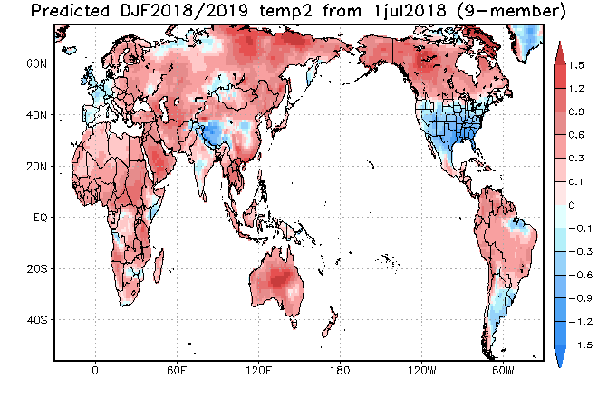
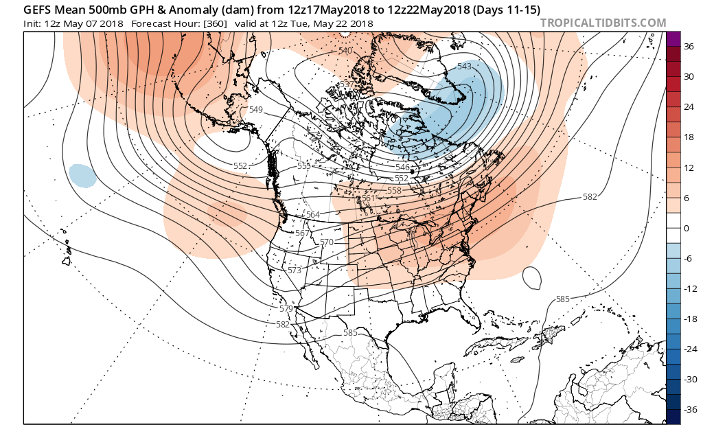 At the surface, all three major global models agree on warmth in the long range period, including the GEFS, EPS, and CFSv2:
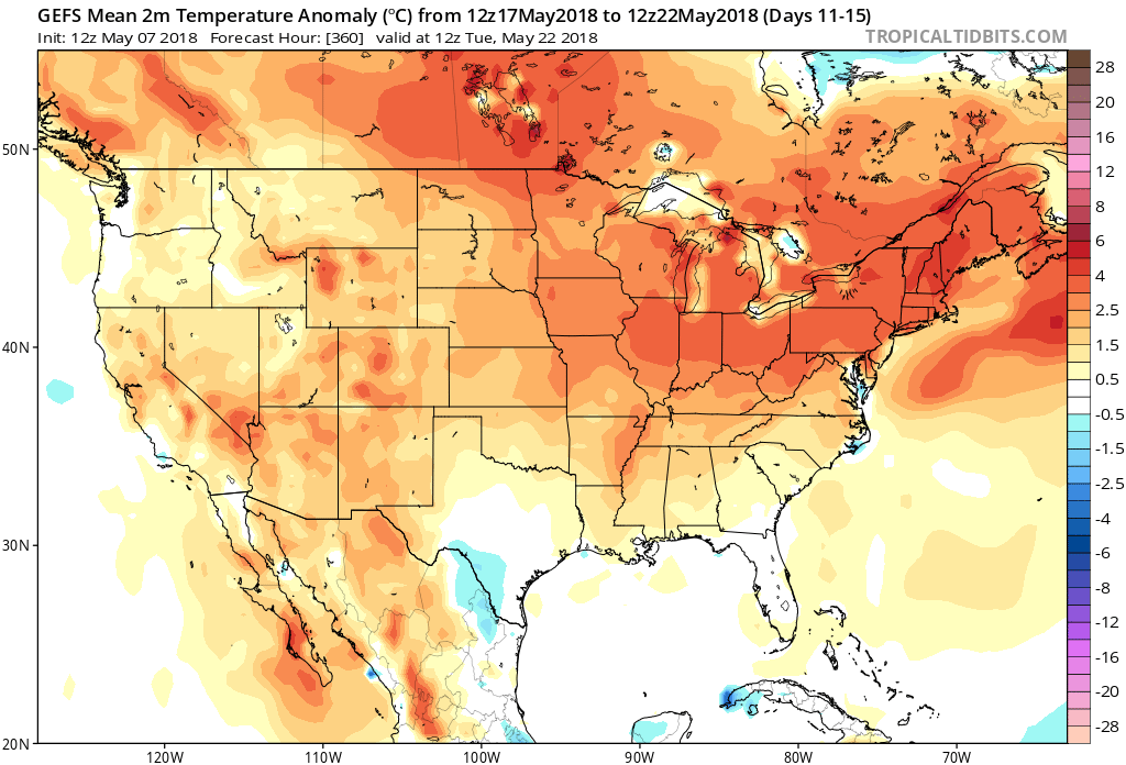
 Guidance suggests below average precipitation during the period. With broad scale ridging in place, we agree on a drier theme compared to normal. While trying to put our finger on the flip from the prolonged cold to warmer was difficult to nail down from March and April, May always looked like a drier than average month from several weeks out. (One note is the potential of active times across the Great Lakes region as “sudden summer” gains steam to the south and stubborn chill refuses to let go to our north. The gradient would promote heavier than normal precipitation relative to average).
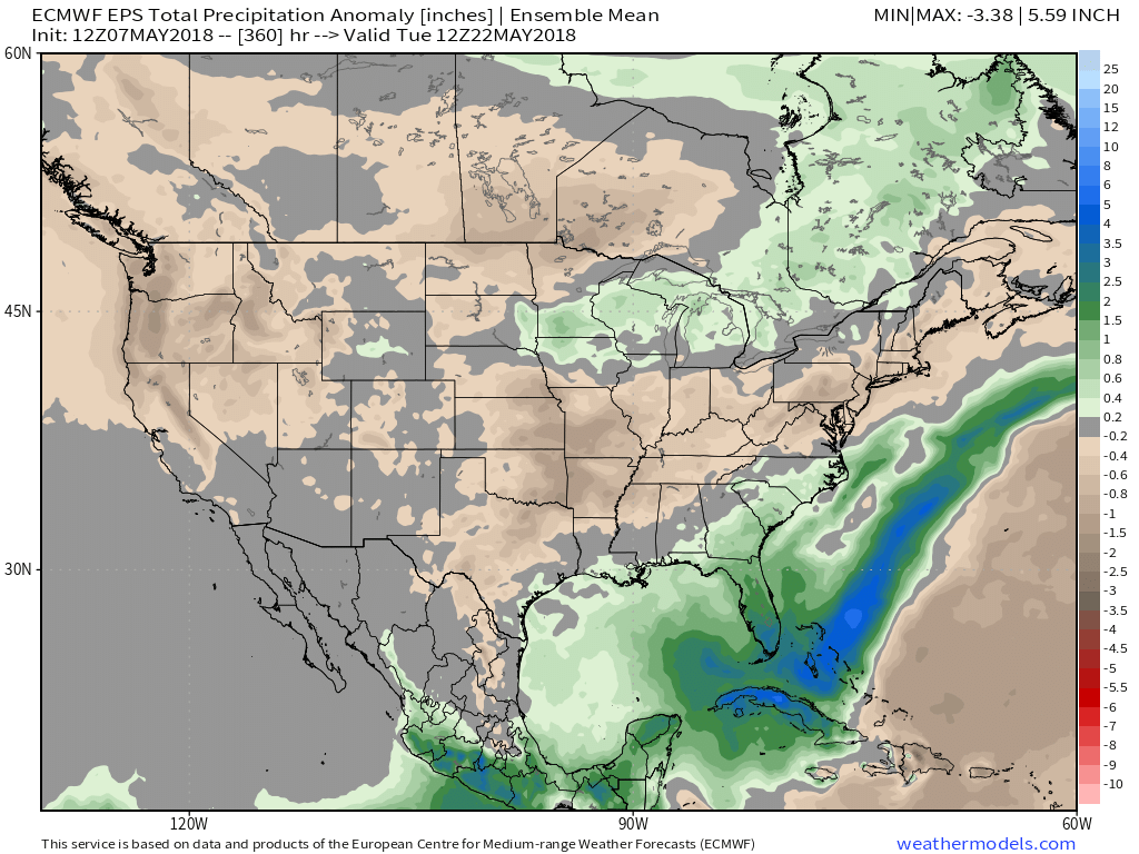
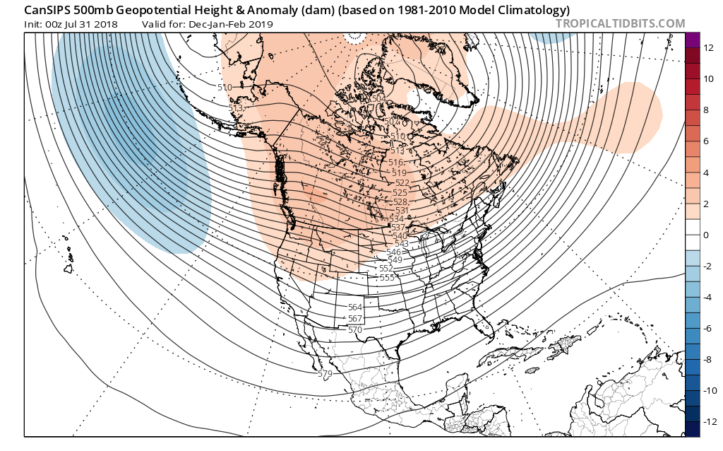
 Given the agreement in the data, along with some additional pattern drivers, we continue to believe the medium to longer term period (including mid and late May) will feature an overall warmer than average pattern along with drier than normal conditions.