You must be logged in to view this content. Click Here to become a member of IndyWX.com for full access. Already a member of IndyWx.com All-Access? Log-in here.
Category: AG Report
Permanent link to this article: https://indywx.com/eyeing-the-first-freeze-of-the-season-late-next-week/
Oct 03
Storms Return Thursday; Summer-Like Weekend…
You must be logged in to view this content. Click Here to become a member of IndyWX.com for full access. Already a member of IndyWx.com All-Access? Log-in here.
Permanent link to this article: https://indywx.com/storms-return-thursday-summer-like-weekend/
Oct 03
Wednesday Morning Rambles…
I.) An unseasonably warm pattern will remain as we move into the middle of the week. A more summer-like feel can be expected as opposed to the increasingly chilly early October air we should be dealing with. Highs will reach the middle 80s this afternoon along with a gusty SW breeze.
 II.) After a windy and warm Wednesday, scattered showers and thunderstorms will return Thursday. Not everyone will get wet, but a few locally heavy downpours can be expected.
 III.) The ridge will “flex its muscle” into early and middle parts of next week and promote an extended (and unusual) stretch of 80s. Don’t put those shorts away just yet…
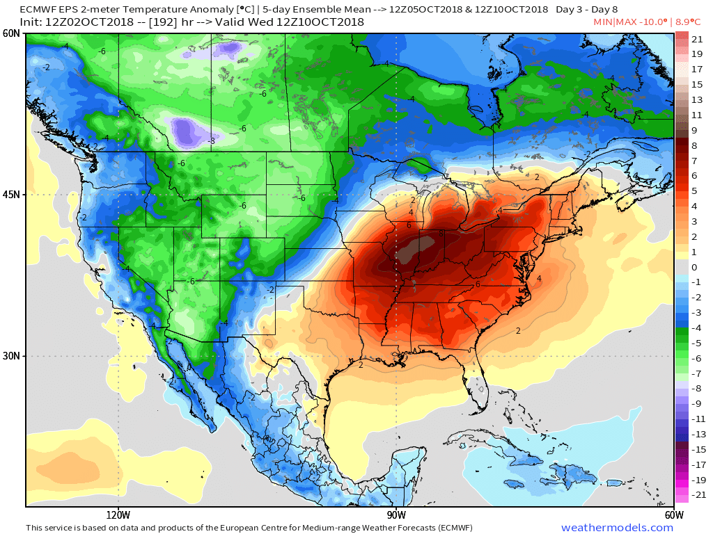 IV.) A “game changer” of a cold front will approach late next week with better chances of organized rain and storms followed by a return of more seasonal times…
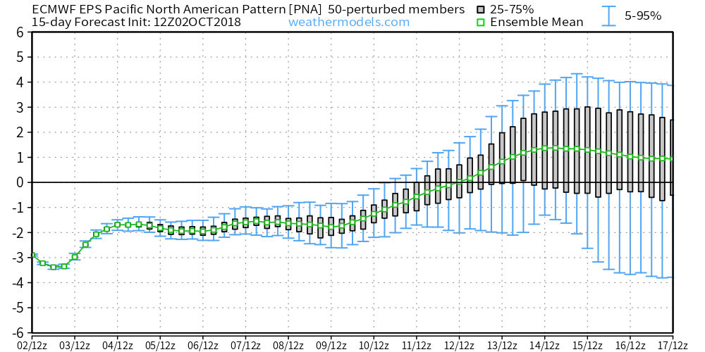
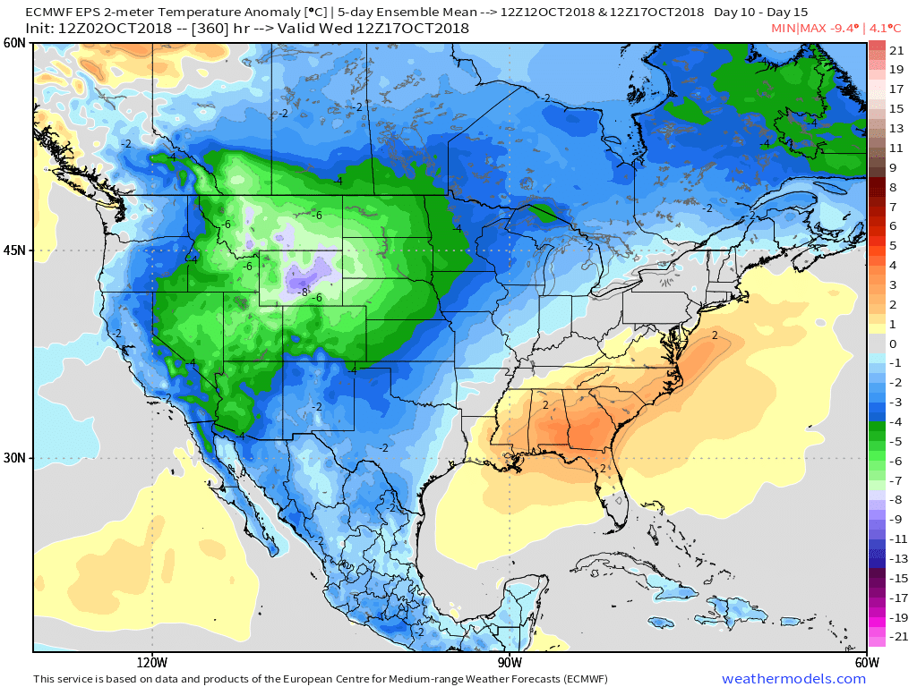
 V.) Ingredients are in place for a significant shift in the pattern around the middle of October and colder times continue to look like they will return as we flip the page into Weeks 2-3.
Permanent link to this article: https://indywx.com/wednesday-morning-rambles-9/
Sep 19
Ready For Fall, Y’all?
Meteorological fall (began September 1st) is running warmer than average across the eastern half of the country. More specifically, Indianapolis is running 4.8° above average through the period.
 The culprit? A persistent strong eastern ridge (the same ridge that trapped Florence across the Carolinas after she made landfall).
That said, things are changing in significant fashion and these changes will result in much colder conditions as we wrap up the month and open October.
We note the PNA (Pacific North America pattern) trending strongly positive during the period.
 A positive PNA typically leads to an eastern trough- especially during the fall months into the spring. Something like this kind of upper level pattern usually results.
 Sure enough, the models are going to this look.
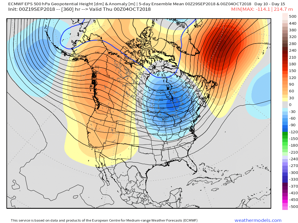 At the surface, the eastern warmth is reversed in a significant fashion with well below average temperatures. In fact, temperatures will grow cold enough to support high ground snow in the Rockies and northern Great Lakes and the threat of an early frost into the upper Mid West and perhaps portions of the Ohio Valley during the period.
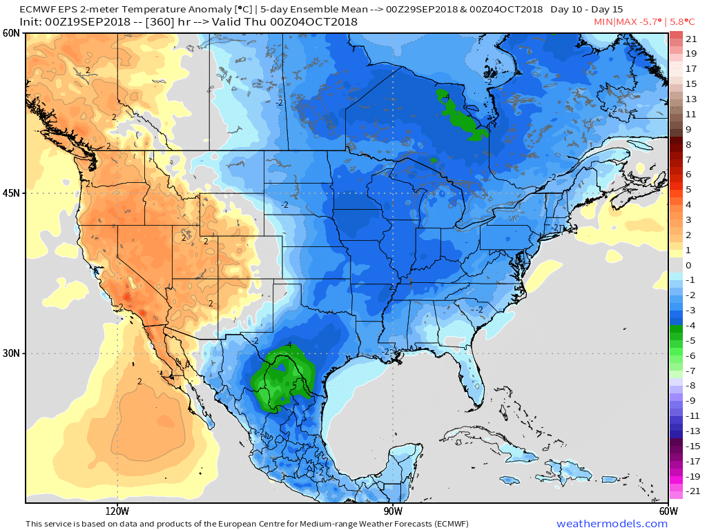 Ah, true pumpkin spice season is right around the corner. 😉
Permanent link to this article: https://indywx.com/ready-for-fall-yall/
Sep 06
Long Stretch Of Wet Weather Ahead…
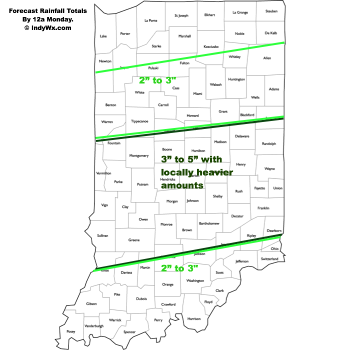 I. Slow-moving showers and thunderstorms will begin to dissipate this evening and tonight with the loss of daytime heating. Some area rain gauges have already picked up between 0.50″ and 1″ of rain this afternoon and this will only serve to lay the ground work for further problems moving forward.
II. A growing shield of rain will engulf northern and central parts of the state Friday afternoon. Initially, this will mostly be of the light to, at times, moderate variety. Additionally, we’ll notice an increasingly stiff easterly flow as the afternoon and evening wear on. Temperatures will fall from a high in the middle 70s into the 60s late Friday afternoon and evening.
III. A frontal boundary will remain draped across central parts of the state Saturday while the remnant circulation of what once was Tropical Storm Gordon pushes closer. As such, rainfall intensity will increase as we move through the day Saturday- particularly by evening into the overnight, on into Sunday morning. Periods of heavy rain can be expected during this time frame. Rainfall rates will begin to diminish Sunday PM before moisture exits stage right Sunday evening.
By the time all is said and done, widespread 3″ to 5″ rainfall totals can be expected through the heart of the state, including Indianapolis, but there will be locally heavier totals upwards of 6″ to 7″ in spots. Flooding, unfortunately, will result. If you live near water ways please ensure to keep close tabs on water levels and expect rapid rises Saturday into Sunday. Have a plan in place to escape to higher ground.
IV. After a week of excessive heat and humidity, the coming cooler regime will be welcome by most. Temperatures most of Saturday and Sunday will remain in the 60s. At times, “wind chills” (haven’t used that term in a while) will fall into the 50s.
Warmer times will return late next week as ridging re-establishes itself.
Permanent link to this article: https://indywx.com/long-stretch-of-wet-weather-ahead/
