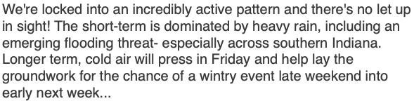
We Have The Storms; Time To Add The Cold…

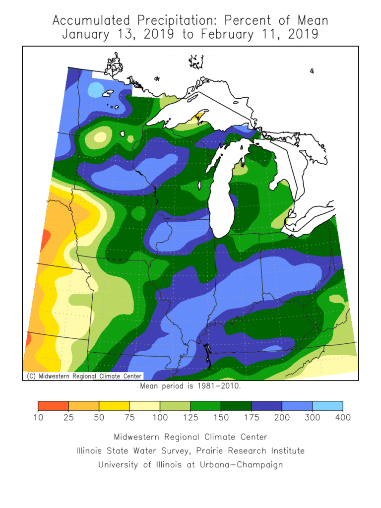
Over the past month, a widespread portion of the Ohio Valley, including central Indiana, is running close to 200% of average in the precipitation department. There’s no wonder flooding issues have resulted in spots- especially across the lower OHV region.

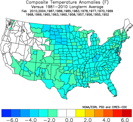
As we look ahead, the active storm track will persist, but there will be one key missing ingredient from the better part of the past couple of weeks and that’s more in the way of sustained cold. After reviewing some of the latest data, there’s no reason to change our ongoing idea of the transitional period (in the midst of that now) giving way towards one that will feature more in the way of “lock and load” cold in that 2.18 through 3.10 time period. We expect this period will run well below average in the temperature department and above average in the snowfall category. Snow removal clients, we recommend gearing up for a busy time of things over the upcoming few weeks.

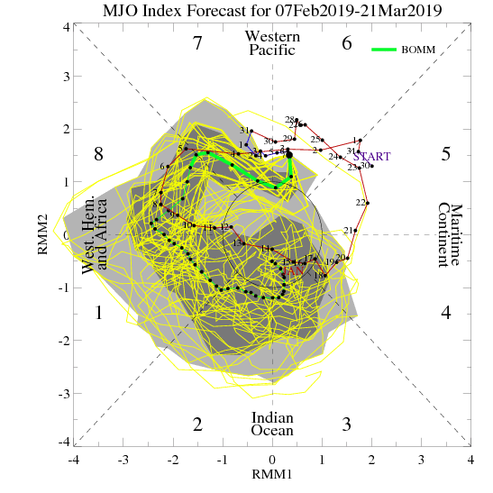
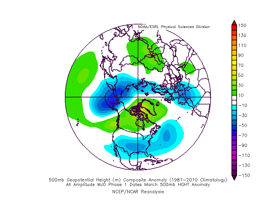
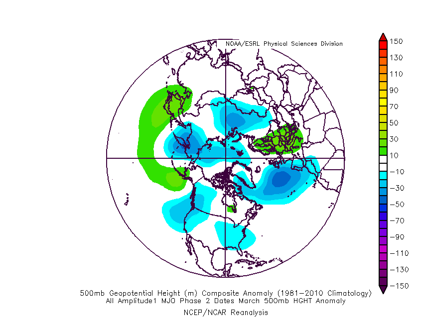
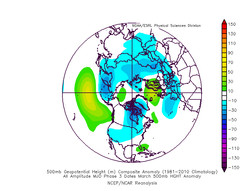
The basis of this idea initially focused squarely on the MJO and the fact that modeling was keying in on things swinging into the favorable cold phases of 8, 1, and 2.

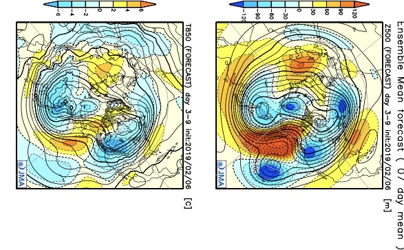
Taken at face value, this would be the corresponding upper air look in those respective phases:

Phase 8 (coldest)

Phase 1

Phase 2

Phase 3 (cold begins to “back into the west and there’s at least a hint of the SE ridge returning)

As most longtime followers know, we put more stock into the NAO state during the latter winter and spring months, as this teleconnection can “trump” others during this time frame. We notice the NAO is forecast to trend negative as we progress through the back half of February.

A negative NAO will result in widespread cold this time of year:

After remaining strongly positive for the past couple of weeks, the AO is forecast to plunge negative as we progress through the remainder of February. Again, this increases confidence on a return of more sustained and significant cold potential.

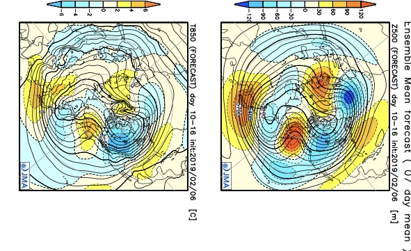
It should also be pointed out that the active pattern should continue, especially considering the southeast ridge should put up some resistance over the upcoming couple of weeks. The latest ensemble products would agree in the mean upper air pattern:

With colder air overwhelming the pattern, more of these storms will be capable of producing impactful wintry precipitation over the upcoming few weeks. After storms grab the headline, attention will shift to the possibility of another significant arctic blast before the end of the month.

In the more immediate term, we continue to keep close tabs on the following dates for the potential of snow and/ or ice:

I. Friday night, 2/15 and Saturday, 2/16- southern half of Indiana

II. Sunday, 2/17

III. Tuesday night, 2/19 and Wednesday, 2/20

No Rest For The Weary; Reviewing The New European Weeklies…

In the short-term, rainfall will increase in overall coverage and intensity as we progress through the overnight and on into Tuesday morning.

Most central Indiana rain gauges can expect to accumulate between 0.50″ and 1.00″ tonight into Tuesday morning. Heavier amounts will be found downstate.

We continue to closely monitor the precise track of vigorous upper level energy that will result in a narrow, but more intense, band of snow Tuesday afternoon into the evening hours. While temperatures will be marginal, it wouldn’t shock us in the least by a wet 1″ to 2″ stripe of snow that’s laid down in a narrow southwest to northeast corridor and this will warrant close attention with subsequent model updates overnight. An early idea of where this may be is below:

Regardless of where this potentially more significant snowband lies, all of us will get in on the “backlash” snow showers/ squall action Tuesday evening and night.

Looking ahead, continued active times loom. We’re tracking additional storms Thursday night into Friday and again over the upcoming weekend. Yet another storm is slated for an arrival early parts of the following week. As cold air continues to get more involved, these storm systems will be plenty capable of dealing out more in the way of wintry “fun and games,” but the pattern is “hectic” right now and each storm will have to be dealt with as they come. Understanding that it’s still in the 6-10 day time period, the storm early next week seems to have the greatest potential of widespread wintry implications of significance. This is given the overall pattern evolution away from the “transitional” period we’re currently in and squarely inside the cold/ wintry window we’ve been outlining from 2/18 through 3/10. Time will tell…

European Weeklies

The new European Weeklies show the cold currently confined to the PAC NW and northern Plains “spreading out” and encompassing a more widespread portion of the country- especially from the Appalachians and points west (but periodically making it as far east as the coast). The cold is forecast by the model to dive deep into the southern Plains and into the Southeast as we move into the latter parts of February into early March. Perhaps the biggest change from tonight’s update from Thursday is the idea that the cold will linger deeper into March than previously thought. (Please note this doesn’t change our current *official* idea of cold lifting by mid-month, but simply just rehashing model output). Let’s see if we can get some consistency to develop before altering our current forecast.

From a teleconnection stand point, the model does take the NAO neutral to negative late Feb into early March before returning things solidly positive by mid-month.

Dissecting Today’s Severe Potential; Winter Returns & Looking More In-depth At The New JMA Weeklies…

The Storm Prediction Center (SPC) has significantly expanded the “slight risk” area to include a large portions of the state.


While a fresh batch of heavy rain will move into central Indiana later this morning (another 1″ to 2″ is a good bet for most communities), the focus shifts to a window where severe thunderstorms will be possible during the early to mid afternoon.

A warm front will lift north through central IN late morning and this will allow relatively warm and moist air to briefly surge as far north as a Logansport to Fort Wayne line.

Note dew points will spike to 60 to 63 degrees over much of central and eastern IN this afternoon.

It’s during the 1p to 5p window when we’re most concerned for the chance of a few severe thunderstorms ahead of the cold front. Damaging winds are of greatest concern, but anytime you have a warm front hanging around central Indiana with these kinds of setups, the potential of a tornado is in the back of your mind. I don’t foresee this being a major tornado outbreak whatsoever, but parameters do suggest the chance of a quick spin-up tornado is present, as well during this timeframe.

The cold front will crash into Indianapolis between 4p and 5p and you’ll certainly know it.

Strong and gusty northwest winds will blow sharply cold air into the region this evening and tonight. In fact, highs in the lower to middle 60s this afternoon will be into the 20s before midnight. Lows Friday morning will fall into the 10s and highs Friday will only top out in the lower 20s with wind chill values in the single digits most of the day.

After a dry open to the weekend, we continue to monitor the potential of a light wintry event Sunday into early Monday. This doesn’t appear to be a big deal, but the chance is there for an inch or two of snow for portions of the central and northern Ohio Valley during this timeframe.

Additional challenges await early and mid next week, but we’ll save those for updates later this afternoon or evening.

JMA Weeklies

The updated JMA Weeklies are in and in short suggest the southeast ridge continues to put up a fight over the next couple of weeks before getting “squashed” in the Weeks 3-4 timeframe.

This is in line with our thinking of the “transitional” period beginning this upcoming week. We think cold will begin to “push,” but isn’t ready to lock-in as of yet. There will be cold readily available to present more of a wintry potential with storms that track through the region when compared to this week, but we think it’s the period from 2/17 through early March that has the capability of featuring more sustained cold.

That’s a strong signal being painted by the JMA Weeklies in the Weeks 3-4 timeframe for widespread cold. Given that the MJO is forecast to swing into Phase 8 by this timeframe, along with the NAO/ AO looking to dip negative, the widespread cold look is a good idea to us during this particular time period.