
You must be logged in to view this content. Click Here to become a member of IndyWX.com for full access. Already a member of IndyWx.com All-Access? Log-in here.
Category: AG Report
Permanent link to this article: https://indywx.com/video-pick-of-the-week-heat-builds-this-weekend/
Sep 22
Weekly AG And Severe Weather Update…
Forecast Period: 09.22.19 through 09.29.19
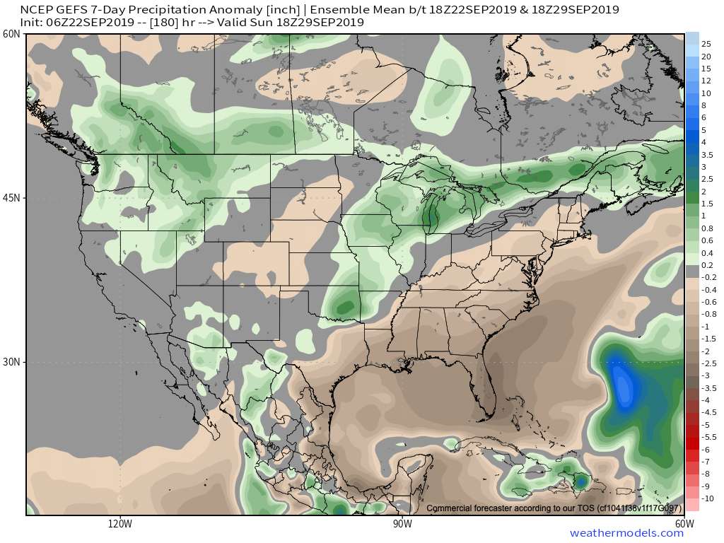
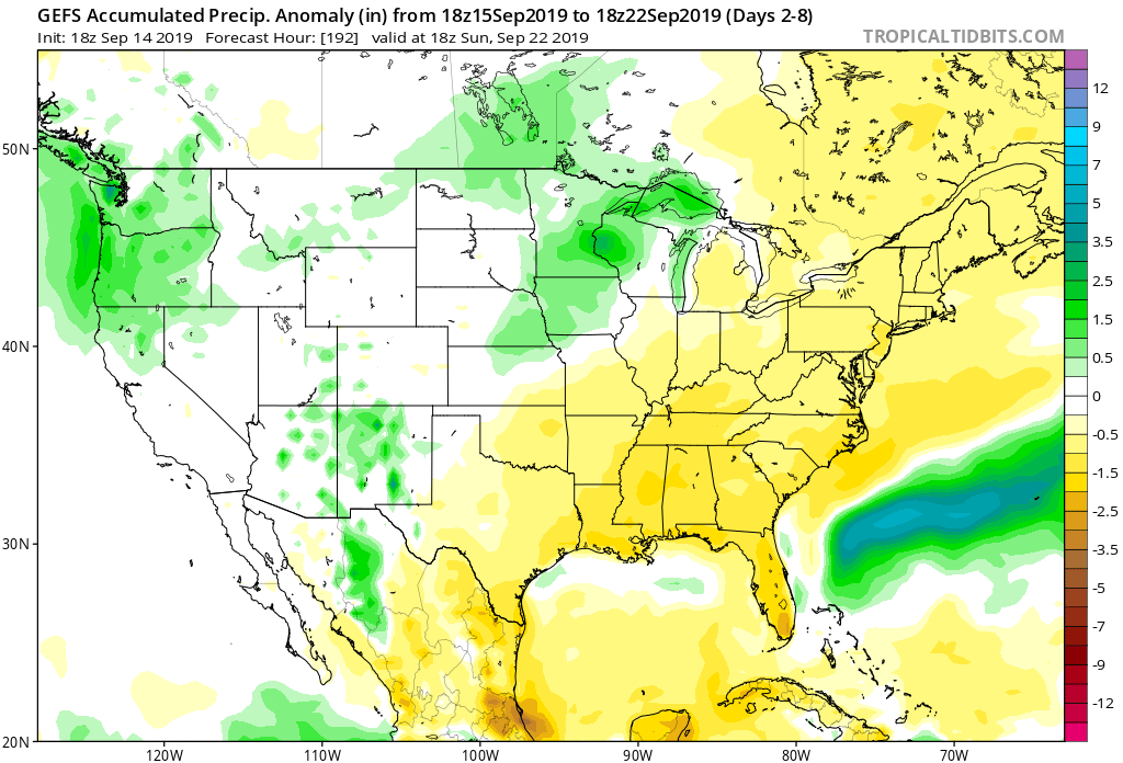
7-Day Precipitation: Below average precipitation is expected through the period.
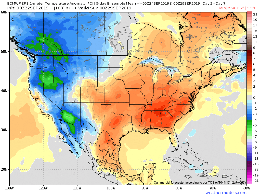
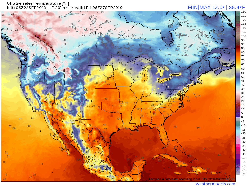
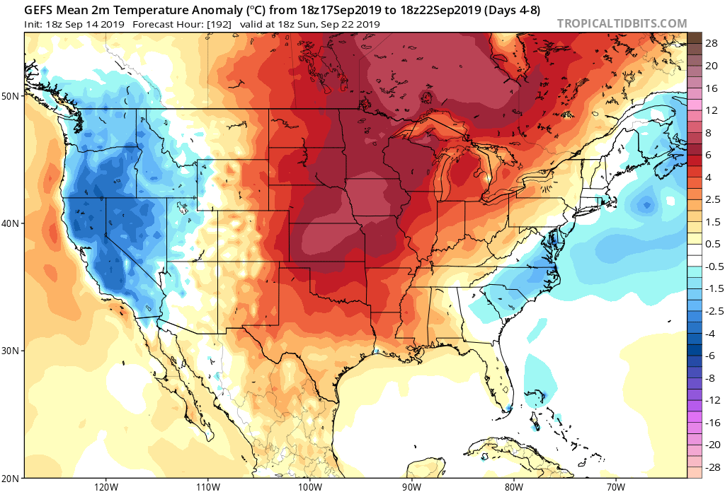
7-Day Temperatures: Well above average temperatures are expected through the period.
Severe Weather: Organized severe weather isn’t expected through the forecast period.
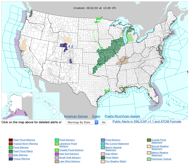
Frost/ Freeze: The growing season will come to an end this week across the central Rockies (frost and freeze warnings are up) and eventually across the Bitterroot range as lows fall into the mid and upper 20s by late week.
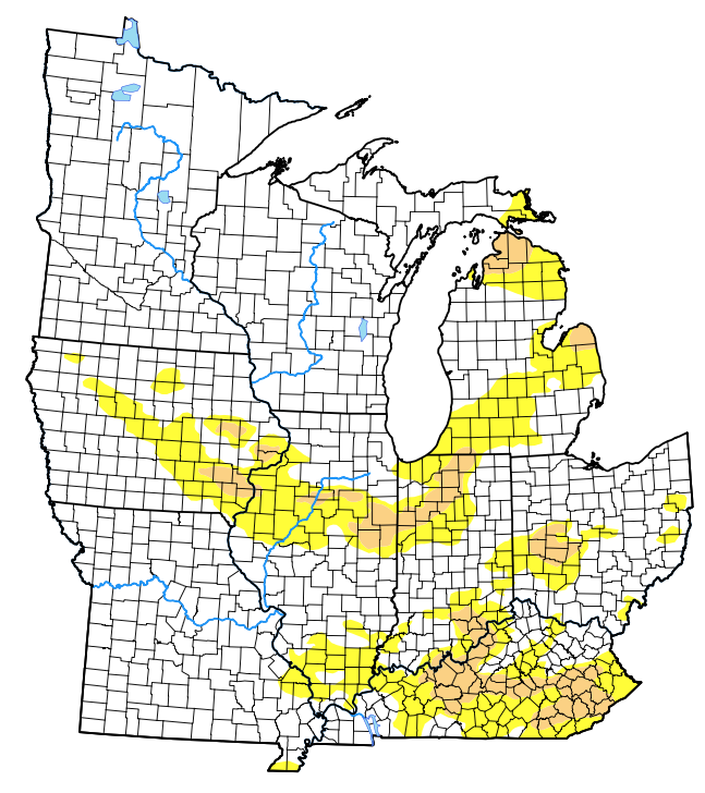
Drought Monitor: The latest drought monitor shows widespread dryness across the central and southern portions of the Ohio Valley, extending north and northwest into IA and MI. A good chunk of these dry/ droughty areas from MO, IA, and IL will be wiped out by Thursday’s update as beneficial soaking rains fall on this area today from the remnants of Imelda and a passing cold front.
Summary: A cold front and remnant moisture from Imelda will lead to better rain chances across central Indiana this evening into early Monday morning. With that said, the widespread soaking rains our friends just west of our area are receiving this morning will diminish as they move into central Indiana tonight. While there will be a couple of exceptions (with heavier rainfall totals), most central Indiana rain gauges will likely pick up between 0.25″ and 0.50″ tonight. Thereafter, temperatures will trend cooler (more seasonable) for the early and middle part of the work week before an expansive ridge engulfs the eastern portion of the country late week into Week 2. This will promote not only well above average warmth, but in some cases rival records.
Permanent link to this article: https://indywx.com/weekly-ag-and-severe-weather-update-7/
Sep 14
Weekly AG And Severe Weather Update…
Forecast Period: 09.15.19 through 09.21.19
7-Day Precipitation: Precipitation is expected to run below normal through the forecast period.
7-Day Temperatures: The upcoming forecast period above will feature well above average temperatures.
Severe Outlook: Widespread and organized severe weather isn’t expected through the forecast period.
Summary: A couple of storm complexes will “flirt” with central Indiana as we open up the new week, but these should be in a weakening state (if not flat-out diminish entirely) as they grow closer to our immediate region. Other than that, dry and warm/ hot weather is expected until late week. Things look increasingly unsettled with better coverage of showers and thunderstorms during this time. We’re still only looking at scattered coverage with any one particular rain gauge expected to accumulate less than half an inch by late next weekend.
*Next week’s AG/ Severe Weather Update will incorporate frost/ freeze outlooks, as well as drought discussion(s) across the Lower 48.
Permanent link to this article: https://indywx.com/weekly-ag-and-severe-weather-update-6/
Sep 09
A Teleconnection Tale…
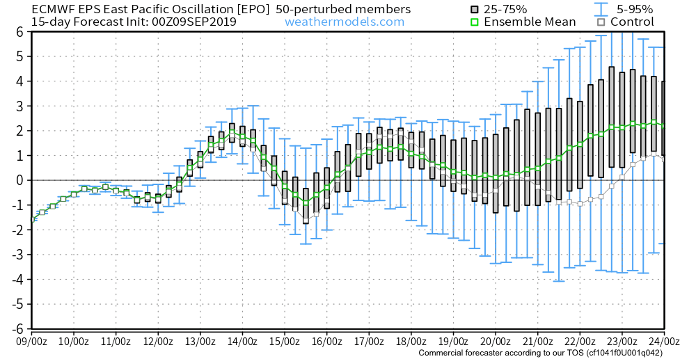
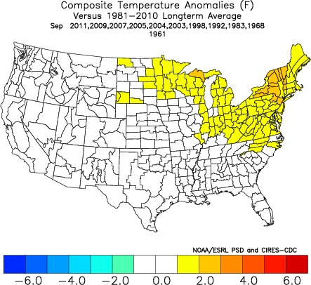
Before we display the mean upper level pattern ahead over the next couple weeks, let’s look at some of the various teleconnections to gain some insight behind what’s driving the overall pattern.
EPO- primarily positive to strongly positive (warm signal).
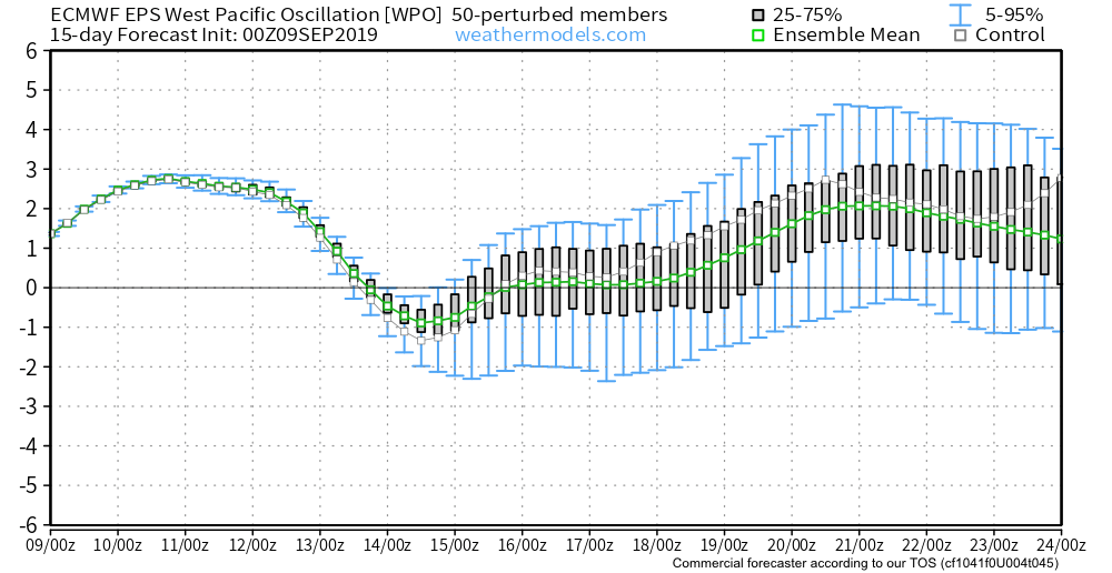
WPO- primarily positive to strongly positive (warm signal).

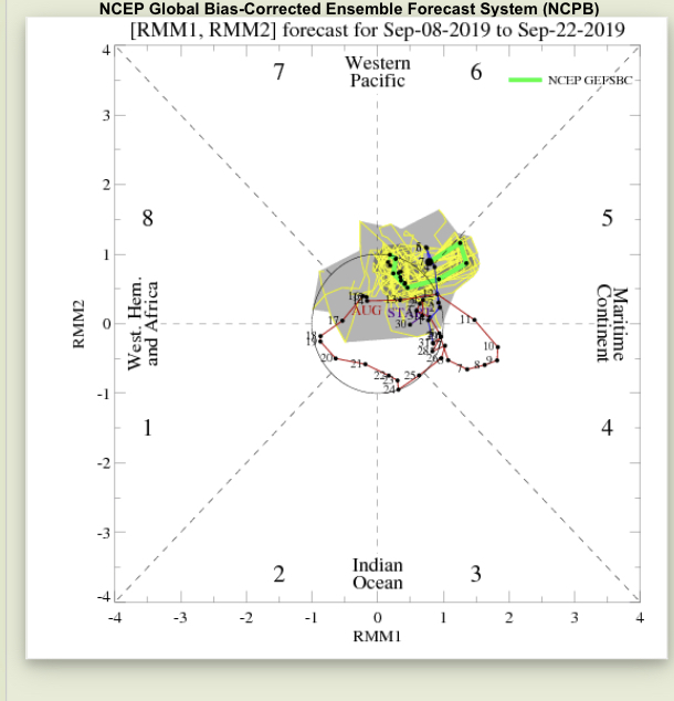
MJO- heading into Phase 6 with a look like it wants to rumble into Phase 7. This is a warm signal this time of year.

With the warm signals above, it should come as no surprise of the next couple weeks offering up a predominant eastern ridge.
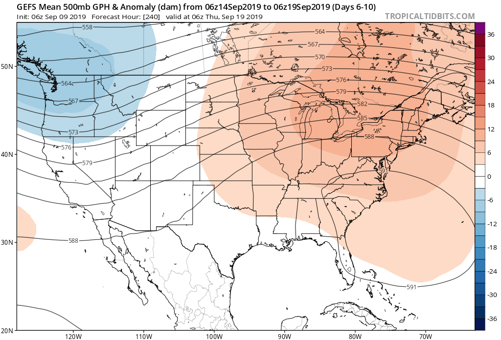
Days 6-10
Days 10-14
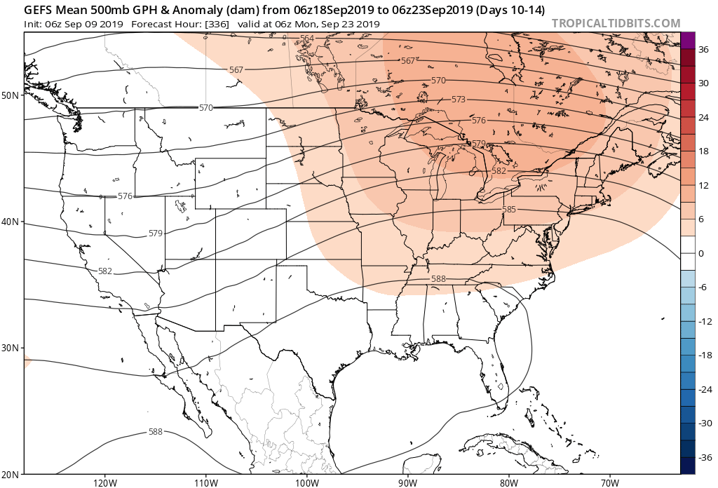
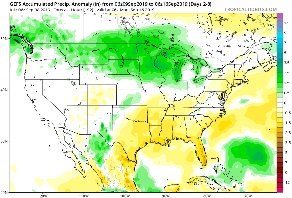
While a couple of weak cold fronts may lead to somewhat cooler air briefly, the balance of the next couple of weeks looks to offer up much more in the way of summer-like heat and well above normal warmth. It should also be noted that the overall pattern looks like a dry one over the next 10-14 days, as well.
Don’t put away that swim suit just yet!
Permanent link to this article: https://indywx.com/a-teleconnection-tale/
Sep 08
Weekly AG And Severe Weather Outlook…
Forecast period: 09.08.19 through 09.15.19
7-Day Precipitation: Precipitation is expected to run below normal through the forecast period.
7-Day Temperature Outlook: Temperatures will run well above average through the forecast period above.

Severe Weather Outlook: Organized severe weather isn’t expected during the period.
Summary: After an unseasonably cool open to meteorological fall, summer-like heat will fight back over the upcoming week. Several days of highs in the upper 80s to lower 90s are expected with unseasonably warm overnight lows around 70° by the middle part of the week and beyond. From a precipitation perspective, best chances of more organized shower and thunderstorm activity will arrive by the 2nd half of the work week, but coverage will remain scattered. As a whole, we’re expecting the upcoming forecast period to only result in 0.25” to 0.75” of precipitation.
Permanent link to this article: https://indywx.com/weekly-ag-and-severe-weather-outlook/