You must be logged in to view this content. Click Here to become a member of IndyWX.com for full access. Already a member of IndyWx.com All-Access? Log-in here.
Category: AG Report
Permanent link to this article: https://indywx.com/video-chilly-pattern-settles-in-easter-storm-and-looking-ahead-to-potential-wet-end-to-april/
Apr 04
Weekly #AGwx And #Severe Outlook…
The first Saturday in April can only mean one thing and that’s the return of our weekly #AGwx and Severe Weather Outlook. Similar to last year, this will be posted each Saturday morning through the month of September.
Weekly Highlights:
I. A strong area of low pressure will move in off the Pacific and provide heavy rain across CA, including intense mountain snow Sunday through Wednesday.
II. A strong cold front will move through the Midwest and Ohio Valley Wednesday into Thursday. This will result in a drastic change from late spring like temperatures to more winter-like by late next week.
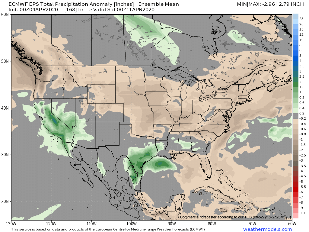

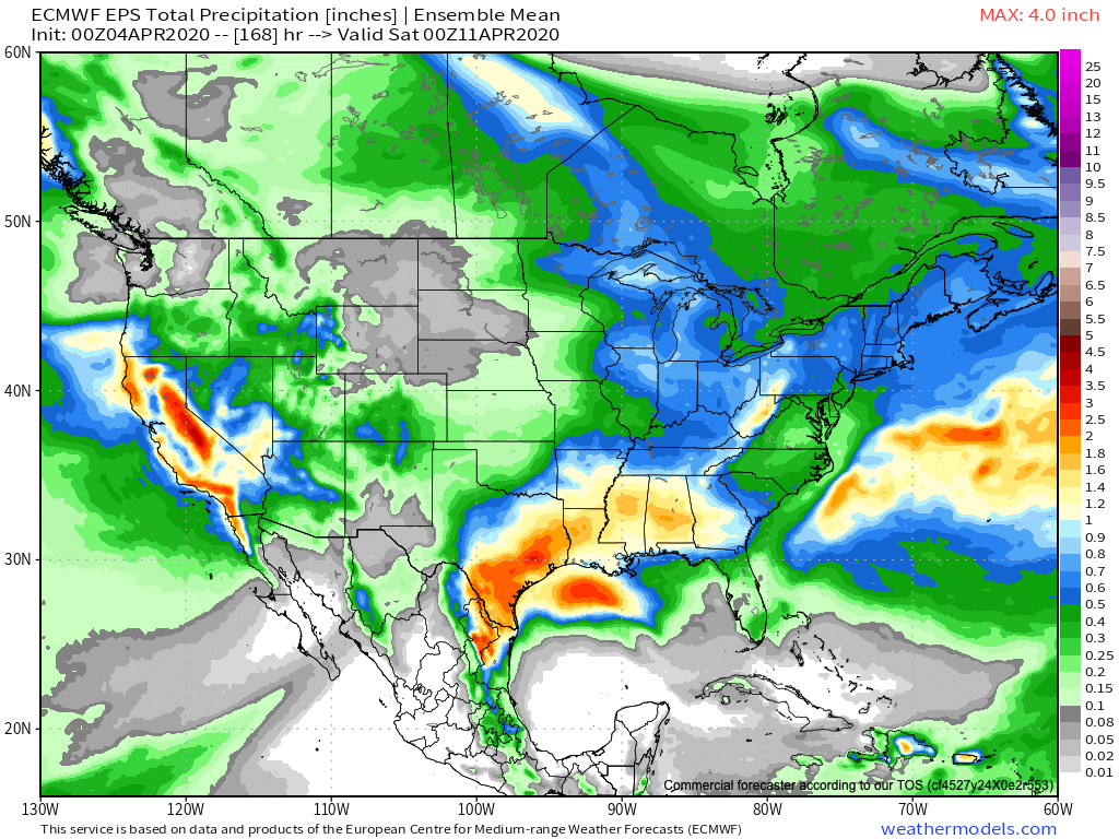
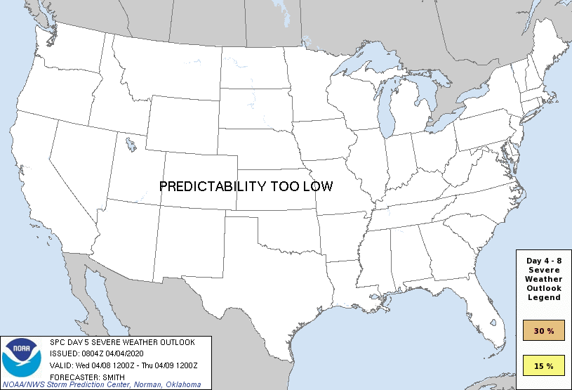
More specific to central Indiana, we’ll have 3 weather makers to track over the upcoming week:
This afternoon- A cold front will pass through the state without much fanfare. A few showers are possible here and there, but some won’t see a drop of rain and those that do can expect only light amounts.
Tuesday through Thursday- Scattered showers and thunderstorms will impact the area during this time frame as a couple of fast moving disturbances track across the Ohio Valley. A strong cold front will cross the region Thursday with a band of rain followed by windy and much colder air to close the week and head into next weekend.
Week 2 (April 11th-18th) trends are for much colder air along with the prospects of light mixed rain/ snow showers at times. There’s the threat of a stronger system late in the Week 2 time frame that we’ll continue to monitor.
Permanent link to this article: https://indywx.com/weekly-agwx-and-severe-outlook/
Mar 21
March To-Date And Looking Ahead…
March to-date is running warmer and wetter than average across not only central Indiana, but a good chunk of the central and eastern part of the country.
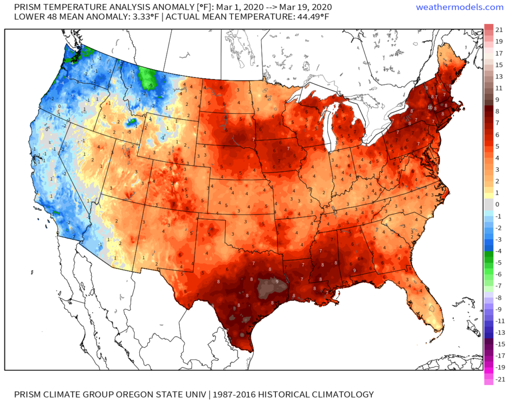
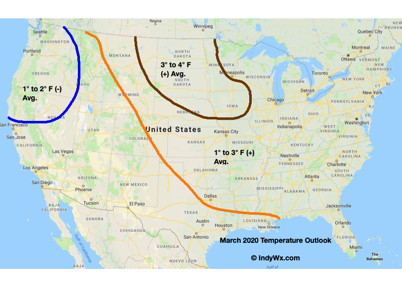
For comparative purposes, our March Temperature Outlook is above. It’ll be interesting to see how everything shakes out by month’s end.
We anticipated a wet month, as well, into the middle MS Valley into the Ohio Valley, and eastern Lakes/ Northeast.

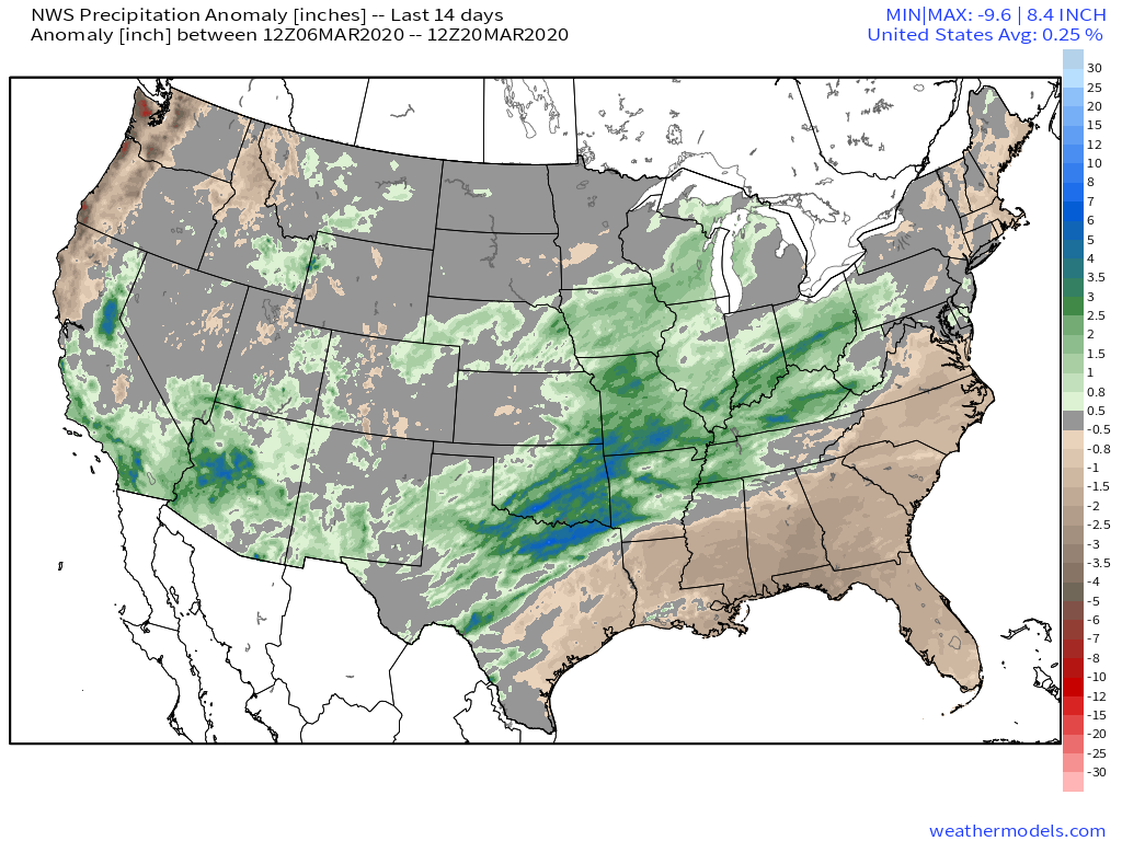
Indianapolis is running a little more than 1″ above normal in the rainfall department, and this will grow larger as we progress through the next (10) days.
This upcoming week, alone, we expect storm systems to deliver rain Sunday PM, Tuesday PM, and again late Thursday into Friday. Widespread central Indiana rainfall totals are currently pegged between 1″ and 1.5″, but given the pattern, it wouldn’t surprise me to see those numbers increase as we go forward. Thankfully, there aren’t any storms on the immediate horizon that look to be big severe weather producers, locally.
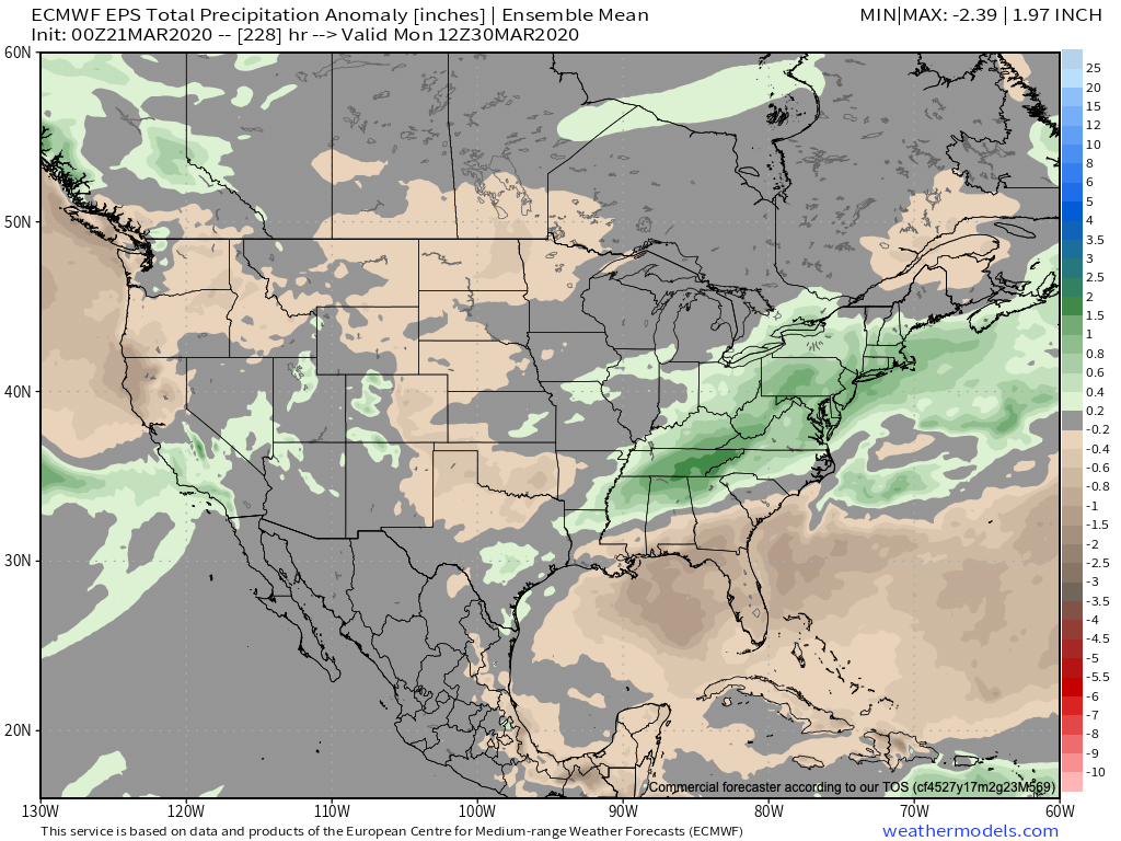
Despite this weekend’s chill, the balance of what’s left in the month should run well above average across the eastern half of the country.

More on what we think April will provide a bit later…
Permanent link to this article: https://indywx.com/march-to-date-and-looking-ahead/
Mar 10
Very Active Pattern Looms For Mid And Late March…
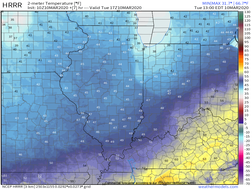
Before we get into the longer range weather pattern, rain this morning has been locally heavy in spots. Moving forward today, that rain will push east of the state and we’ll turn cooler. Temperatures will settle into the middle to upper 40s this afternoon across central Indiana.
Another couple of weak systems will scoot through the area as we push through the remainder of the work week. The first, tomorrow, will impact areas primarily to our north, however, a cold front will sweep through the state Thursday night and early Friday with light rain and an abrupt wind shift to the northwest. Rainfall amounts with the passage of this cold front should average only between a trace and 0.05″.
A third system will push east across the TN Valley Saturday into early Sunday. With marginally cold air in place across the Ohio Valley, precipitation may transition to wet snow or a mix of rain and snow along the I-70 corridor during this time frame. The northward extent of the precipitation shield is in question and we’ll have to keep a close eye on this system over the next couple of days.
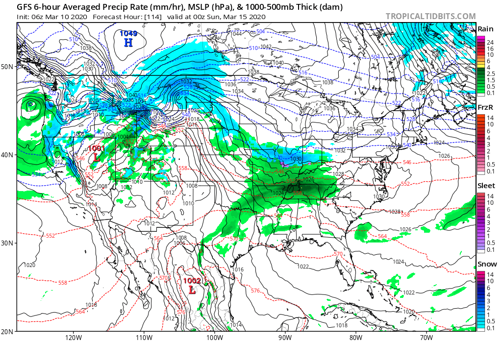
As we look longer term, a tight thermal gradient is expected to setup shop across our region. This will force a cold pattern across the west with eastern seaboard warmth. We’ll be in that “back and forth” battle zone of sorts, locally.
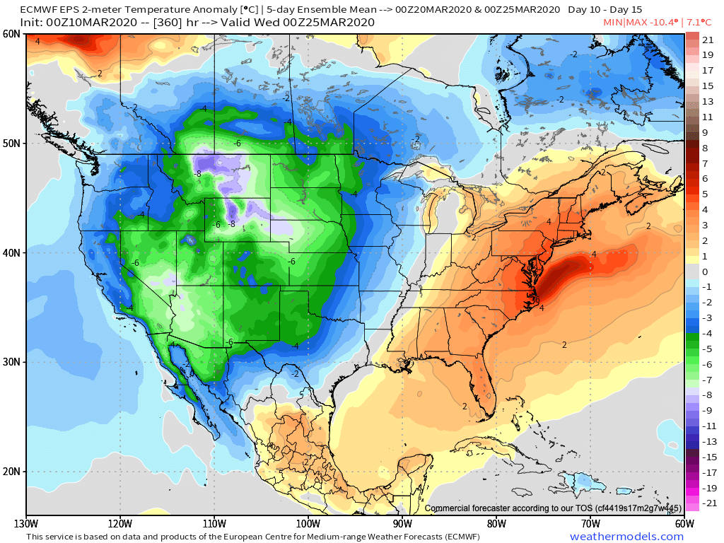
What this will also do is help assist in a hyper storm track through the MS River Valley and Ohio Valley. Above to well above average precipitation is expected during the middle and latter part of March across our region.

Unfortunately, local landscaping companies, turf management, farmers, and others with ag interests are likely to experience delays as we move through the 2nd half of March and into early April.
Permanent link to this article: https://indywx.com/very-active-pattern-looms-for-mid-and-late-march/
Nov 14
VIDEO: Long Range Thoughts To Wrap Up November And Looking Ahead To December…
You must be logged in to view this content. Click Here to become a member of IndyWX.com for full access. Already a member of IndyWx.com All-Access? Log-in here.
Permanent link to this article: https://indywx.com/video-long-range-thoughts-to-wrap-up-november-and-looking-ahead-to-december/
