I. Significant heat wave builds from the Plains into the Ohio Valley and Great Lakes.
II. Heavy tropical downpours fall across the Southeast as a surface low meanders around the region early in the period.
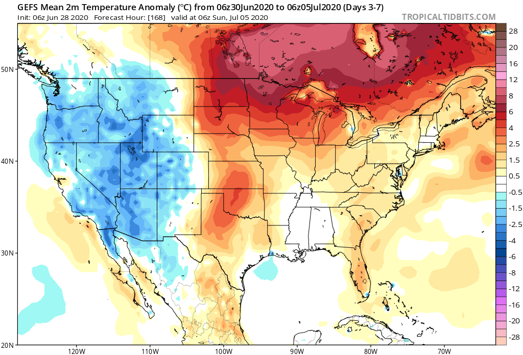
Significant heat will bake the central Plains into the Great Lakes and Ohio Valley this week. Meanwhile, chilly conditions will persist across the Northwest. The Southeast will run slightly cooler than normal.
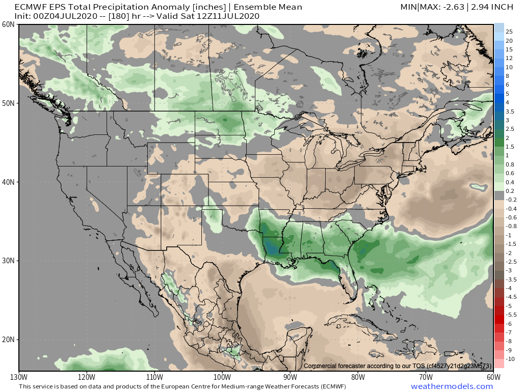
A wet pattern will develop this week across the Southeast region. Wetter than normal conditions will continue across the Northern Plains, as well. Dry conditions can be expected across the OHV and Great Lakes.
Unless you find yourself under an isolated strong storm, most of central Indiana can only expect between 0.10″ and 0.25″ of rain over the 7-day period.
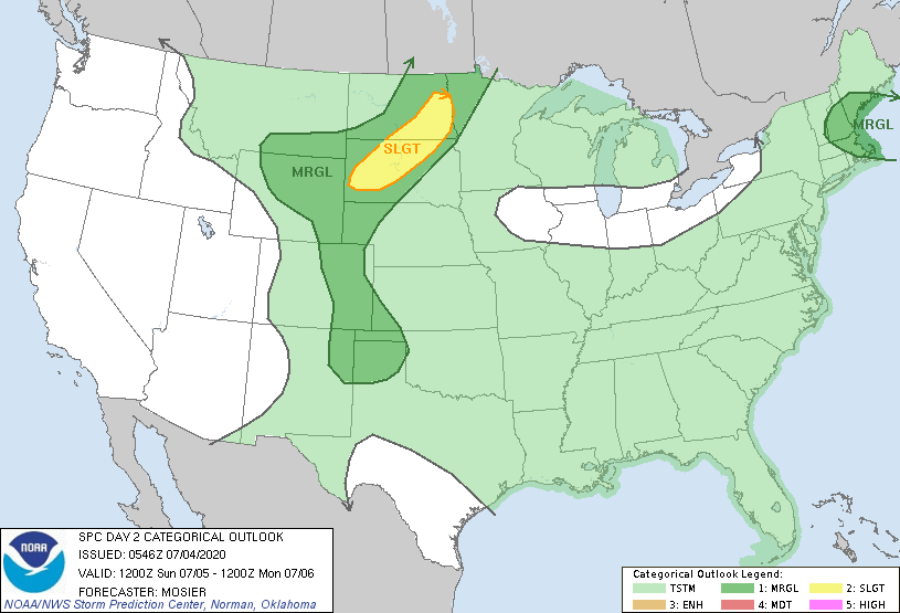
Quiet conditions can be expected, locally, with respect to severe potential. That will be another story entirely across the Northern Plains over the next few days, however.
Forecast Period: 07.04.20 through 07.11.20
A relatively quiet period of weather can be expected across not only central Indiana, but all of the Ohio Valley over the upcoming 7-days as a strong ridge of high pressure dominates our region. This will lead to a significant and prolonged period of hot and increasingly humid conditions, including a consecutive stretch of 90° + highs to the likes of which we haven’t seen since the infamous summer of 2012. If planning time outdoors, build in frequent breaks. Overall dry conditions are also expected this week. The exception to this will be the opportunity of widely scattered storms developing in the prime heating hours (afternoon and evening each day). Count yourself lucky if you get under one of these storms. Unfortunately, some neighborhoods may go the entire week without a drop of rain.
Have a safe and happy Independence Day weekend, friends!
You must be logged in to view this content. Click Here to become a member of IndyWX.com for full access. Already a member of IndyWx.com All-Access? Log-in here.
You must be logged in to view this content. Click Here to become a member of IndyWX.com for full access. Already a member of IndyWx.com All-Access? Log-in here.
II. Persistent hot, muggy regime takes us into the holiday weekend.
Temperatures will run above to well-above normal from the Plains into the Great Lakes and Northeast this week. The Rockies and points west can expect unusually chilly conditions.
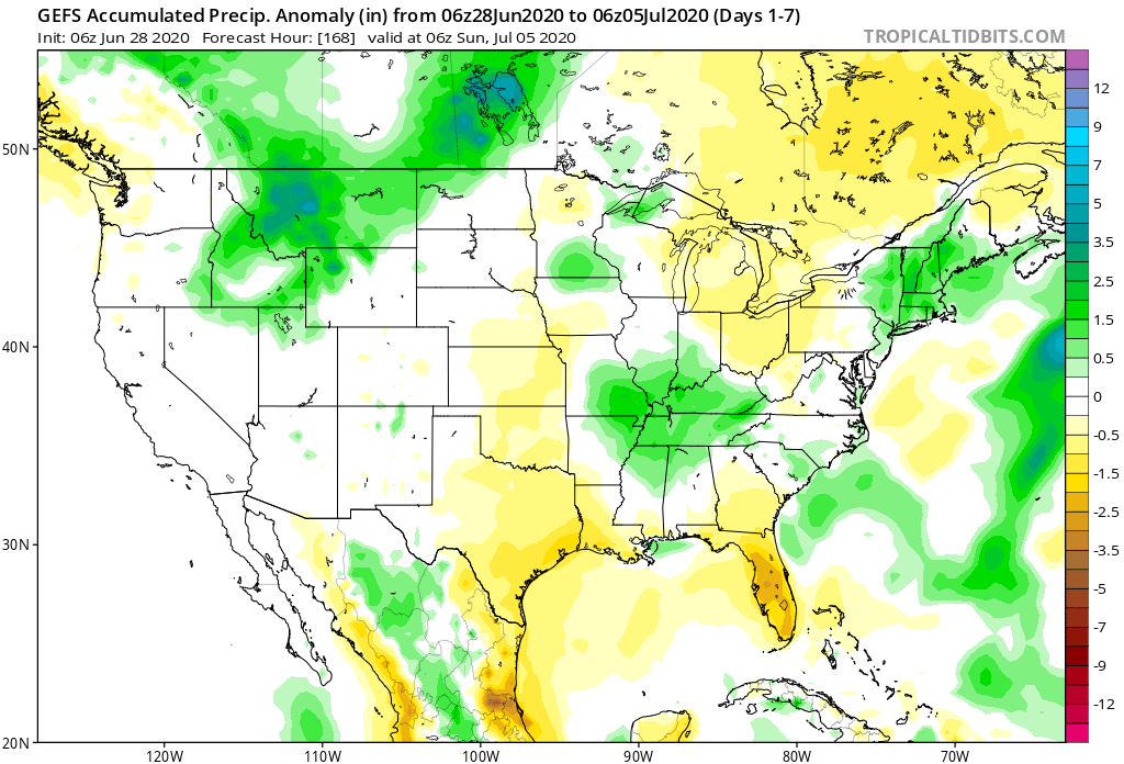
Wetter than normal conditions are expected across the southwestern OH Valley into the TN Valley this week, along with the northern Rockies and New England.
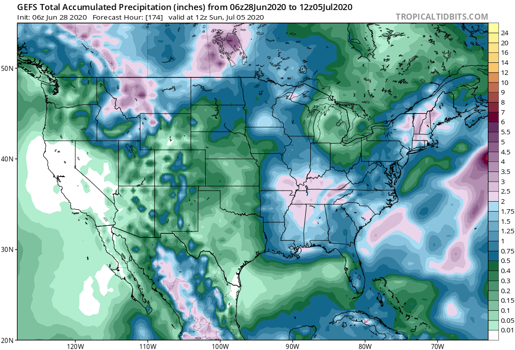
We forecast 7-day rainfall totals for central IN to fall within the 1.75″ to 2.50″ range with locally heavier amounts.
In this pattern it won’t take much to have one or two storms pulse to severe levels, but widespread severe storms aren’t expected, locally. The biggest concern from any stronger storm that does form will be centered around damaging straight line winds.
Forecast Period: 06.28.20 through 07.05.20
A stationary frontal boundary will remain draped across the region until Tuesday night before getting a slight “nudge” off to the southwest Wednesday. The warm and humid pattern in place today will remain locked into the area straight through the holiday weekend (with a small break in humidity midweek). Periods of hefty thunderstorms can be expected- most numerous during the afternoon and evening hours. With such high moisture content in the air, locally heavy rainfall is expected at times. This “rinse and repeat” forecast will begin to change up by the holiday weekend as ridging builds overhead. While this won’t help us with the heat or humidity, this will reduce rain chances. Instead of scattered to numerous coverage, we’ll be talking about isolated coverage for the holiday weekend, itself. Most will stay dry. By this time frame, we’ll monitor the goings on to our south as a cut off low keeps the TN Valley into the Southeast region unsettled with more widespread storm coverage for the holiday weekend.
You must be logged in to view this content. Click Here to become a member of IndyWX.com for full access. Already a member of IndyWx.com All-Access? Log-in here.