II. Keeping eyes to the sky for periods of gusty storms.
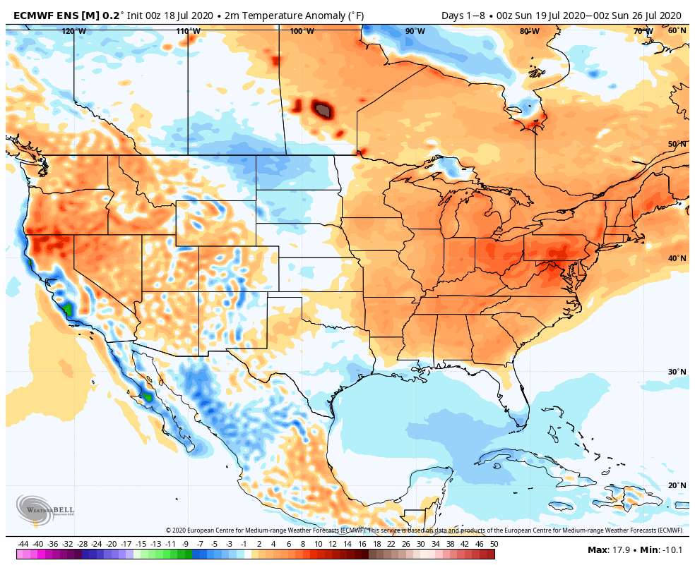
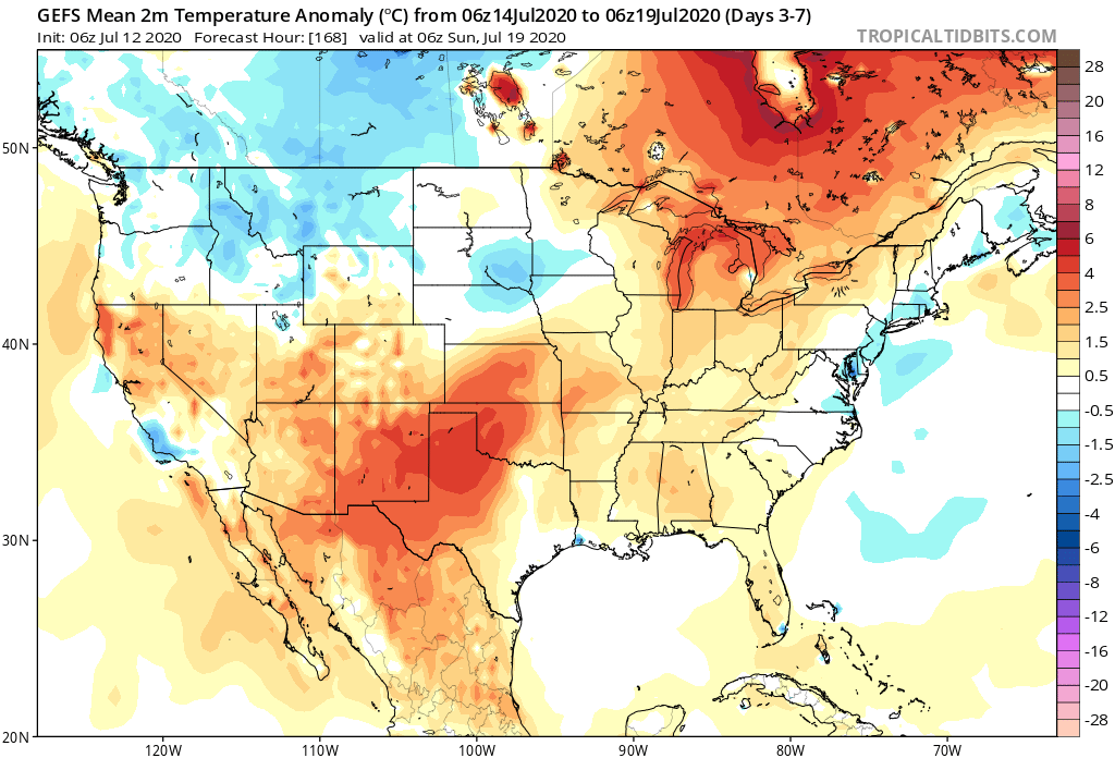
Temperatures will run above average across the eastern half of the country through the period.
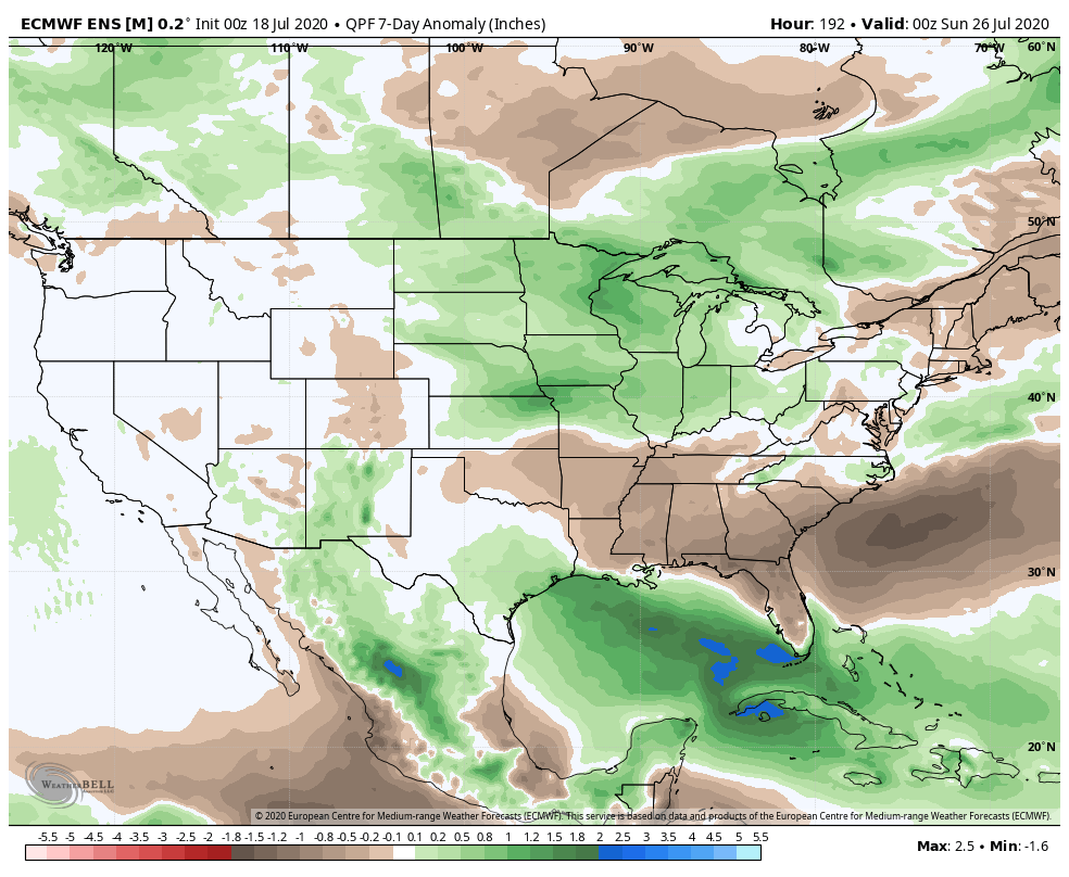
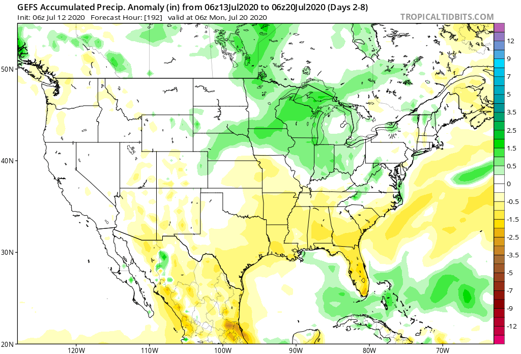
Above average rainfall is expected from the Northern Plains into the western Great Lakes and Ohio Valley through the period. The Southeast will run drier than normal.
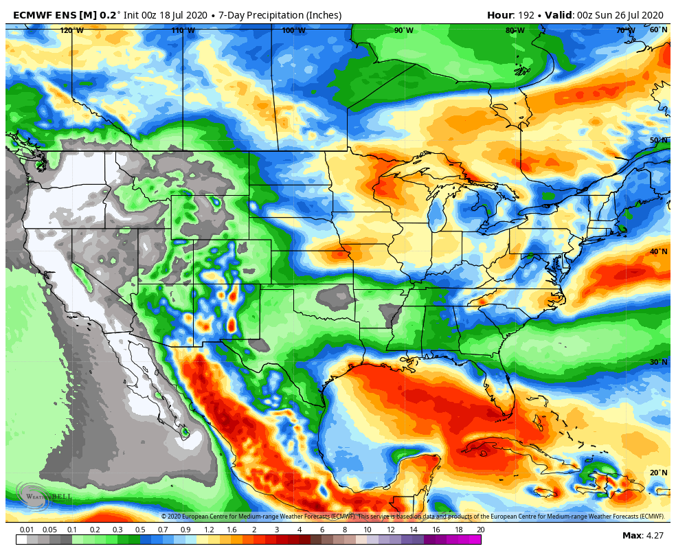
Specific to central Indiana, we expect 7-day rainfall numbers to be very close to 1″ with locally heavier amounts.
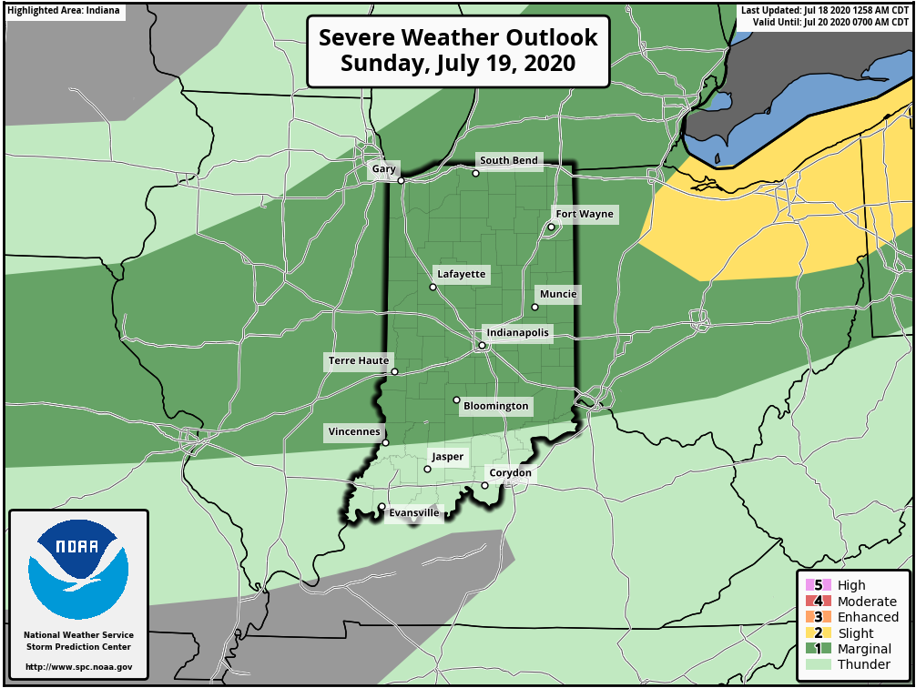
A threat of severe weather is present Sunday (damaging winds are the greatest concern).
Forecast Period: 07.18.20 through 07.25.20
A hot and humid stretch of weather will dominate the upcoming forecast period, including another multi-day stretch with highs in the lower 90s and lows in the lower 70s. The saving grace? Timely rains. After a mostly dry Saturday (only isolated storm coverage expected), more widespread storms are expected Sunday. Some of these could become strong to severe Sunday afternoon, including the threat of damaging winds as a complex moves south through the state. This unsettled theme will continue into the 1st half of the work week with each day offering up scattered showers and storms. Drier air will briefly nudge into the Ohio Valley Thursday and Friday before storm chances return next weekend.
I. Heat and humidity builds as we move through the 2nd half of the week.
II. Pattern once again turns active and unsettled mid and late week.
Seasonable temperatures will rise to slightly above normal levels once to mid week, continuing into the weekend. As a whole, the period will run slightly above normal for central Indiana.
The 7-day period should feature above normal rainfall for central Indiana.
We forecast a total of 1″ to 2″ of rain for central Indiana between now and next Sunday with locally heavier totals.
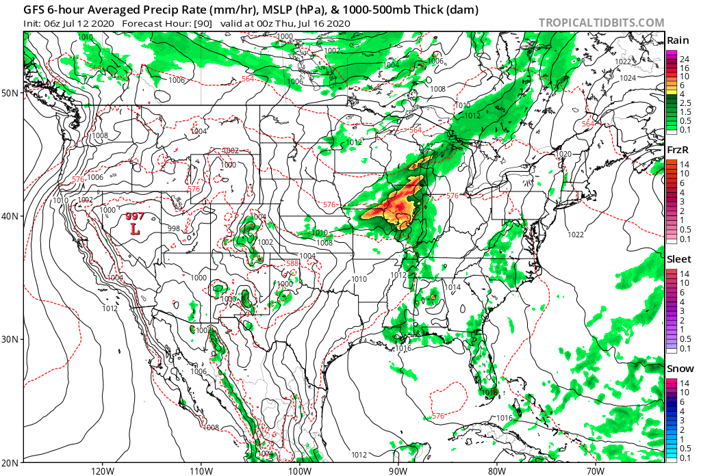
Though the Storm Prediction Center doesn’t currently have a Day 4 severe weather risk highlighted, we need to keep close eyes on this feature for the potential of strong to severe thunderstorms late Wednesday. Large hail and damaging winds are of greatest concern.
Forecast Period: 07.12.20 through 07.19.20
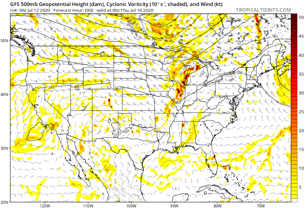
Additional scattered showers and thunderstorms will fire today but shouldn’t be nearly as intense or widespread as what last night delivered. We’ll then welcome a couple of days of cooler, less humid air with dry conditions. Enjoy as the heat, humidity, and storms will return by midweek. In fact, as mentioned above, the potential is present for some stronger storms late Wednesday and it wouldn’t surprise us if the Storm Prediction Center includes portions of the region in a severe weather risk over the next day or two for this threat. This will come on the leading edge of hotter and more humid weather for the 2nd half of the week, continuing into next weekend. As we look longer range (Week 2 time frame), the upper level ridge is expected to retrograde west and open us up to a northwesterly flow aloft. There are strong signals this will lead to a rather busy time of things as we wrap up July, including above to well above average rainfall. Before this takes place, we’re likely looking at another 6-7 day stretch of highs in the lower 90s.
You must be logged in to view this content. Click Here to become a member of IndyWX.com for full access. Already a member of IndyWx.com All-Access? Log-in here.
You must be logged in to view this content. Click Here to become a member of IndyWX.com for full access. Already a member of IndyWx.com All-Access? Log-in here.
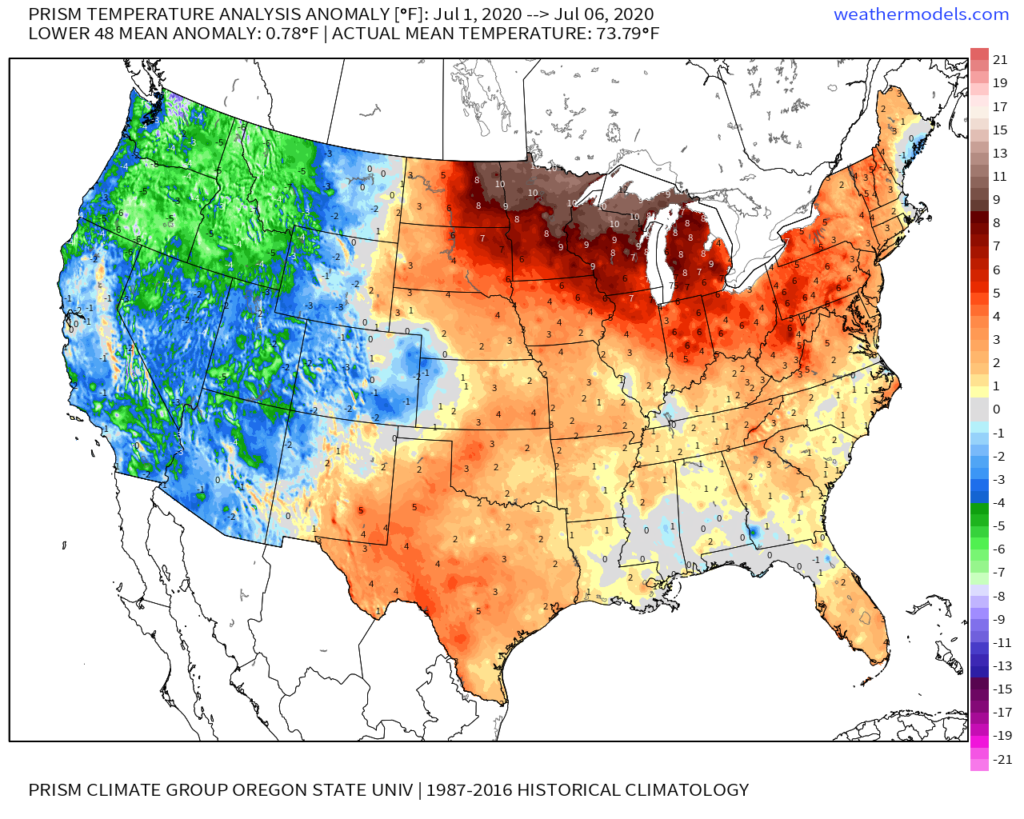
You don’t need us to tell you it’s been a hot month so far. Officially, IND is running 5.8° above average to open the month. At least compared to normal, even greater warm anomalies can be found across the upper Midwest and northern Great Lakes. Meanwhile, the West has been running exceptionally cool.
We’re actually running slightly above normal in the rainfall department (+0.17″) month-to-date at IND. As is typical this time of year, there are your usual “haves and have nots,” but the fact of the matter is that there have been many more neighborhoods that have seen beneficial rains vs. not over the past week.
The remainder of the work week will continue to feature “splash and dash” variety of storms, especially in the afternoon and evening. We believe better overall coverage of rain can be expected by late week and into the weekend. The culprit? The ‘mean’ upper ridge will retrograde southwest and a cold front and associated upper level energy will move southeast across the Ohio Valley. This will also deliver cooler, or “less hot” conditions. We’ll replace highs in the low-mid 90s with highs in the mid-upper 80s and lows in the lower to middle 60s.
A break in the heat is ahead this weekend into early next week.
Recent trends continue to suggest the core of the upper ridge will once again move northeast as we move into Week 2. While it doesn’t appear as if this will have staying power to the likes of what we’re currently seeing, we would anticipate an uptick in the heat/ humidity again in the Week 2 time period (more particular July 14th through 19th). Additionally, organized rain chances will once again transition to the splash and dash variety.
Thereafter, we believe the ridge will settle into the central Plains and it’s here that we expect hottest and driest weather to wrap up the month. The transitional regime continues over the next few weeks with periods of the heat pulling back followed by resurgence…