Updated 06.25.21 @ 7:30a
You must be logged in to view this content. Click Here to become a member of IndyWX.com for full access. Already a member of IndyWx.com All-Access? Log-in here.

Jun 25
Updated 06.25.21 @ 7:30a
You must be logged in to view this content. Click Here to become a member of IndyWX.com for full access. Already a member of IndyWx.com All-Access? Log-in here.
Permanent link to this article: https://indywx.com/video-tropical-airmass-locks-in-timing-out-most-widespread-rain-storm-chances/
Jun 06
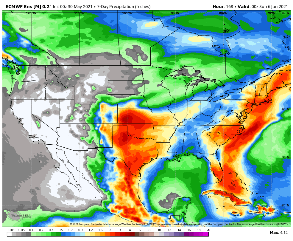
Updated 06.06.21 @ 8:28a

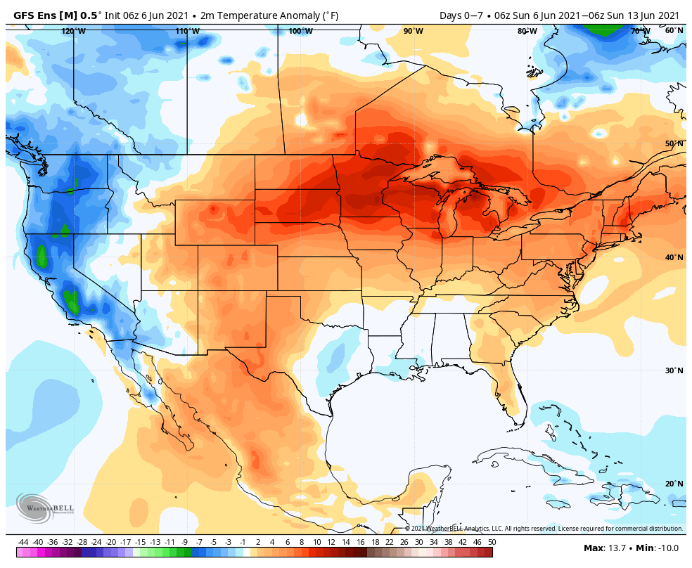
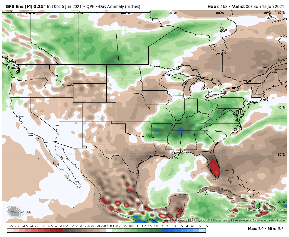

Forecast Period: 06.06.21 through 06.13.21
Our weather pattern will be dominated by a stubborn upper low moving slowly northeast out of the southern Plains. Eventually, this upper low will get entangled in the westerlies and begin to lose influence on our weather towards the tail end of the week. Before that, we’ll notice a rather marked difference in the type of airmass this week compared to what we’ve seen of late. A deep tropical flow, straight out of the Gulf of Mexico, will bring moisture-rich air into the Ohio Valley, including dew points that will approach the oppressive level (65° to 70°). While daytime highs will be kept cooler with the clouds and rain around, overnight lows will be elevated with such a humid airmass in place. A daily dose of showers and thunderstorms can be expected in this pattern- most numerous during the afternoon and evening hours. Given the humidity, locally heavy rain is a good bet at times. While coverage of showers and storms should slowly begin to diminish towards Friday and Saturday, we’ll still keep mention of scattered storms in our forecast into next weekend.
Permanent link to this article: https://indywx.com/weekly-agwx-and-severe-weather-outlook-33/
Jun 04
Updated 06.04.21 @ 7:49a
You must be logged in to view this content. Click Here to become a member of IndyWX.com for full access. Already a member of IndyWx.com All-Access? Log-in here.
Permanent link to this article: https://indywx.com/video-rinse-and-repeat-pattern-next-week/
May 30
Updated 05.30.21 @ 11:09a
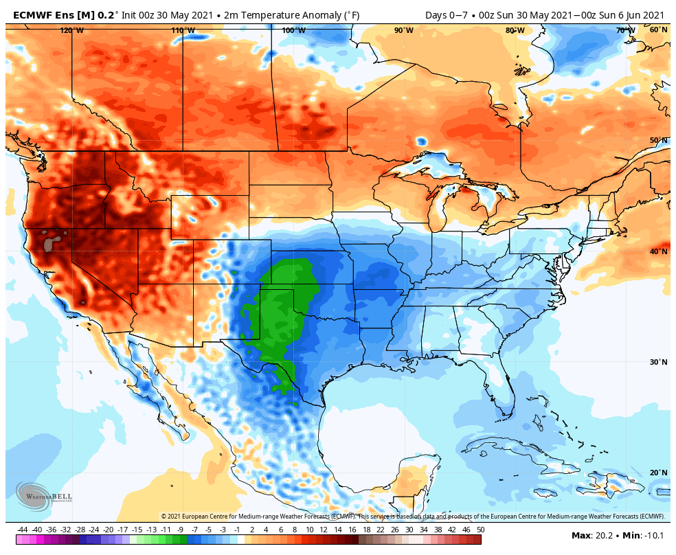
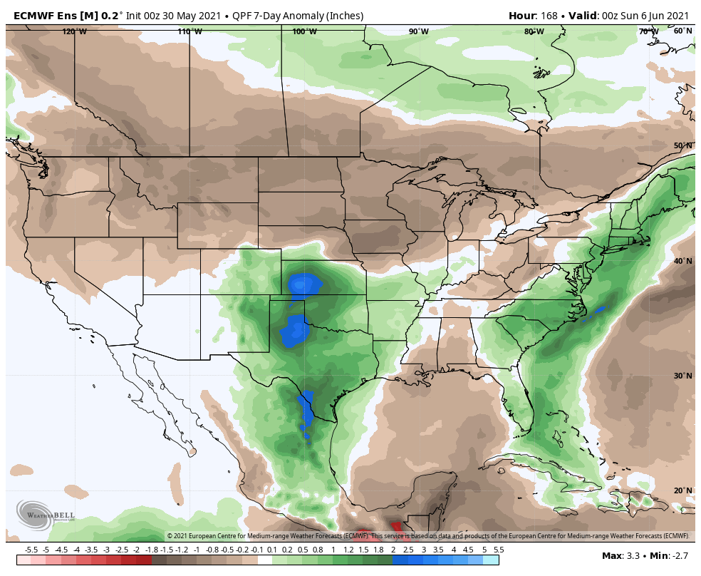
Forecast period: 05.30.21 through 06.06.21
Refreshing times will continue to dominate through the remainder of the holiday weekend. While dry and unseasonably cool air will grab the headlines in the short-term, changes will arrive by midweek as a storm system blows into the Ohio Valley. Shower and thunderstorm chances will be on the increase by Tuesday night and Wednesday and some of these storms may contain locally heavy rain. A broad southwesterly flow will keep things feeling more typical for this time of year for the 2nd half of the week, as well. More seasonable temperatures can be expected late week (lower 80s for daytime highs) along with an increase in humidity levels providing daily chances of afternoon/ evening “splash and dash” storm coverage.
Permanent link to this article: https://indywx.com/weekly-agwx-and-severe-weather-outlook-32/
May 15
Updated 05.15.21 @ 7:29a

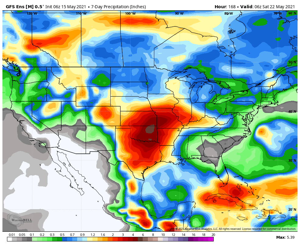
Forecast Period: 05.15.21 through 05.22.21
Change is ahead over the upcoming week towards a pattern more typical of what we’d come to expect this time of year. We’ll say goodbye to the cool, crisp air in the short term period and replace it with an increasingly warm and muggy feel of things. Scattered showers and thunderstorms will accompany this transition. While the chances of widespread heavy rain are diminishing, we will see scattered to numerous showers and storms during the early and middle part of the work week. These will be of the “splash and dash” variety and certainly won’t require any cancellation of outdoor plans. High pressure appears like it’ll nudge its way into the region Wednesday night, allowing us to enjoy another stretch of dry conditions as we close the work week and head into next weekend.
Permanent link to this article: https://indywx.com/weekly-agwx-and-severe-weather-outlook-30/