Frosty Mornings; Late Week Storm System…
 Highlights:
- Dry stretch of weather remains
- Late week storm system offers up rain; t-storm chances
- Much colder next weekend
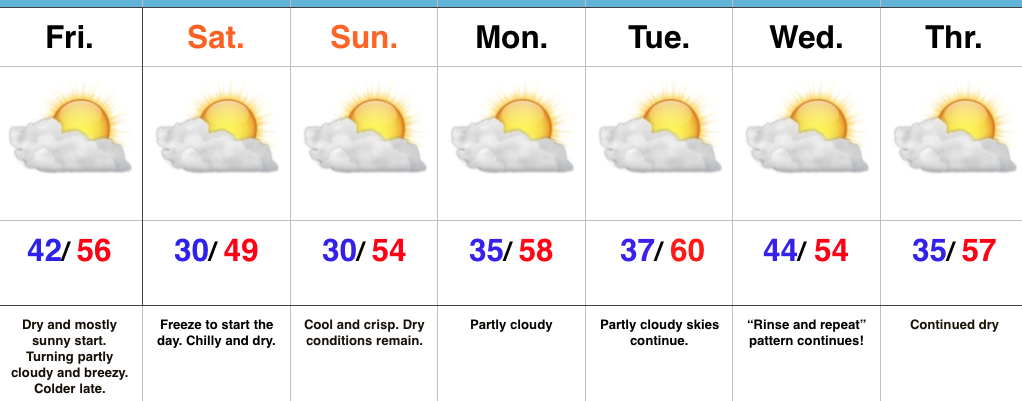
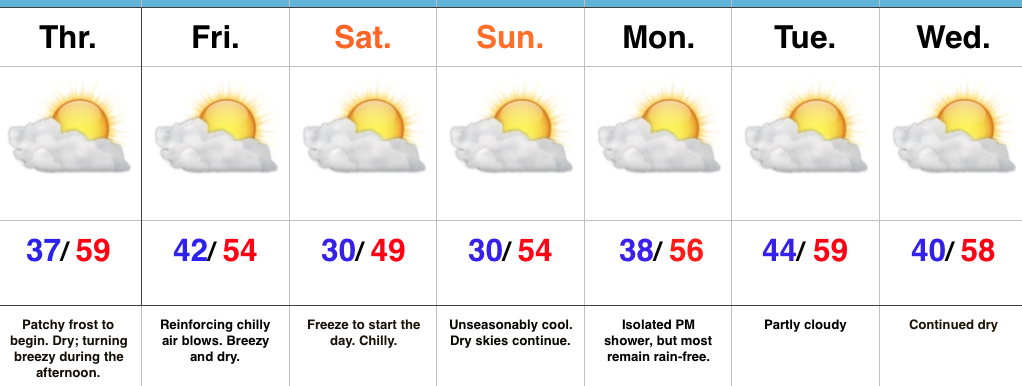
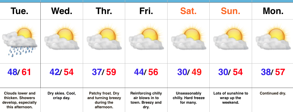
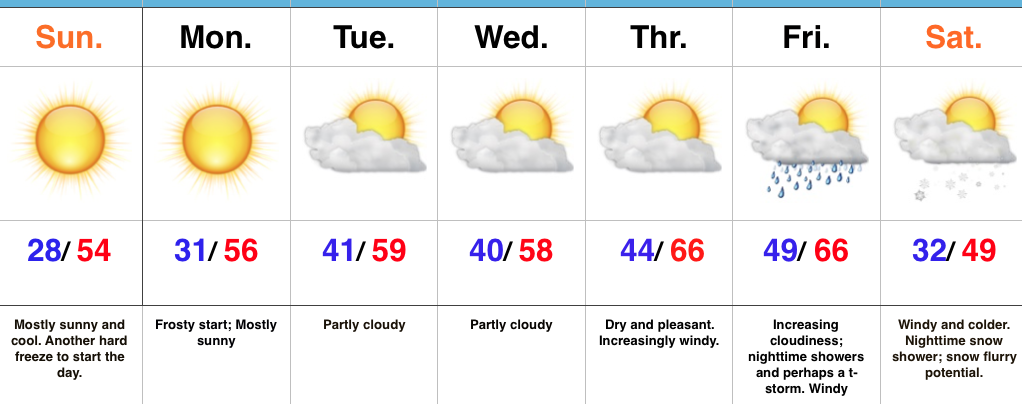
Frosty Mornings To Start The Week…High pressure will dominate our weather pattern to open the new week. As such, skies will remain mostly sunny and temperatures will be very pleasant. Monday morning will feature the third morning in a row with sub-freezing air. Expect another frosty start to the day, including outlying neighborhoods into the 20s yet again.
Looking ahead, our weather will remain rather uneventful until Thursday. Dry conditions will remain, but southwest winds will become increasingly gusty by the afternoon. This is in advance of an approaching storm system that will deliver showers, and perhaps a clap of thunder, Friday evening. Timing will have to be fine tuned as we progress through the week. Behind the boundary, much colder air will pour into the region on gusty northwest winds next weekend. In fact, the air will grow cold enough to potentially lead to scattered snow showers Saturday night into Sunday in the left over “back lash” moisture.
Upcoming 7-Day Precipitation Forecast:
- Snowfall: 0.00″
- Rainfall: 0.25″ – 0.50″