Happy Thanksgiving; Time To Get Used To An Active Pattern…
 Highlights:
- Foggy start to Thanksgiving; Chilly
- Milder start to the week
- Big storm next week
Happy Thanksgiving…Before we dive into the upcoming active period of weather ahead, we want to wish you and yours and very happy and blessed Thanksgiving holiday. We here at IndyWx.com are so thankful for your friendship over the years and the countless weather reports and photos you send in on a daily basis. Find time to relax and enjoy the important things in life this holiday season.
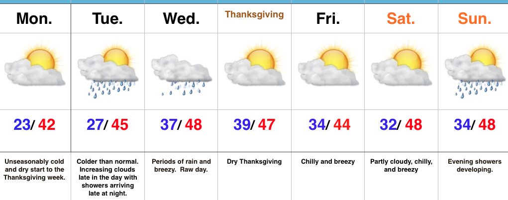
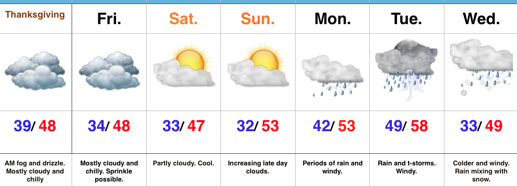
After a wet, raw, and dreary Wednesday, Thanksgiving will be drier. Unfortunately, a large chunk of the day will likely feature low clouds, areas of fog, and drizzle, especially in the morning. Reinforcing cool air will blow in as shoppers hit the stores Friday, along with gusty winds and a possible sprinkle. Saturday will be chilly and blustery. After a Sunday morning freeze, moderating temperatures will develop as we close the weekend and open the new work week. This will be courtesy of SW winds ahead of a significant storm system that’s brewing next week.
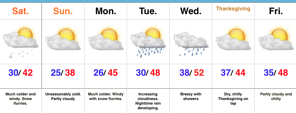
Clouds will increase late Sunday and rain will follow Monday. Rain will increase in coverage and intensity and we’ll also add in the potential of strong storms into the mix Tuesday. (More details to come once we move closer, concerning strong to potentially severe prospects Tuesday). Much colder air will pour into the region behind the storm system and allow precipitation to mix with wet snow Wednesday.
This is only the beginning of what looks to be a very stormy and increasingly cold weather pattern. Longer-term model data suggests this will be the story throughout the majority of December. Our call of a snowier than normal December remains…
Upcoming 7-Day Precipitation Forecast:
- Snowfall: 0.00″
- Rainfall: 2.50″-3.50″