Active Weather Pattern…
 Highlights:
- Colder close to the work week
- Late weekend wintry mix threat
- Double-barrel storm next week
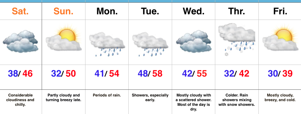
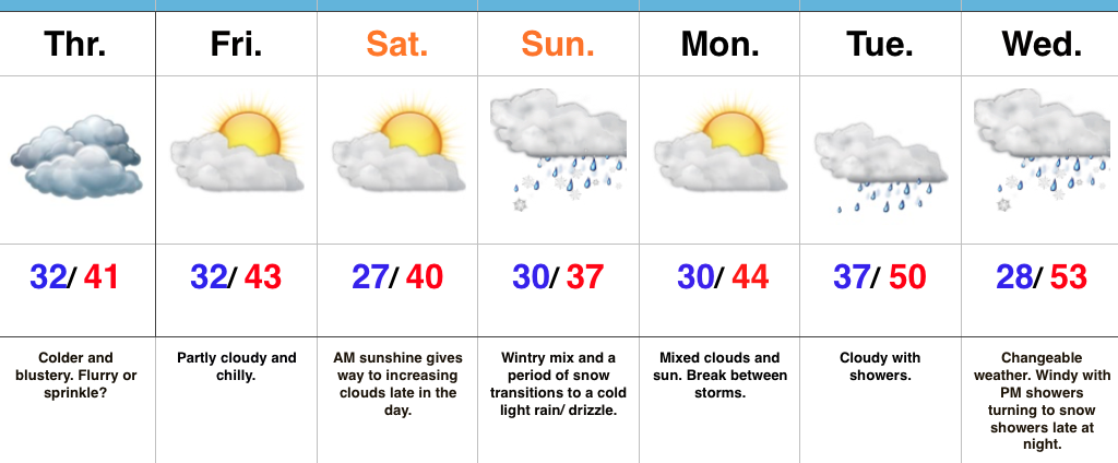
Feeling More Like The Season…Colder air began to press into central IN Wednesday afternoon. That was a hint of what we’ll deal with to wrap up the work week. While nothing too far from normal, it’s definitely going to feel colder when compared to the past couple days. A sprinkle or snow flurry is possible Thursday- especially across northern portions of the state. Friday and Saturday will be dry, but continued chilly.
Our next storm system will approach the region Saturday night into Sunday. A wintry mix, including a period of snow, is a good bet Sunday morning before enough warm air advection leads to a transition to a chilly light rain or drizzle. It’ll be a raw day. Needless to say with model data still in disagreement, we’ll continue to keep a close eye on Sunday’s forecast and update accordingly.
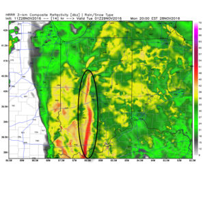
Next week will continue the fast-paced time of things, with a double-barrel storm system taking aim on the region Tuesday into Wednesday. Showers will push northeast Tuesday followed by another round of rain Wednesday. The coldest air of the season looms just beyond this forecast period. Though timing is an issue that will have to be fine tuned, our air mass should grow cold enough to allow for precipitation to transition to snow showers late Wednesday night. Stay tuned.
Upcoming 7-Day Precipitation Forecast:
- Snowfall: Trace
- Rainfall: 0.75″ – 1.50″
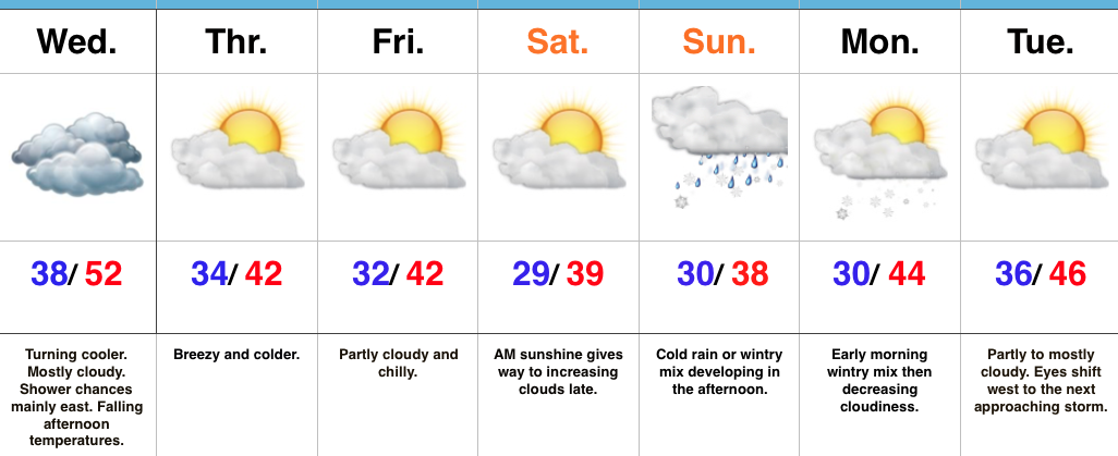
 Considerable cloudiness will remain Tuesday and Wednesday, but both days will be much drier than today. A secondary wave of low pressure will move northeast along a pressing cold front Wednesday. Best rain chances Wednesday will fall across eastern sections of the viewing area.