Buckle Up; Active Winter Pattern Is Only Beginning…
 Highlights:
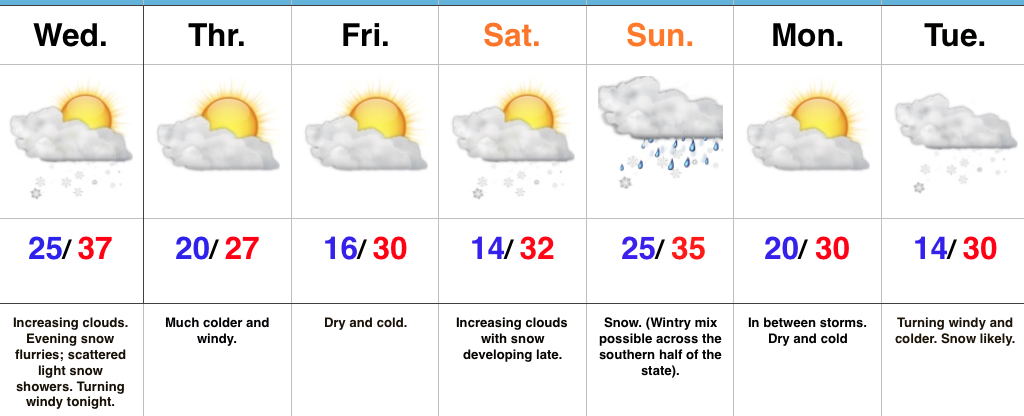
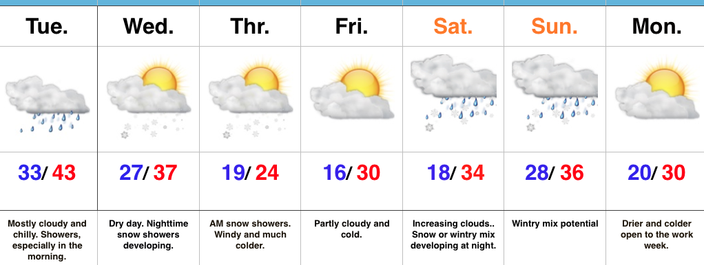
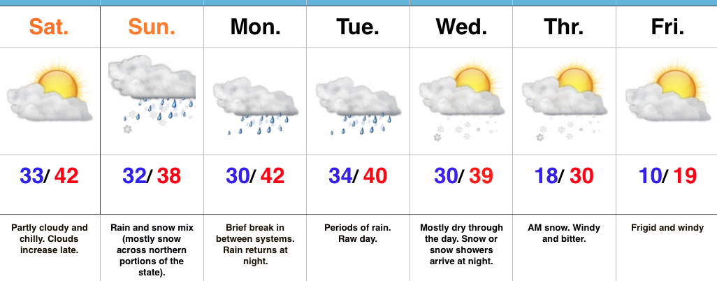
- Very cold with snow showers diminishing
- Messy second half of the weekend
- Awaiting our next storm mid week
- Frigid air awaits
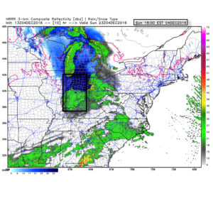
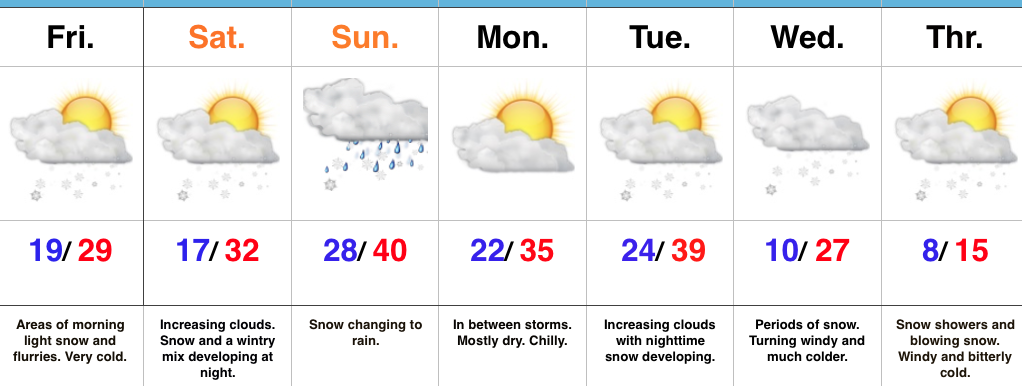
Wintry Hits Are Lining Up…Fresh arctic air combined with even the slightest bit of upper energy can produce an overachieving snow shower event. As was the case overnight with many neighborhoods through central IN accumulating a coating to around 1″ of snow. Take it slow this morning and leave extra time to reach your destination. Bitterly cold air continues to wrap up the work week and head into the weekend (keep in mind our average high and low are in the lower 40s and middle 20s, respectfully). As we look through the upcoming 7-day period, temperatures will run significantly below average throughout.
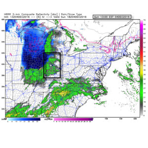
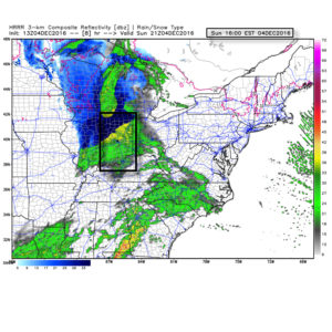
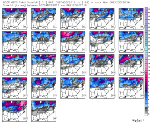
Our next storm system is dialed up this weekend. Clouds will increase as we progress through the second half of the day Saturday and light snow will develop late Saturday night into Sunday morning. As the area of low pressure tracks from northern MO into the Great Lakes, we’ll get into a milder southerly flow Sunday. This will help bring in enough warm air to transition snow to rain during the day Sunday. Beforehand, a light accumulation of snow is possible in and around Indianapolis (more on potential amounts this time tomorrow). Heavier snow will pile up across northern Indiana. Precipitation should shut off rather quickly Sunday night and we’ll be in between systems Monday.
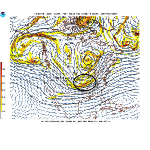
By Tuesday, our attention will turn northwest as we await the arrival of another arctic cold front. As the front moves in, modeling suggests multiple waves of energy move along the boundary, throwing moisture into the cold air and creating a rather snowy scenario as we progress through mid week. We need to get through the weekend first, but this could also be an impactful event. Very windy and frigid conditions move in Wednesday into Thursday, including sub-zero wind chills. Additional snow chances await next weekend…
Upcoming 7-Day Precipitation Forecast:
- Snowfall: 2″- 5″
- Rainfall: 0.25″ – 0.50″