Warmth Dominates…
 Highlights:
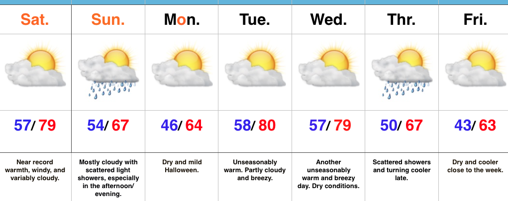
- Near record warmth
- Windy conditions
- Scattered showers to wrap up the weekend
- “Ups and downs” next week
Hard To Believe This Is Late October…A strong southwest flow will help provide a windy, but incredibly warm Saturday. Highs will approach record territory around 80. (We’ll have to keep an eye on that 81 degree record set in 1922). Southwest winds gusting around 30 MPH will be a good bet this afternoon, especially in the open country.
A weak disturbance will push southeast Sunday and help to increase our cloud cover, along with providing scattered showers- mainly in the afternoon and evening. We’ll turn cooler, but still remain above normal for Halloween. Trick-or-treat conditions look ideal, especially considering recent Halloweens have served up rain, storms, and snow across the region.
A warm front will lift north Monday night and offer up another opportunity to push for record warmth Tuesday and Wednesday before a cold front slides through Thursday with showers. Cooler air will settle into the Ohio Valley and Mid West to wrap up the work week.
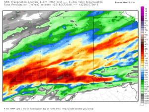
Upcoming 7-Day Precipitation Forecast:
- Snowfall: 0.00″
- Rainfall: 0.10″ – 0.25″
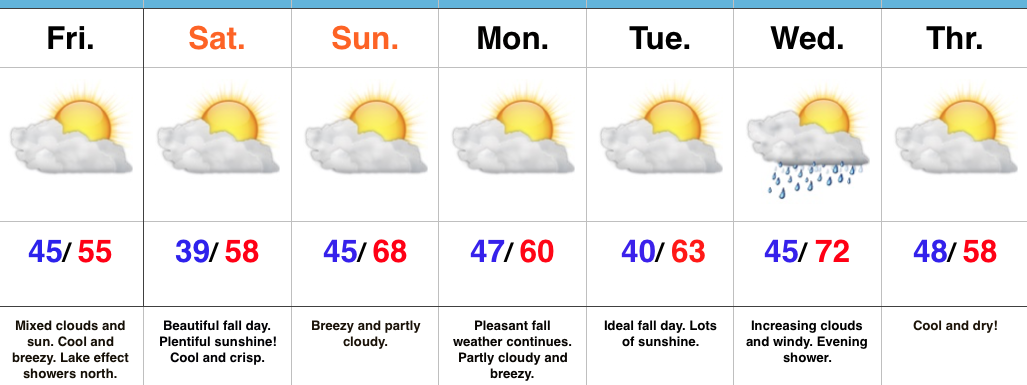
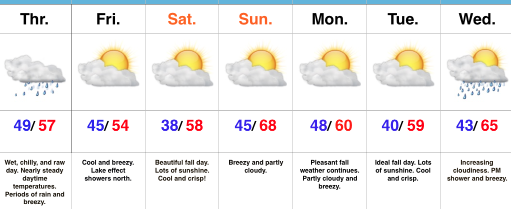
 High pressure will build in over the weekend and create an increasingly sunny sky. The only caveat to that will be today where mixed clouds and sun across central IN become a little thicker and may yield lake effect rain showers across northern portions of the state later this afternoon.