Category: 7-Day Outlook
Highlights:
- Dry, mild open to the work week
- Election Day showers
- Freeze likely this weekend
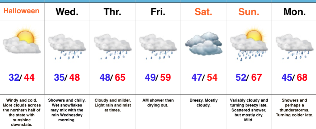
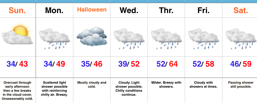
Enjoy Today; Changes Loom…High pressure will supply a beautiful open to the work week, complete with plentiful sunshine and highs close to 10 degrees above normal. Find a way to get outside and soak in this pleasant late-autumn weather!
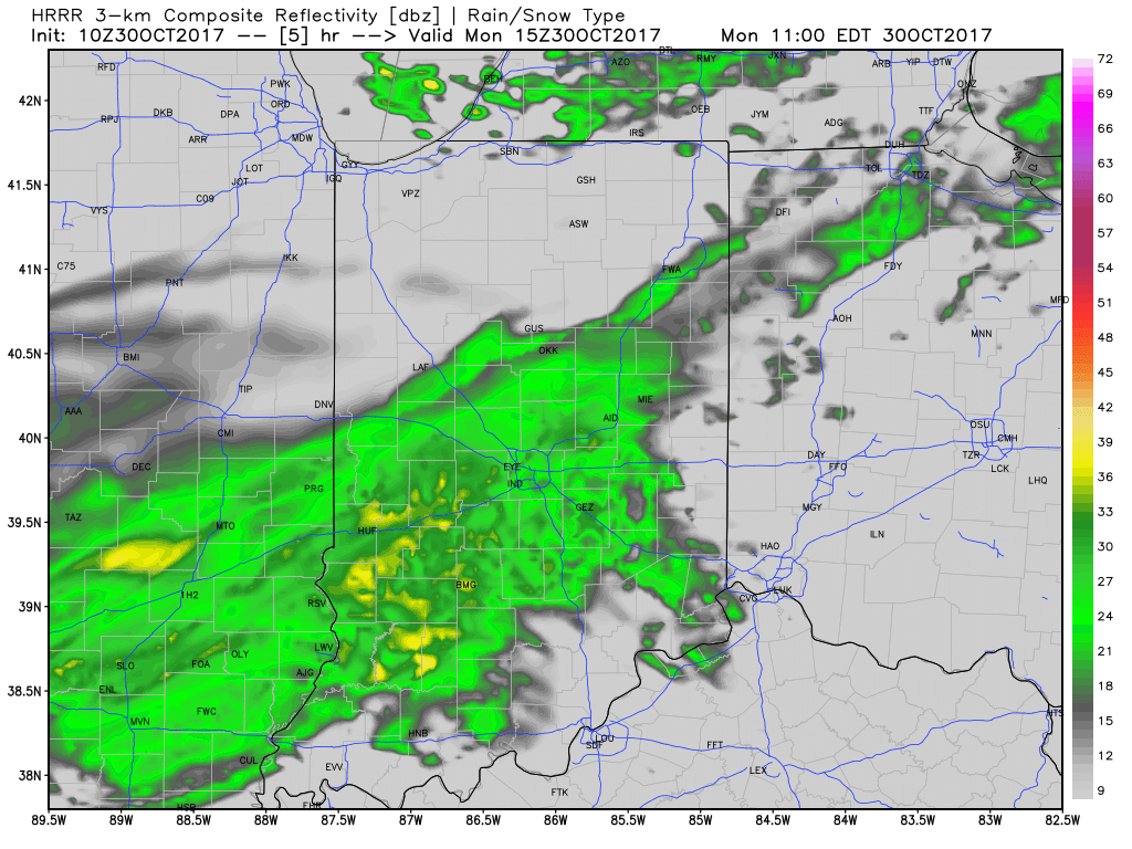
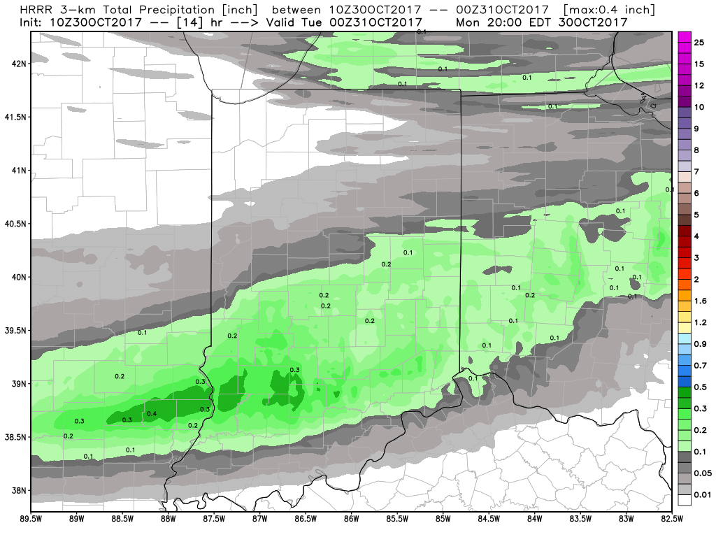
A cold front will sweep through the state on Election Day. The day will open dry, but a band of light showers will move through the state during the afternoon-evening. This won’t be a big event and “light” is the key word. Chilly air will filter into the area behind the boundary for mid week.
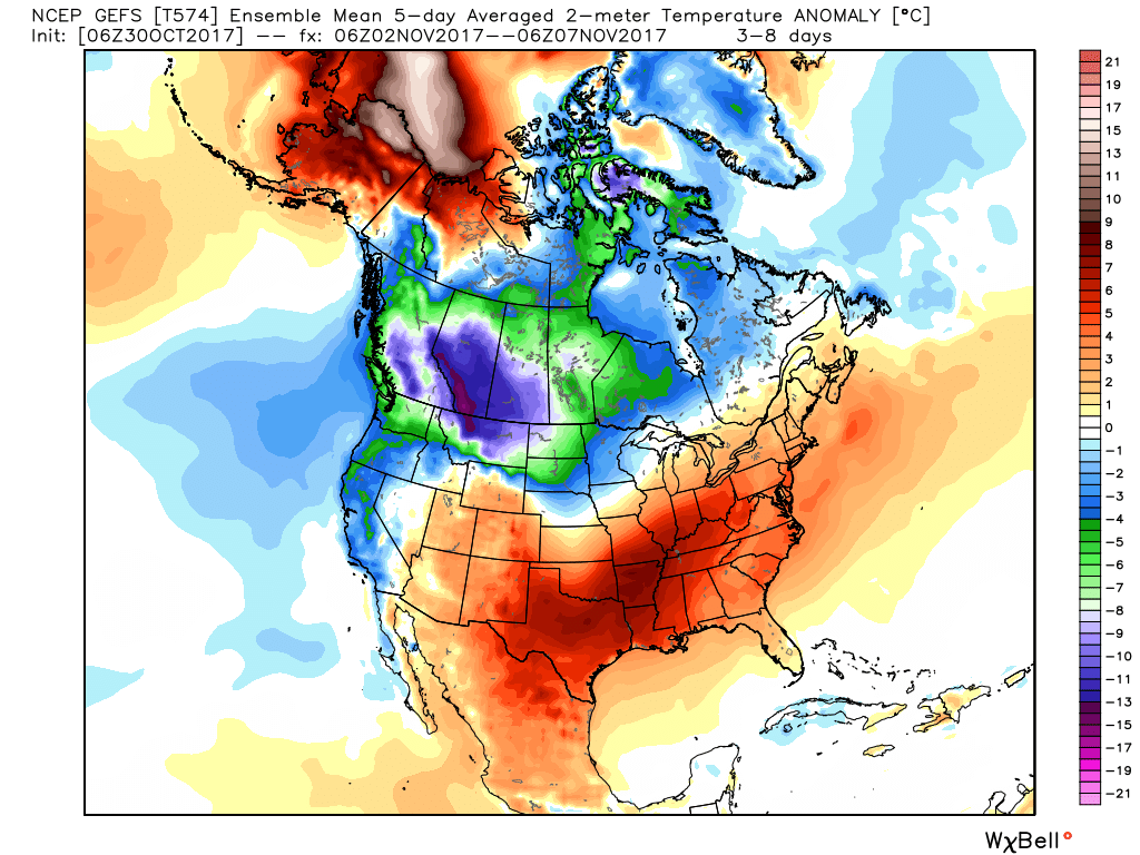
Speaking of chilly air, the coolest air of the season thus far is slated for a weekend arrival. Winds will shift to the north Friday evening and help usher in the season’s first freeze for many by Saturday morning (some upper 20s can be expected away from the city). Dry conditions will remain this weekend.
Looking ahead, plenty of “fun and games” await by mid-month…
Upcoming 7-Day Precipitation Forecast:
- Snowfall: 0.00″
- Rainfall: 0.10″ – 0.25″
Permanent link to this article: https://indywx.com/2016/11/07/election-day-showers-unseasonably-chilly-weekend/
Highlights:
- Frosty start
- Pleasant fall weather
- Light scattered shower Tuesday evening
Lots Of Sunshine…Most folks around central IN woke up to the most widespread frost of the season so far. Many neighborhoods away from the city slipped into the middle 30s overnight. (It’s about time)!
High pressure will supply dry conditions through the weekend and into early next week. With crisp, dry air in place, it’ll feel mighty nice outside. Given what will likely be an increasingly “busy” (and cooler) second half of November, we’d recommend spending as much time outdoors as possible this week.
A weak frontal boundary will pass through central IN Tuesday night. Though the air mass will be very dry in front of this system, we can’t completely rule out the chance of a light shower Tuesday evening as the front moves through. (This won’t be a big deal).
Reinforcing chilly air will blow into town to wrap up the work week and early indications hint at the first freeze for many by next weekend.
The 2016-2017 IndyWx.com Winter Outlook has been posted and is available here.
Upcoming 7-Day Precipitation Forecast:
- Snowfall: 0.00″
- Rainfall: 0.10″
Permanent link to this article: https://indywx.com/2016/11/05/trending-colder-late-in-the-period/
Highlights:
- Morning fog and drizzle burns off
- Pleasant fall weather this weekend
- Extended dry stretch
Morning Fog Gives Way To Weekend Sunshine…There’s really no reason to waste a lot of pixels in this morning’s 7-day. High pressure will supply an extended stretch of dry weather, complete with plentiful sunshine. Morning fog and drizzle will give way to PM sunshine today. Though cooler than we’ve been, with the exception of seasonable temperatures today, every day through the rest of the forecast period will be above normal.
We’re still eyeing a mid-month pattern transition that should set up a much more active and wintry regime Thanksgiving to Christmas. Speaking of that, our complete winter outlook was released last weekend. If you haven’t had an opportunity to see it, click here.
Upcoming 7-Day Precipitation Forecast:
- Snowfall: 0.00″
- Rainfall: 0.00″
Permanent link to this article: https://indywx.com/2016/11/04/pleasant-dry-stretch/
The 2016-2017 IndyWx.com Winter Outlook is now available.
Highlights:
- Unseasonably warm Wednesday
- T-storms tonight
- Cooler close to the work week
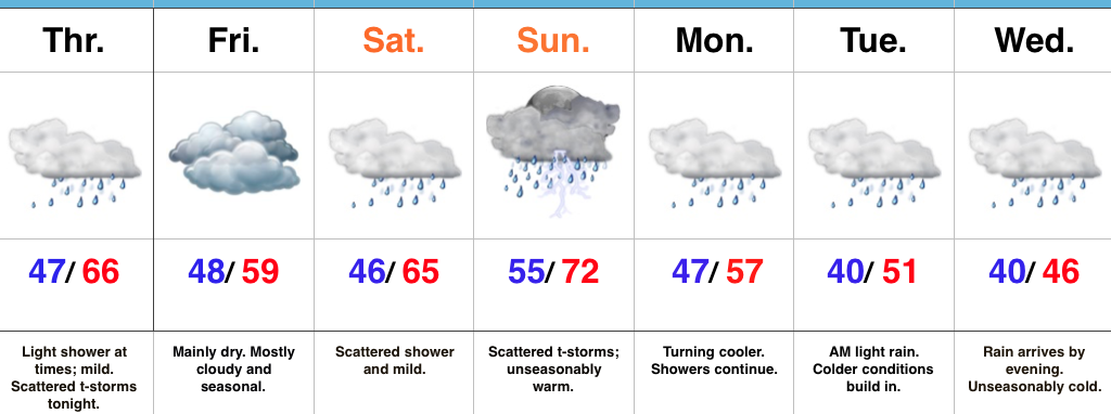
Cold Front Arrives Late Tonight…The majority of today will be dry (and warm), but we do note some of the high resolution model data suggest we deal with an initial round of scattered showers and thunderstorms this evening (in the 4p-7p time frame). This would be in advance of more widespread showers and thunderstorms tonight into the wee morning hours Thursday.
Cooler air will flow into the region to wrap up the work week and dry conditions will prevail through the upcoming weekend. We note patchy frost potential Saturday morning away from the city.
Our next storm system will approach early next week. From this distance, Election Day looks mostly dry through the daytime hours, but shower chances will begin to increase by evening.
Longer term, model data continues to suggest we’re in line for a mid-month pattern change to cooler conditions. While this will initially be a “step-down” (back and forth) process, the potential is on the table for a downright wintry pattern to develop by late month. We note the GEFS (GFS ensembles) keying in on this (images courtesy of weatherbell):
Days 1-5
Days 6-10
Days 10-15
Upcoming 7-Day Precipitation Forecast:
- Snowfall: 0.00″
- Rainfall: 0.50″ – 0.75″
Permanent link to this article: https://indywx.com/2016/11/02/one-more-warm-day-t-storm-chances-tonight/
The 2016-2017 IndyWx.com Winter Outlook is now available.
Highlights:
- Great trick-or-treat weather in store this evening
- Near record warmth Tuesday-Wednesday
- Cooler to close the week
Pleasant Halloween Weather…Recent Halloweens have produced accumulating snow, heavy rain, and storms. Thankfully, today will be much more pleasant and feature mostly cloudy skies and pleasant temperatures.
Speaking of temperatures, they’ll get a big boost Tuesday and Wednesday (both days will feature near record highs). A breezy SW wind will be in play and clouds will increase Wednesday, eventually giving way to showers Wednesday night. Rain will continue Thursday morning as a cold front moves through the region. Cooler, drier air will move in as we close the work week.
Looking ahead to the weekend, Saturday will be dry and pleasant. Sunday is a bit of a question mark. The European model is suggesting a reinforcing push of cooler air will ooze into the area, while the GFS is less impressed. We’ll lean our forecast more towards the European for now. Regardless, Sunday will be a dry day.
Upcoming 7-Day Precipitation Forecast:
- Snowfall: 0.00″
- Rainfall: 0.50″
Permanent link to this article: https://indywx.com/2016/10/31/weather-certainly-more-of-a-treat-than-a-trick/
Highlights:
- Near record warmth
- Windy conditions
- Scattered showers to wrap up the weekend
- “Ups and downs” next week
Hard To Believe This Is Late October…A strong southwest flow will help provide a windy, but incredibly warm Saturday. Highs will approach record territory around 80. (We’ll have to keep an eye on that 81 degree record set in 1922). Southwest winds gusting around 30 MPH will be a good bet this afternoon, especially in the open country.
A weak disturbance will push southeast Sunday and help to increase our cloud cover, along with providing scattered showers- mainly in the afternoon and evening. We’ll turn cooler, but still remain above normal for Halloween. Trick-or-treat conditions look ideal, especially considering recent Halloweens have served up rain, storms, and snow across the region.
A warm front will lift north Monday night and offer up another opportunity to push for record warmth Tuesday and Wednesday before a cold front slides through Thursday with showers. Cooler air will settle into the Ohio Valley and Mid West to wrap up the work week.
Upcoming 7-Day Precipitation Forecast:
- Snowfall: 0.00″
- Rainfall: 0.10″ – 0.25″
Permanent link to this article: https://indywx.com/2016/10/29/warmth-dominates/
Highlights:
- Cooler and blustery today
- Warmer times coming to close the month and open November
- Scattered showers return next week
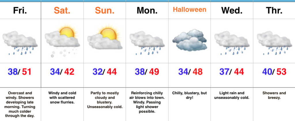
Chilly Today, But Warmer Times Loom…A cold front swept through central IN earlier this morning. Since we’re on the NW side of the front now, a cooler air mass is filtering in as we type this. Today will be blustery and chilly with considerable cloudiness. That said, the chilly air will only hang around for 24 hours, as we begin to moderate Friday afternoon. SW winds will blow Friday PM and help give a chilly start to the day a rather significant boost into the upper 60s for a high. Saturday will out-do that as we zoom into the middle 70s.
A weak front will slip through here Sunday and cool us off a few degrees. While a light shower is possible as the front moves through, we think most stay dry.
We quickly return to the warm regime early next week. At this time, Halloween looks mild and dry for those trick-or-treaters out there.
Looking further down the road, significant changes loom by mid and late November. Those changes include the following words: cold and wintry…
Upcoming 7-day Precipitation Forecast:
- Snowfall: 0.00″
- Rainfall: 0.10″-0.25″
Permanent link to this article: https://indywx.com/2016/10/27/warm-close-to-october-and-open-to-november/
Highlights:
- Cool open to the work week
- Mid and late week fast-moving storm systems
- Weekend timing questions
Fall Feel To Open The Week…A dry frontal boundary will pass through central IN late tonight. Our winds will shift to the NW after midnight and help drive in a cooler air mass to open up the new work week. Despite lots of sunshine, temperatures will be running below average to open the work week.
A fast-moving storm system will scoot through the lower Great Lakes region Wednesday. This will help serve to strengthen our winds (SW direction) along with create a chance of scattered showers Wednesday evening. Another pop of unseasonably cool air will blow into town Thursday.
Yet another storm system will press through the region as we get set to head into the weekend. Rainfall totals don’t look particularly impressive, but we’ll lean more towards the Friday night/ Saturday morning storm system as being the better rain-maker of the (2) systems this week. Cooler air will flow in behind the storm system for the weekend.
Upcoming 7-Day Precipitation Forecast:
- Snowfall: 0.00″
- Rainfall: 0.50″ – 0.75″
Permanent link to this article: https://indywx.com/2016/10/23/another-active-week/
Highlights:
- Cool close to the work week
- Ideal autumn weekend
- Turning breezy early next week
- Scattered showers Wednesday PM
Grab The Jacket…After a significant rain event across central Indiana, the weekend will offer up a much-needed time to dry out! Here’s an illustration of where heaviest rains fell over the past 24-36 hours, courtesy of Weatherbell.com. Please note these aren’t official rainfall storm totals. Many ground-truth reports into the office include amounts of 1.5″-3″. Thanks to each of you for your reports!
High pressure will build in over the weekend and create an increasingly sunny sky. The only caveat to that will be today where mixed clouds and sun across central IN become a little thicker and may yield lake effect rain showers across northern portions of the state later this afternoon.
We’ll turn briefly milder Sunday (upper 60s to around 70), but it’ll be a breezy day as a dry cold front sets it’s eyes on the region for a Sunday evening sweep! Reinforcing cool air will blow in to open the work week, but this should be a rain-free frontal passage as our air mass will be very dry.
The next storm system that could deliver rain arrives Wednesday evening. Along with scattered showers, a gusty SW wind can be expected before cooler air blows in to close next week.
Upcoming 7-Day Precipitation Forecast:
- Snowfall: 0.00″
- Rainfall: 0.10″ – 0.25″
Permanent link to this article: https://indywx.com/2016/10/21/increasing-sunshine-unseasonably-cool-close-to-the-work-week/
Highlights:
- “Raw” weather today
- Increasing weekend sunshine
- Patchy frost Saturday morning
Wet And Chilly Today…An area of low pressure will track northeast along the Ohio River, into the interior portions of the Northeast between now and Friday. Additionally, a cold front will continue to press southeast today. The combination of these ingredients will equal a wet, raw, and breezy day across central IN. (Definitely NOT a chamber of commerce day). Temperatures will remain nearly steady through the daytime hours before sliding off relatively quickly tonight.
We’ll wrap up the work week and head into the weekend with increasing sunshine, but the coolest air of the fall season thus far. Temperatures will grow chilly enough Saturday morning to present a patchy frost threat for outlying areas away from the metro.
Winds will increase Sunday as our next cold front approaches. The air mass ahead of this front is very dry so we’re not expecting much, if any, precipitation with this next frontal passage (FROPA), but it will serve to offer up reinforcing cool air early next week.
The next storm system that could offer up rain will arrive Wednesday evening. From this distance, it doesn’t appear to be a heavy rain event.
Upcoming 7-Day Precipitation Forecast:
- Snowfall: 0.00″
- Rainfall: 0.75″ – 1.50″
Permanent link to this article: https://indywx.com/2016/10/20/much-cooler-feel-increasing-weekend-sunshine/