Mild Air On Borrowed Time; Turning Wintry…
 Highlights:
- Dry midweek
- Rain changes to snow
- Turning bitter
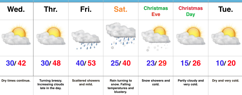
Changes Await…The midweek stretch will feature dry and unseasonably mild conditions. A storm system will deluge the Tennessee Valley today, but will be too far south to impact our weather. We’ll shift our air flow around from the northeast today to more of a southerly direction Thursday afternoon. This is in advance of our next storm system that will deliver showers as we wrap up the last work week before Christmas.
While confidence is beginning to increase in the evolution of things as we head into Christmas weekend, important details are still a bit “iffy” and will require additional fine tuning over the next day, or so. With that disclaimer, here’s how we see things playing out:
A cold front will slip southeast Friday night and a surface low will move northeast along the boundary Saturday. The general consensus this morning is that this wave of low pressure will track further southeast when compared to yesterday’s data. This would yield a colder solution, locally, and subsequent faster changeover to a period of wet snow Saturday. In fact, if trends continue, we may have to bust out the first snowfall map of the season for Saturday. Hope for a White Christmas is very much alive and kicking.
MUCH colder air will drill southeast Christmas Eve and with enough upper level energy in place, we forecast an additional period of snow and snow showers Christmas Eve. Bitterly cold temperatures will take control for Christmas and into early next week.
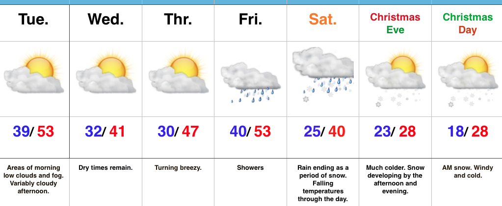
Upcoming 7-Day Precipitation Forecast:
- Snowfall: 1″ – 2″
- Rainfall: 0.25″ – 0.50″
 Highlights:
 Highlights:
 Highlights:
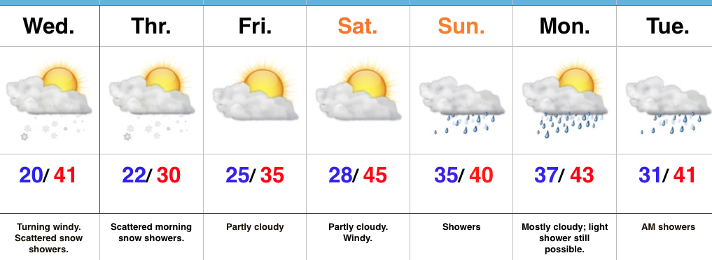 Highlights: