Another Cold Week; Snow Showers Develop Overnight…
 Highlights:
- Snow showers develop overnight
- Another arctic shot
- Milder for the weekend
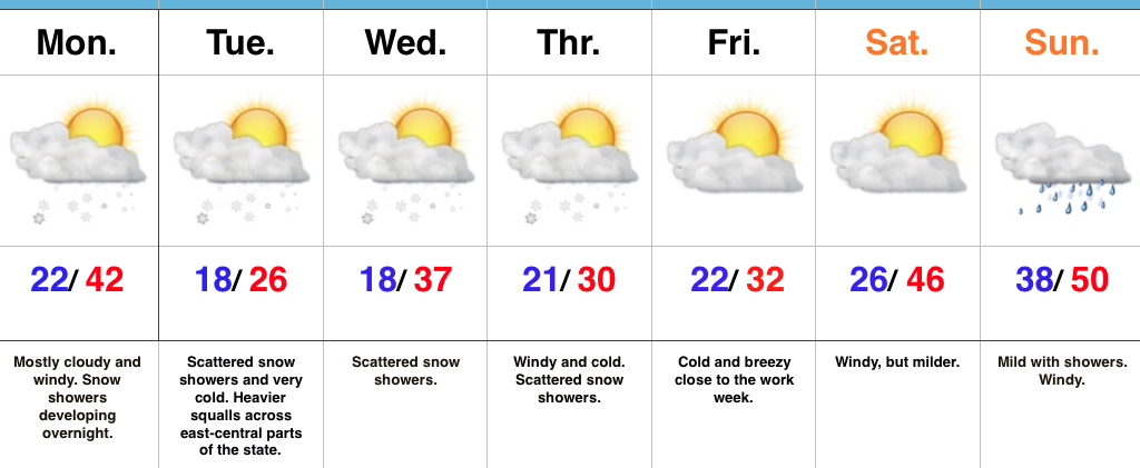
Snow Showers Develop Overnight…Another fast moving upper air disturbance is on the move southeast this morning and will result in a mostly cloudy and blustery open to the work week. As cold air advection (CAA) kicks in overnight and Tuesday, snow showers will develop across the region. We’ll also note the potential of a more intense and persistent lake effect band setting up across east-central Indiana (where a couple inches will accumulate Tuesday). If your travels take you into eastern and northeastern portions of the state Tuesday, prepare for sudden drops in visibility and slick travel.
Additional upper level energy will scoot through here during the middle part of the work week and while this will help to reinforce the cold, it’ll also provide scattered snow showers.
We’ll switch gears and get into a briefly milder southwesterly air flow over the upcoming weekend. Strong and gusty southwest winds will aid in giving a boost to the mercury, but showers will make for a damp end to the weekend.
Upcoming 7-Day Precipitation Forecast:
- Snowfall: Dusting (for most) to 2″ across east-central Indiana
- Rainfall: 0.25″
 Highlights:
 Highlights:
 Highlights:
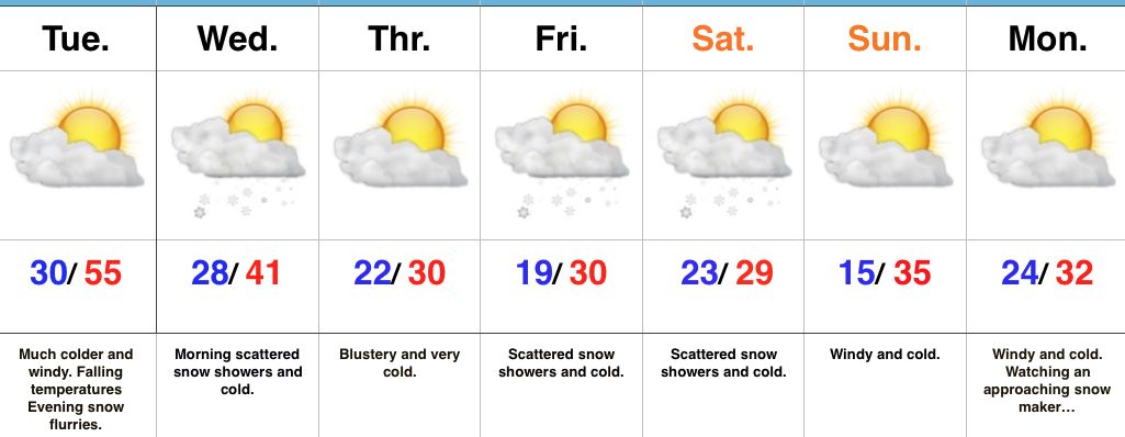 Highlights: