Additional Snow Overnight; Dangerous Cold Grips The Region…
 Highlights:
- Blowing and drifting issues
- Snow returns late tonight
- Prolonged stretch of severe cold
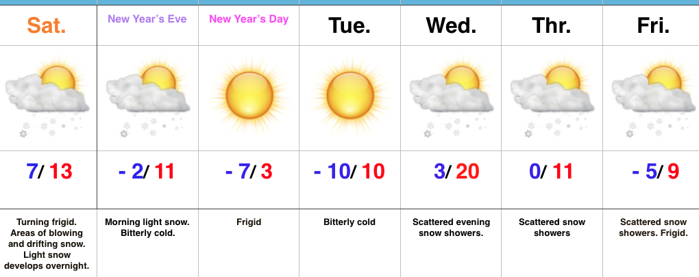
Bundle Up; Snow Returns Overnight…Yesterday’s snow event went as planned and many Hoosiers are waking up to several inches of powder this morning. The winners yesterday stretched from Frankfort to Elwood to Winchester with a 6″ to 7″ band of snow. All of that fresh snow will be blown and drifted about today with strong and gusty northwest winds. If your travels take you into the open country, plan on significant blowing and drifting and leave extra time to reach your destination.
Additional upper level energy will scoot across the region late tonight into early Sunday and this will help kick up an area of light snow for central and southern portions of the state as we head into New Year’s Eve. With the arctic air mass in place, don’t be surprised if we squeeze a quick inch out in spots.
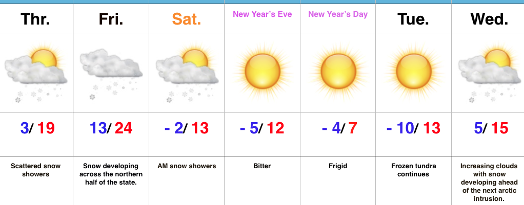
Otherwise, the big story is the prolonged nature of this severe cold. At times, wind chill values will drop to more than 30° below zero through early week. Take the frigid conditions seriously. Reinforcing arctic air will pour in here late next week and lead to scattered snow showers along with a bitter feel after slight midweek “moderation.”
Upcoming 7-Day Precipitation Forecast:
- Snowfall: 1″ to 3″
- Rainfall: 0.00″
 Highlights:
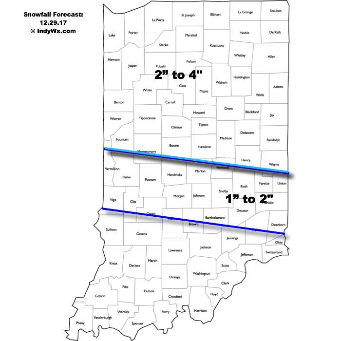
 Highlights:
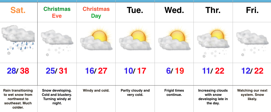 Highlights:
 Highlights: