Updated 10.23.23 @ 5:45p
I. Today’s model suite continues to suggest quite the unsettled stretch of weather awaits for pre-Halloween festivities. I know, please don’t shoot the messenger. The culprit? A strong autumn cold front stalling out for a time in response to waves of energy riding along the boundary. The end result will likely be a widespread swath of 1″+ rains over the weekend with a more localized 2″+ band. Details will have to be fine tuned as we get closer, but folks with outdoor activities and ag/ harvest ’23 interests should plan on a rough stretch of weather in the Saturday through Monday timeframe.

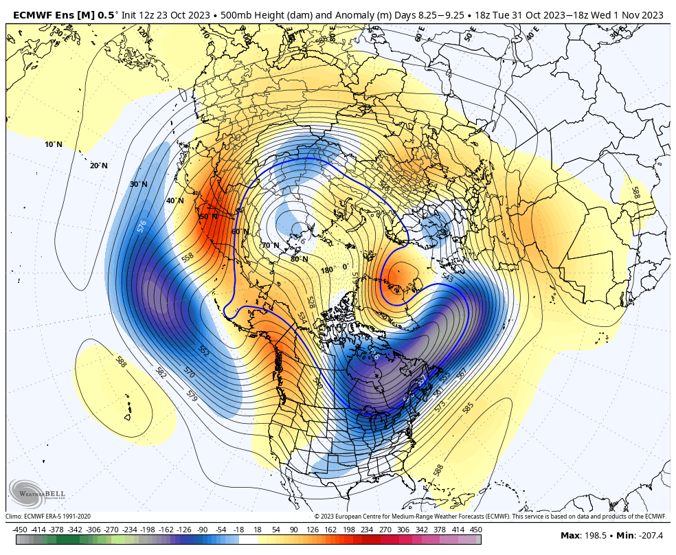
II. The coldest air so far this fall season will come rushing in on the heels of all of the aforementioned rain in the 8-10 day timeframe. Today’s European guidance is going all-in on a potent early season “jab” of arctic air, including highs around freezing and lows deep into the 20s. Perhaps extreme? Certainly, but this also has merit given where the pattern is. Though this will likely only be a brief intrusion of bitter air (at least by early November standards), I’d certainly go ahead and plan on the growing season coming to a screeching halt in just a little over a week from today.

