Updated 10.06.23 @ 7:56a
As we type this, we’re in the midst of the season’s 1st big blast of chilly air. These shots will become progressively cooler (colder) in the coming weeks and months. Speaking of that, we’re also working on a post that we’ll unveil over the weekend looking specifically at the upcoming holiday season and what our analog package/ respective SST configuration says we may have in store this season.
For the purpose of this post, we’ll focus squarely on the pattern through the remainder of October.
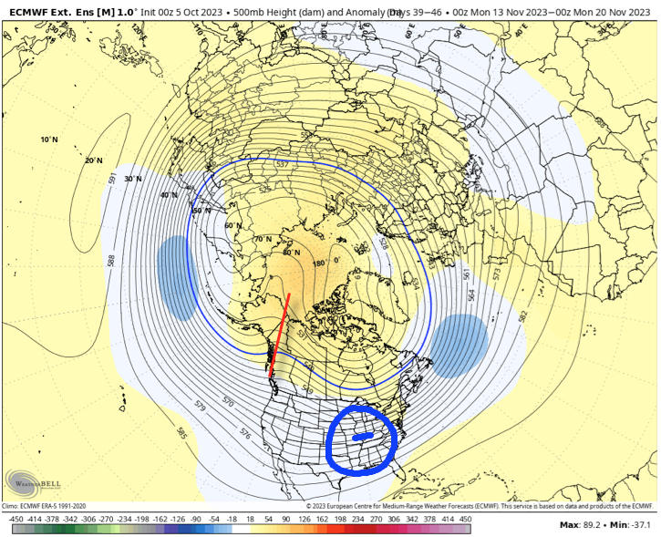
As we typically do, the pattern drivers (+ PNA and – EPO) both suggest a ‘mean’ trough should take up shop across the eastern 1/3 of the country over the next couple weeks. What’s interesting is that the updated European Weeklies also suggest this general theme should continue into at least mid-November. Despite a favorable setup with respect to the PNA/ EPO, the model tries to wash out the chill and hints at a ridge down the road. In my humble opinion, this is the model feeding back on itself and once again showcasing an inability to see below normal temperatures in the longer range. We’ve shown time and time again over the summer and even into the early fall where the model is “forced” to cool the closer we get to a given period and believe that will, once again, be the case this go around, especially with the anticipated positive PNA and negative EPO.
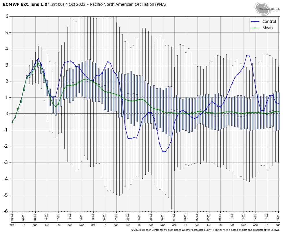
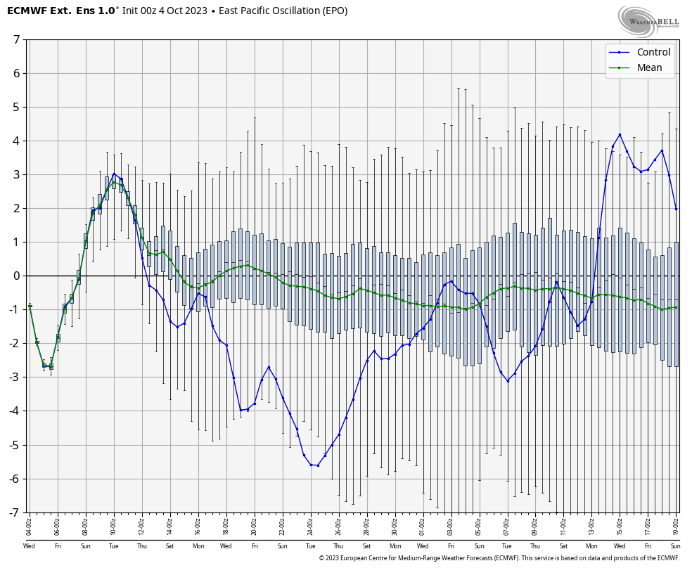
The upper pattern, illustrated with last night’s European Weeklies, is one that breaks the trough down towards Halloween. While there is a possibility of some brief warming around this timeframe, I suspect we’ll once again look back at the model having to correct colder over the east as we rumble into November. More on that in a moment.
Week 1: 10/5 through 10/11

Week 2: 10/11 through 10/18
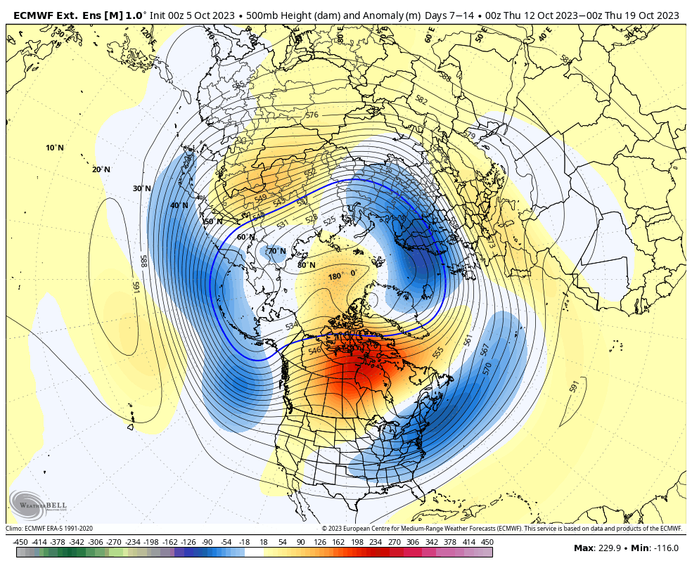
Week 3: 10/18 through 10/25

Week 4: 10/25 through 11/1
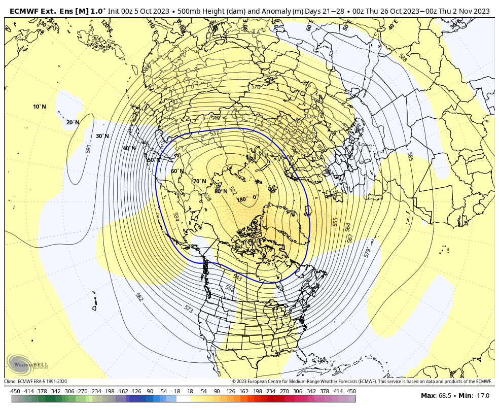
The period ends with a warmer look around Halloween and while this is on the table, it’s also a look that should promote building heights over AK and western Canada and another period of blocking with a subsequent cold trough developing over our neck of the woods and the central/ east as we rumble through into November. The model is seeing the building heights, but not picking up on the magnitude of a downstream trough and associated colder pattern, IMO. Frankly, this 500mb look is capable of producing very cold weather sometime during mid-November and I suspect the model will have to start playing catch up as we move forward.
