Updated 02.10.23 @ 7:55a
You must be logged in to view this content. Click Here to become a member of IndyWX.com for full access. Already a member of IndyWx.com All-Access? Log-in here.

Feb 10
Updated 02.10.23 @ 7:55a
You must be logged in to view this content. Click Here to become a member of IndyWX.com for full access. Already a member of IndyWx.com All-Access? Log-in here.
Permanent link to this article: https://indywx.com/video-tracking-2-storms-next-week-summer-23-pattern-ideas/
Feb 09
Updated 02.09.23 @ 8:53p
After a bitter Christmas period, the “snap back” came on with authority. The mild start to the year has carried into February. A look at the past (30) days:

Despite multiple attempts, the cold “jabs” haven’t had any staying power. In the short term (upcoming 10-14 days), an overall milder than normal regime will carry the day.
With that said, longer range teleconnections are providing clues that the pattern may, indeed, begin to resemble a more sustained colder than normal temperature regime by late February, continuing through the bulk of March:
Negative NAO:

Negative WPO:

Negative AO:

Negative EPO:

Then, perhaps most significant, the MJO is showing signs of cycling in Phase 8 to close February and open March.

Both periods feature a cold, to much colder than normal, pattern in Phase 8:
MJO Phase 8: Feb

MJO Phase 8: March

Perhaps the latest European Weeklies for late Feb through late March are onto the correct idea…

Permanent link to this article: https://indywx.com/mjo-and-other-drivers-aligning-for-cold-close-to-meteorological-winter-open-to-spring/
Feb 09
Updated 02.09.23 @ 5:45a
After a wet night, a line of storms will rumble through central Indiana over the next couple hours. These will likely precede some brief clearing as we move into the late morning hours.
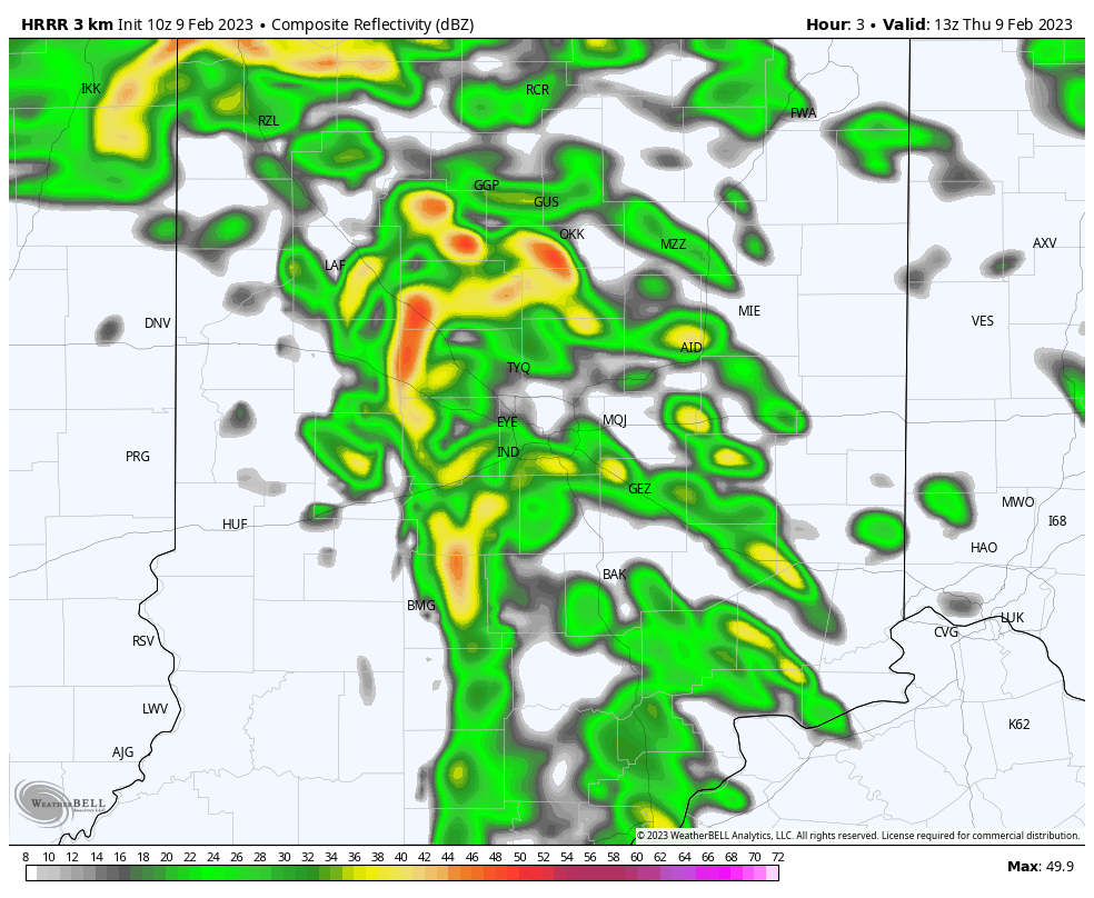
While the storms will remain below severe levels, non thunderstorm wind gusts very well may approach, if not exceed, severe criteria late morning through the afternoon. Gusts approaching 60 MPH are a good bet in spots through the region. Unfortunately some power outages and tree damage is expected across the area through the evening.
After a mild start to the day, temperatures will fall around lunchtime through the 40s and into the 30s by the evening rush.

Much more later today in our updated video discussion, including a look at the longer range pattern to close February and into March, along with a first idea of the summer pattern!
Permanent link to this article: https://indywx.com/storms-rumble-in-this-morning-damaging-wind-threat-increases-late-morning-through-the-afternoon/
Feb 08
Updated 02.08.23 @ 7:20a
Our next storm system will take aim on the region tonight and Thursday. As low pressure tracks into the western Great Lakes, it’ll help pull 2 slugs of moisture north into the state.
A period of rain can be expected this evening (well after the evening rush).
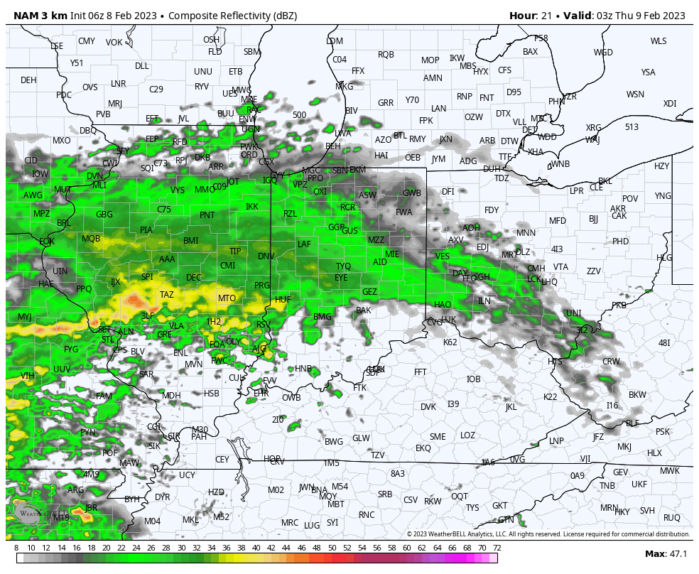
Followed by another period of rain and embedded thunder Thursday morning. Heaviest rain totals (1”+ amounts) will favor western and northern Indiana with this system.
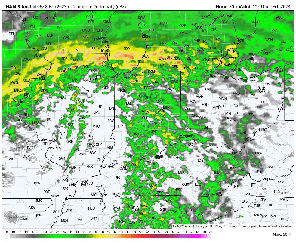
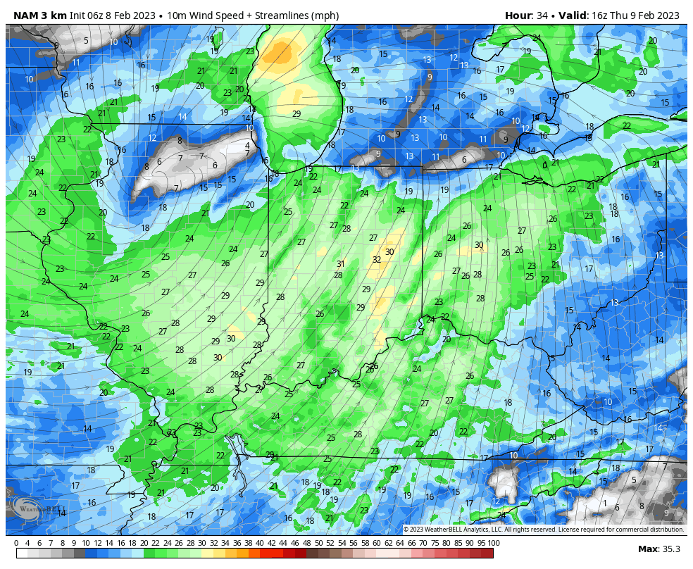
The bigger headline will actually be the strong winds Thursday morning. Sustained wind of 30 MPH with gusts to 50+ MPH will create the potential of downed trees, limbs, and increase the potential of power outages by mid and late morning.
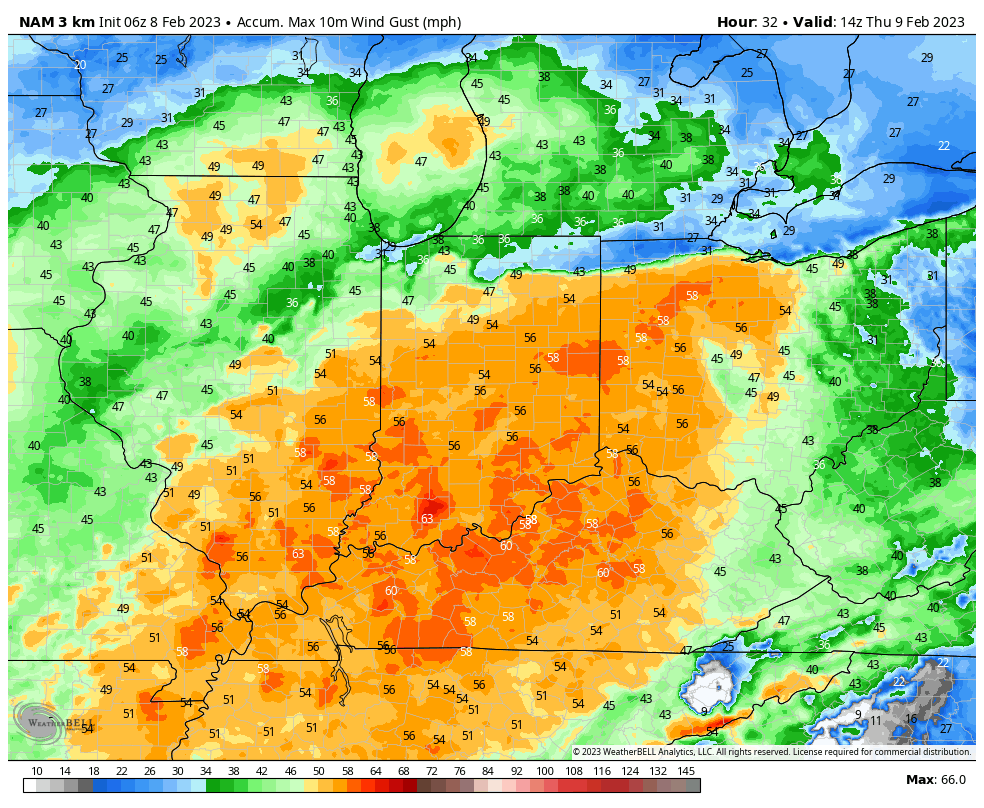
Looking ahead to the “follower” system we’ve been discussing over the past week, modeling now has zeroed in on this being a southern and Mid Atlantic event Friday night through Super Bowl Sunday. While the ole saying goes “never trust a closed upper low,” it’s becoming increasingly likely a heavy, wet snow storm looms for the southern Appalachians and into the southern portion of the Mid Atlantic this weekend.
Meanwhile, an unseasonably mild pattern continues here next week.
Permanent link to this article: https://indywx.com/rain-returns-tonight-batten-down-the-hatches-thursday-morning/
Feb 07
Updated 02.07.23 @ 5:37a
You must be logged in to view this content. Click Here to become a member of IndyWX.com for full access. Already a member of IndyWx.com All-Access? Log-in here.
Permanent link to this article: https://indywx.com/video-milder-air-arrives-late-week-model-trends/